Author: Ben Castellani (Page 35 of 358)

Ben grew up in southwestern Pennsylvania and holds both a bachelor's and a master's degree in Meteorology, the latter being from CU Boulder. His hometown received nearly three feet of snow from the Storm of the Century back in March of 1993, sparking his initial interest in impactful weather. Ben currently works on remote sensing and data analysis software at NV5 Geospatial Software in Boulder.

Premium BoulderCAST Daily – Tue 07/29/25 | Much cooler today with extensive clouds and a chance of storms

Boulder baked under the sun Monday, hitting 99°F—just one degree shy of breaking a record that’s been standing since the 1940s. Most spots along the Front Range's lower elevations landed in the upper 90s, while the Foothills managed slightly cooler temps in the 80s. A few northeastern communities even cracked the triple digits. Thankfully, the intense heatwave is already behind …

Premium This Weekend in Colorado Weather: One final chance at soaking monsoon storms on Thursday before a heat dome takes over this weekend

Today’s our last real shot this week to squeeze some action out of that juicy monsoon plume that’s been draped over Colorado since Tuesday. Unfortunately, the Boulder–Denver corridor hasn’t gotten much out of it—just enough rain in some spots to smudge the dust. On the other hand, southeast Denver, the Palmer Divide, east Greeley, and Fort Collins managed decent totals …

Premium BoulderCAST Daily – Wed 07/23/25 | Locally heavy rain expected as slow-moving storms bubble this afternoon and evening

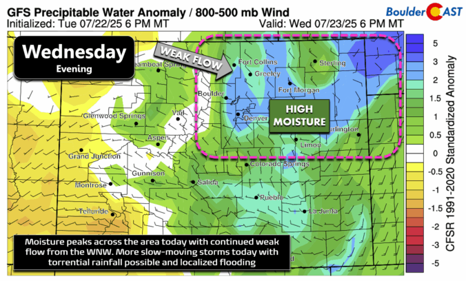
After yesterday’s underwhelming rainfall—just a trace to a few hundredths of an inch around Boulder—we’ve got another shot today and again tomorrow. Monsoon moisture is still elevated, and tonight we’ll see precipitable water values spike to nearly two standard deviations above average. With weak winds aloft from the west-northwest, the setup once again favors slow-moving storms that could drop heavy rain …

BoulderCAST Daily – Tue 07/22/25 | Slow-moving monsoon storms may cause localized flooding through midweek

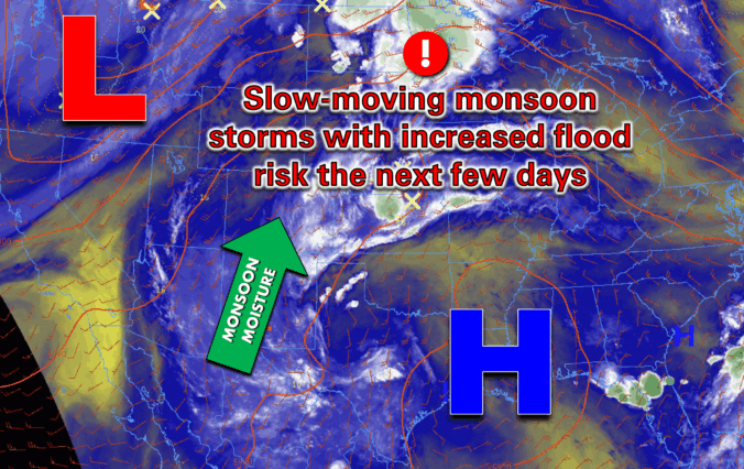
Moisture from the subtropics—yep, the good ol’ summer monsoon—is surging north into Colorado this week. A favorable setup is taking shape: strong high pressure is parked over the Gulf Coast while a stubborn trough lingers in the Pacific Northwest. The flow between these two systems is coming straight up from the south, loaded with moisture and sprinkled with embedded shortwaves. …

Premium This Weekend in Colorado Weather: Monsoon moisture keeps storm chances around as our temperatures inch upward

Today is starting out with a very similar look and feel to yesterday in the Front Range, but we promise, the eventual outcome of today will be quite different. Low clouds, fog, urban pollution and smoke are making for quite the gross scene across the lower elevations this morning. The view looking west from Boulder is not enjoyable in the …

Premium BoulderCAST Daily – Wed 07/16/25 | Severe weather outbreak likely across the Front Range today

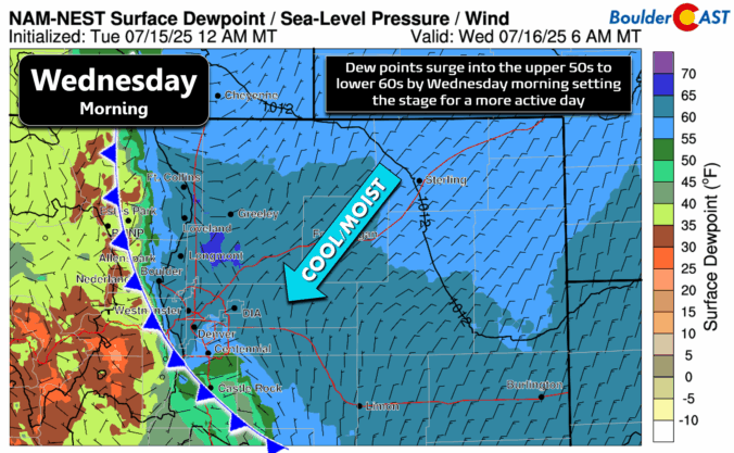
Both anticipated weather changes for our area have arrived overnight and are conveniently visible from the same east-facing Eldora webcam timelapse this morning. Yes, we're of course talking about the moist cold front from the northeast that blew in around 3AM, which has spawned low clouds and patchy fog across the lower elevations, and the influx of lofted wildfire smoke …

Premium BoulderCAST Daily – Tue 07/15/25 | Hot and mostly dry today, wildfire smoke and a cold front blow in tonight

We’re still sitting under the influence of high pressure to our west today, but a weather system moving in from the northwest is knocking on the northern Rockies’ door — and it's set to stir things up over the next few days. This morning, skies are crystal clear over the Front Range, thanks to a batch of dry air overhead. …

« Older posts Newer posts »