

With Independence Day now upon us, summer is in full-swing across the Front Range. We discuss the weather-week ahead (spoiler: it’s going to be hot!), and give our thoughts on when those monsoon rains might finally show up.
Author: Ben Castellani (Page 326 of 358)
Ben grew up in southwestern Pennsylvania and holds both a bachelor's and a master's degree in Meteorology, the latter being from CU Boulder. His hometown received nearly three feet of snow from the Storm of the Century back in March of 1993, sparking his initial interest in impactful weather. Ben currently works on remote sensing and data analysis software at NV5 Geospatial Software in Boulder.
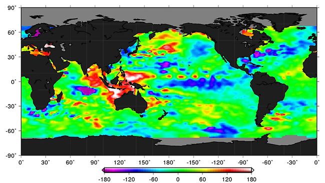
The El Niño that has been with us for the last seventeen months has finally met its demise. The atmosphere is in the process of responding to this change as we speak. We provide an update on the situation as we begin our transition into a La Niña pattern. We also review how well our late-winter predictions verified. Read on for our full outlook for the remainder of the summer season.
Live Radar

Trending Content


Recent Premium Posts

BoulderCAST Daily – Sun 11/15/26 | Morning Fog Gives Way to a Warmer Stretch of Weather
🌫️ Fog Disperses — Morning low clouds and fog exit, with sunshine in …
BoulderCAST Daily – Sat 11/14/26 | A Pair of Foggy Mornings With Little Rain
🌫️ A Pair of Foggy Mornings — Moisture banked up along the Foothills …
BoulderCAST Daily – Fri 11/13/26 | Quiet Today But Turning Unsettled Tomorrow
☀️ Quiet Today — Sunshine and low to middle 60s across the Front …
© 2026 Front Range Weather, LLC