
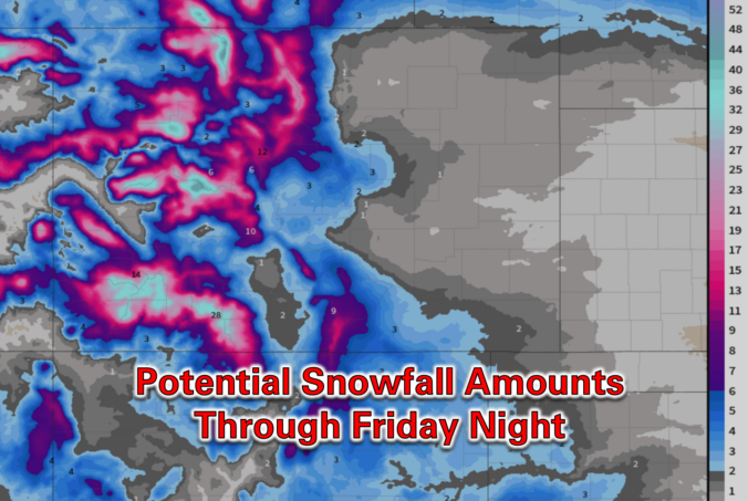
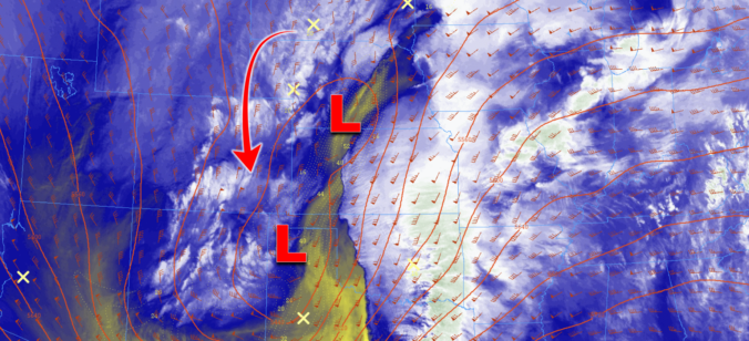
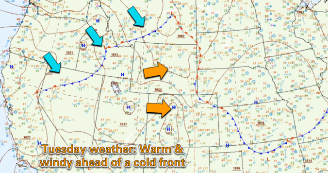
As we head into the second week of March, Mother Nature will offer up a wide range of weather in the Front Range, including elevated fire danger, unseasonably warm temperatures, and an impressively strong spring storm system by Friday. The late-week storm will usher in Mountain snow and widespread strong winds to the state. Depending on how things evolve, blizzard conditions and blowing dust may be an issue east of Denver, but things aren’t looking too bad in our immediate area. Read on for all the details.
Author: Ben Castellani (Page 31 of 304)
Ben grew up in southwestern Pennsylvania and holds both a bachelor's and a master's degree in Meteorology, the latter being from CU Boulder. His hometown received nearly three feet of snow from the Storm of the Century back in March of 1993, sparking his initial interest in impactful weather. Ben currently works on remote sensing and data analysis software at NV5 Geospatial Software in Boulder.
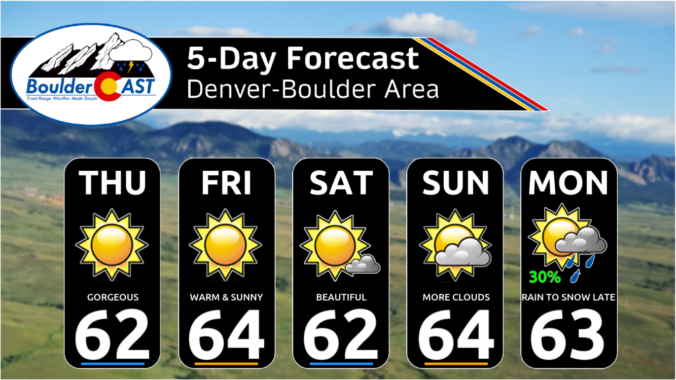
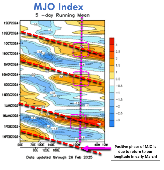
The last two weeks have been considerably colder than normal across the Front Range (thanks Flatiron Freddy!), but that changes this week as the atmospheric pendulum swings the other direction ushering in a welcomed pattern shift across all of Colorado. The week ahead will be largely dry in our area with temperatures well above normal every day except Wednesday. The beautiful conditions will continue through the upcoming weekend, but the first week of March will see a return of cooler and unsettled weather with rain and snow chances in tow.
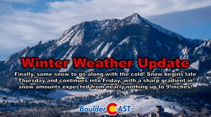
It’s been a brutally cold week in the Boulder-Denver area with temperatures remaining entirely below freezing since Saturday morning. Up until now, we haven’t had much snow to show for this Arctic plunge, but that changes later on Thursday as we finally get some moisture and a real storm system passing through to generate widespread snowfall across the Front Range. We discuss the latest forecast details, including how models have been trending the storm further south in recent runs which will make for a tricky forecast, one with a very sharp gradient in expected snowfall totals. Let’s take a look.

Live View of Boulder

Current Conditions

Live Radar

Recent Premium Posts

BoulderCAST Daily – Sun 06/21/26 | First Notable Smoke Plume Arrives for the First Day of Summer
🌫️ Smoky skies return: A large wildfire in Utah has smoke surging into …
BoulderCAST Daily – Sat 06/20/26 | Supercells on the Plains, Fire Danger in the High Country & Boulder Quiet In Between
🌩️ Severe storms fire east of I‑25 this afternoon with supercells producing 1.5–2.5″ …
BoulderCAST Daily – Fri 06/19/26 | Quiet end to the week but storms return Saturday, including a significant severe risk towards Kansas
☀️ Quiet finish to the week — Weak ridge brings sunshine, light winds, …
3-Day Forecast

Trending Content

© 2026 Front Range Weather, LLC