Author: Ben Castellani (Page 283 of 301)
Ben grew up in southwestern Pennsylvania and holds both a bachelor's and a master's degree in Meteorology, the latter being from CU Boulder. His hometown received nearly three feet of snow from the Storm of the Century back in March of 1993, sparking his initial interest in impactful weather. Ben currently works on remote sensing and data analysis software at NV5 Geospatial Software in Boulder.
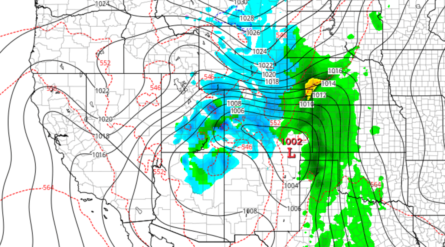
We’ve been tracking the storm very closely over the last week. With forecast temperatures trending down over the last several days, the threat of potentially flooding rain has morphed into the concern for a dumping of heavy, wet spring snow for everyone across the Front Range. Read on as we present our final forecast for this historic storm.

A powerful, slow-moving system is still on track to impact the region through the weekend. The Foothills are undoubtedly set for massive snow totals, but uncertainty remains in exactly how much the lower elevations will pick up. We summarize recent model trends and give a forecast update on this upcoming historic weather event.
Not surprisingly, there is already A LOT of media hype surrounding the potential for another “epic snowstorm” this weekend across the Denver Metro area. It’s been all over social media and the news, with even a few shades of optimism present in our own forecasts. However, let’s take it one step at a time and not line ourselves up for disappointment. Continue reading as we set realistic expectations for this weekend’s potential storm.

Live View of Boulder

Current Conditions

Live Radar

Recent Premium Posts

BoulderCAST Daily – Tue 05/12/26 | Slightly cooler following an overnight front, but record highs near 90° return by tomorrow
🔥 Record‑tying heat: Boulder hit 88°F Monday, matching May 11th highs from 1961–63 …
BoulderCAST Daily – Sun 05/10/26 | Cooler today but the 80s are not far behind
☀️ Sunshine and pleasant temperatures with upper 60s for our Sunday 🌡️ Trending …
BoulderCAST Daily – Sat 05/09/26 | Watching some late-day showers ahead of a cold front tonight
🌧️ Scattered showers this afternoon and evening ahead of a cold front setting …
3-Day Forecast

Trending Content

© 2026 Front Range Weather, LLC
You must be logged in to post a comment.