Author: Ben Castellani (Page 2 of 295)
Ben grew up in southwestern Pennsylvania and holds both a bachelor's and a master's degree in Meteorology, the latter being from CU Boulder. His hometown received nearly three feet of snow from the Storm of the Century back in March of 1993, sparking his initial interest in impactful weather. Ben currently works on remote sensing and data analysis software at NV5 Geospatial Software in Boulder.

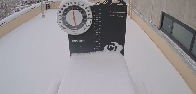
A tandem of low pressure systems — one warm and moisture‑rich, the other colder and more dynamic — teamed up just enough to deliver a surprisingly efficient burst of snowfall across the Front Range to end the week. We break down how this two‑part event unfolded, why the timing mattered so much, and where our forecast over‑ and under‑performed. Continue reading


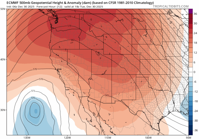
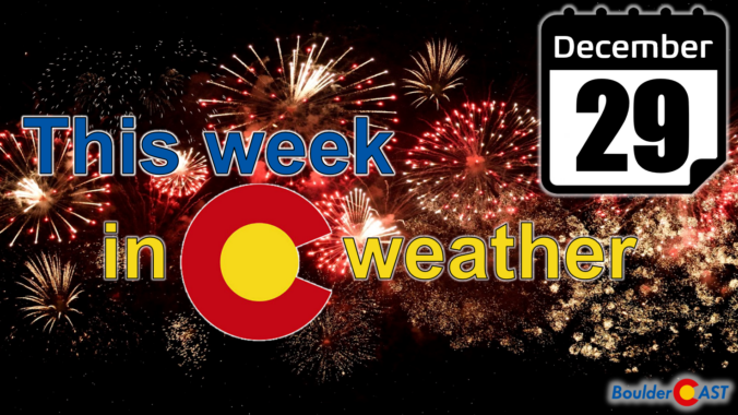
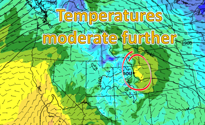
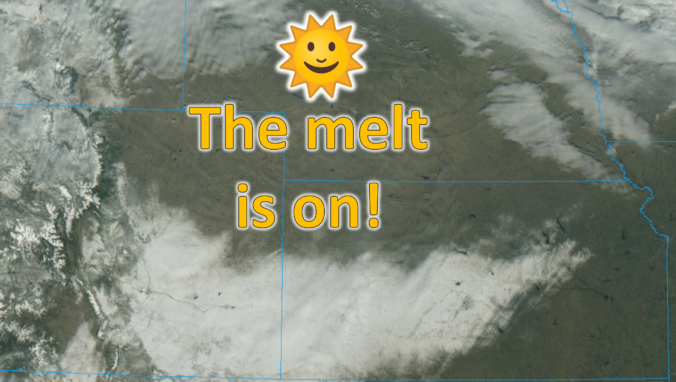
After a quick burst of weekend snow and our coldest temperatures since early December, the week ahead turns much quieter across Colorado. Temperatures will climb steadily as Boulder and Denver stay dry into the New Year, while the Mountains prepare for a well‑timed round of snow for the holiday weekend. We’ll walk you through the day‑to‑day weather this week, where the snow will fall, and check in on long‑range guidance which still isn’t advertising much in the way of winter for eastern Colorado.

Live View of Boulder

Current Conditions

Live Radar

Recent Premium Posts

BoulderCAST Daily – Tue 01/27/26 | Early morning clouds will give way to a sunny Tuesday
🌤️ Clouds Clearing Fast — Early morning mid‑level clouds from northwest flow fade …
BoulderCAST Daily – Sun 01/25/26 | Light snow develops later today into this evening
❄️ Light snow this afternoon and tonight: A fast-moving clipper type system brings …
BoulderCAST Daily – Sat 01/24/26 | Bitter Cold This Weekend With Light Snow Again Sunday
🥶 Arctic blast is here: Arctic Air lingers through the weekend with teens …
3-Day Forecast

Trending Content

© 2026 Front Range Weather, LLC