Author: Ben Castellani (Page 152 of 358)

Ben grew up in southwestern Pennsylvania and holds both a bachelor's and a master's degree in Meteorology, the latter being from CU Boulder. His hometown received nearly three feet of snow from the Storm of the Century back in March of 1993, sparking his initial interest in impactful weather. Ben currently works on remote sensing and data analysis software at NV5 Geospatial Software in Boulder.

BoulderCAST Daily – Tue 07/13/21 | Near 90 degrees with lots of elevated smoke & gusty showers

MDetailed Forecast Discussion: oisture has been on the increase overnight as mid-level flow shifts to be from a more westerly direction. The overnight satellite animation below shows the increase in moisture and a wind shift across the Front Range, with everything rotating around two lobes of high pressure in southern California and southern Nevada. Ironically this setup is not great …

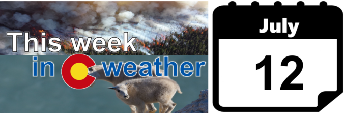
This week in Colorado weather: July 12, 2021

As of Monday morning, thick smoke from numerous large wildfires blankets the Front Range and this will remain the case through much of the week ahead. There will be some improvement in the smoke as monsoonal moisture returns in the coming days alongside late-day storm chances. Let’s run through the weather of the next ten days or so for the Denver Metro area.
Continue reading

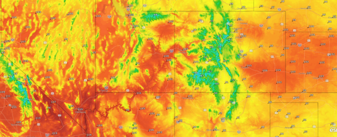
Despite the heatwave, Boulder failed to reach 100 degrees on Thursday and will likely come up short again today

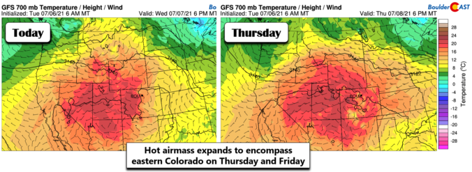
Denver’s temperature soared past the century mark on Thursday for the fourth time this summer, but Boulder came up short again. Near-record hot temperatures will again be possible on Friday ahead of a cold front which will set the stage for a pleasant weekend ahead. We discuss the cause of this heatwave, which cities will again be challenging records on Friday, and why we should consider ourselves lucky it wasn’t hotter this week.
Continue reading

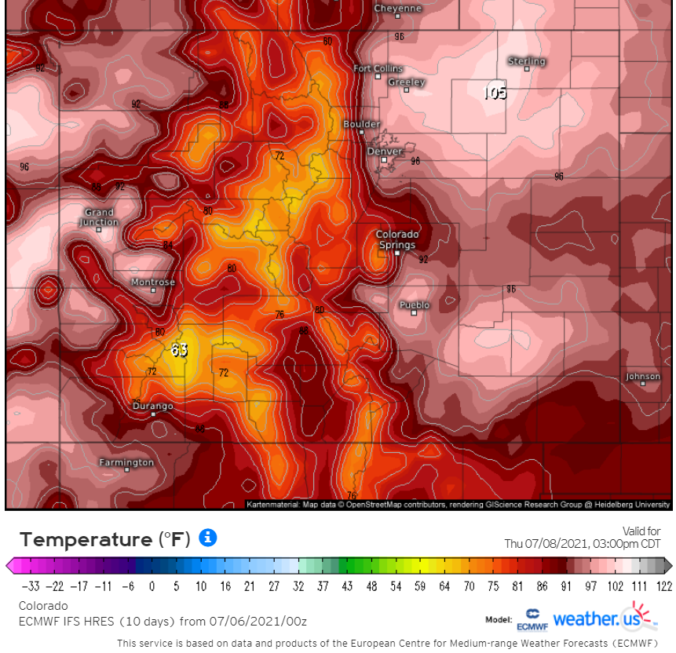
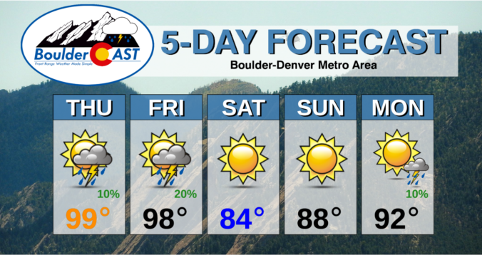
BoulderCAST Daily – Thu 07/08/21 | Approaching 100 degrees today & tomorrow, then a cold front

TDetailed Forecast Discussion: he ridge continues to strengthen across the Four Corners region today and this intensification trend will last through the weekend ahead spurring on another heatwave for the western United States. Over the next few days, the center of the ridge will retrograde westward from the Four Corners into southern California (see animation below). Similar to how the …

BoulderCAST Daily – Wed 07/07/21 | Dry & seasonal as monsoonal flow pauses, the heat ramps up tomorrow

ADetailed Forecast Discussion: pause has been put on the flow of monsoon/subtropical moisture into the southwestern United States as high pressure begins to intensity near the Four Corners. Steering winds in the Front Range are out of the northwest today with limited moisture embedded. As you can see below, moisture is below average today across northern Colorado while the monsoon …

BoulderCAST Daily – Tue 07/06/21 | About ten degrees cooler

TDetailed Forecast Discussion: emperatures today will be about 10 degrees cooler thanks to a cold front, increased cloud cover, and upslope flow. These changes are in response to a weak trough moving across the upper Midwest which has edged into the Front Range. The result will be a more stable atmosphere today behind the front. So despite the moisture and …

BoulderCAST Daily – Thu 07/01/21 | The apex of storm chances for the week is today as monsoon season begins!

HDetailed Forecast Discussion: appy first day of July! Yesterday's flash flooding threat was realized across the Front Range, but storm coverage was less than expected with many areas remaining dry or reporting just a few sprinkles. A couple very slow moving thunderstorms did develop east of Fort Collins and Greeley producing localized flooding with 2 to 5" of rainfall dumping …

« Older posts Newer posts »