Author: Andy (Page 3 of 220)
Born and raised in St. Louis, Andrew obtained a Ph.D. in Atmospheric Science from the University of Colorado in 2015. From 2015 to 2020, he worked remotely in Boulder as an atmospheric scientist with NOAA's Atlantic Oceanographic and Meteorological Laboratory in Miami. Andy is now a full-time meteorologist.
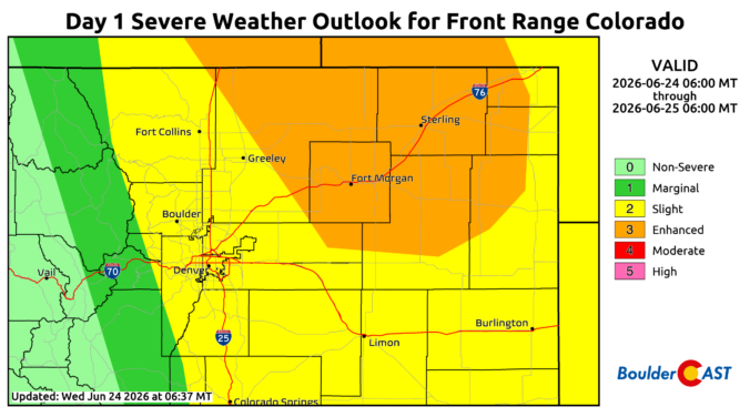
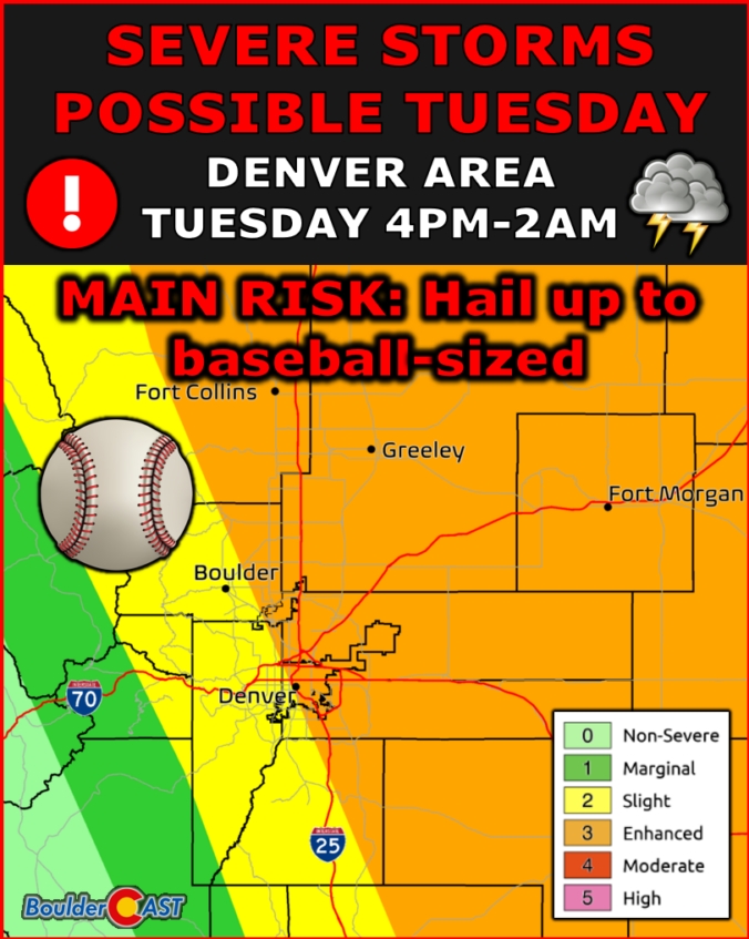
A western heat dome is gearing up to push the Front Range toward its hottest stretch of the season so far, with downslope winds and fire‑weather concerns building right alongside it. A weak front will try to break the heat later in the week, but largely fail as temperatures rebound into the 90s quickly by Friday and the weekend. As our spring wet season has now come to an end, storm chances remain woefully low throughout the extended leading to further drought intensification statewide.

Live View of Boulder

Current Conditions

Live Radar

Latest Smoke Forecast

Recent Premium Posts

BoulderCAST Daily – Sun 07/26/26 | Record Heat Continues…
🔥 Heat Advisory Still in Effect — Near-record temperatures near‑100° this afternoon. 🌩️ …
BoulderCAST Daily – Sat 07/25/26 | Temps soar into the upper 90s to near-100°
🔥 Heat Advisories — Heat Advisory this weekend as temps soar toward the …
BoulderCAST Daily – Fri 07/24/26 | Intense Heat Roars Back This Weekend as Storms Decline
🌤️ Today’s setup — Low to mid‑90s in the Metro area with collapsing …
3-Day Forecast

Trending Content

© 2026 Front Range Weather, LLC