Author: Andy (Page 116 of 217)
Born and raised in St. Louis, Andrew obtained a Ph.D. in Atmospheric Science from the University of Colorado in 2015. From 2015 to 2020, he worked remotely in Boulder as an atmospheric scientist with NOAA's Atlantic Oceanographic and Meteorological Laboratory in Miami. Andy is now a full-time meteorologist.
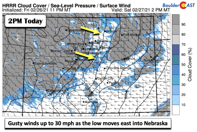

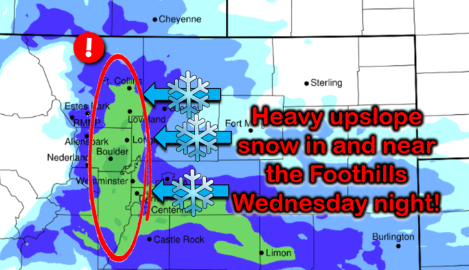
The weather models by and large are coming into a slightly snowier agreement this afternoon. We provide a quick update as winter weather bears down on the Front Range, including our final snowfall forecast map with totals adjusted upwards in many locations.

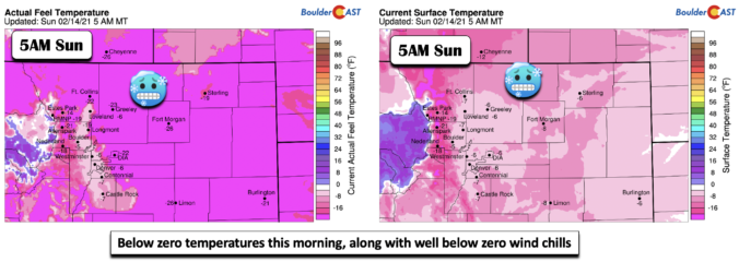
After a bitter cold stretch under the fringes of the Polar Vortex, a “relative” warming trend develops this week but we still remain largely below average. By mid-week a cold front will bring the return of light snow to the area. Week’s end may turn breezy and finally near normal with potential Chinook winds developing. Let’s dig into the details.

Live View of Boulder

Current Conditions

Live Radar

Recent Premium Posts

BoulderCAST Daily – Tue 06/02/26 | Storms Reload This Afternoon, But With Noticeably Less Bite
❄️ Monday delivered lots of hail to northeast Colorado, with one supercell tracking …
BoulderCAST Daily – Sun 05/31/26 | Dry and warm today but rain chances increase this week
🌦️ Overall dry and warm Sunday, though cannot rule out a very widely …
BoulderCAST Daily – Sat 05/30/26 | A stray shower today as most activity resides well east of Denver
🌦️ Spotty showers today, mainly well east of the Denver Metro area, where …
3-Day Forecast

Trending Content

© 2026 Front Range Weather, LLC