Front Range weather will be quiet for the most part this week — a welcomed change considering how crazy things were around here recently. Temperatures will stayed near to slightly above normal in the days ahead. The only chance of precipitation will be on Tuesday alongside a shortwave trough and a cold front. However, this system will mostly hit the Mountains. We are also watching a potential late-weekend system into early next week that could bring a return chance for snow for the area. Read on for more details.
This week’s highlights include:
- Precipitation: A vigorous upper-trough will race through Tuesday into Wednesday, with snow showers in the High Country but just isolated rain/snow gusty showers on the Plains Tuesday evening.
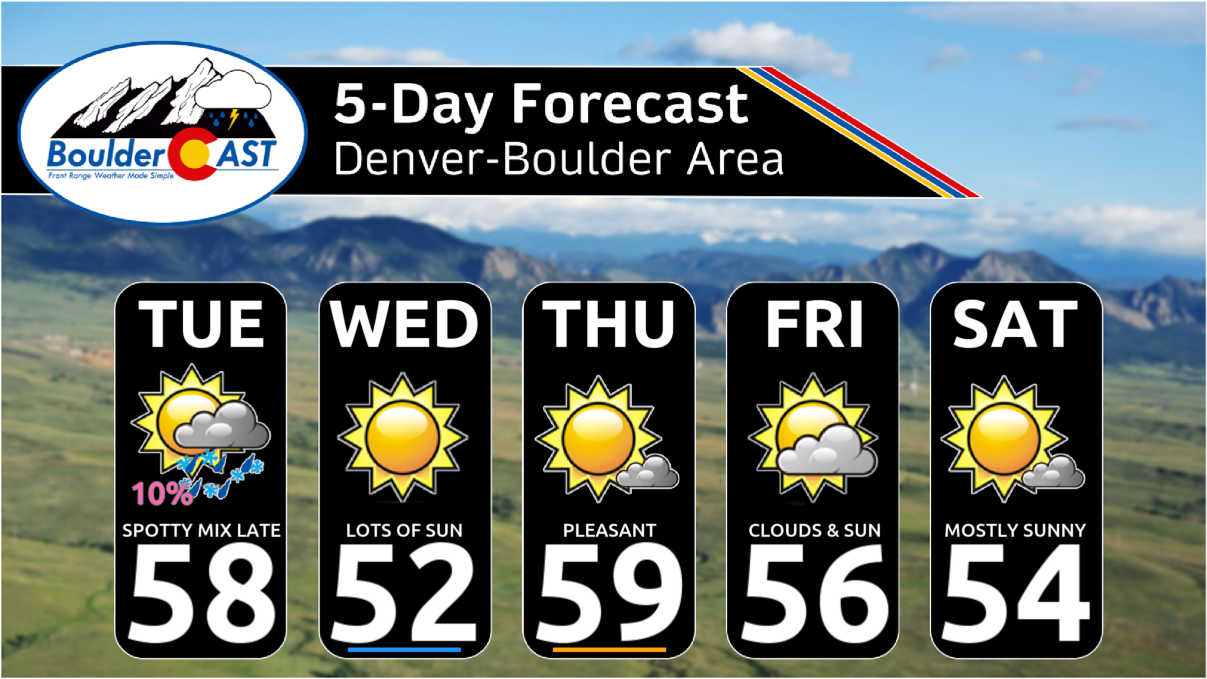
- Temperatures: Near to above normal high temperatures are expected through the week, ranging from the lower 50s to lower 60s
- Next shot of snow? Extended-range guidance hints at a possible cold trough late in the weekend to early next week. It’s too far out right now, but bears watching in the days ahead…
DISCLAIMER: This weekly outlook forecast is created Monday morning and covers the entire upcoming week. Accuracy will decrease as the week progresses as this post is NOT updated. To receive daily updated forecasts from our team, among many other perks, subscribe to BoulderCAST Premium.
Daily Forecast Updates
Get our daily forecast discussion every morning delivered to your inbox.
All Our Model Data
Access to all our Colorado-centric high-resolution weather model graphics. Seriously — every one!
Ski & Hiking Forecasts
6-day forecasts for all the Colorado ski resorts, plus more than 120 hiking trails, including every 14er.
Smoke Forecasts
Wildfire smoke concentration predictions up to 72 hours into the future.
Exclusive Content
Weekend outlooks every Thursday, bonus storm updates, historical data and much more!
No Advertisements
Enjoy ad-free viewing on the entire site.
Quiet with near to above normal highs
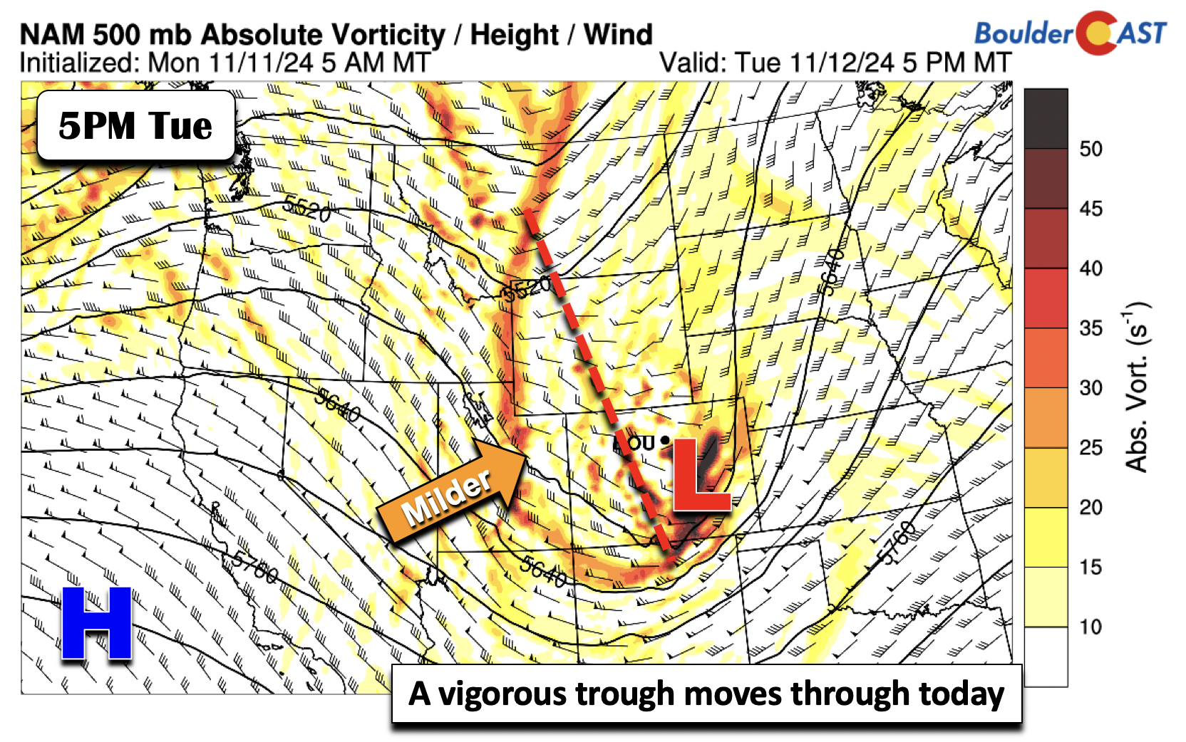
Avigorous trough will track from west to east across the state Tuesday afternoon and evening. Generally, a system this strong would warrant precipitation chances. And, to be fair, our chances today are not zero, but they are generally small. The trough, no doubt, will favor rain/snow showers across the higher terrain and some gusty winds on the Plains behind a passing cold front this evening. Milder weather will return late Wednesday, but more likely Thursday.
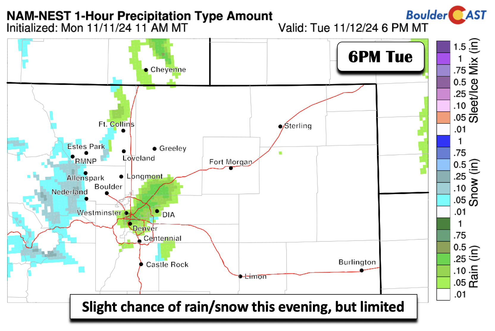
The NAM-NEST (below) and its partner the NAM, are the most robust on precipitation chances across the lower elevations Tuesday evening. It shows a mix of some rain/snow showers from Boulder to Denver. Temperatures Tuesday afternoon will rise to the mid to upper 50s ahead of the approaching trough and front.
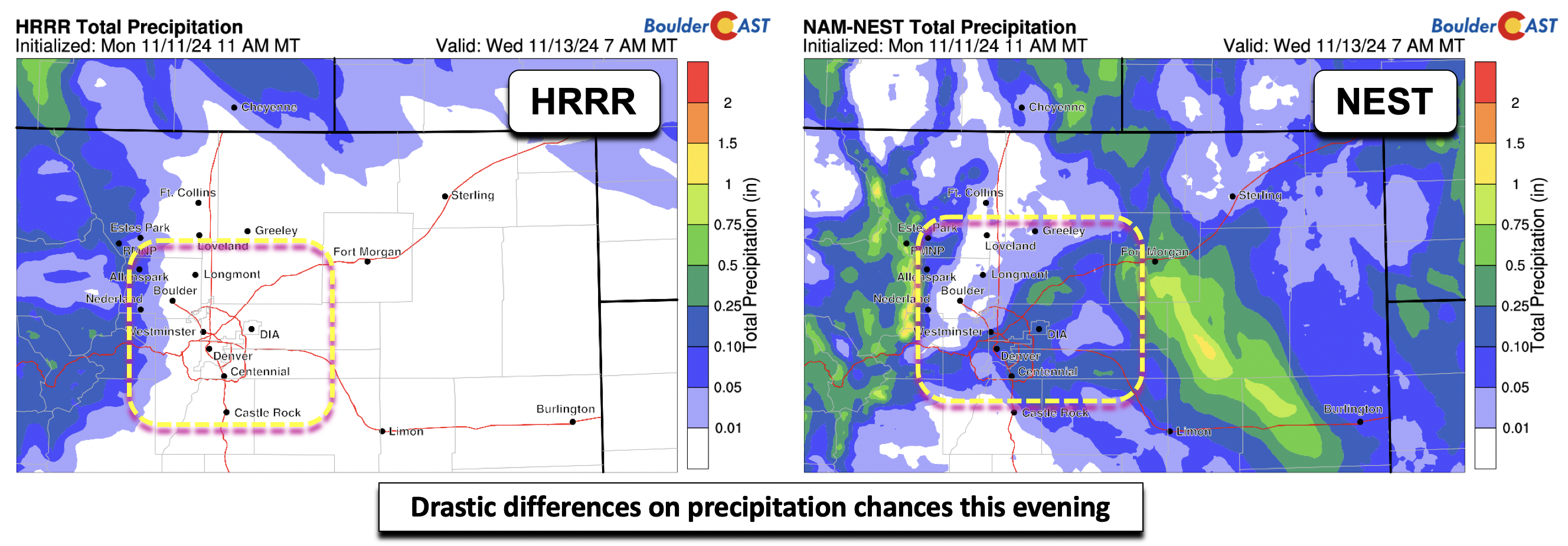
Unfortunately, we feel our rain/snow chances are quite low, given the overall downslope flow taking shape as an area of low pressure forms in northeast Colorado. Northwest winds as the low passes this evening will gust to between 20 and 40 MPH at times. The HRRR and NAM-NEST total precipitation forecasts through 7AM Wednesday vary quite a bit (below). The HRRR basically has nothing east of the Foothills, while the NEST has a trace to a quarter inch, mainly along/east of I-25. Realistically, the solution is likely somewhere in-between the two.
Overall, rain/snow chances are only about 10 to 20%, highest along east of Denver. But amounts should be light, with only a few hundredths expected. The main time frame to land a shower or two will be from 3PM to Midnight Tuesday evening.
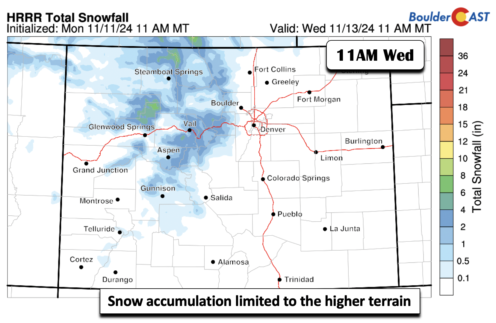
No doubt the High Country will see snowfall Tuesday into Tuesday night from this passing wave, with the northwestern facing peaks in northwest Colorado favored under upslope flow there. Amounts from the HRRR suggest some 2 to 7 inches by midday Wednesday.
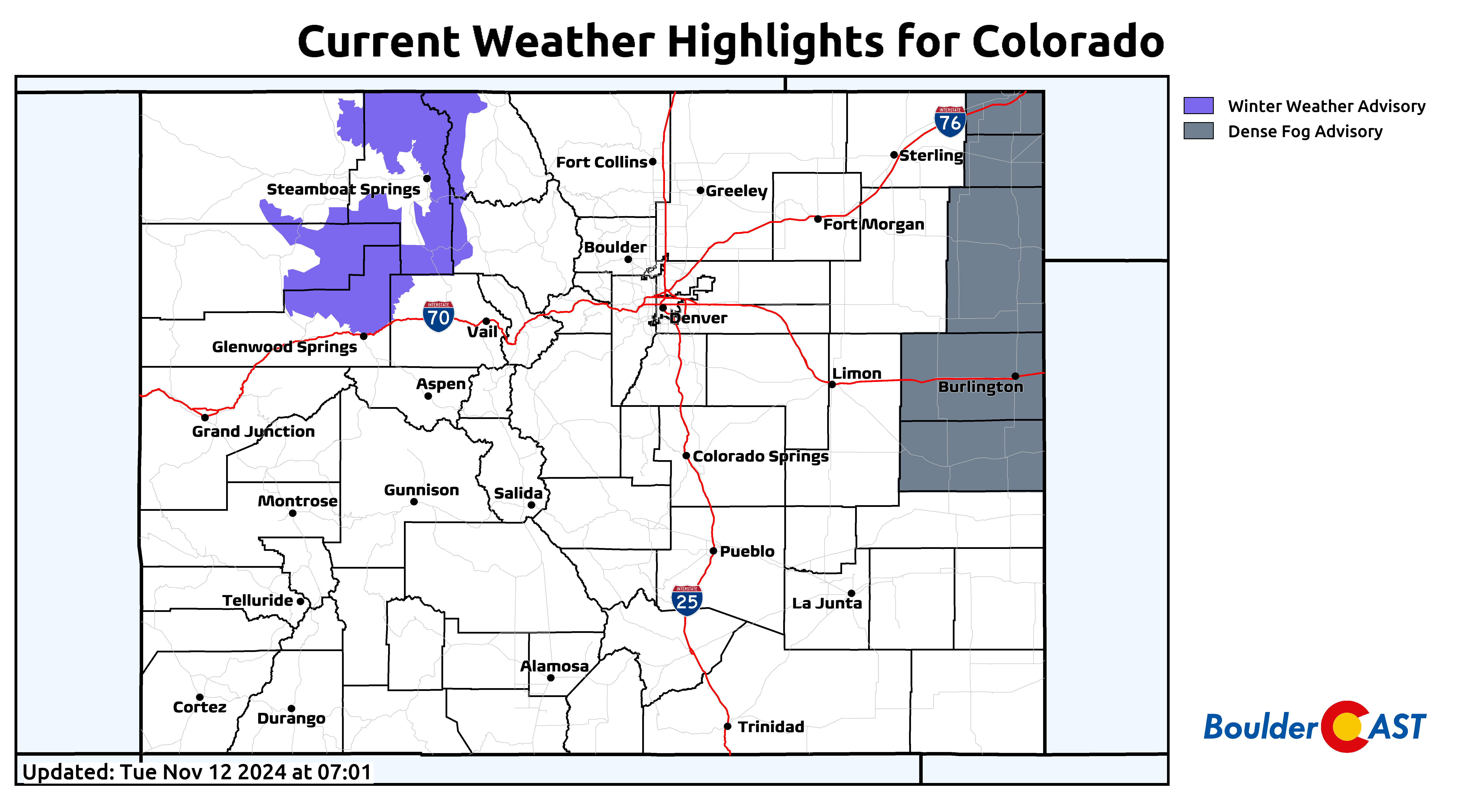
The Flat Tops, Park and Gore Ranges near Steamboat have a Winter Weather Advisory in effect through Wednesday morning. Use caution if you happen to be traveling wayyy over there!
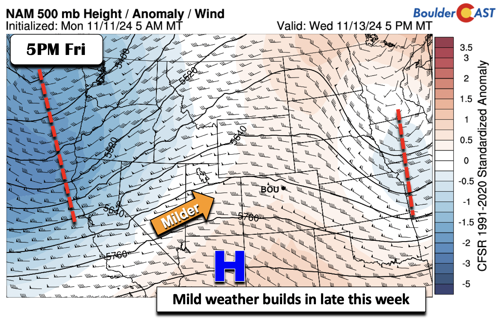
After a chilly day on Wednesday behind the cold front in the lower 50s (slightly below normal), a ridge of high pressure will start to build eastward for Thursday and Friday. That will spell out highs to end the work week slightly above normal in the mid 50s to low 60s.
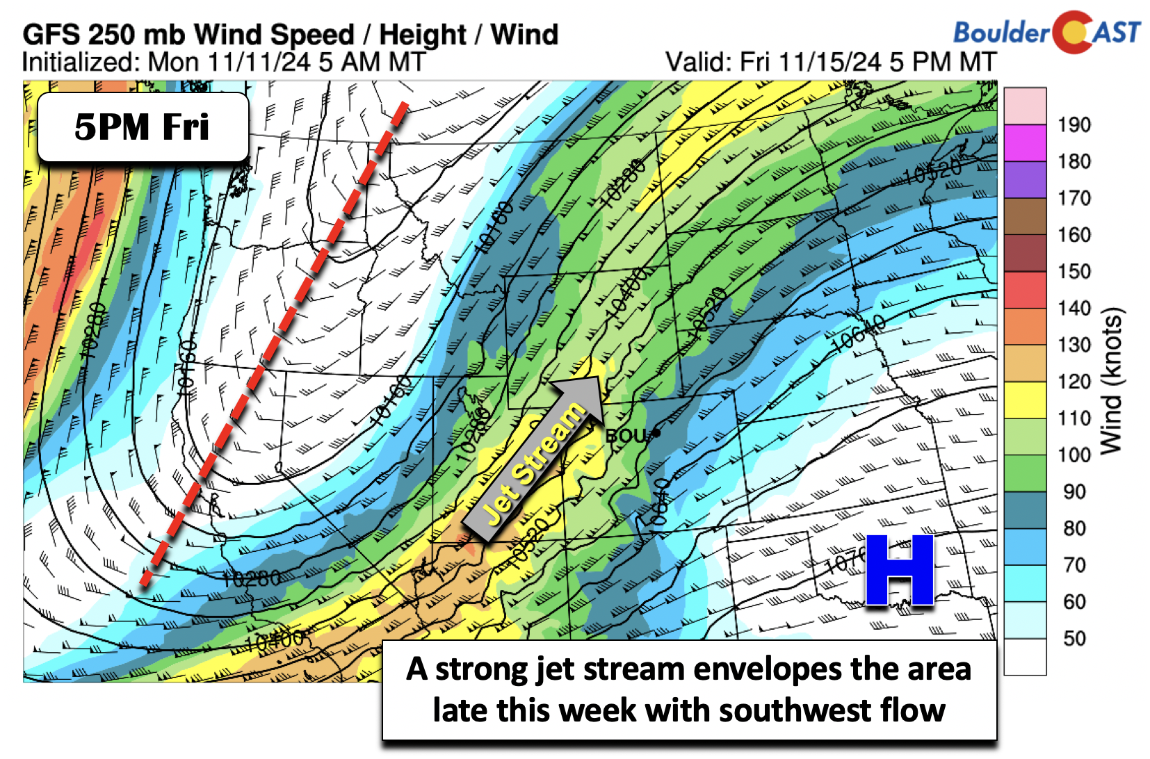
A deep trough is poised to move onshore over the western and southwestern US late this week on Friday and track east-northeast into Saturday. As that happens, a strong jet stream in the southwest flow will aid the passage of another cold front sometime Saturday. That should keep temperatures largely in the 50s for us in the extended.
Watching a late-weekend system
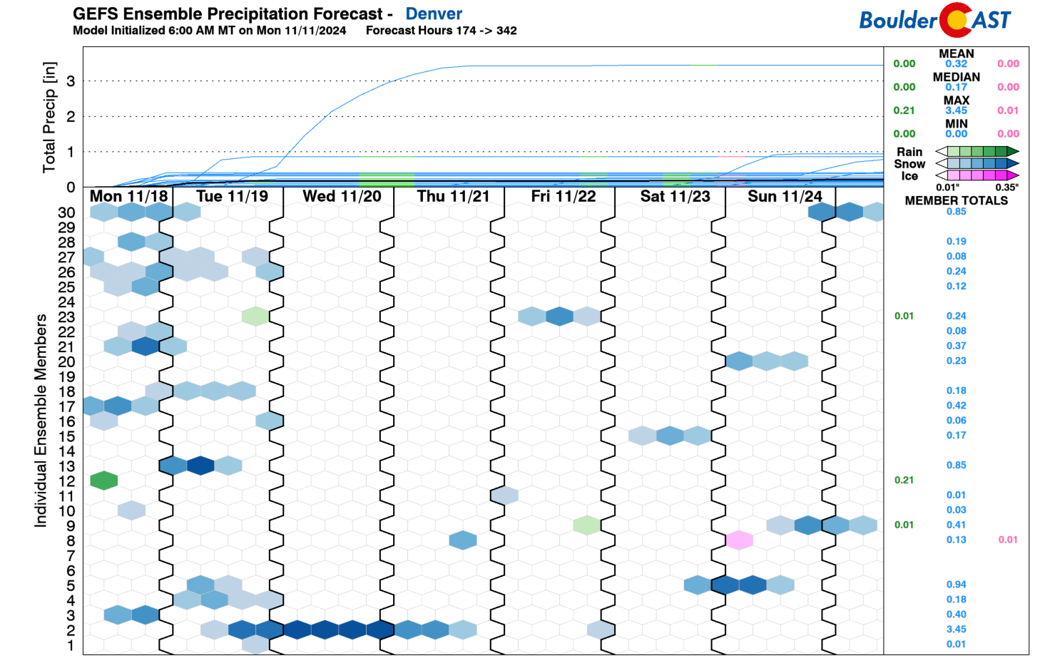
Over the weekend, the guidance is mixed on how the aforementioned deep trough in the southwest US ejects northeastward and possibly closes off to become a watcher for early next week — around Sunday or Monday. The GEFS extended plume precipitation forecast has some members that produce snowfall over Denver during this timeframe. However, as you can see, there is quite a bit of spread with little to no consistent precipitation signal.
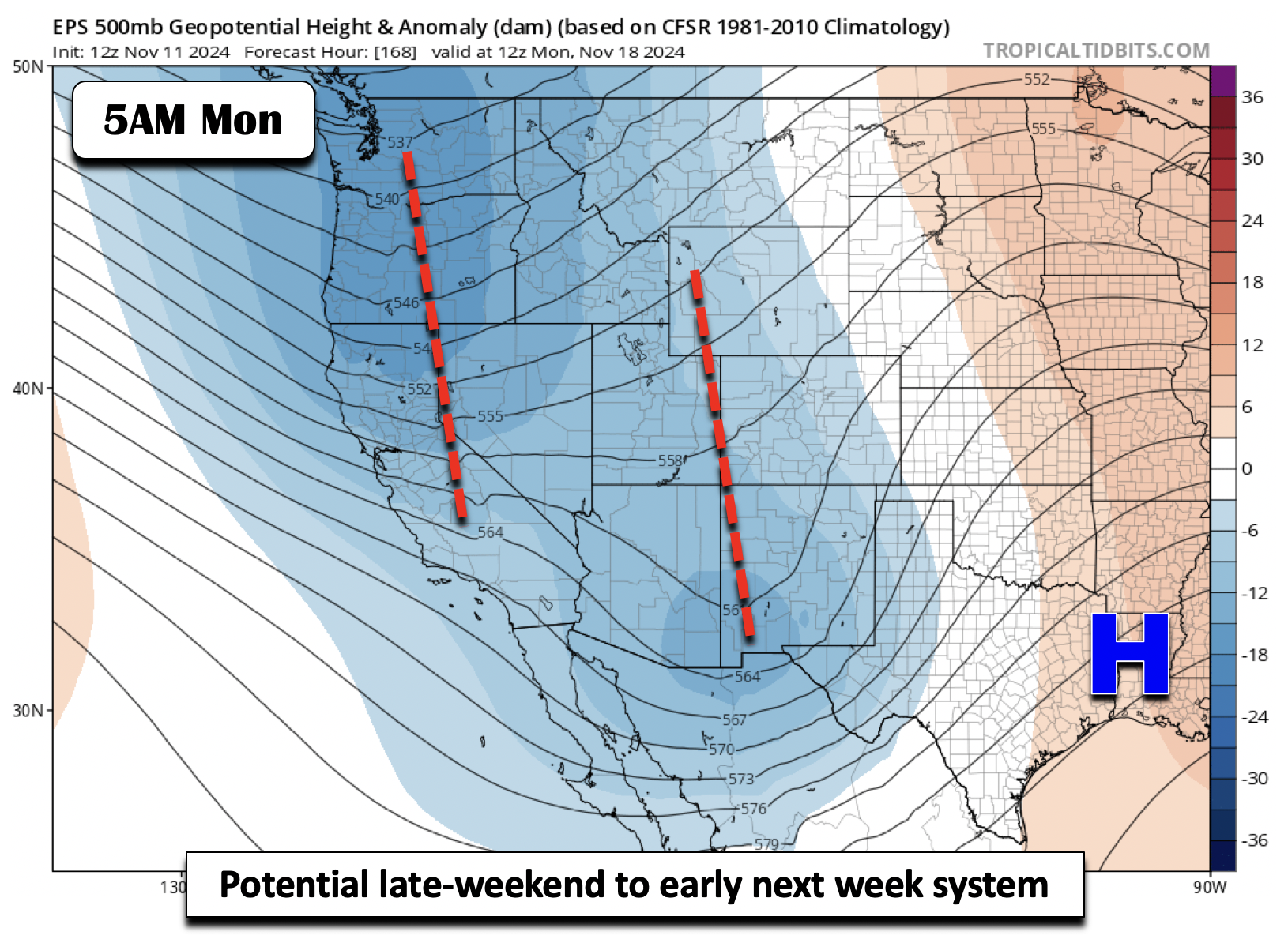
Nevertheless, the European ensemble and associated global models show the system could potentially slide northeastward sometime Monday, as indicated below. Depending on where it ejects could favor a return chance for snow in the middle part of November. This is still too far out to make any definitive conclusions, but it bears watching. We’ll keep you posted.
For now, plan on a brief spritz of rain/snow/wind Tuesday evening followed by mostly quiet and seasonal weather the rest of the week into the weekend. Highs every day will be in the 50s, with perhaps a chance to touch the lower 60s in some locations.
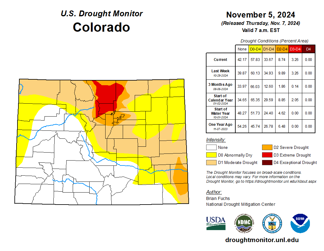
We’re still riding our moisture high from last week’s dumping of rain and snow in the Front Range, but do keep an eye out in a few days for an updated drought map which should look a better than it does now. Enjoy the short work week ahead!
Forecast Specifics:
Tuesday: Sunny skies becoming mostly cloudy with a 10-20% chance of isolated rain or snow showers between 3PM and Midnight. Any showers could be accompanied by up to 35 MPH wind gusts. Highs in the mid to upper 50s on the Plains and mid to upper 40s in the Foothills. Accumulation up to an inch is possible in the highest Foothills.
Wednesday: Sunny and a little gusty in the morning. There could be a few late-day wave clouds developing towards sunset. Chillier with highs in the low 50s on the Plains and low 40s in the Foothills.
Thursday: Warmer under sunny skies with highs in the upper 50s to near 60 for the Plains and upper 40s to near 50 in the Foothills.
Friday and Saturday: A mix of clouds and sun with highs ranging from the middle to upper 50s for the Plains and mid to upper 40s in the Foothills.
Weekend: There is a decent amount of uncertainty in the extended but there could be a system to watch for return chance of snow late Sunday or Monday, but as of now, this is a low risk.
Get BoulderCAST updates delivered to your inbox:
DISCLAIMER: This weekly outlook forecast is created Monday morning and covers the entire upcoming week. Accuracy will decrease as the week progresses as this post is NOT updated. To receive daily updated forecasts from our team, among many other perks, subscribe to BoulderCAST Premium.
Daily Forecast Updates
Get our daily forecast discussion every morning delivered to your inbox.
All Our Model Data
Access to all our Colorado-centric high-resolution weather model graphics. Seriously — every one!
Ski & Hiking Forecasts
6-day forecasts for all the Colorado ski resorts, plus more than 120 hiking trails, including every 14er.
Smoke Forecasts
Wildfire smoke concentration predictions up to 72 hours into the future.
Exclusive Content
Weekend outlooks every Thursday, bonus storm updates, historical data and much more!
No Advertisements
Enjoy ad-free viewing on the entire site.
Enjoy our content? Give it a share!





You must be logged in to post a comment.