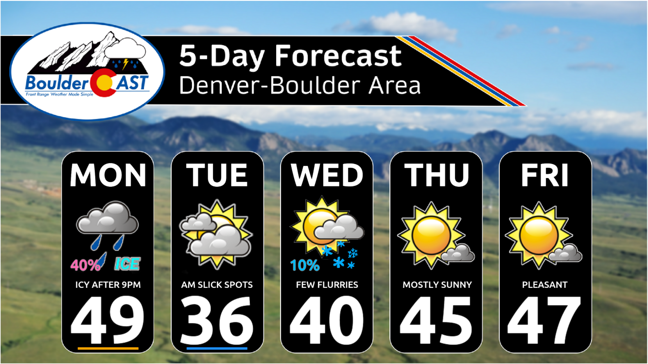
A shortwave trough from the Pacific Northwest will track into the Desert Southwest over the next few days and be a player for our weather through much of the week ahead. A cold front moving south Monday night will bring a threat of a wintry mix of freezing drizzle, snow and rain into early Tuesday, with some slick spots possible in Boulder and Fort Collins. Afterwards, the system is forecast to remain south of us the rest of the week but could bring a slight chance of snow for the Front Range Plains Wednesday or Thursday — but that chance is slim. Otherwise, this week will be mainly dry with below normal temperatures preceding a warming trend heading into the weekend. The outlook for a “white” Christmas is also not looking so good. Read on for more details.
This week’s highlights include:
- A shortwave trough diving southeast into the Desert Southwest will impact our weather much of the week with below normal temperatures after Monday
- A southward moving cold front Monday night will warrant a wintry mix of freezing drizzle or light snow — mainly from Boulder County northward with limited slick spots
- Highs near the upper 40s Monday will trend below normal into midweek with middle 30s to middle 40s
- The shortwave system is forecast to remain south of us, but it could bring a slight chance of light snow Wednesday or Thursday, mainly to our south
- Temperatures moderate closer to normal and eventually above average by the weekend as high pressure ridging builds in from the West Coast
DISCLAIMER: This weekly outlook forecast is created Monday morning and covers the entire upcoming week. Accuracy will decrease as the week progresses as this post is NOT updated. To receive daily updated forecasts from our team, among many other perks, subscribe to BoulderCAST Premium.
Daily Forecast Updates
Get our daily forecast discussion every morning delivered to your inbox.
All Our Model Data
Access to all our Colorado-centric high-resolution weather model graphics. Seriously — every one!
Ski & Hiking Forecasts
6-day forecasts for all the Colorado ski resorts, plus more than 120 hiking trails, including every 14er.
Smoke Forecasts
Wildfire smoke concentration predictions up to 72 hours into the future.
Exclusive Content
Weekend outlooks every Thursday, bonus storm updates, historical data and much more!
No Advertisements
Enjoy ad-free viewing on the entire site.
A chance of freezing drizzle/snow Monday night
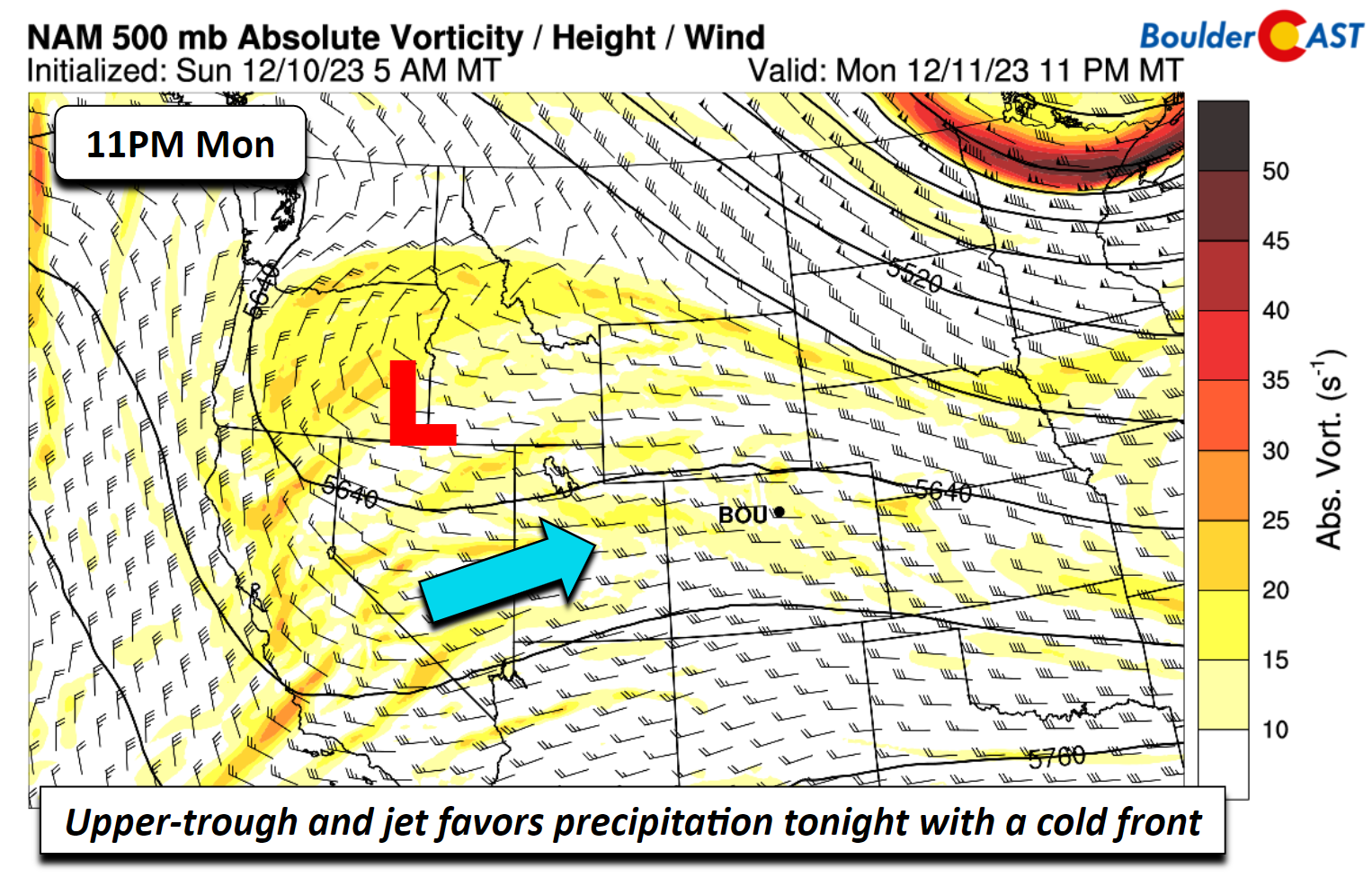
Ashortwave trough, currently over the Pacific Northwest on Monday, will impact our weather much of the week ahead — but more on that later. The trough today will be situated over Oregon and Idaho. East of the trough, southwest flow will be in place across northern sections of Colorado and southern Wyoming. As you’ll see in a bit, the jet stream will be oriented west to east to our north and influence some banded precipitation across our northern sections, but it also generates some upslope with a cold front moving south tonight.
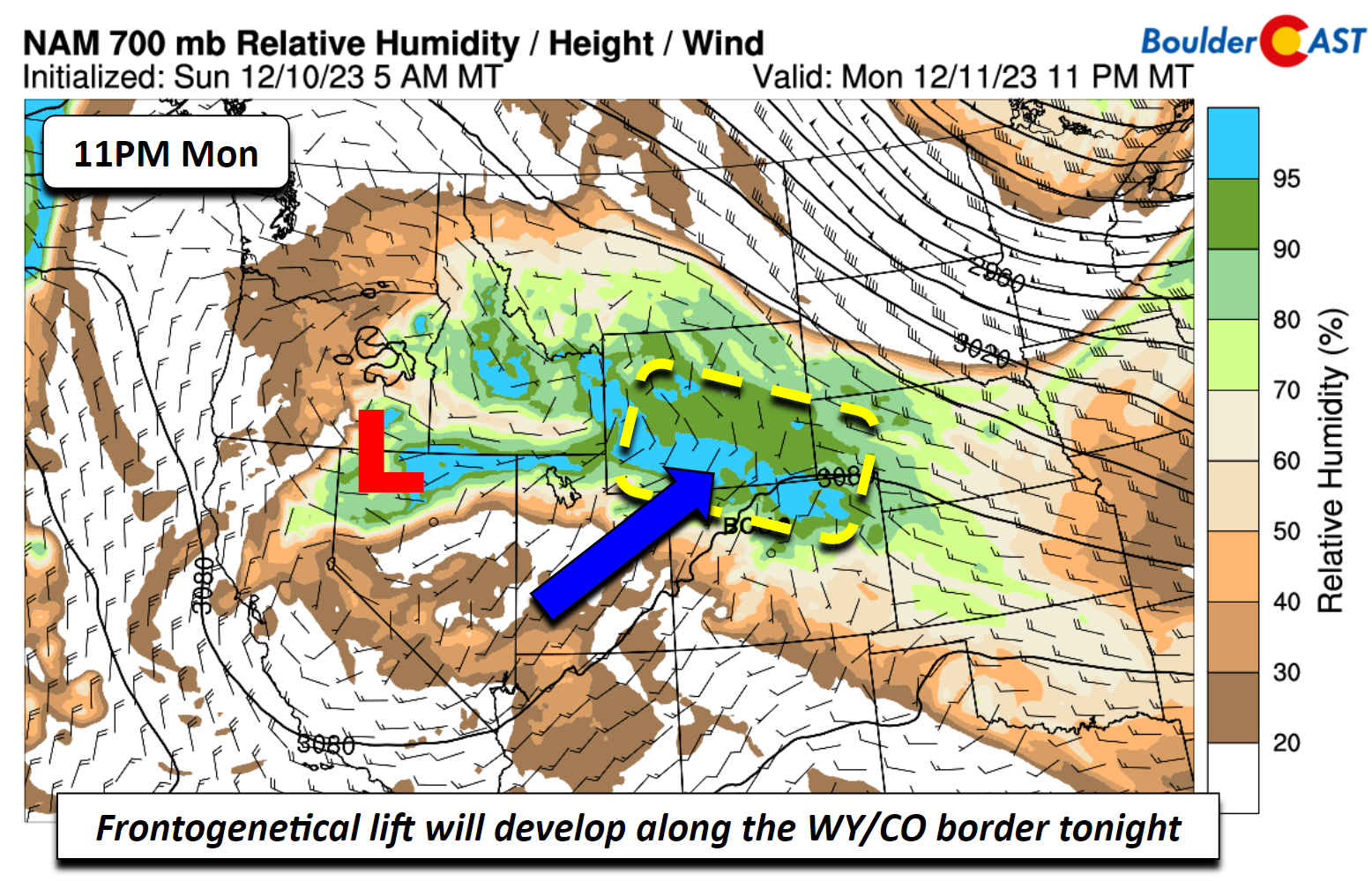
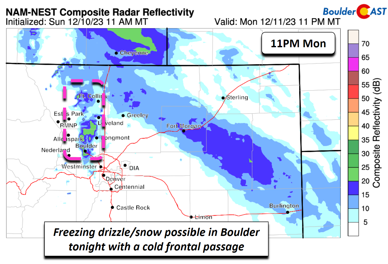
East of the upper-low, southerly winds in the low to mid-levels will favor frontogenetical forcing as the surface cold front moves south. The upper-jet overhead will favor banded precipitation. This banded precipitation will largely spare us, we expect it to remain along and north of Fort Collins. However, the lift aloft should combine with shallow upslope for a chance of freezing drizzle in Boulder, as we’ll discuss next.
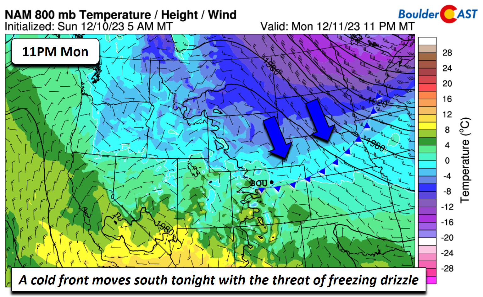
Ahead of the cold front tonight, temperatures will warm up to the upper 40s on Monday. A pre-frontal trough will move through this afternoon, but the cold air and front will not pass until later tonight, no later than 11 PM (see below).
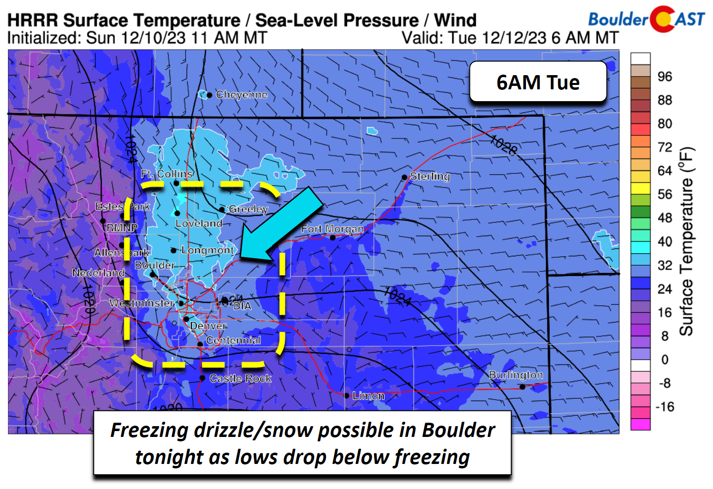
As the front moves south, temperatures will drop near to below freezing into the upper 20s to around 30 by the overnight hours into daybreak Tuesday. The HRRR also shows a weak upslope flow, maximized in Boulder County and near the Foothills heading northward towards Wyoming.
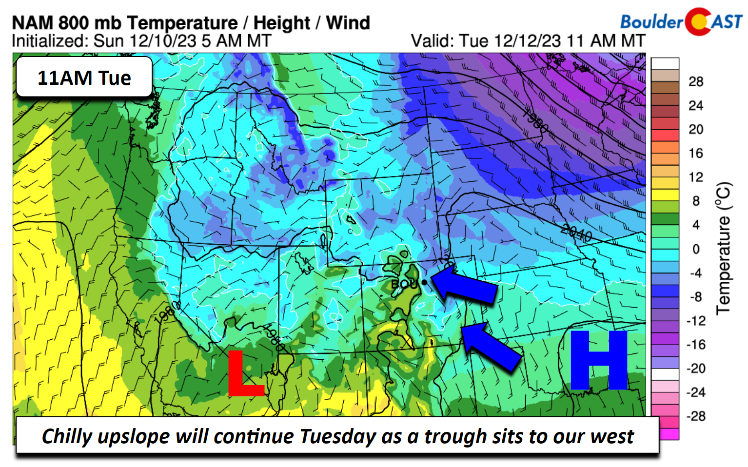
The air aloft behind the front is not particularly cold enough for ice crystal growth to favor a dominant precipitation type of snow. The cold air about 5000 ft off the ground is about -5 to -8°C. Typically, snow is favored when temperatures are near -10°C or colder. Given that, the shallow upslope behind the front will bring some light freezing drizzle, mainly in Boulder and Larimer Counties (see below). The high-res models show the best chance of this freezing drizzle between 10:00 PM and 5:00 AM Monday night. There could also be some light snow mixed in at times, but snow amounts should generally be no more than a light dusting as the deeper lift resides to our north near the Wyoming border. The freezing drizzle could produce some slick spots on the roadways in Boulder so use caution when heading to work Tuesday morning.
A shortwave trough impacts us much of the week with below normal temperatures
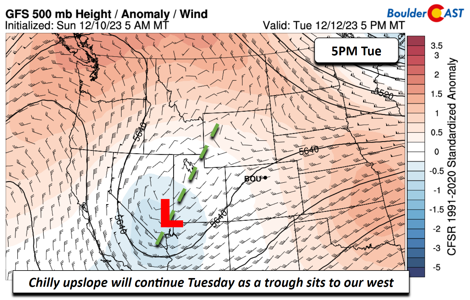
The aforementioned shortwave trough over Oregon is forecast in most of the model guidance to take a southeastward track toward the Desert Southwest through the week. Most model solutions also keep it to our south with limited impacts across the Front Range. Even with that, it will influence our highs via cloud cover and persistent chilly upslope flow. On Tuesday, the system is forecast to be near southern Nevada.
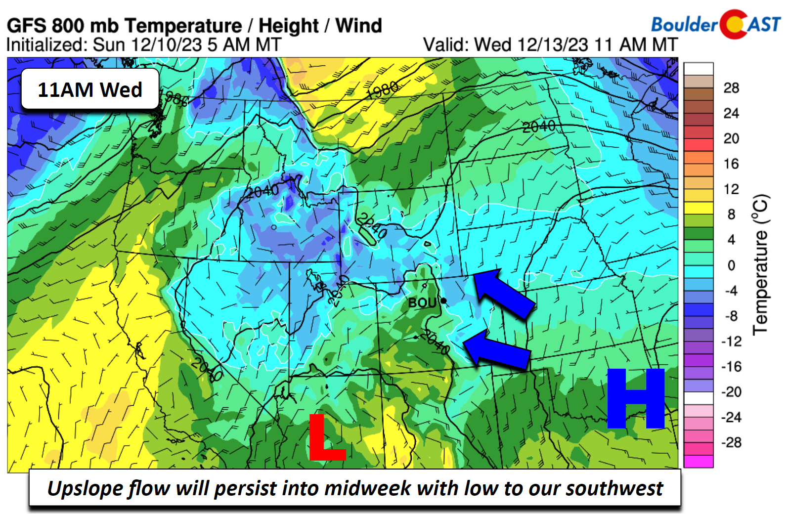
With surface high pressure over Oklahoma and a surface low over southern Nevada, chilly upslope flow on the Plains will result in a cooler than normal day with upper 30s for highs. Cloud cover will be prevalent as well with the upper-trough to our southwest. There could be a chance of light snow Tuesday night in the upslope flow but most of the lift will reside to our southwest in southern parts of Colorado. At this stage, our confidence is too low to forecast an amount but we would not expect much impacts unless the forecast drastically changes.
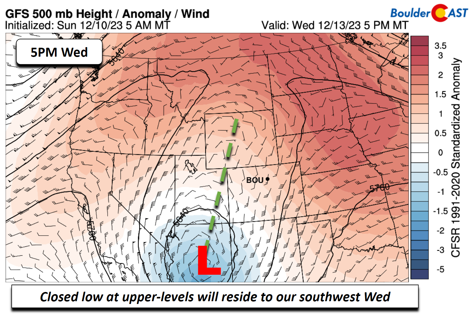
The upper-low on Wednesday will move just a tad, located over southern Arizona, with a trough axis extending into western Wyoming.
High pressure at the surface will continue to reside over Oklahoma and the surface low will move into southern Arizona. Upslope flow, therefore, remains into midweek with temperatures still below normal in the upper 30s to low 40s under partly sunny skies.
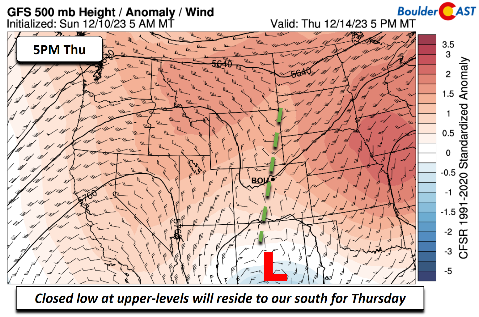
Most models keep the system still to our south Thursday, though the GFS (below) is a tad farther south than the operational ECMWF. The trough on Thursday will be over central New Mexico. We should stay dry, barring any drastic northward shift in the system.
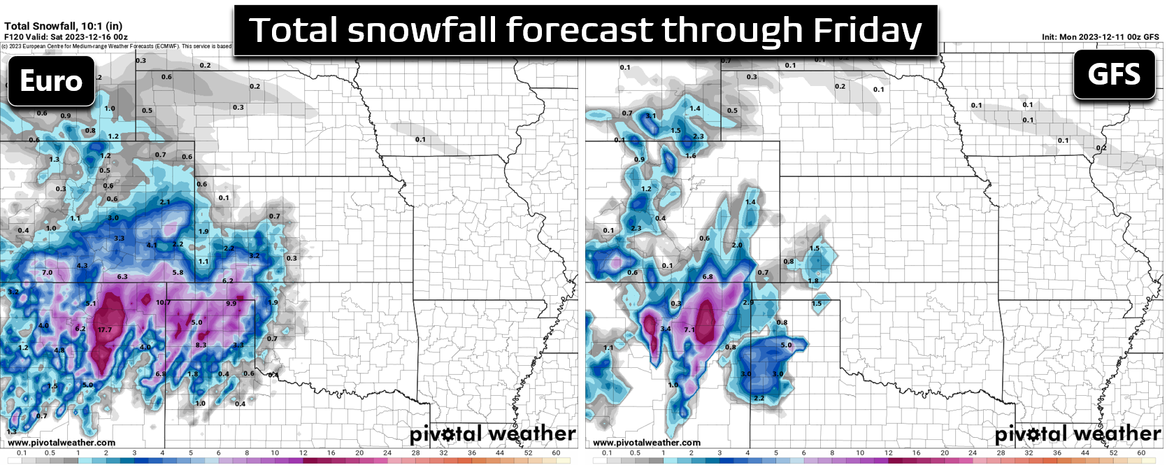
Snow is favored over the southern Colorado mountains Wednesday into Thursday, but the most substantial snow will land across northern New Mexico. As you can see below, the Euro model has the breadth of the snowfall stretching further northward into Colorado than the GFS. While direct impacts into the Denver Metro area seem quite unlikely, this situation will continue to be monitored in case there is a northward shift in track.
Moderating temperatures for the upcoming weekend
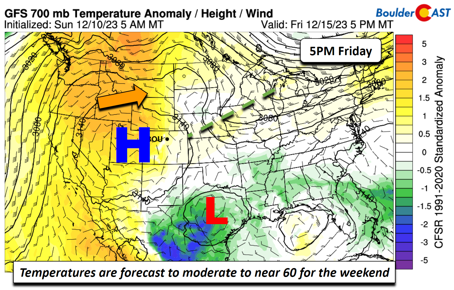
Ensemble and deterministic data show that by week’s end the aforementioned upper-low will finally slide to our east and south over Texas (below). In its wake, a strong and anomalous warm ridge of high pressure will build into much of the Intermountain West and West Coast. This will lead to a trend towards above normal temperatures for the weekend, possibly into the 60s by Saturday and Sunday. Friday will be a transition day, with highs close to the lower 50s.
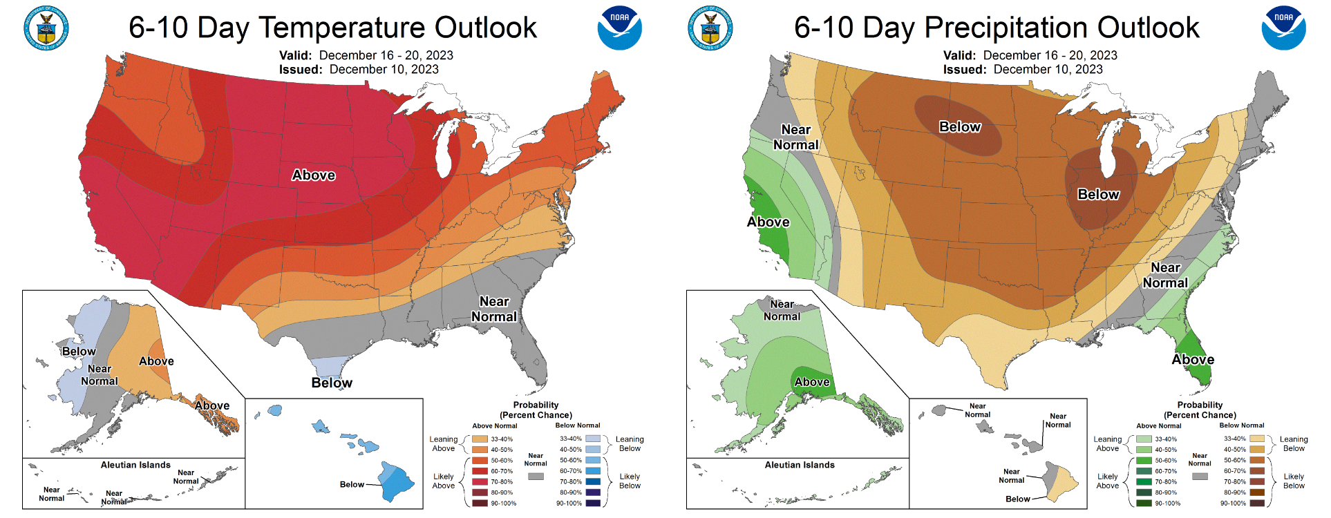
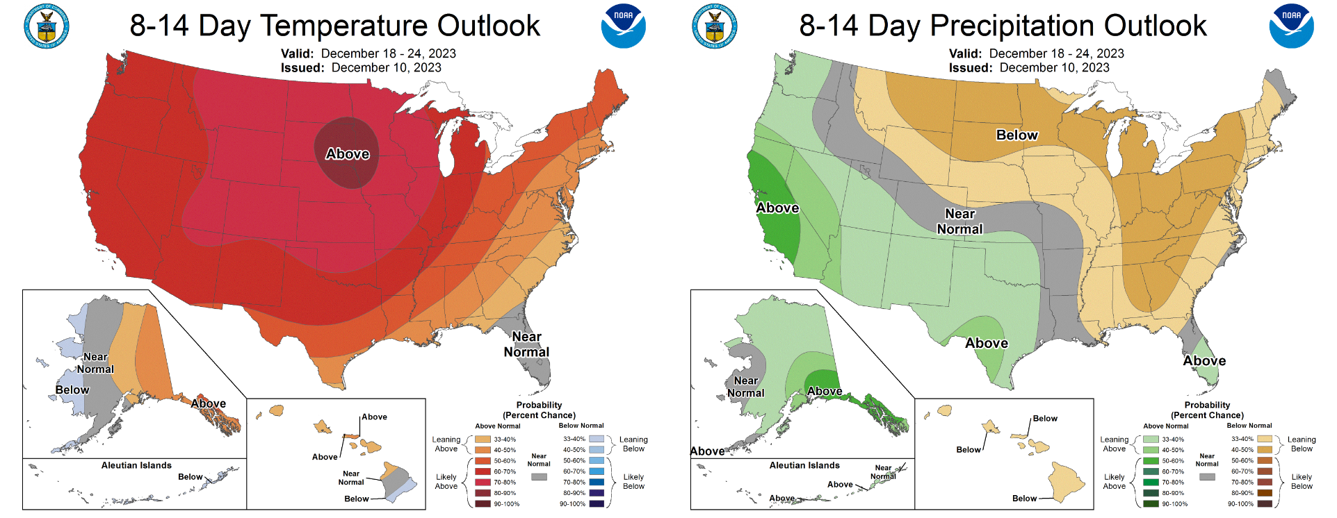
Both the 6-10 day and 8-14 day outlooks from the Climate Prediction Center look warm and dry for our area which certainly doesn’t bode well for any hopes of white weather around the holidays. We won’t fully rule out a snowstorm between now and then, but it is looking less likely by the day.
Have a great week!
Get BoulderCAST updates delivered to your inbox:
Forecast Specifics:
Monday: Morning sunshine, then increasing clouds with highs in the upper 40s for the Plains and upper 30s in the Foothills. Tonight, lows dipping into the upper 20s to around 30 on the Plains and lower 20s in the Foothills, with freezing drizzle and light snow for the Plains/Foothills, mainly along/north of Boulder. A light glaze of ice possible with little or no snow accumulation.
Tuesday: Partly to mostly cloudy and cold. Watch for side-streets and sidewalks to be slick in the morning with a coating of ice. Highs in the middle 30s on the Plains and upper 20s in the Foothills. Light snow or flurries may develop late at night into early Wednesday.
Wednesday: Partly sunny and chilly with highs near the low 40s for the Plains and low 30s in the Foothills. A few flurries may be around in the morning or afternoon with little to no accumulation expected.
Thursday: A mix of clouds and sunshine. Highs warmer but still below average in the mid to upper 40s for the Plains and middle 30s in the Foothills.
Friday: Partly cloudy and a tad warmer with highs closer to average with near 50 for the Plains and upper 30s in the Foothills.
DISCLAIMER: This weekly outlook forecast is created Monday morning and covers the entire upcoming week. Accuracy will decrease as the week progresses as this post is NOT updated. To receive daily updated forecasts from our team, among many other perks, subscribe to BoulderCAST Premium.
Daily Forecast Updates
Get our daily forecast discussion every morning delivered to your inbox.
All Our Model Data
Access to all our Colorado-centric high-resolution weather model graphics. Seriously — every one!
Ski & Hiking Forecasts
6-day forecasts for all the Colorado ski resorts, plus more than 120 hiking trails, including every 14er.
Smoke Forecasts
Wildfire smoke concentration predictions up to 72 hours into the future.
Exclusive Content
Weekend outlooks every Thursday, bonus storm updates, historical data and much more!
No Advertisements
Enjoy ad-free viewing on the entire site.
Enjoy our content? Give it a share!





You must be logged in to post a comment.