The pipeline remains active for quick-moving disturbances to trek across Colorado. Mountain snow is the main story this week, though gusty downslope winds across the lower elevations come in as a close second.
Mountain snow, windy down low
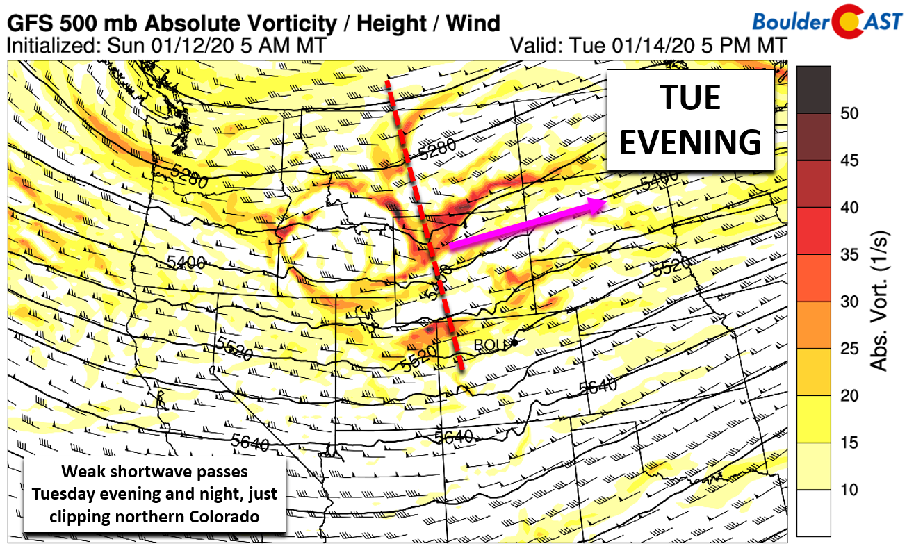
The active weather pattern will continue through the week with a series of quick-moving shortwave disturbances impacting the northern Rockies. The GFS 500 mb vorticity forecast animation below shows at least three gearing-up for the week ahead: the first Monday morning, the second Tuesday night, and a third on Friday.
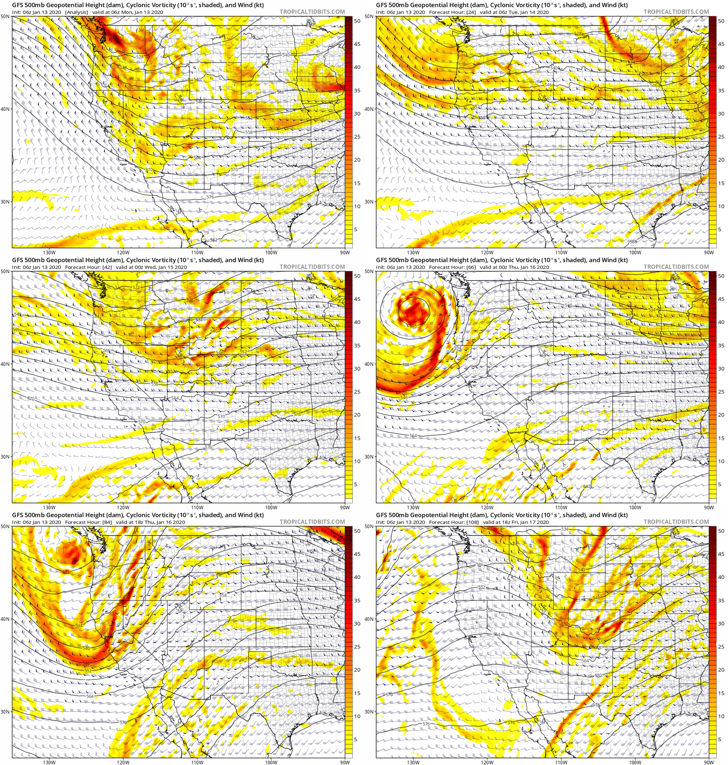
GFS 500mb vorticity animation through Friday afternoon showing three shortwaves moving through this week
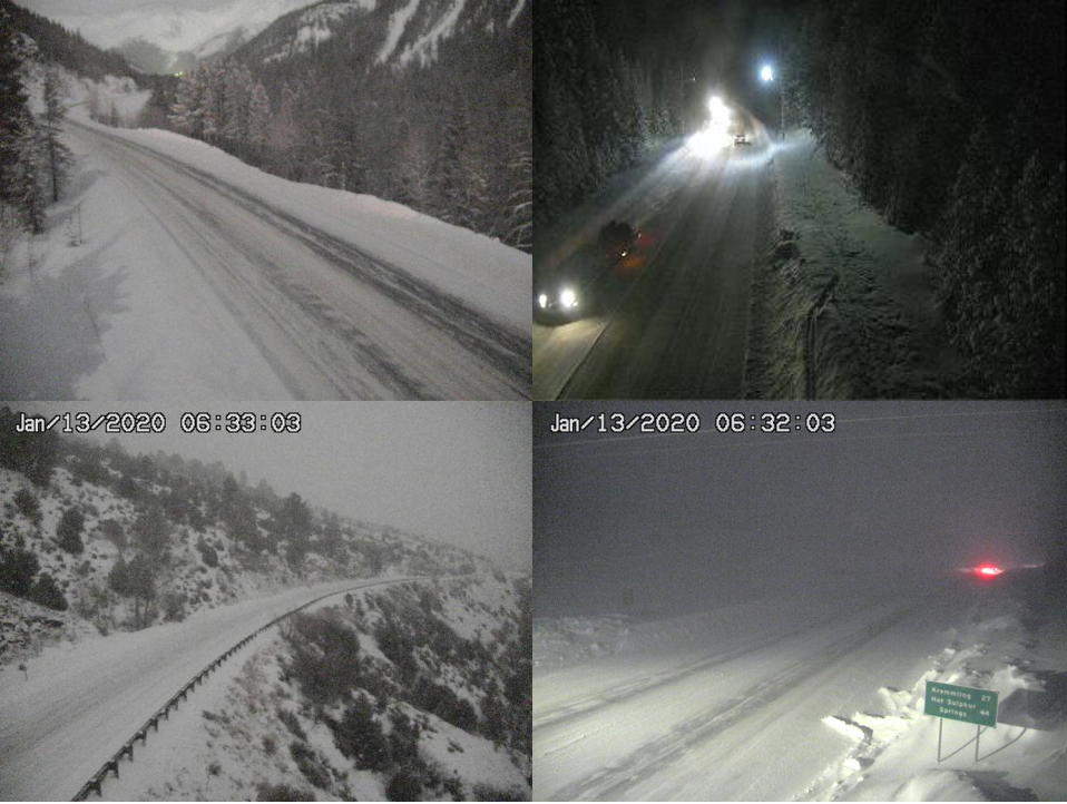
The first is already moving through the area as of Monday morning with light to moderate snowfall occurring in the Mountains statewide. The webcams this morning are a little snowy!
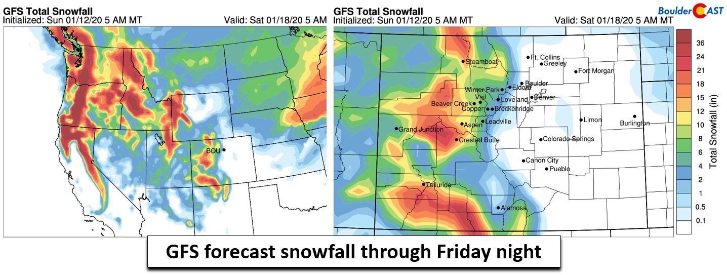
You know the drill with these quick-movers embedded in the northwest flow: snowfall in the High Country will be the main story this week as the Denver Metro area sees primarily downslope with each passing disturbance. Ahead of the shortwaves, large-scale lift and favorable orographics will lead to widespread snow in the Mountains. At times, snowfall rates could be rather intense, but the quick-moving nature of the flow will limit overall accumulations. The GFS model is predicting week-long snow totals of 8 to 16″ in the Mountains (shown below), with locally more than 2 feet possible. As is the norm, Colorado will receive whatever Pacific moisture is left-over after the upstream mountain ranges squeeze out what they want. The Pacific Northwest, Idaho and Utah will pile up much more powder than Colorado this week. Beggars can’t be choosers, though… This should be enough to keep the skiers satisfied for the next week or so!
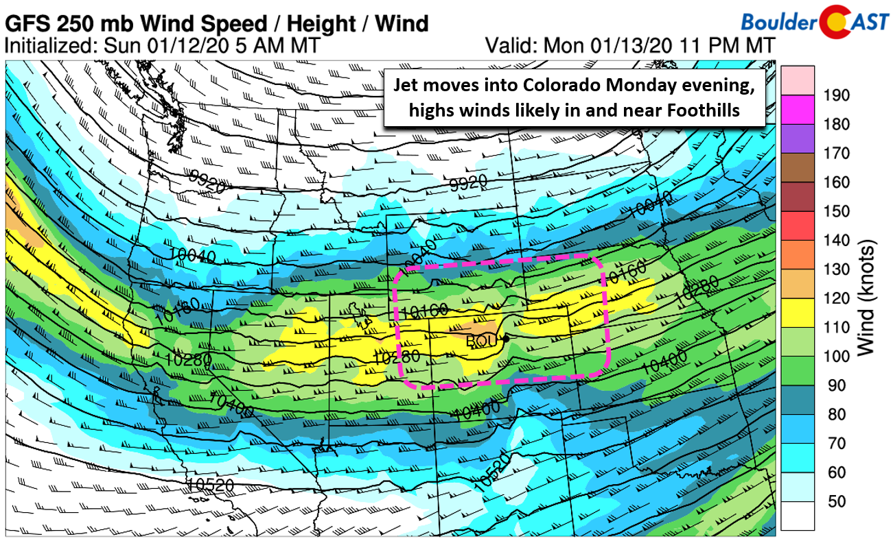
East of the Continental Divide, it will be a much different week in weather! We don’t have to worry about snow, or any precipitation for that matter. The feature we’re most concerned with is more than five miles above the surface. That’s right…the overhead jet stream! In one form or another, the jet will either be directly overhead or very close nearby through Friday evening. This will keep things blustery across the Front Range during this time. Remember those shortwaves we mentioned earlier? As each one exits our area to the east, large-scale subsidence and increased stability will likely lead to periods of very strong winds in and near the Foothills.
The first potential wind event is already coming into focus for late Monday afternoon and into the evening. As our first disturbance exits and snowfall tapers off in the Mountains, a 130 MPH jet streak will enter the picture. This generates a weak mountain wave across northern Colorado. We’re not seeing any extreme winds, like those that occurred just one week ago, but do expect a breezy afternoon turning quite windy for areas in and near the Foothills. Gusts of 55+ MPH are possible in these areas. Winds should die down some after midnight Monday night.
Tuesday looks to be more of the same for the Boulder and Denver area. Our next upper-level shortwave will move through mainly Wyoming and extreme northern Colorado, probably too far north to produce another mountain wave. While we do expect continued gusty conditions across the Plains during the day, there shouldn’t be another round of overly strong winds. If there is, it wouldn’t be until Wednesday morning.
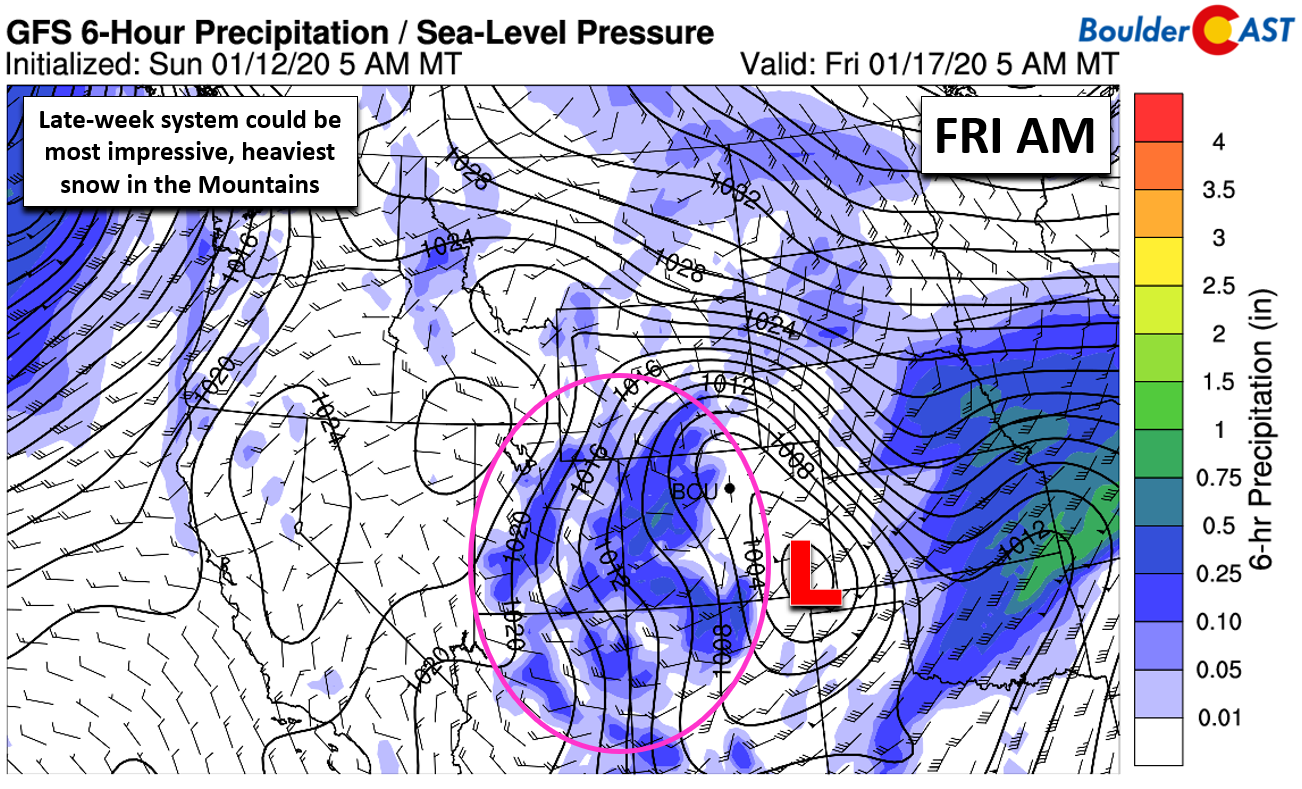
After calmer weather Wednesday and early Thursday, the final shortwave of the week will enter the picture Thursday night. It’s currently advertised to be the most intense and therefore most intriguing. It should offer the greatest potential snowfall in the High Country, with snow beginning Thursday evening continuing into Friday night. Across the lower elevations, we’ll remain dry with blustery conditions likely to return.
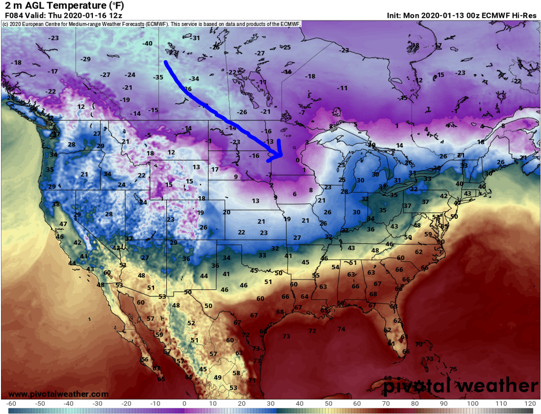
Let’s talk about the final piece of the puzzle: temperatures. Colorado will be dodging a bullet mid-week as Arctic air surges southward into the center of the country. Luckily it takes a dive further east and avoids the Front Range. The map below shows the European model’s forecast overnight lows Thursday morning.
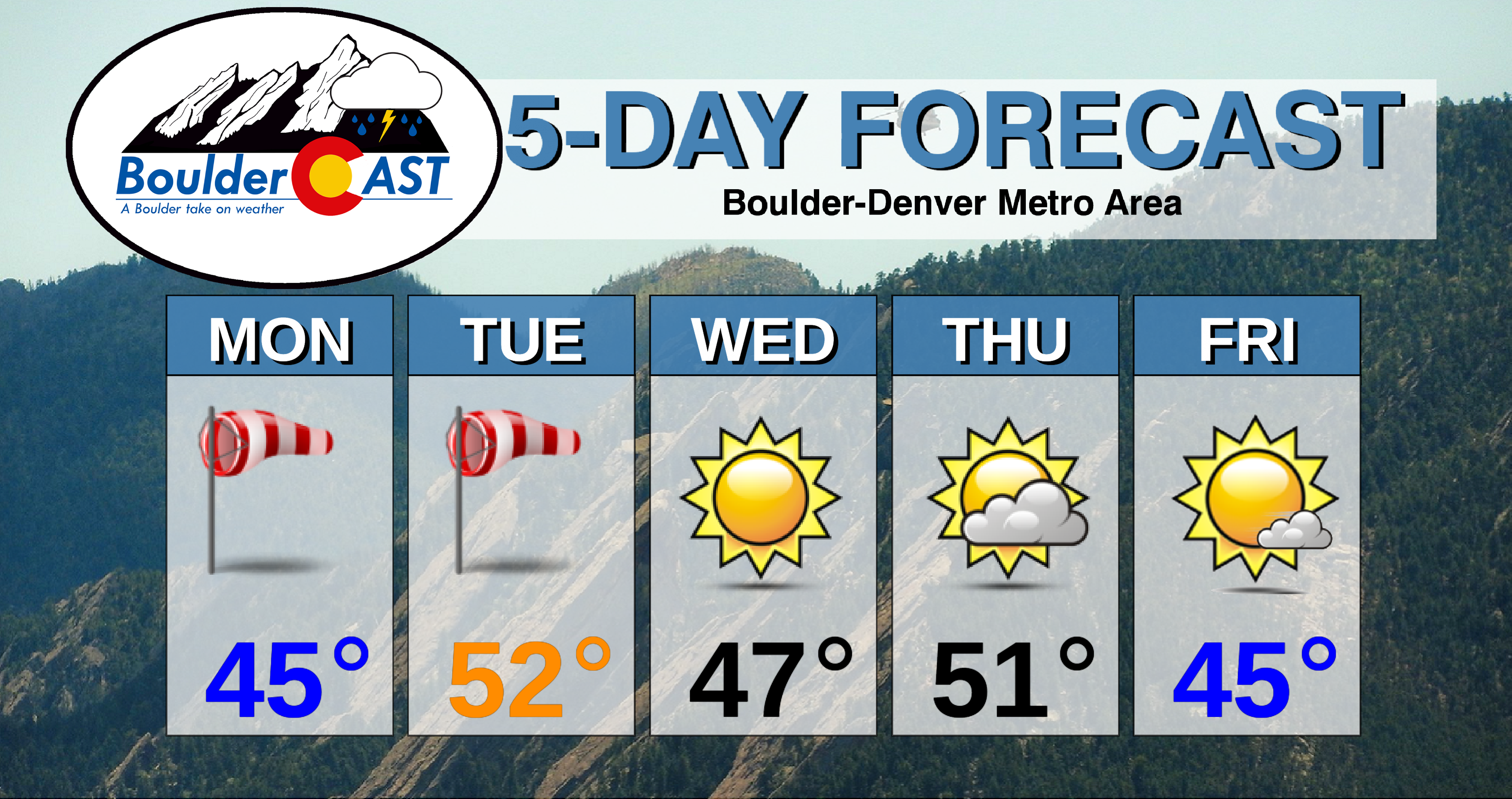
In general our readings will remain fairly seasonal through the week thanks to the downslope flow. As much as you may dislike wind, sometimes it helps protect us from the bitter cold. High temperatures this week will fluctuate from day-to-day, largely remaining between 45 and 55 degrees.
Forecast Specifics:
Monday: Partly to mostly sunny and breezy during the day. Stronger downslope winds develop in the evening with gusts of 30+ MPH in most areas and 50+ MPH in and near the Foothills. Winds will relax somewhat after midnight. Highs in the middle 40’s across the Plains and in the middle 30’s in the Foothills.
Tuesday: Sunny and breezy. Highs in the lower 50’s on the Plains and upper 30’s in the Foothills.
Wednesday: Sunny. Highs cooler in the middle 40’s on the Plains and lower 30’s in the Foothills.
Thursday: Mild with increasing clouds and calmer winds. Highs in the lower 50’s for the Plains and lower 40’s for the Foothills.
Friday: Mostly sunny and possibly windy. Temperatures in the 40’s for the Plains and 30’s in the Foothills.
High Country: Periods of snowfall will impact the Mountains this week along with blustery conditions. The first wave of snow will be Monday morning into the afternoon. The second arrives Tuesday evening into Tuesday night. The final, strongest push of snow develops Thursday afternoon into Friday night and stands to produce the most snow. Snowfall totals by the end of the week will range from 8 to 16″, with locally more than 24″ in some ranges. Check our PowderCAST page for always-updated weather forecasts for all of Colorado ski resorts.
DISCLAIMER: This weekly outlook forecast is created Monday morning and covers the entire upcoming week. Accuracy will decrease as the week progresses as this post is NOT updated. To receive daily updated forecasts from our team, subscribe to BoulderCAST Premium.
.
Spread the word, share our forecast!




You must be logged in to post a comment.