We begin the first full-week of August on the hot side but trend slightly cooler as the week wears on thanks to monsoon moisture returning back into the area from the southwest. Read on for more details.
Hot with chance of storms today and tomorrow
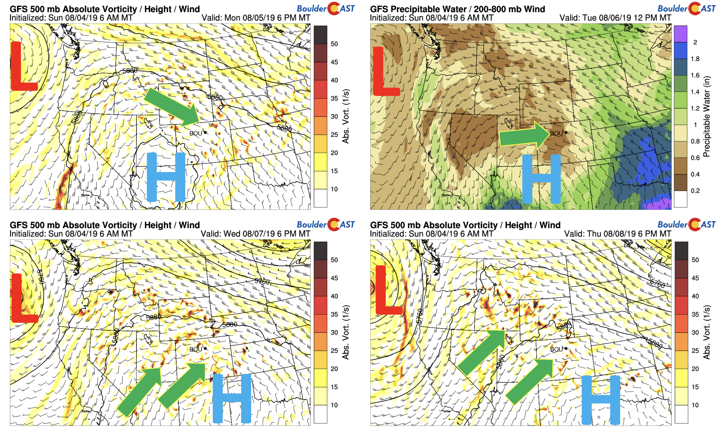
Much of the weather for the week ahead will be controlled by two large-scale weather players… 1) a ridge of high pressure just to our southwest and 2) a deep area of low pressure hanging out over the Pacific. Both of these factors will be at play in advecting monsoon moisture into the area. The low pressure system out in the Pacific will bring in weak shortwaves from the southwest, while the ridge will slowly move back into the Texas Panhandle, allowing moisture from Arizona to move into Colorado as the week progresses. This is shown below in the 4-panel plot.
Today (bottom left), high pressure is centered over northern Arizona. Northwest flow is present in the northern part of Colorado as the flow rotates around the ridge. The eastward shift of the high can be seen in the two bottom panels (Wednesday and Thursday).
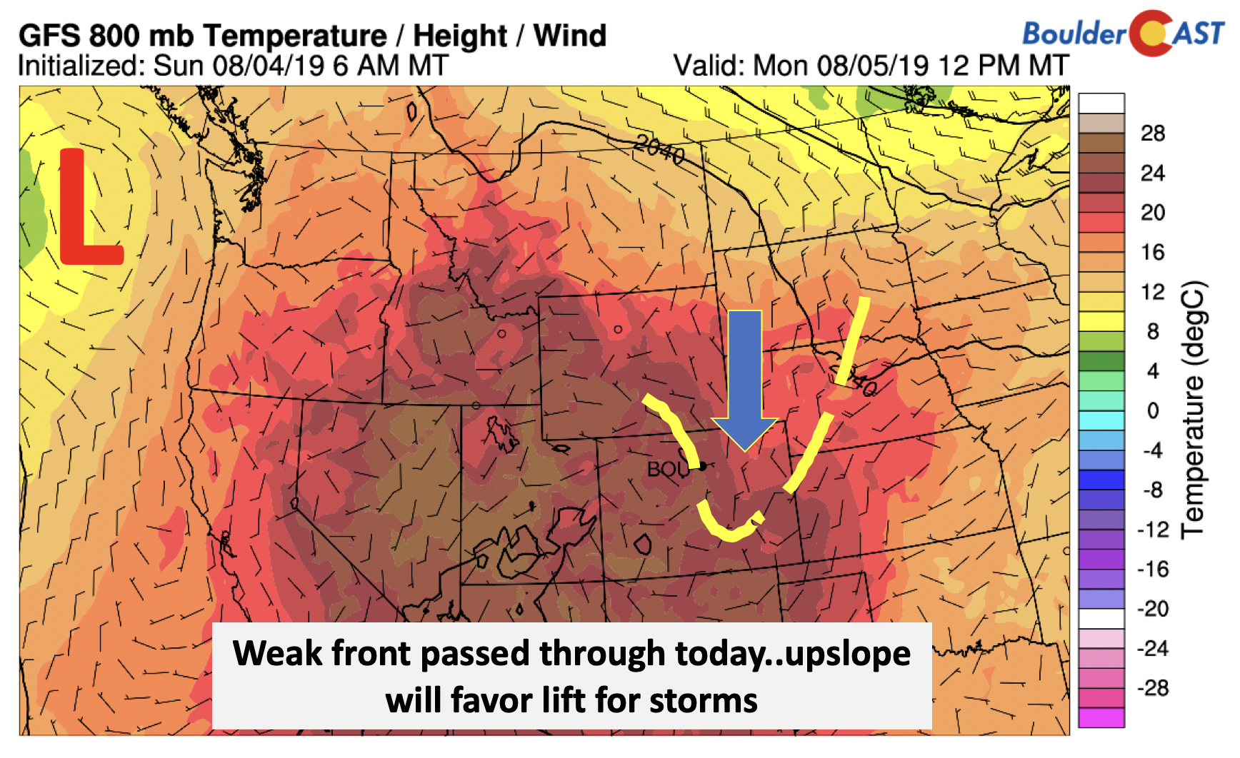
There is also a weak cool front which is passing through on this Monday morning (below). While there isn’t any cold air with the front (unfortunately), it will largely result in northeasterly upslope flow this afternoon and evening at the surface.
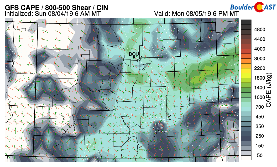
That coupled with instability in the northwest flow will lead to another round of scattered showers and thunderstorms later Monday afternoon and evening. CAPE values around Boulder will only be 700 J/kg this afternoon (see below). Further east and southeast of Denver, this increases above 1500 J/kg. We have chances of storms on Monday at 40% with the potential for brief heavy rainfall and small hail. Monday’s highs will be near 90 degrees.
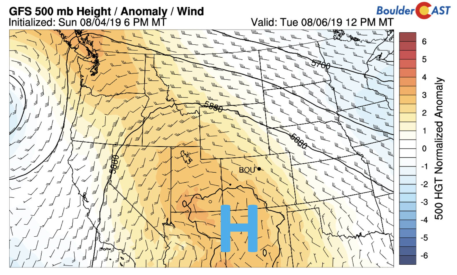
By Tuesday, the ridge will bring drier air into the state and there won’t be any shortwaves passing through. This will lessen our storm threat but there will still be minor chances in the afternoon and evening. Highs will warm into the lower to middle 90’s.
Wetter Wednesday and beyond
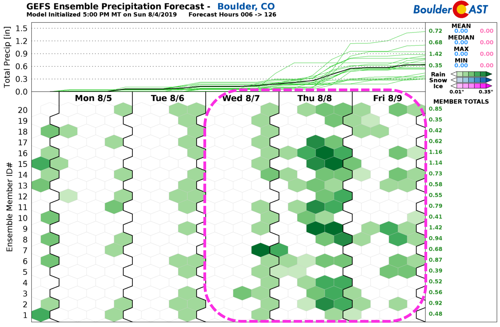
Similar to last week, we anticipate a wetter end to the week. As shown in the four-panel plots below, the ridge and trough patterns in the west will allow monsoonal moisture to rebuild back into the state. In addition, a series of mid-level shortwaves will advect in each day Wednesday through Friday, focusing lift for showers and thunderstorms. The threat for these storms will largely be heavy rainfall potential due to the higher moisture content present in the atmosphere. There is also some indication for severe weather in our area, especially Wednesday and Thursday, but it’s too early to say for sure just yet. As a result of increasing moisture and clouds, the latter part of the week will be somewhat cooler in the middle 80’s to near 90 degrees.
The increased rain threat is also visualized in the ensembles….
Forecast Specifics:
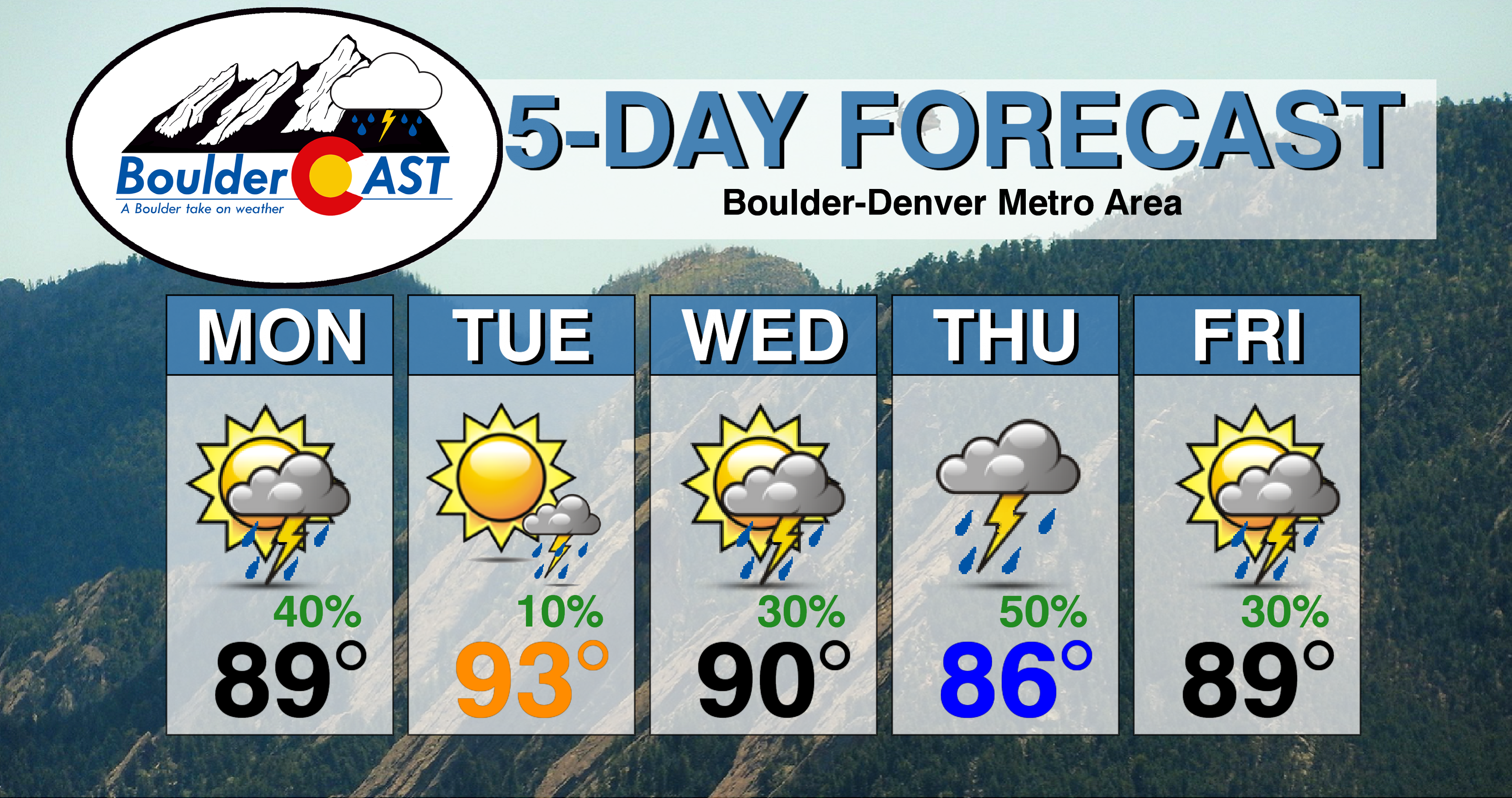
Monday: Mostly sunny giving way to increasing clouds with scattered showers and thunderstorms in the late afternoon/evening. There is potential for brief heavy rainfall and small hail in the strongest storms. Highs near 90 degrees across the Plains and in the upper 70’s in the Foothills.
Tuesday: Mostly sunny with more dry time. Only a 10-20% chance of storms in the afternoon/evening hours. Hot with high temperatures in the lower to middle 90’s for the Plains with lower 80’s in the Foothills.
Wednesday: A better chance of storms returning to the forecast. Increasing clouds with widely scattered afternoon and evening storms. Highs in the lower 90’s across the Plains and near 80 degrees in the Foothills.
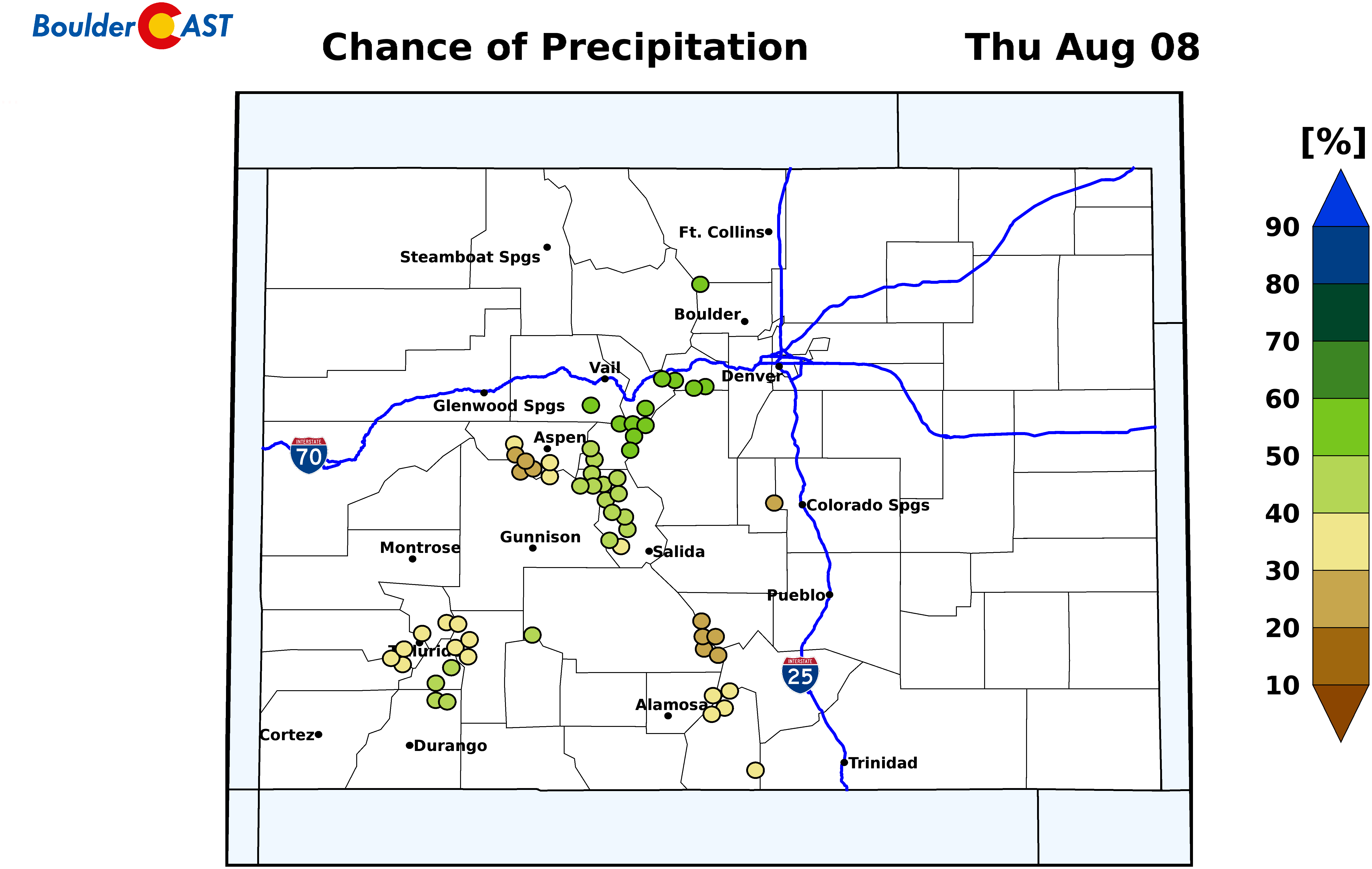
Thursday: Increasing clouds with scattered to widespread showers and thunderstorms possible and highs in the middle 80’s on the Plains and middle 70’s in the Foothills.
Friday: Partly to mostly cloudy with scattered showers and thunderstorms possible with upper 80’s on the Plains and upper 70’s in the Foothills.
High Country: Scattered showers and thunderstorms will remain in the forecast over the higher terrain throughout the week thanks to monsoonal flow, especially during the latter part of the week. Visit our SummitCAST page for updated forecasts for more than 120 Colorado mountain destinations, including all of our state’s majestic 14ers.
DISCLAIMER: This weekly outlook forecast was created Monday morning and covers the entire upcoming week. Accuracy will decrease as the week progresses as this post is NOT updated. To receive daily updated forecasts from our team, subscribe to BoulderCAST Premium.
.
Spread the word, share our forecast!





You must be logged in to post a comment.