Monsoon season has geared up across Colorado! As a result, the chance of thunderstorms will persist in our forecast throughout the week bringing the threat of heavy downpours and localized flooding at times. We also discuss a gradual warming trend with temperatures soon returning to the 90’s.
Monsoon rains to start the week
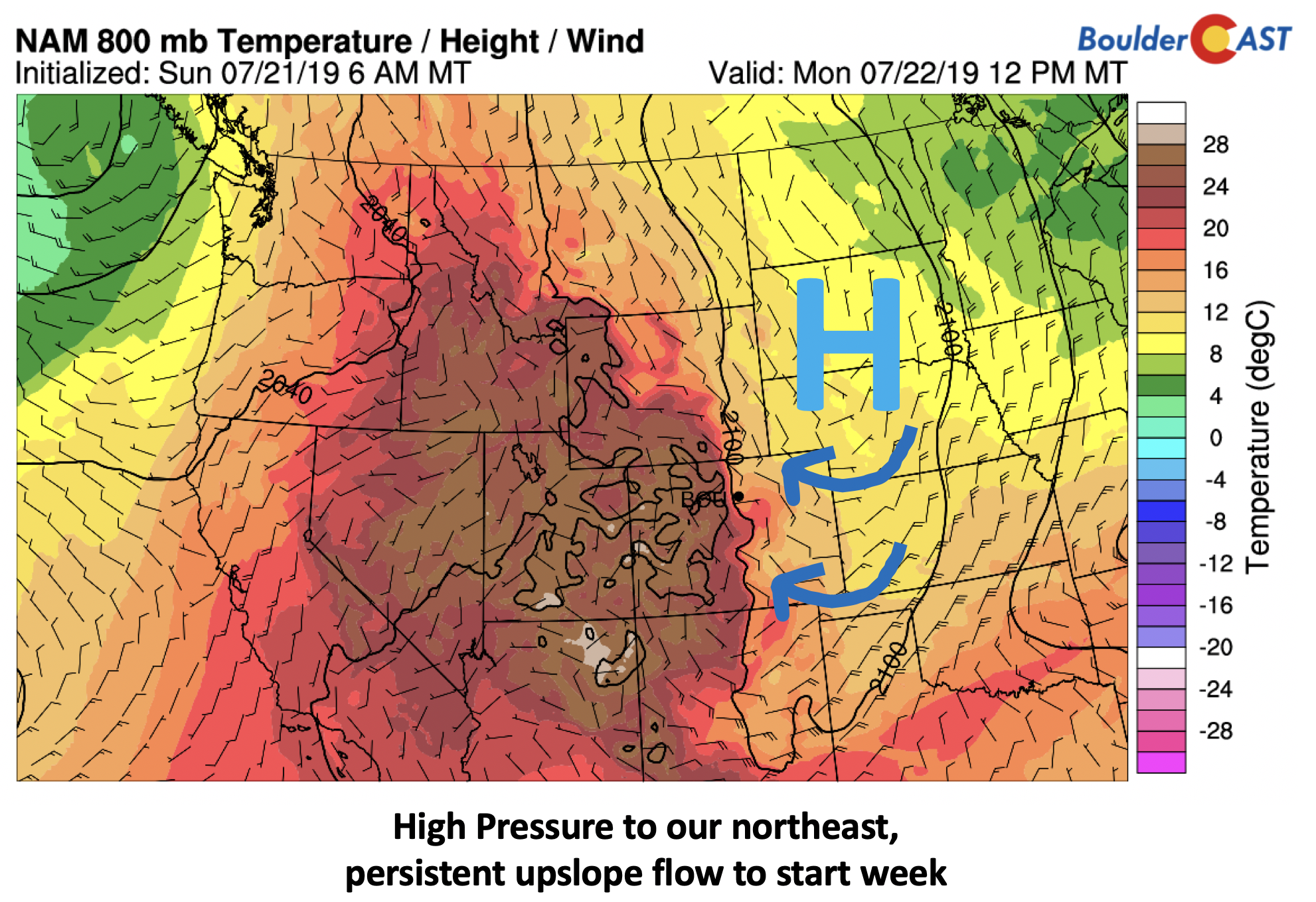
This past Saturday, a cold front pushed through. Behind it, surface high pressure has been dominating our weather and is currently situated over South Dakota and Nebraska. Easterly upslope flow remains across the Plains of Colorado. That should keep us cool once again in the upper 70 to lower 80’s to kick off the week. By Tuesday, this high pressure will slide off to the east a little allowing warmer air to build back in from the west with highs pushing back to normal in the mid to upper 80’s.
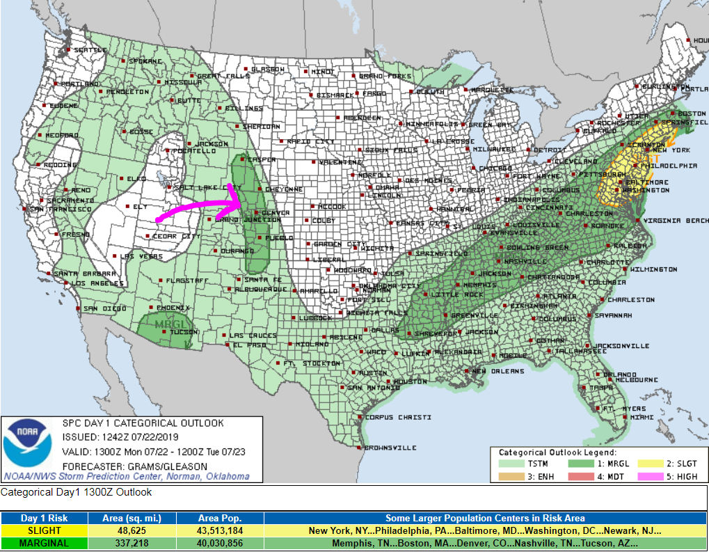
As much as 2.25″ of rain fell Sunday night in eastern Boulder County as slow-moving thunderstorms remained stationary near Lafayette. A very similar mid and upper-level pattern that was with us Sunday night will persist today and tomorrow as well. The threat these next couple days will again be heavy downpours, lightning, and isolated hail given minor levels of directional shear in the atmosphere.
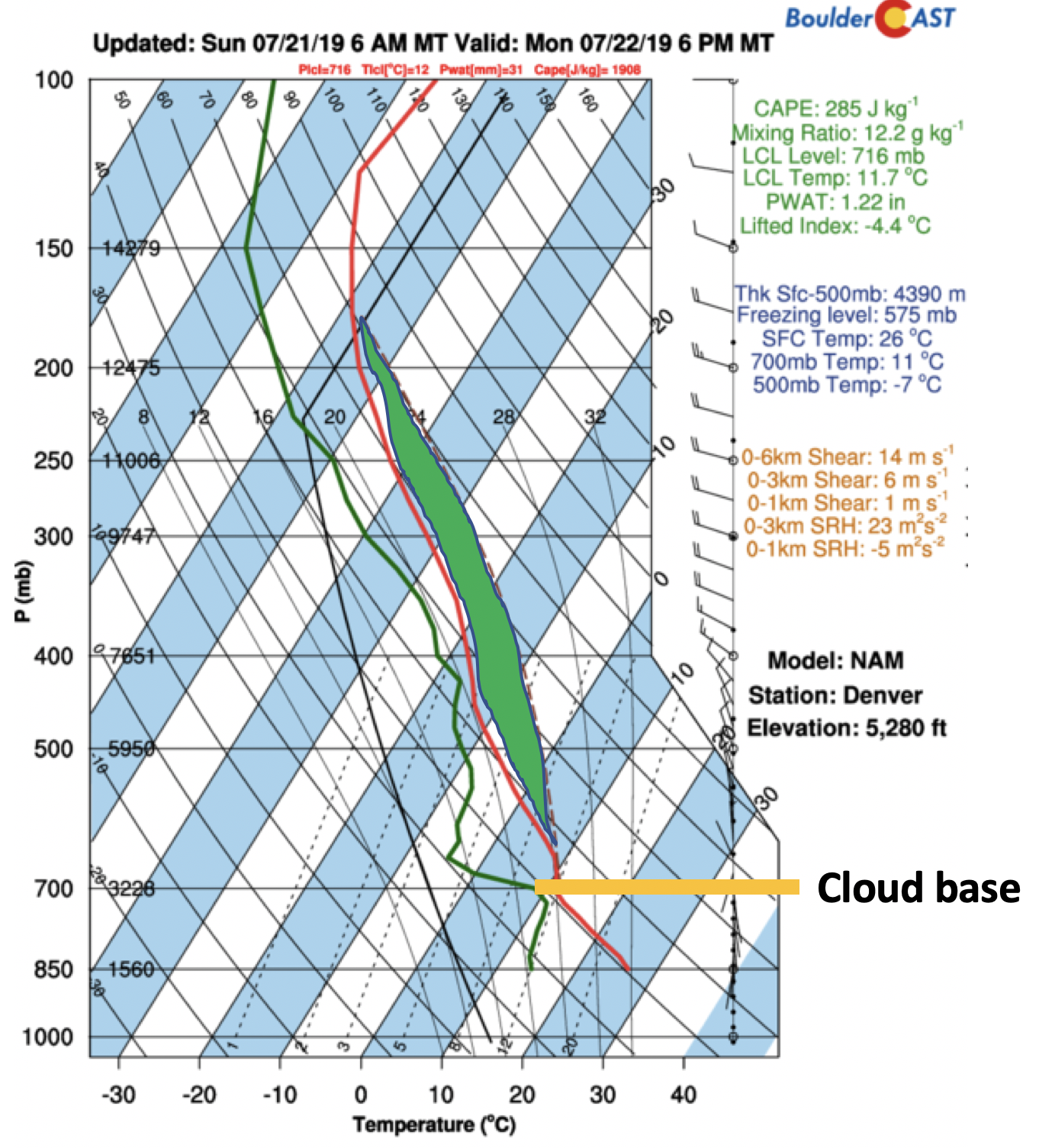
Monsoon moisture remains elevated with precipitable water values approaching 1.2 inches, definitely above average for late July. Also, the upper-level flow is weak (only about 10 knots out of the west-northwest), meaning that any storms that form will be slow to move leading to the threat of localized flooding. Below is the Skew-T forecast this evening for Denver from the NAM forecast model. The cloud base (orange line below) is relatively low, at around 5000 feet above ground. We typically see that with a moist atmosphere, as will be present today and Tuesday. Unstable air (shaded green region below) will be prevalent both days and be more than enough for storm development at 30 to 50%, with prime time being between 3 PM and midnight each day.
As we saw Sunday, storms will develop late in the afternoon and evening across the Foothills, then track east-southeast through the late evening into the Denver Metro area. Again, the main threats appear to be heavy rainfall, localized flash flooding, and hail up to 1″ in diameter.
Persistent moist flow throughout week, warming up too!
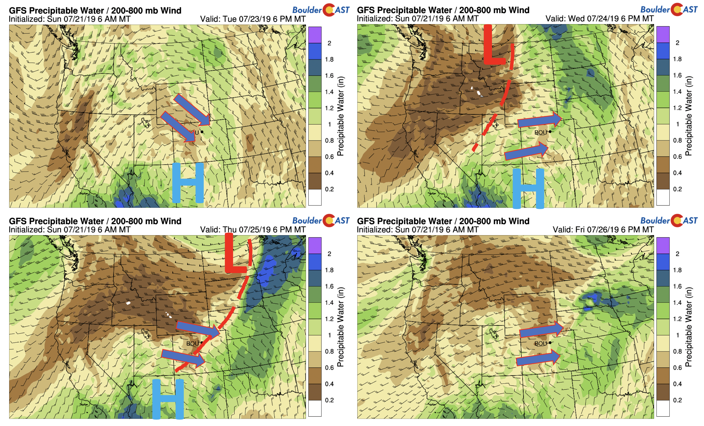
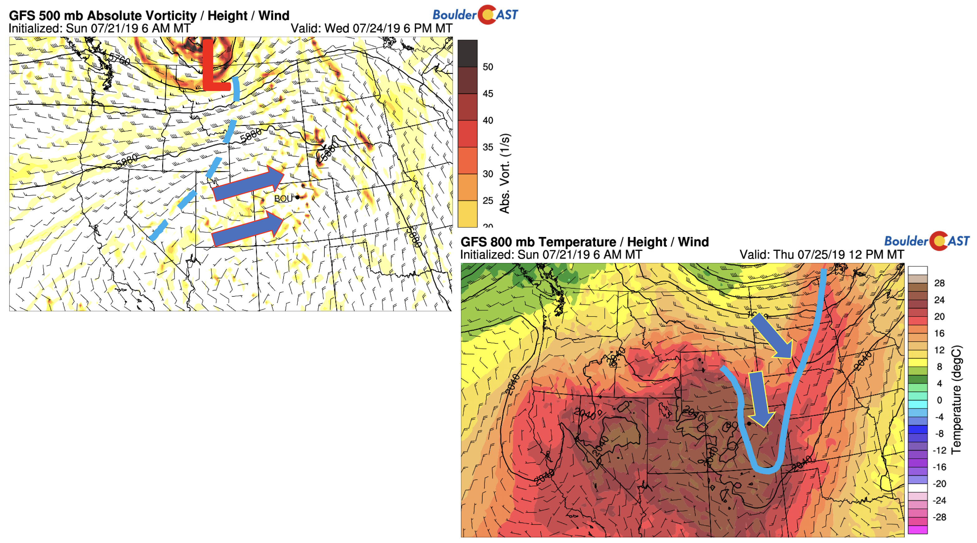
The mid to upper-level atmosphere through Friday will favor storms each day thanks to a favorable flow pattern and moisture remaining near or slightly above 1 inch of precipitable water. The bottom figures show the precipitable water and flow patterns for Tuesday (below left), Wednesday (below right), Thursday (far bottom left), and Friday (far bottom right). You’ll notice different flow patterns as depicted by the arrows, depending on the position of the high pressure. Also, on Wednesday and Thursday, a Pacific trough will move onshore and track into Montana/North Dakota. This is expected to usher in a cold front Thursday, altering the flow and position of the high pressure ridge. The ridge will slowly migrate south-southwest through the week, thanks to the approaching trough after Wednesday. No matter the flow, the elevated moisture and allow enough lift each day will keep storms in our forecast.
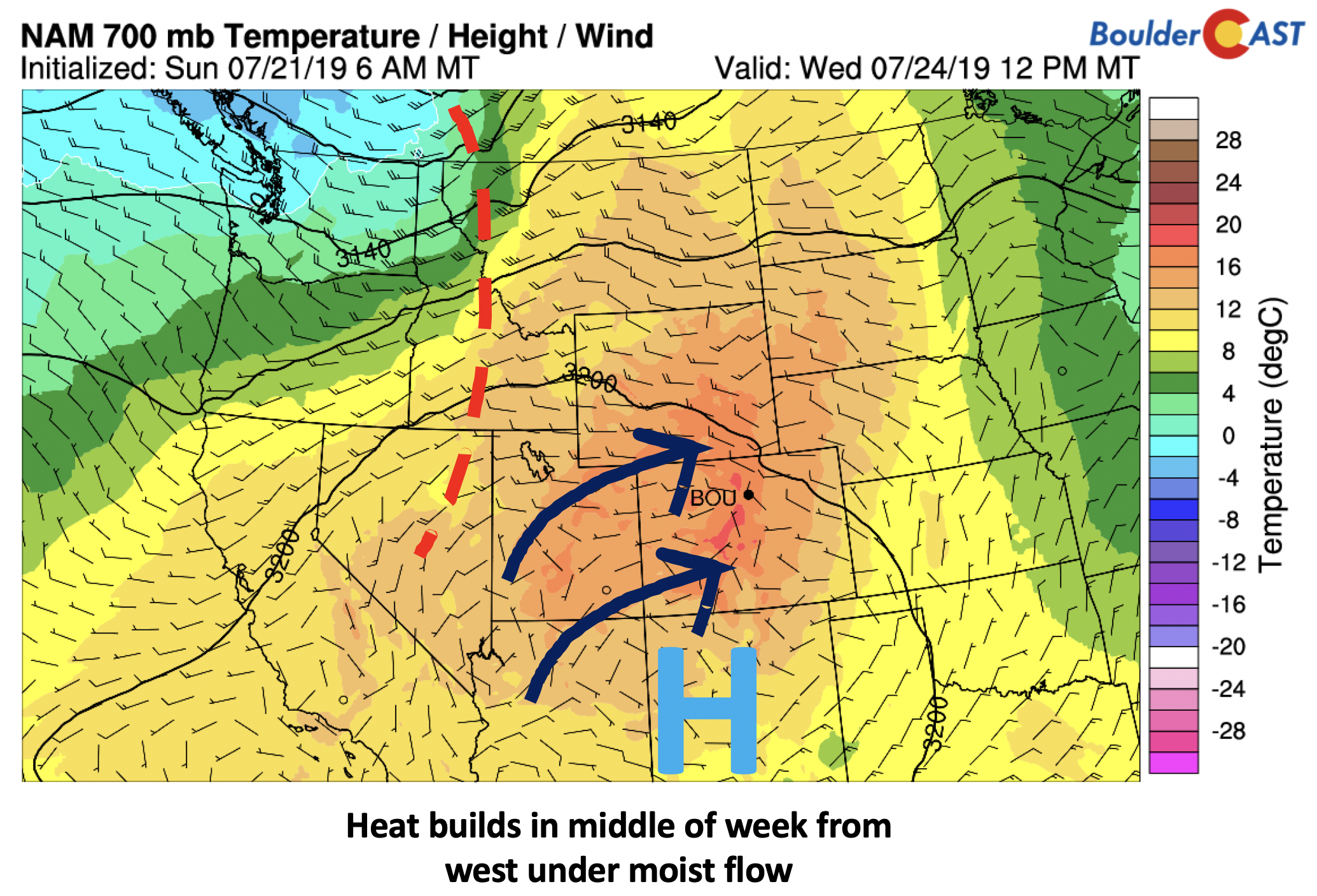
We also our predicting a warming trend as the week progresses. The mid-level pattern favors a warming phase after tomorrow, from Wednesday into Friday, albeit with a slight reprieve on Thursday. This will not be the excessive heat we saw last week as storms and clouds will indeed limit our solar heating. Nevertheless, by Wednesday (below), southwest winds advect in the desert heat to Colorado. We should see lower 90’s Wednesday and possibly Friday too.
As mentioned earlier, we have a front that is currently slated for a late Wednesday/Thursday timeframe. A Pacific trough will move into northern parts of the CONUS during this period (bottom left), bringing in a trough axis and attendant cold front (bottom right) by Thursday. Timing will likely be honed-in as we progress through the week. It will likely cool us off a tad for Thursday, probably back somewhere into the 80’s. The approaching front and trough will once again warrant storms. There are some hints, however, that this trough may advect is some slightly drier air Thursday/Friday. While this is not confirmed in the models as of yet, it may hold true and lead to a slightly less chance of storms in the latter part of the work week. We still stress though the elevated moisture will keep storms in the forecast.
Watching something for the weekend
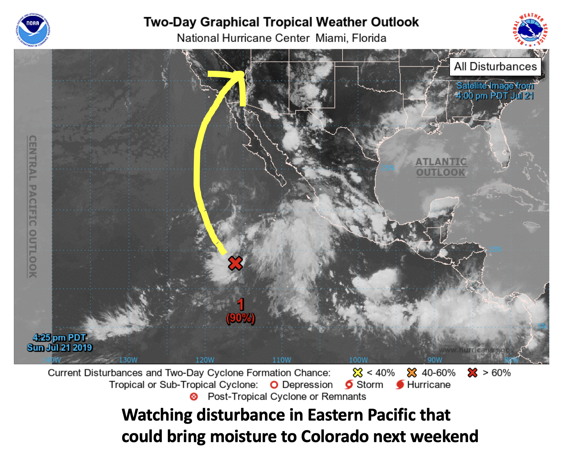
For the upcoming weekend, the ridge we discussed earlier will retrograde to our southwest into Arizona. The flow will also turn zonal (west to east oriented). Currently out in the Eastern Pacific Ocean(below) there is a disturbance of low pressure that, if the pattern is just right, could advect in tropical moisture to the state over the week. This is all speculation at this point, but bears watching since it would keep our extended outlook wet and unsettled.
Forecast Specifics:
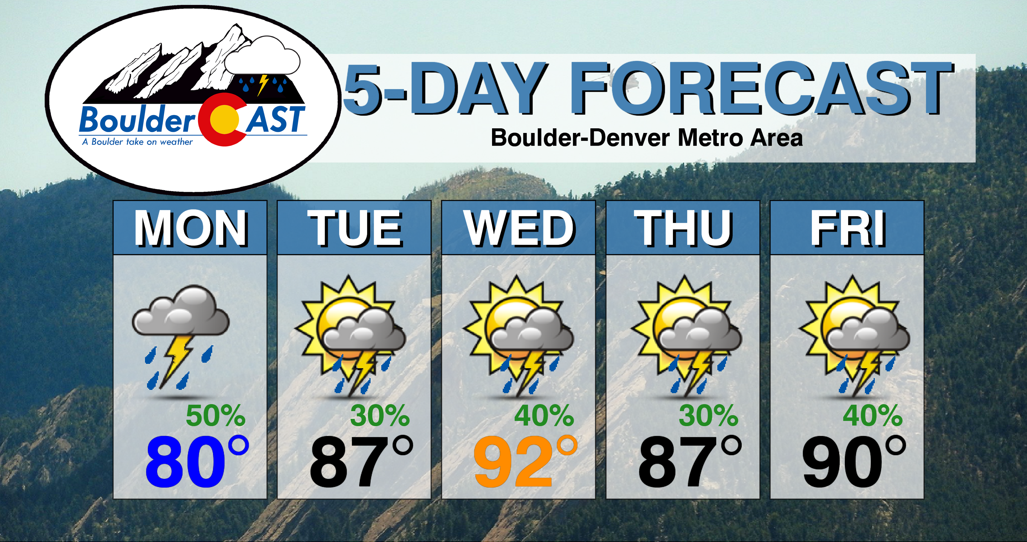
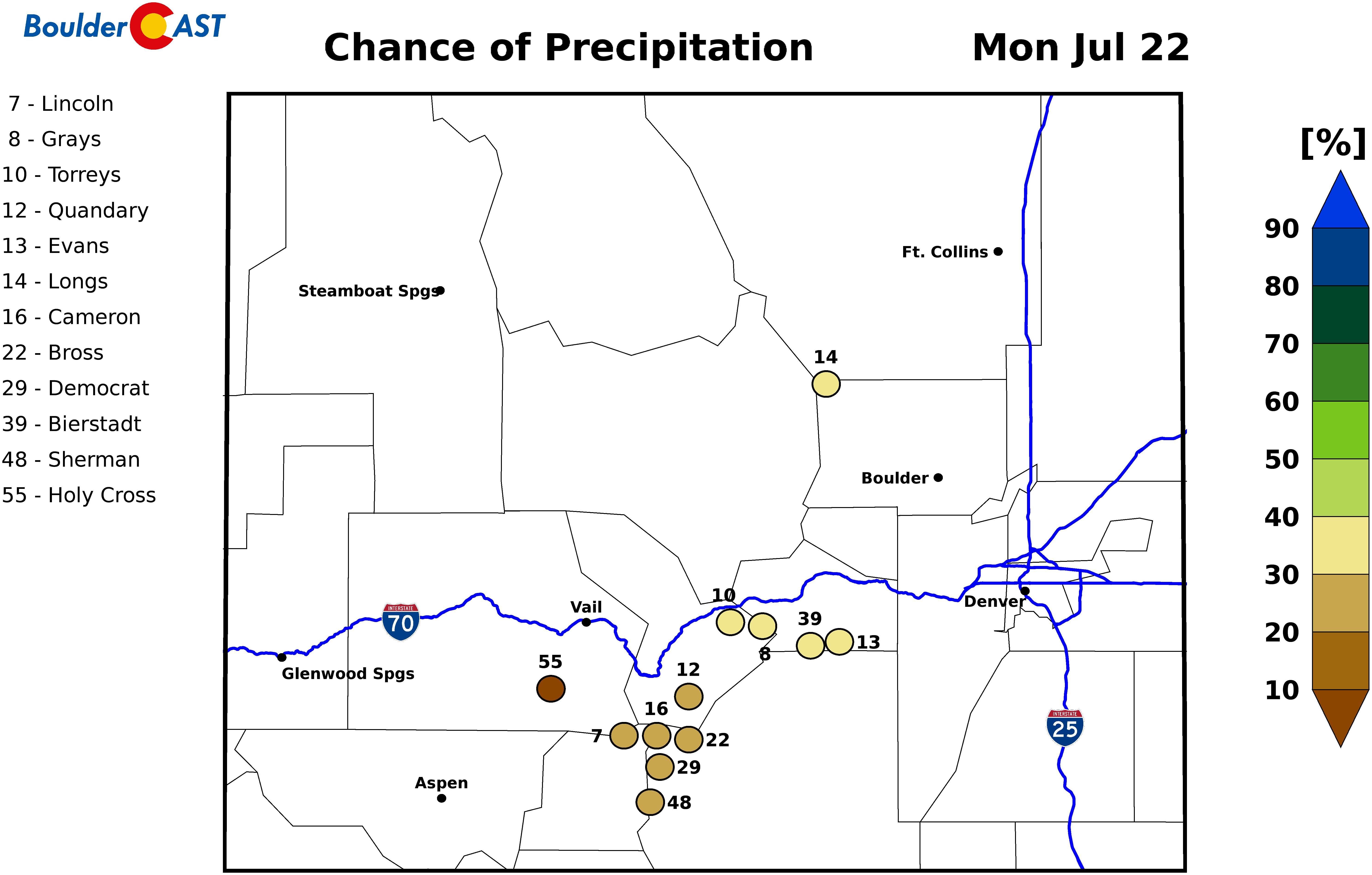
Monday: Patchy morning low clouds, then partly sunny with scattered showers and thunderstorms in the late afternoon/evening hours. The threat exists for heavy rainfall and isolated 1″ hail. Expect highs near 80 across the Plains and in the near 70 in the Foothills.
Tuesday: Morning sun, then increasing clouds with widely scattered afternoon/evening showers and thunderstorms. Heavy rainfall will again be a threat. Highs in the mid to upper 80’s across the Plains and in the middle 70’s in the Foothills.
Wednesday: Partly cloudy and warmer with scattered showers and thunderstorms in the late afternoon/evening. Highs in the lower 90’s across the Plains and in the upper 70’s in the Foothills.
Thursday: Slightly cooler with scattered showers and thunderstorms. Highs in the mid to upper 80’s on the Plains and middle 70’s in the Foothills.
Friday: Partly cloudy with scattered showers and thunderstorms possible. Highs in the lower 90’s on the Plains and near 80 in the Foothills.
High Country: Each day this week will feature a significant threat of afternoon and evening storms across the higher terrain thanks to a favorable moist flow. Take care to start your outdoor activities early to avoid being caught in a storm. Visit our SummitCAST page for updated forecasts for more than 120 Colorado mountain destinations, including all of our state’s majestic 14ers.
DISCLAIMER: This weekly outlook forecast was created Monday morning and covers the entire upcoming week. Accuracy will decrease as the week progresses as this post is NOT updated. To receive daily updated forecasts from our team, subscribe to BoulderCAST Premium.
.
Spread the word, share our forecast!




You must be logged in to post a comment.