A wet and unsettled week is in store for the area as a slow-moving system moves across Colorado. There’s even have a chance of snowflakes Wednesday night into Thursday. We also detail the forecast for the CU commencement this Thursday. Read on for more details.
T
he week’s weather can be summed up in one animation, shown below from GOES infrared last evening. A cut-off low pressure system was offshore California yesterday, with Pacific moisture building across the West due to southwest winds. A line of severe thunderstorms as well are evident across the Midwest. This cut-off system will be our main focus for the week!
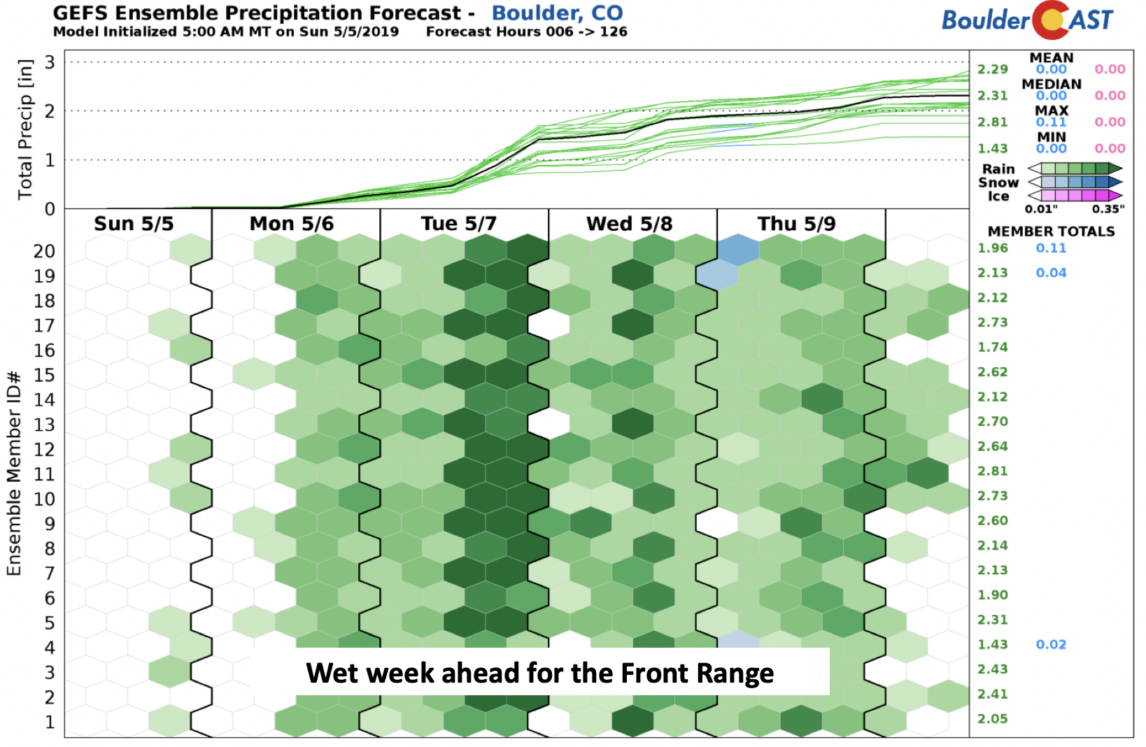
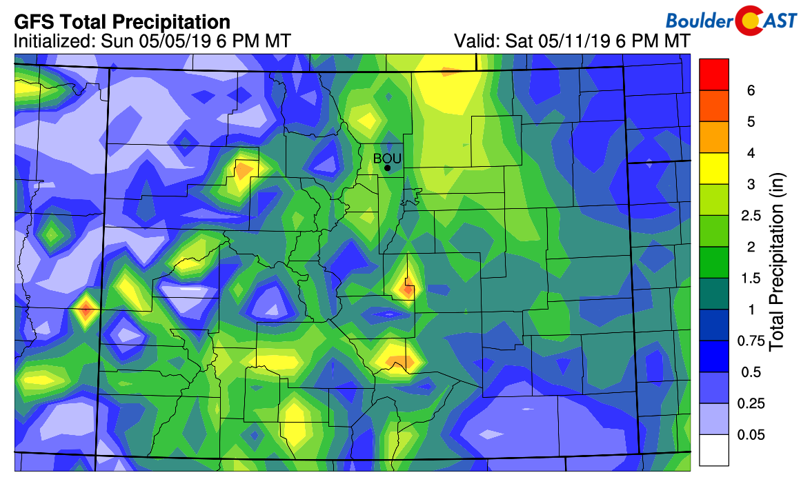
As a result of this, the week ahead will be rather wet, as evidenced by the GEFS ensemble below, supported by a number of regional and global models as well. Depending on the forecast, parts of the region could see up to 2 inches of precipitation.
Scattered showers and storms with 60’s to start the week
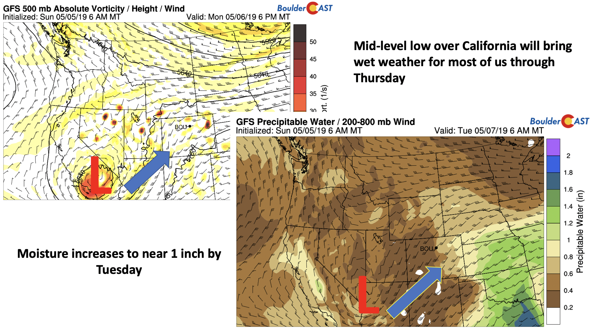
The large-scale setup to start the week today features a mid-level cut-off low pressure system over southern California. The system has also brought with it increased moisture, which will be on the rise through tomorrow, approaching 1 inch of precipitable water by Tuesday evening around Denver.
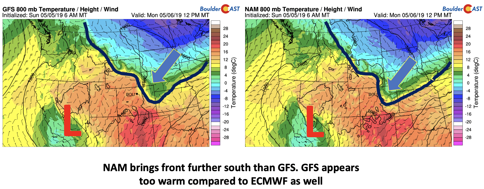
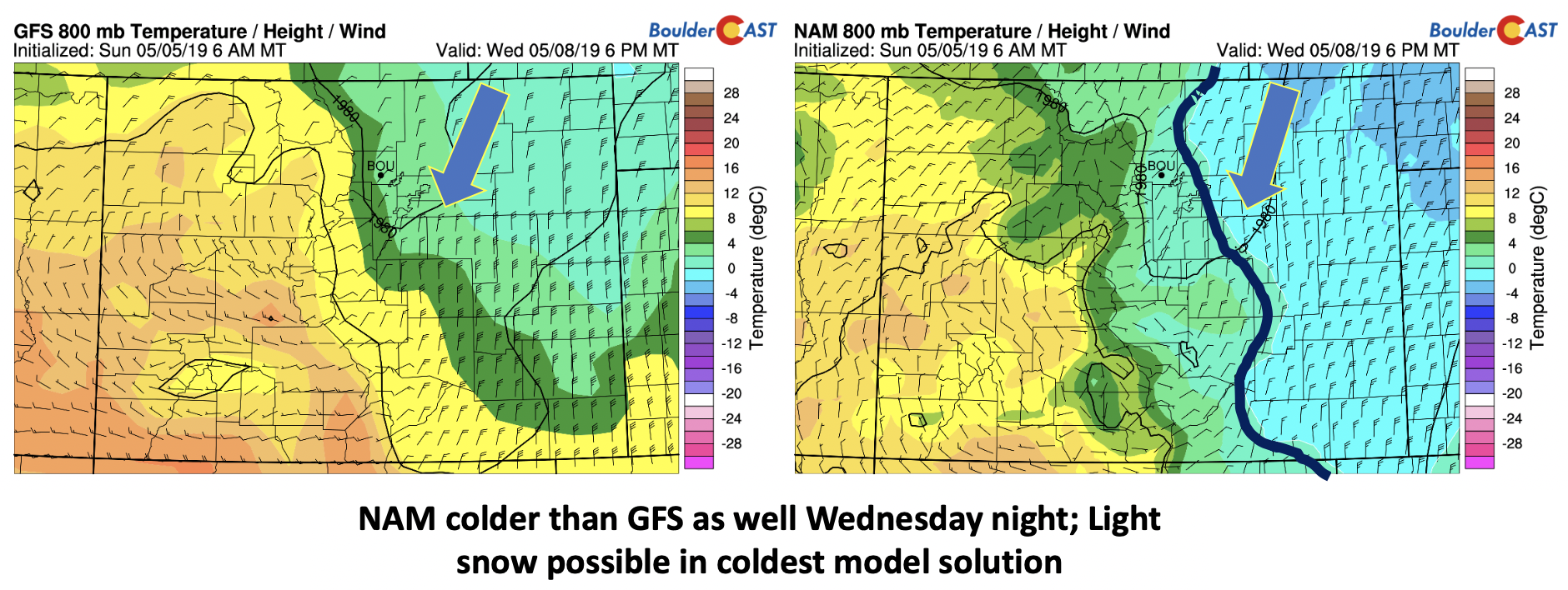
A cold front pushed through the region of northeast Colorado late last night, making it’s way through Boulder around 1:00 AM. This is evident below in the low-level 800 mb temperatures from the GFS (left) and NAM (right). Easterly flow ensues today as a result and some low clouds hanging around Monday morning.
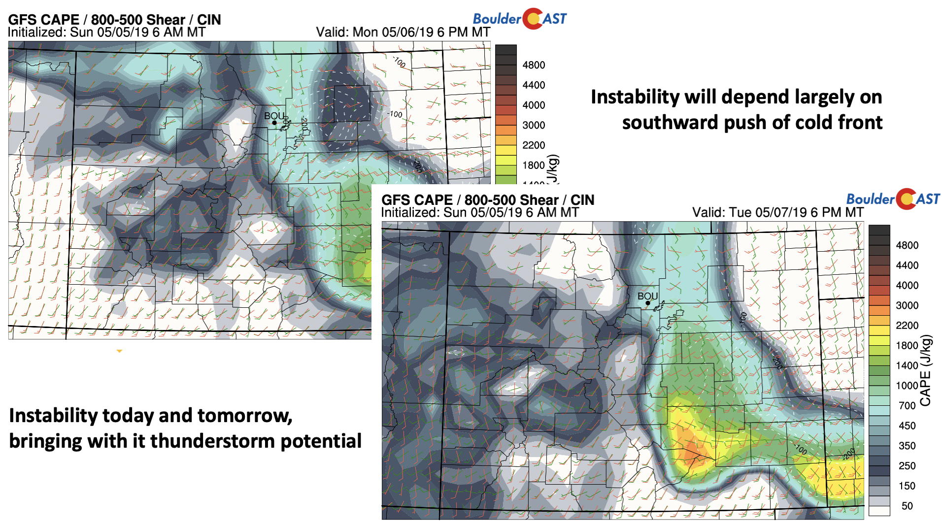
The NAM, and partly the Euro model, are colder than the GFS today through Wednesday. The GFS indicates upper 60’s today, while the NAM suggests middle 50’s. This highlights a rather uncertain picture on maximum temperatures and a resulting discrepancy in daytime instability. Nevertheless, the mid-level system will advect in some shortwave energy today and tomorrow during the afternoon and evening hours. Tuesday the system will be pushing into western Colorado, further advancing the large-scale lift. This combined with plentiful moisture and the front nearby will be prime for good chances of showers and embedded thunderstorms. If you believe the warmer GFS, CAPE values in excess of 1000 J/kg will be possible (below) these next few days.
Chilly and unsettled to end week…maybe snow too!
Over the course of the week, the aforementioned cold front will continue to sag back and forth from north to south through tomorrow. It will make its full push through the area early Wednesday as the cut-off low tracks into eastern Colorado and Kansas and northerly winds take over. As mentioned earlier, the GFS is a warm outlier, with the NAM and ECMWF a tad colder (below). The NAM shows the freeze line (blue) just to our east, while the GFS keeps in it Wyoming.
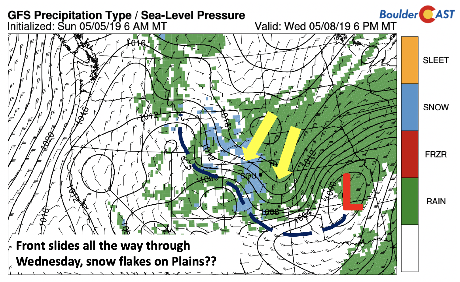
We’ll likely fall into the 40’s on Wednesday with the frontal passage and colder air advancing through. Large-scale lift remains as the mid-level system starts to move out. Deeper upslope will also be present (below). There should not be any instability with the colder airmass, so any precipitation will be showery, not stormy. As noted below as well, there are “hints” at snow mixing in, primarily for the Foothills and Mountains.
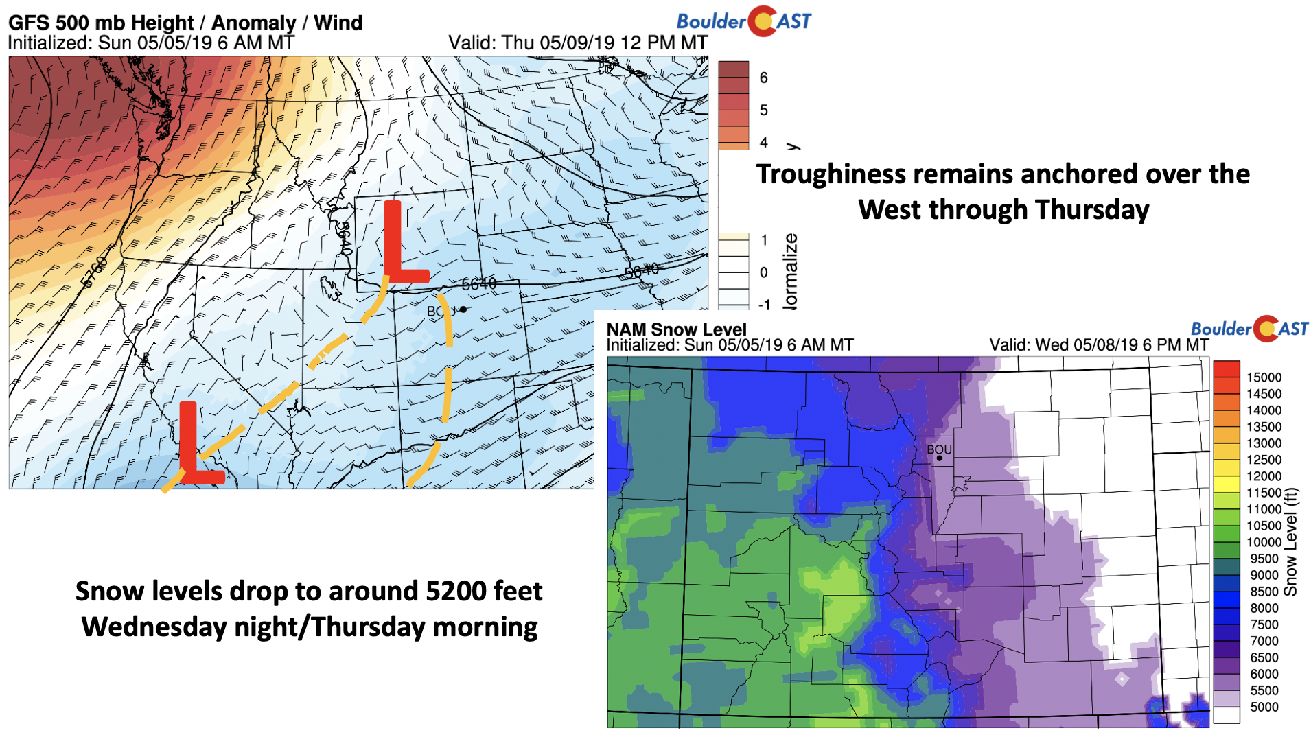
Thursday’s highs likely will not get out of the 40’s again. Large-scale troughiness (below) will still exist. This coupled with low-level lingering upslope, should keep the area cloudy, drizzly, and damp. As for snow, the NAM brings snow levels down to about 5200 feet – close enough to mention snowflakes in the forecast. The GFS is not as cold, so it will be marginal at best. Right now, any snow that may fall would not produce any accumulation.
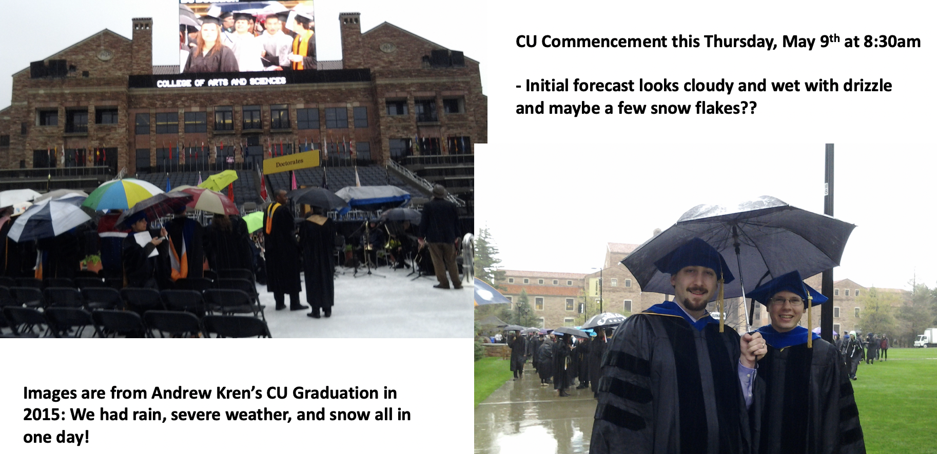
The CU commencement ceremony takes place Thursday at 8:30 am. This will be happening at some of the coldest moments of the week! This is certainly nothing new, as my graduation in 2015 had a variety of crazy weather: rain, tornadoes, heavy rain, and snow, all in the same day! We won’t see ALL these for this year, but certainly it looks cold, cloudy, and wet, with a hint of snowflakes also on the table.
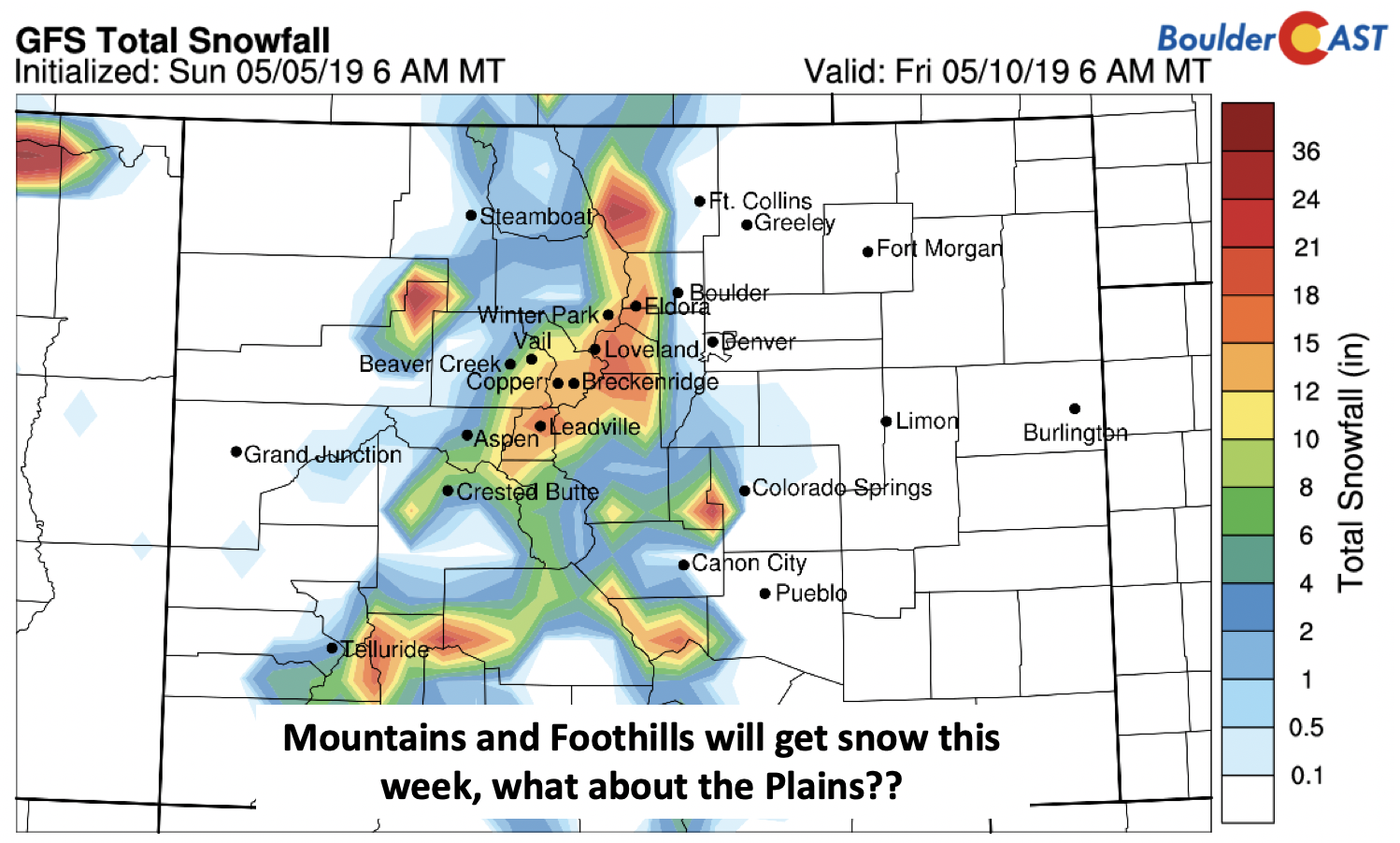
The snow chance is much higher in the Mountains (below), with several inches possible as the cut-off storm system passes across Colorado, especially for areas above 11,000 feet. The Foothills could see measurable snow as well late Tuesday night through Thursday. For the Metro area, we’ll continue to monitor the situation for Thursday, especially in regards to how cold it gets. Some snow is probably in the works, but the potential for accumulating snow remains uncertain.
By Friday, the clouds may slowly move out with partial sunshine. The upcoming weekend looks warmer and more tranquil, as ridging builds in from the west. There is indeed light at the end of the soggy tunnel!
Forecast Specifics:
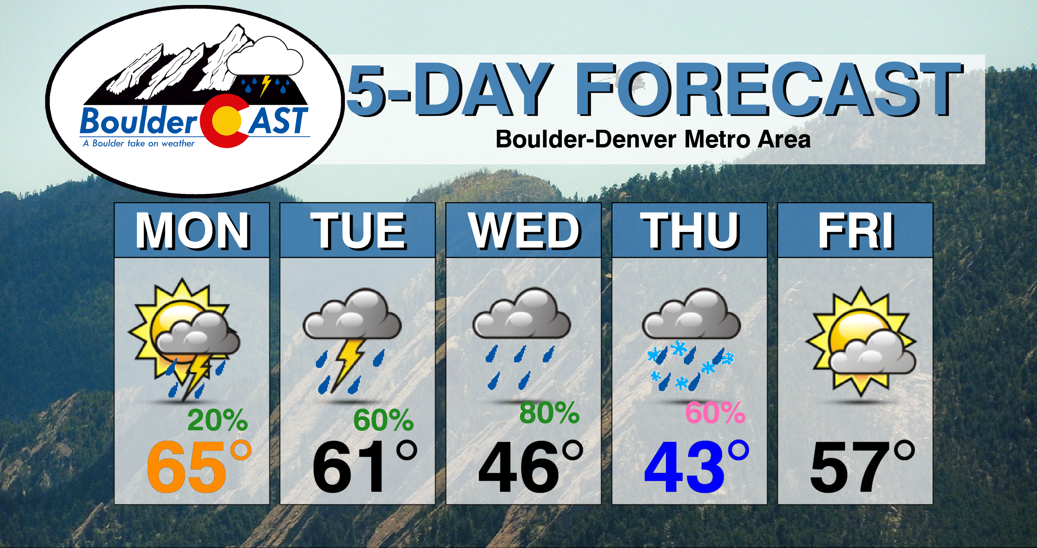
Monday: Morning low clouds giving way to partly cloudy skies and widely scattered showers and storms in the afternoon/evening. Highs in the middle to upper 60’s on the Plains and middle 50’s in the Foothills.
Tuesday: Cloudy early, then partial afternoon sunshine with widespread showers and thunderstorms lingering into the evening, giving way to rain showers overnight. Highs in the lower 60’s on the Plains and lower 50’s in the Foothills.
Wednesday: Mostly cloudy and foggy with drizzle likely in the morning, then periods of rain showers in the afternoon/evening, possibly mixing with wet snow Wednesday night. Highs on the Plains in the 40’s to near 50 and upper 30’s in the Foothills.
Thursday: Overcast skies with drizzle or light snow to start, then light rain/drizzle in the afternoon. Highs in the low to middle 40’s on the Plains and middle 30’s in the Foothills.
Friday: Mostly cloudy skies trending toward some sunshine. Highs near the middle 50’s on the Plains and middle 40’s in the Foothills.
High Country: Unsettled weather will exist over the higher terrain each day this week. Scattered storms are likely today and tomorrow, with embedded snow showers. Widespread rain/snow will exist late Tuesday into Thursday. Drier and calmer weather returns for Friday and the weekend, though we cant rule out isolated showers Friday either. Check PowderCAST for updated forecasts for all the Colorado ski resorts.
DISCLAIMER: This weekly outlook forecast was created Monday morning and covers the entire upcoming week. Accuracy will decrease as the week progresses as this post is NOT updated. To receive daily updated forecasts from our team, subscribe to BoulderCAST Premium.
.
Share our forecast!




You must be logged in to post a comment.