Unseasonably cold conditions and those pesky snowflakes will persist through today and tonight, though amounts will be on the light side. As for the rest of the week, we remain chilly and unsettled, watching as well the threat of a snow event to end our week. Read on for more details.
Cold & snowy Tuesday
We start off the shortened work-week on the cold side, along with light snow in the forecast once more. Our weather pattern for this afternoon and evening is shown below in the 500 mb absolute vorticity and height map. A weak area of low pressure is centered right over Colorado and will be tracking west to east tonight. Highlighted in green over eastern Colorado will be enough mid-level lift east of the trough this evening for light snow to develop across the Denver Metro area. Lift is not very strong and there is no jet forcing. However, some weak instability across the higher terrain will help to fuel some snow showers that will track east onto the Plains this afternoon and evening. The focus will be across the western and southern portions of Denver.
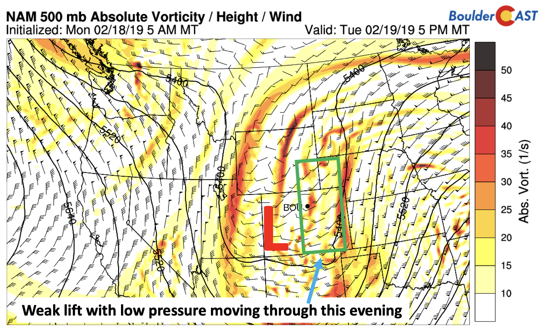
NAM 500 mb absolute vorticity today
Much of the snow will be flirting with the evening commute, so take it easy on the drive home. Amounts will be light across the region, generally only a dusting up to 2″ is possible over the Boulder/Denver area. Highs Tuesday will be in the middle 20’s under mostly cloudy skies.
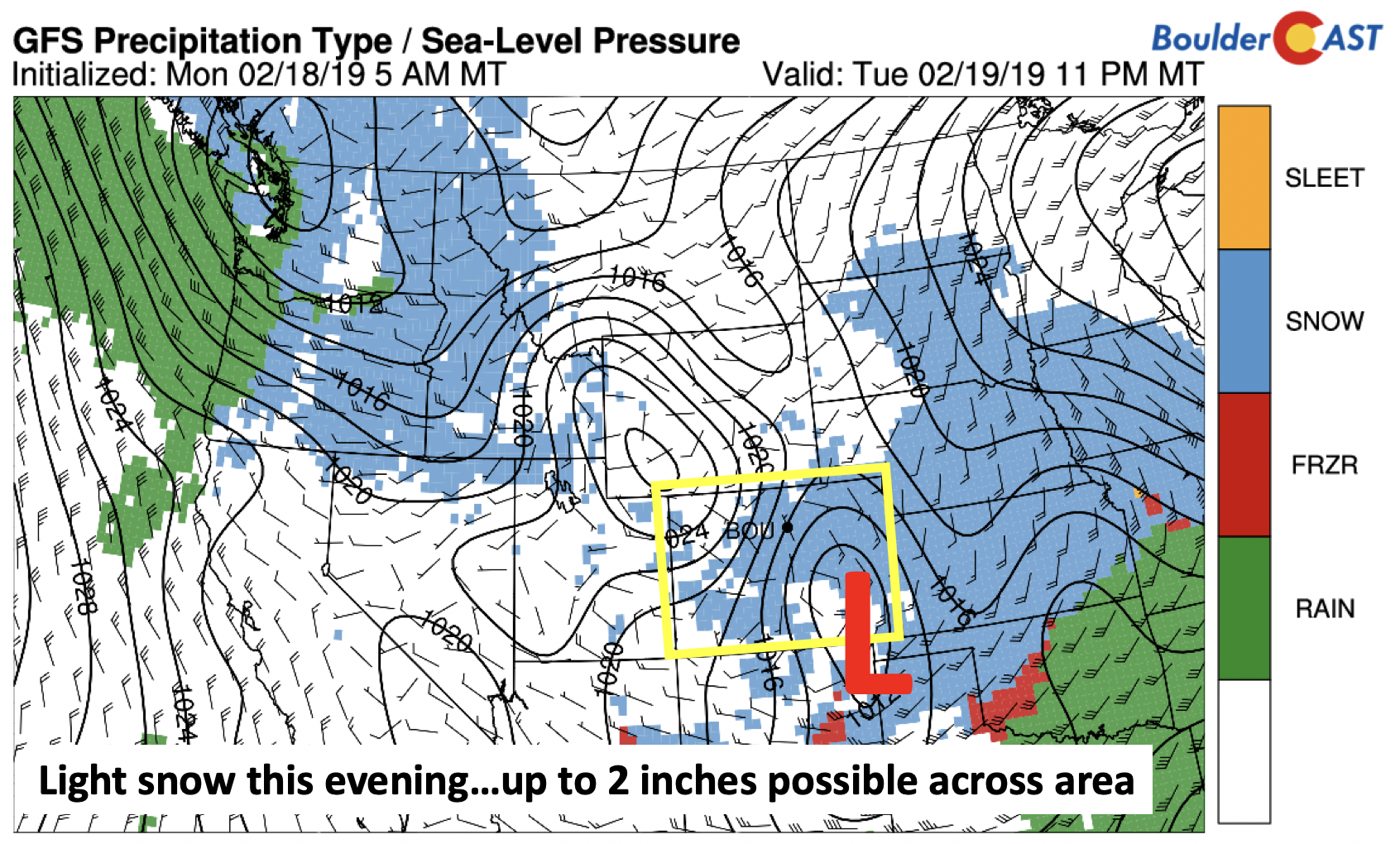
GFS precipitation type tonight
The rest of our week is shown below as a schematic of precipitation chances from the GEFS ensembles. Today’s snowfall is shown, with amounts rather light. We dry out tomorrow. Late Thursday into Friday night sees the potential return for a more snow, depending on the exact track and placement of the storm system…more on that below. A decent spread in the ensembles is evident for Friday so we’ll likely know more in a few days.
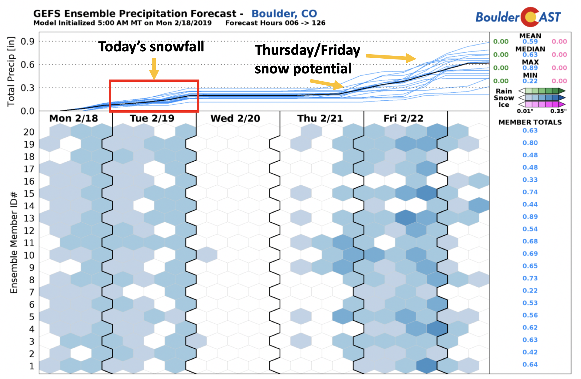
GEFS Precipitation forecast this week
Warmer Wednesday
Tomorrow, downslope flow will take over (below), which will aid in highs warming into the 30’s under the westerly winds. Depending on the exact quantity of snowflakes tis evening, highs may be a few degrees colder. A low pressure system is evident as well in the image below, lurking over Nevada…this system will be our focus for Thursday and Friday.
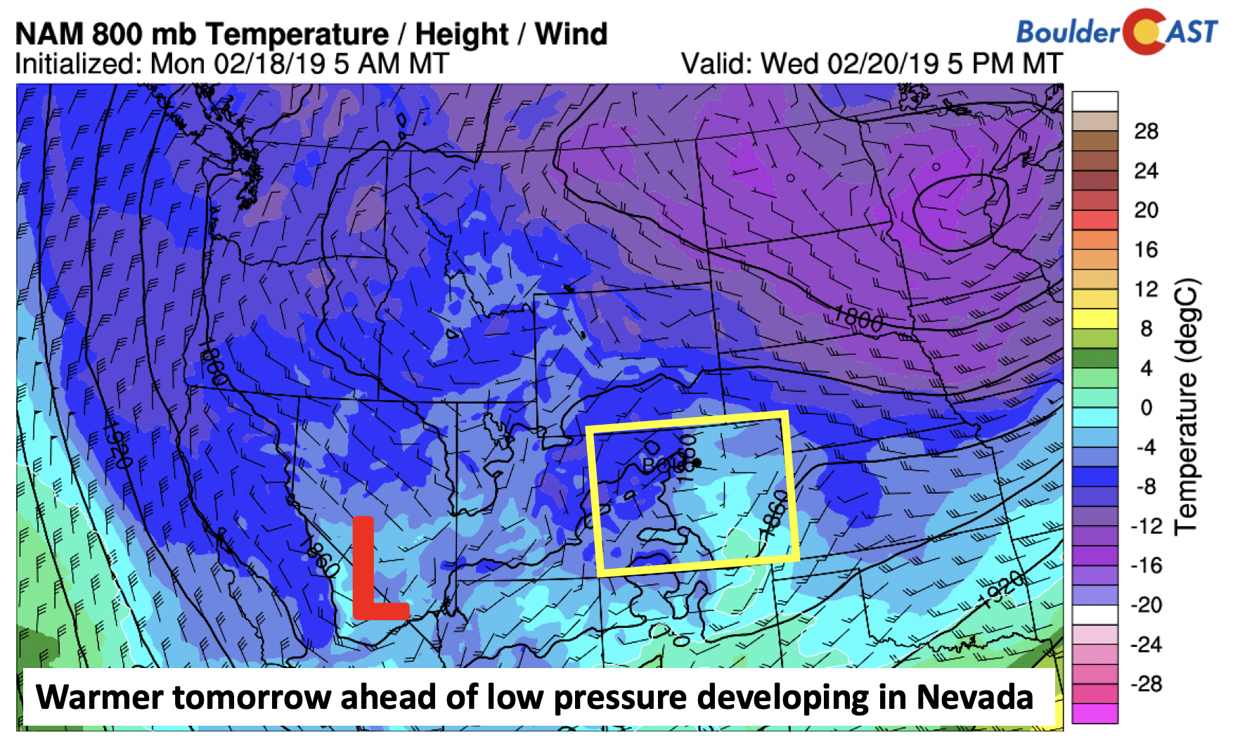
NAM 800 mb temperature tomorrow
Uncertainty Thursday/Friday with possible potent storm
On Thursday, a deep trough of low pressure is expected to be situated to our southwest over southern California and Nevada (below). Anomalously low heights are present within this region. Between midday Thursday into early Saturday, how this system evolves and tracks will ultimately determine our weather for the end of the week and how much snow, if any, we see.
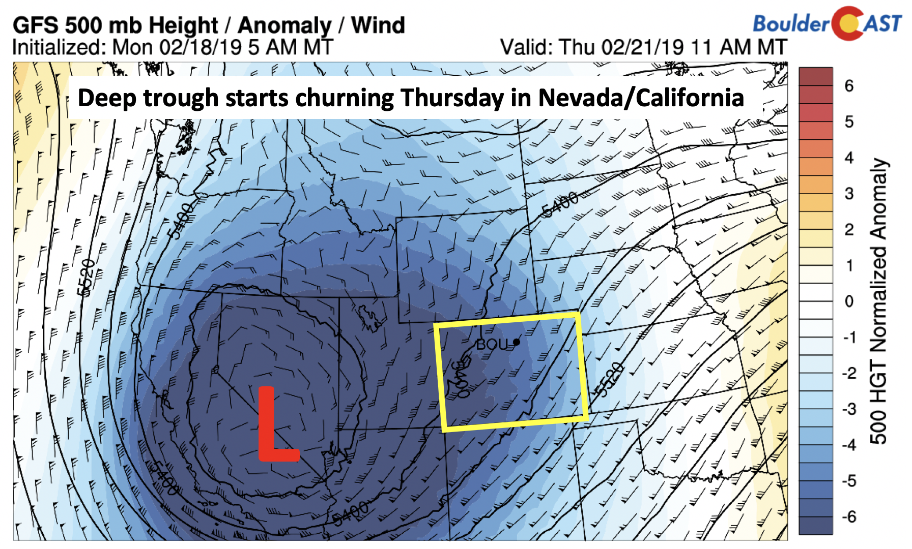
GFS 500 mb height anomaly on Thursday
Below shows the upper-level jet stream pattern late Thursday night into Friday morning. Some of the models (as hinted below) show a southwest to northeast oriented jet streak from Arizona into Nebraska. Although marginal, the hint is there for possible jet forcing for banded snow Thursday night, highlighted in red. Uncertainty remains, however, so we will have to watch this pattern closely over the next day or two.
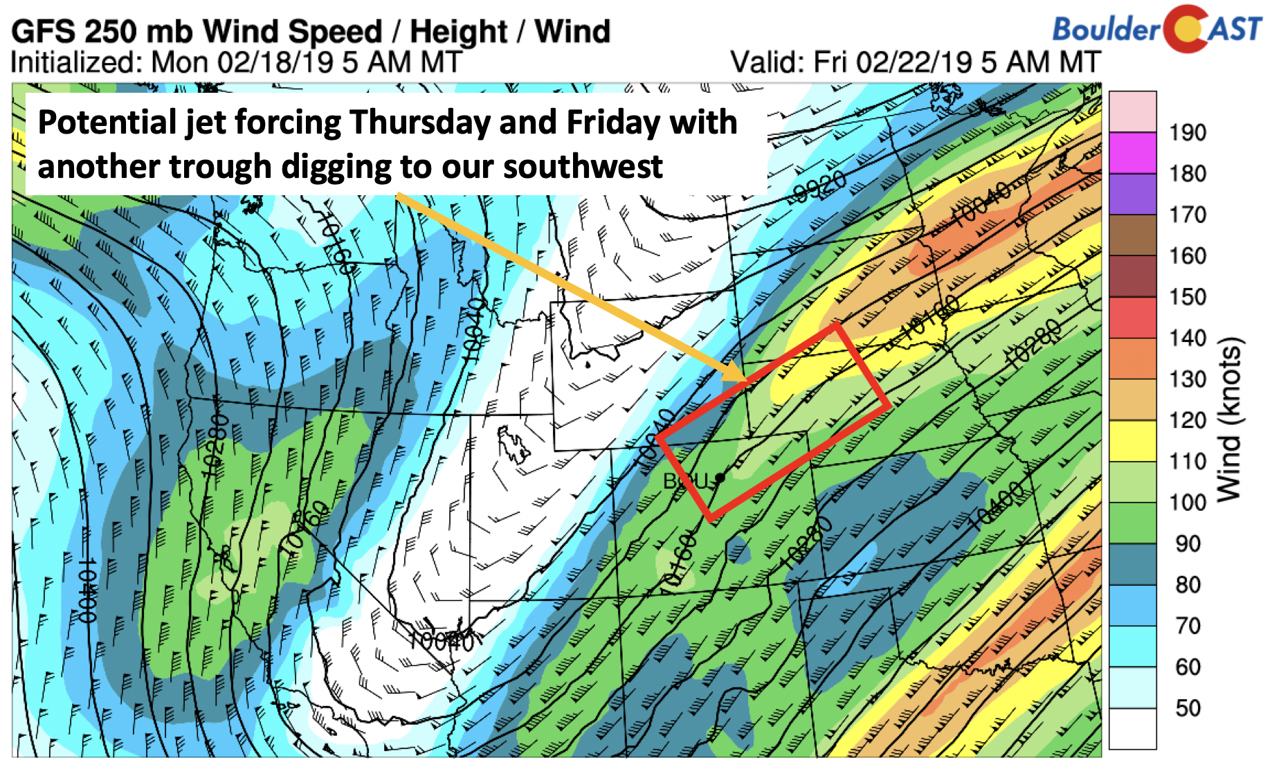
GFS 250 mb jet stream Thursday night and early Friday
Lift from the ejecting trough will be in place for much of Friday as well, at least from the GFS (below), with a southwest to northeast region of lift. Regions of maximum lift are unknown until the storm track is more certain.
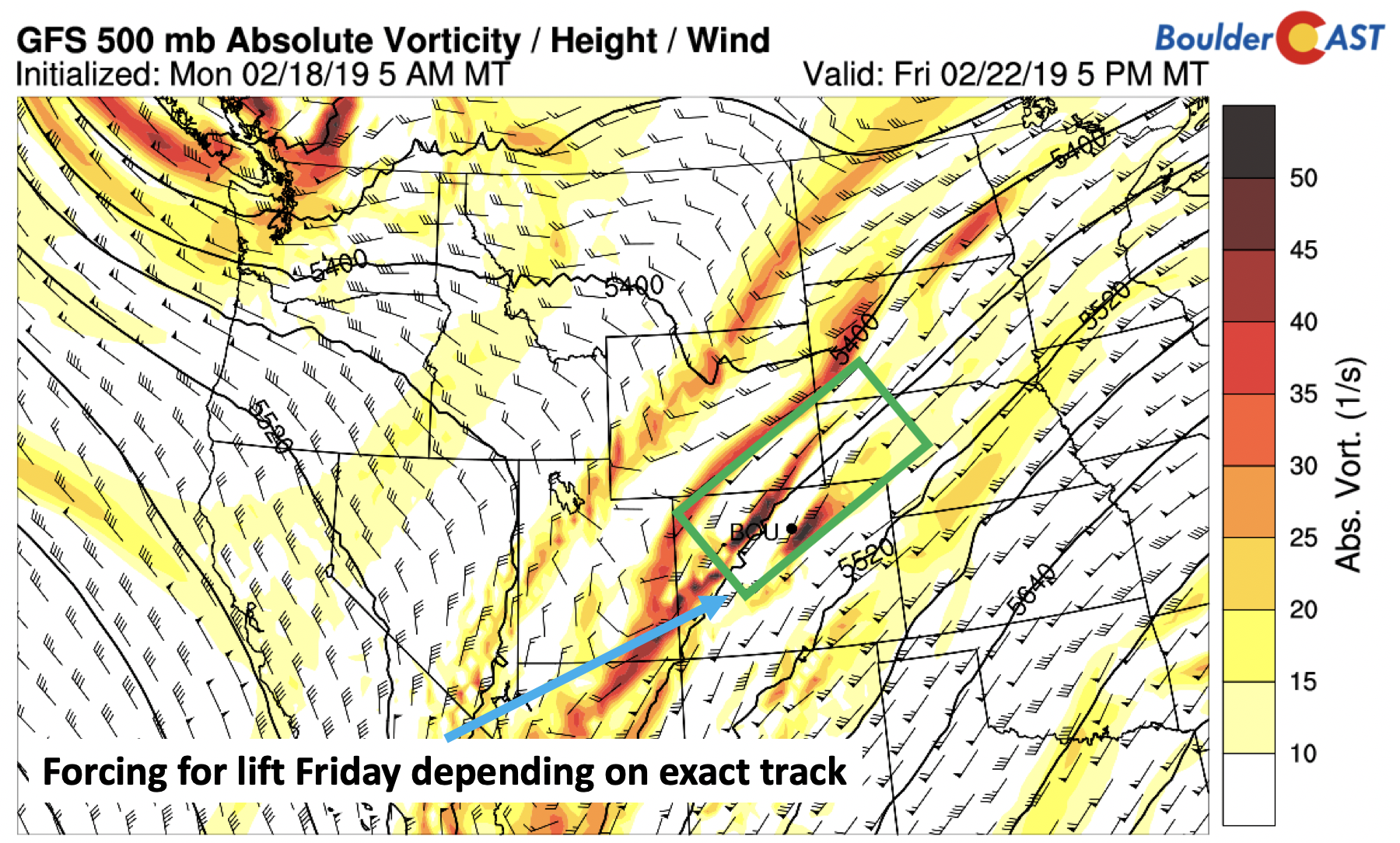
GFS 500 mb absolute vorticity on Friday
The large-scale precipitation forecast (below) as a result of the combined ingredients shows the potential for light snow developing Thursday night, possibly continuing off-and-on into Friday and Friday night, before tapering off early Saturday. Right now, given the uncertainty, we think Thursday’s highs will be cooler than Wednesday with upslope returning. Highs on Friday look similar to Thursday, with warmer and drier weather on Saturday.
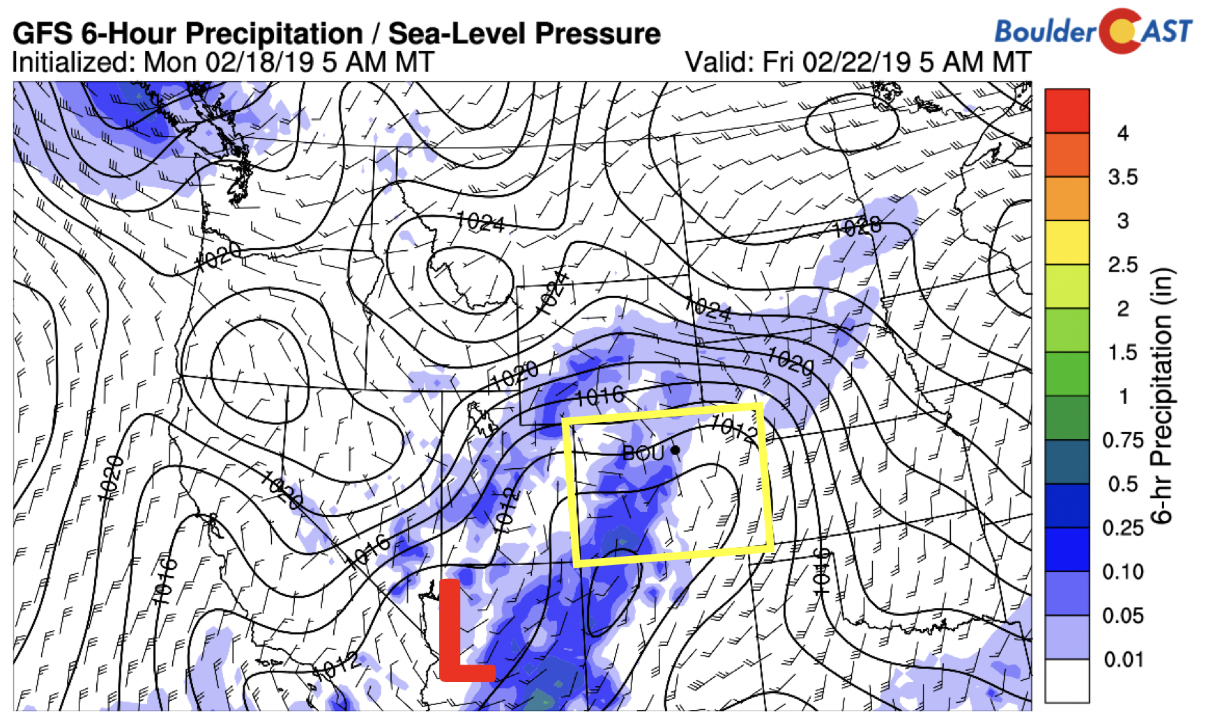
GFS precipitation forecast Thursday night and Friday
How much snow? To be honest, we are not entirely sure at this point. Current model runs from the Euro and GFS have us leaning towards a 1 to 3″ snow event. If the storm tracks further north and west, there exists the potential for more significant snow amounts. For now, plan on the period from late Thursday through early Saturday to turn out like the early part of this week, chilly and (at times) snowy. Stay tuned!
Forecast Specifics:
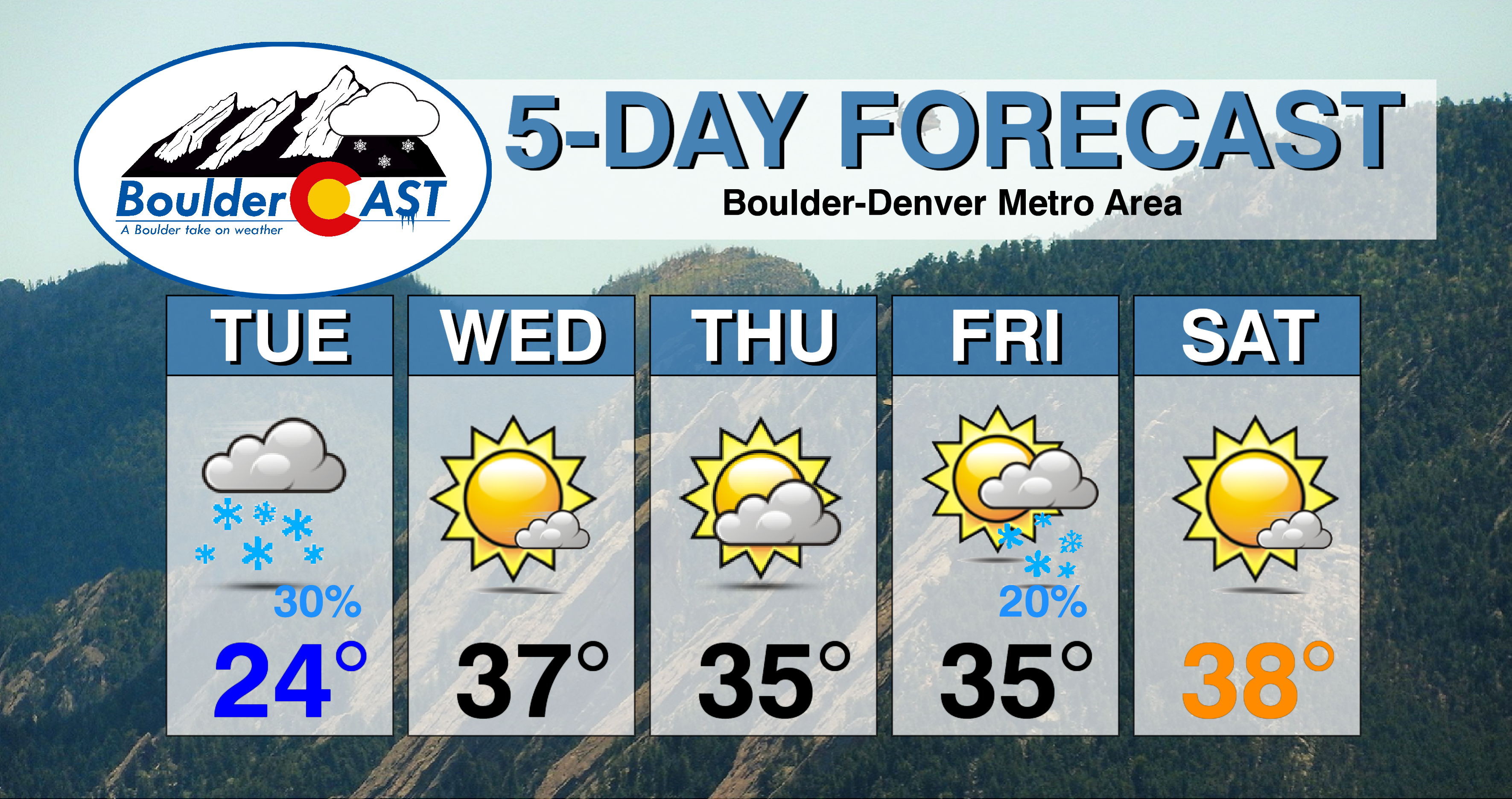
Tuesday: Mostly cloudy with flurries possible in the morning. Light snow showers developing by late afternoon into the evening with snow totals of a light dusting up to 2″. Highs in the middle 20’s for the Plains and upper teens in the Foothills.
Wednesday: Sunny skies taking over with warmer temperatures in the middle 30’s for the Plains and upper 20’s in the Foothills.
Thursday: Sunny skies becoming mostly cloudy with light snow possible overnight into Friday. Any accumulation should be light. Highs in the lower 30’s on the Plains and middle 20’s in the Foothills.
Friday: Partly to mostly cloudy with light snow possible. Highs in the low to middle 30’s on the Plains and middle 20’s in the Foothills.
Saturday: Partly sunny skies becoming sunny with highs in the middle 30’s on the Plains and upper 20’s in the Foothills.
High Country: Light snow will be in the forecast for the mountains today with a system pushing through. Drier weather is expected tomorrow under weak high pressure. Off and on light to moderate snow showers appear likely Thursday night into Saturday with another system tracking from southwest to northeast. Check PowderCAST for updated forecasts for all the Colorado ski resorts.
DISCLAIMER: This weekly outlook forecast was created Tuesday morning and covers the entire upcoming week. Accuracy will decrease as the week progresses as this post is NOT updated. To receive daily updated forecasts from our team, subscribe to BoulderCAST Premium.
.
Share our forecast!




You must be logged in to post a comment.