With the passage of a cold front this morning, the atmosphere will be primed for severe weather in Boulder County on both Wednesday and Thursday, with the greatest threat being large hail and tornadoes. Read on to find out when you should keep an eye to the sky.
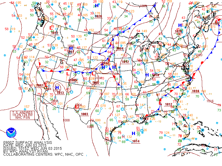
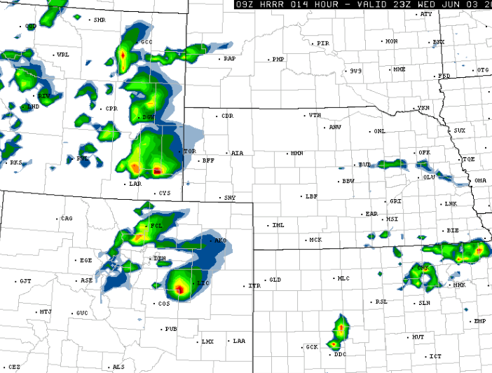
After high temperatures across the Plains climbed to near 90 degrees on Tuesday, a cold front is progged to move through Boulder by 9am today, bringing in low-level upslope and abundant moisture. This moist, easterly low-level flow will generate significant shear with WSW flow aloft. Combined with forecast CAPE values of 1500-3000 J/kg, supercell thunderstorms will likely spawn by mid-afternoon. Today is a rare instance where the greatest instability will be near the Foothills, at least initially. Areas from the city of Boulder to I-25, from the Palmer Divide north into southeast Wyoming, will have the best chance of storm development early. The action will shift eastward through the late afternoon into the evening. The most likely timeframe for severe weather near Boulder will be 2pm to 6pm.
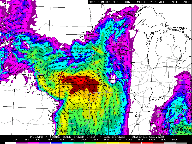
NAM 4km model forecast CAPE for 3pm Wednesday, showing values 2000-3000+ J/kg all along I-25, as well as 40+ knots of shear
The Storm Prediction Center outlook for hail today shows a greater than 30% chance of 1″+ diameter hail within 25 miles for nearly all of Boulder County and a greater than 10% chance of 2″+ diameter hail.
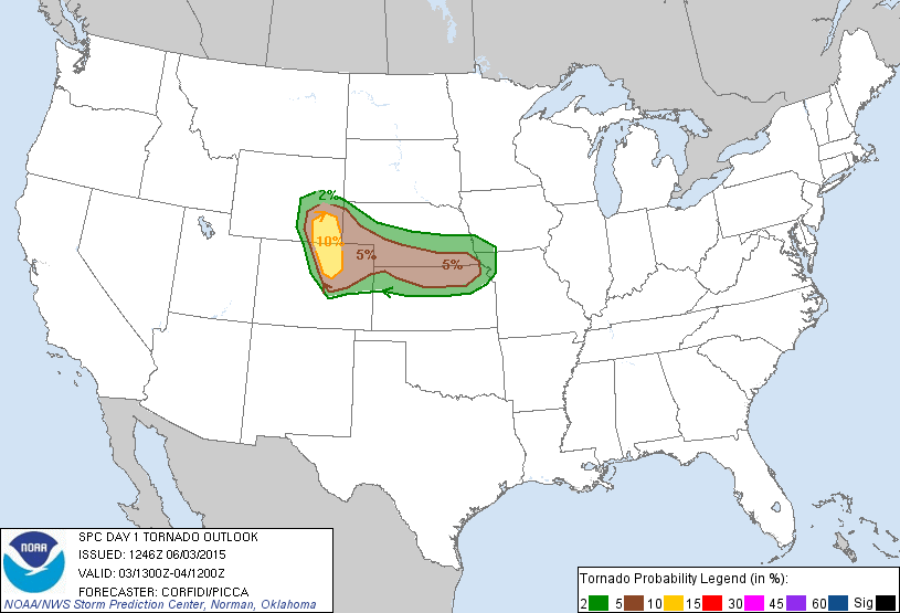
The tornado outlook is similar, but with the bull’s-eye of greater than 10% chance right over eastern Boulder County and the entire I-25 Corridor from Denver to Cheyenne.
With relatively weak 500mb winds, storms/supercells that do form will slowly drift northeastward.
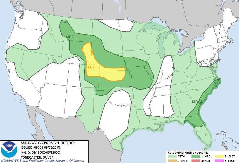
For Thursday, the threat of severe weather for Boulder will be diminished, but cannot be entirely ruled out just yet. As of now, the SPC has most of NE Colorado, including eastern Boulder County in the “Slight Risk” area.
In addition to parking your car in a hail-safe location, we urge those in Boulder to keep an eye to the sky and an open ear to listen for tornado sirens through the day. The severe threat this afternoon is without question Boulder’s most significant so far in 2015.





You must be logged in to post a comment.