
Following a very warm end to June, the first week of July will continue the hot trend but also blend in late-day thunderstorms typical for this time of year. Read on for more details, including the outlook for the Fourth!
Widespread afternoon and evening storms to start week
Much of the first half of this week will feature a persistent pattern, albeit with slight changes. We’ll see a consistent south-southwest flow in the mid to upper-levels of the atmosphere, keeping moisture at or slightly above average. This combined with daytime instability will fuel excellent afternoon and evening thunderstorm chances early in the week.
Below shows the mid-level pattern for today and this evening. In southeastern Colorado, there is a weak area of low pressure, with coincident trough axis. Further north and west, near Oregon, is a stronger and more developed wave of low pressure. This system will slowly move into Idaho and Wyoming as we end the week. That will create a broad area of southwest flow across our state, maintaining the heat and lessening the moisture somewhat.
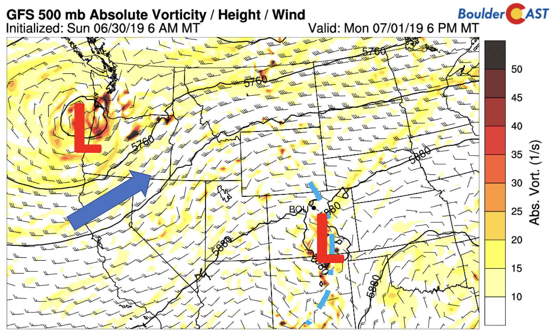
GFS 500 mb vorticity map for Monday
In addition the mid-level shortwave today, last night a weak cool front slid south into northeast Colorado. Its leading edge is shown below in the low-level temperature field. High pressure exists in the Dakotas, which has ushered in weak upslope flow to the region.
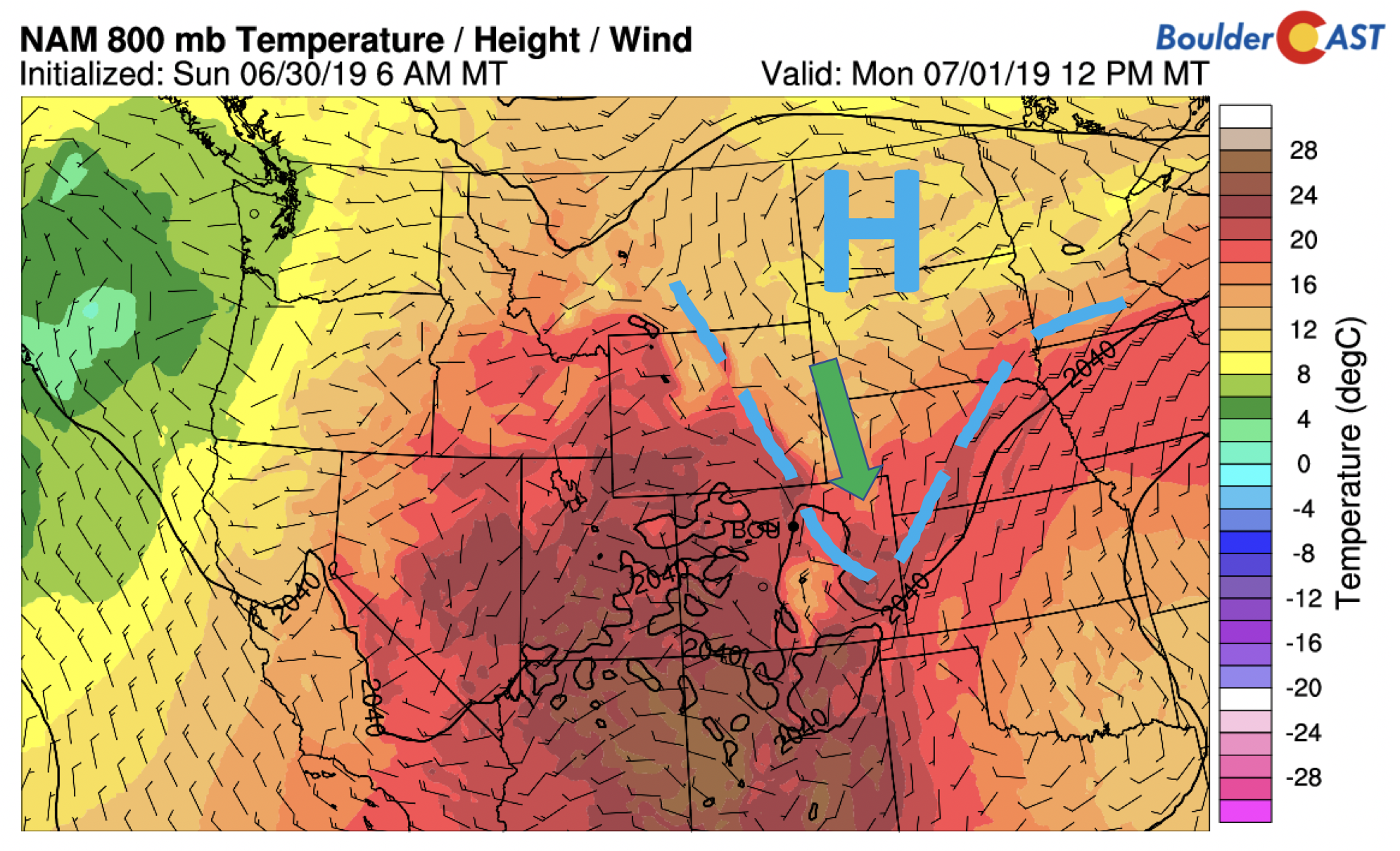
NAM 800 mb temperature and wind map for Monday
Comparable to yesterday, we’ll see afternoon/evening storms break out across the High Country and Plains. Morning clouds may slow the start of the activity in some areas. Enough daytime heating should commence by mid-day to interact with the front and allow scattered showers and thunderstorms. Given weak shear aloft, the main threats will be lightning and heavy rainfall, although isolated strong gusty winds are not out of the question. Localized flooding is a concern on Monday for sure. It is possible that the main activity will reside in southeastern Colorado with the trough axis, but this is difficult to discern given the current guidance. We’re forecasting highs in the middle 80’s with a 50% chance of storms on Monday.
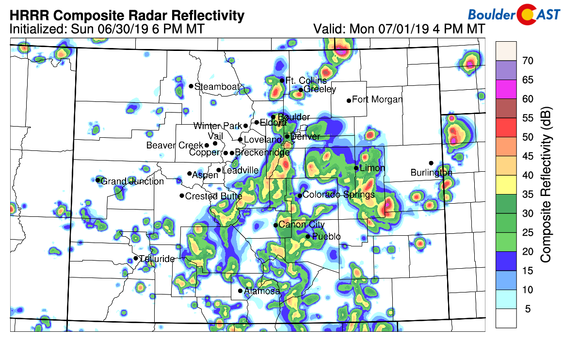
HRRR model simulated radar for Monday evening
Beyond today, tomorrow and Wednesday will see elevated moisture over the region. The one field we like to look at is precipitable water, also known as the total atmospheric column moisture from the surface to the upper-levels. It is a good measure of the total available moisture present in a particular region. For us this time of year, values at or above 1 inch of precipitable water are indications of a moist atmosphere. Much of the area, as mentioned above, will see weak south-southwest flow in the low and mid-levels through Wednesday (below). In addition, the moisture values exceed 1 inch Monday and are right around 1 inch Tuesday and Wednesday. Not much will change in the overall pattern as you can see thanks to a trough in the Pacific Northwest and weak ridging in the east.
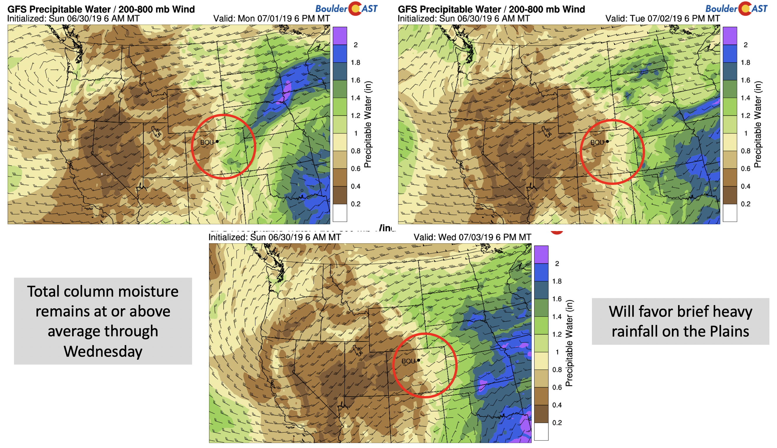
GFS precipitable water forecast for Monday, Tuesday, and Wednesday.
Since moisture and instability are closely linked, there is no surprise that favorable CAPE values (unstable air for thunderstorm development) are present each day through midweek (see below). Values come near or exceed 1000 J/kg each day, enough to support towering cumulus and storm activity. However, as we said earlier, wind shear is relatively weak throughout the atmosphere. Weak wind shear will prohibit strong to severe storm development since the downdraft (rain-cooled air) will eventually kill the updraft (vertical lift in cloud) due to weak winds. With this, our main threats will be heavy rainfall, lightning and thunder, and gusty winds.
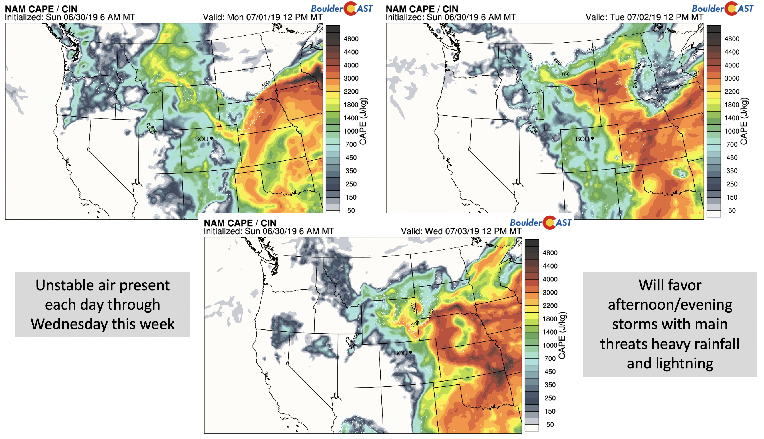
NAM CAPE forecast for Monday, Tuesday, and Wednesday
Storms will likely be scattered in nature this week with no clear frontal boundaries or mid-level disturbances to speak of, except for Monday. A 20-40% chance of storms Tuesday and Wednesday appears reasonable with highs in the mid to upper 80’s. Each day will start out sunny followed by increasing clouds from storm development in the afternoon and evening.
One final reminder that the “stormy” pattern we have seen periodically of late is NOT the monsoon. We’re still expecting that to be at least two weeks out. The current pattern is similar to the monsoon, but it is not established yet across the American Southwest. The bump in moisture in Colorado yesterday and today was an offshoot of now deceased Tropical Storm Alvin in the Eastern Pacific Ocean.
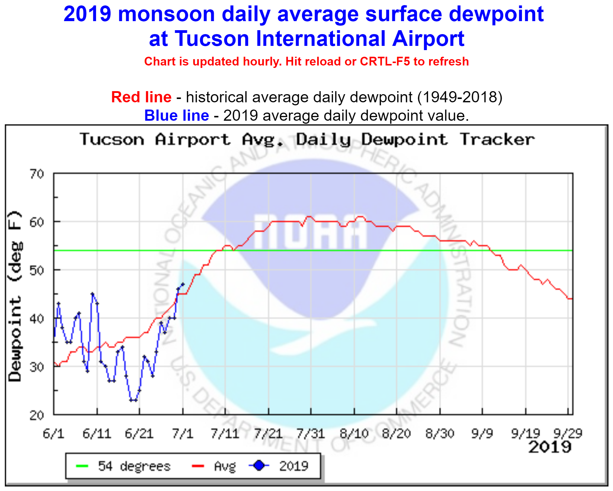
Dew point tracker in Tucson, AZ shows monsoon is not here yet!
Heat remains for 4th; less storms for latter part of week?
Late in the week, the aforementioned trough in the Pacific Northwest will play a slightly larger role in our overall weather pattern. Its center is projected to be over Idaho (below) by midday Thursday. That would place Colorado in the region of peak heating. There are some hints that available moisture decreases a little by Thursday/Friday as drier air works in from the Desert Southwest. However, it remains to be seen if this will verify…time will tell. Nevertheless, we see the chance of storms lessening under this pattern. That would mean an isolated nature of storm activity in contrast to earlier in the week. More sunshine would be expected as well with highs potentially getting back to near or just above 90 degrees.
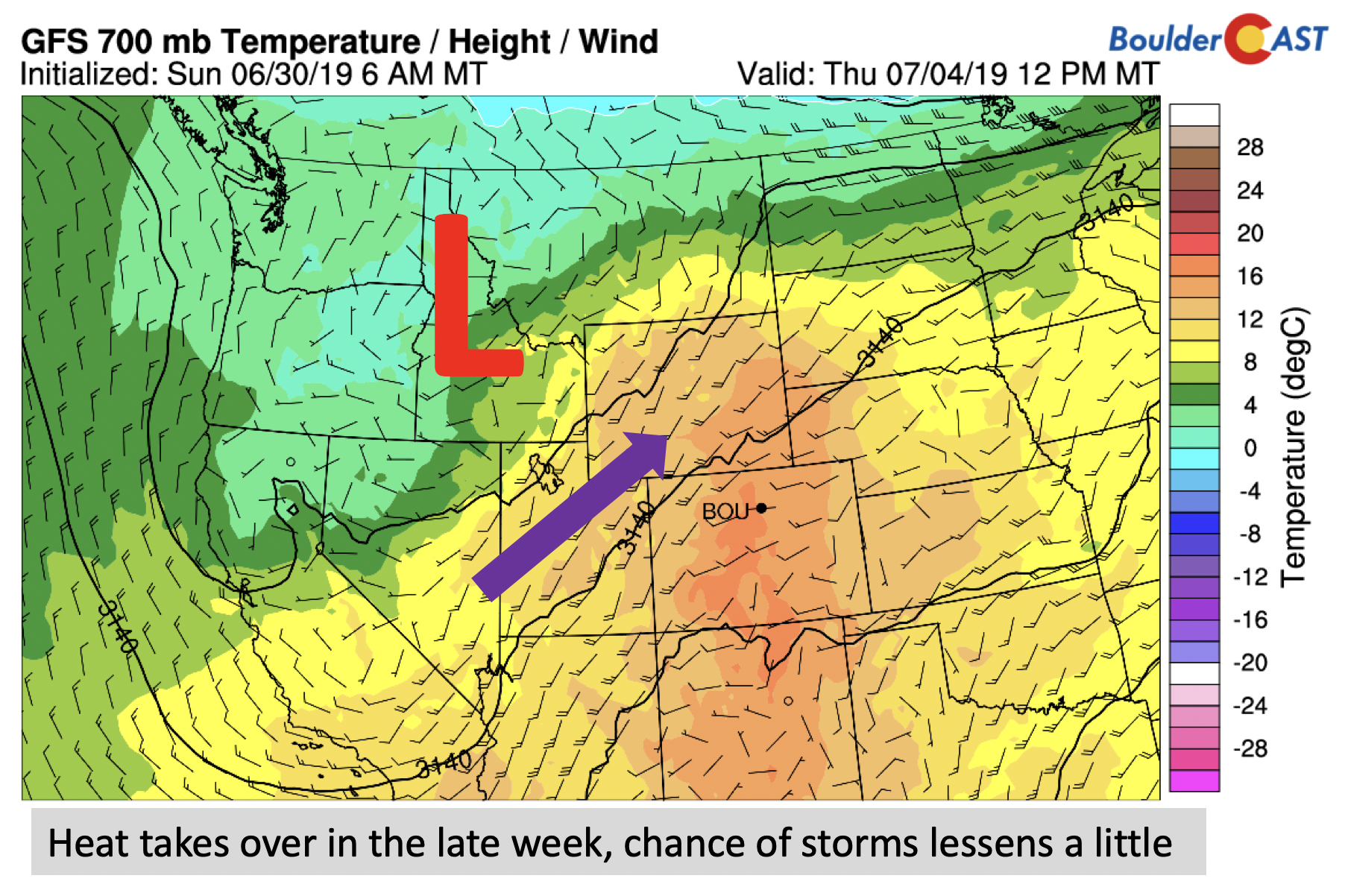
GFS 700mb temperature and wind forecast for Thursday
Early indications for the 4th of July would favor highs near 90 degrees with an isolated chance of evening storms. Similar to last year, we may be able to celebrate Mother Nature’s fireworks alongside the man-made ones again this year.
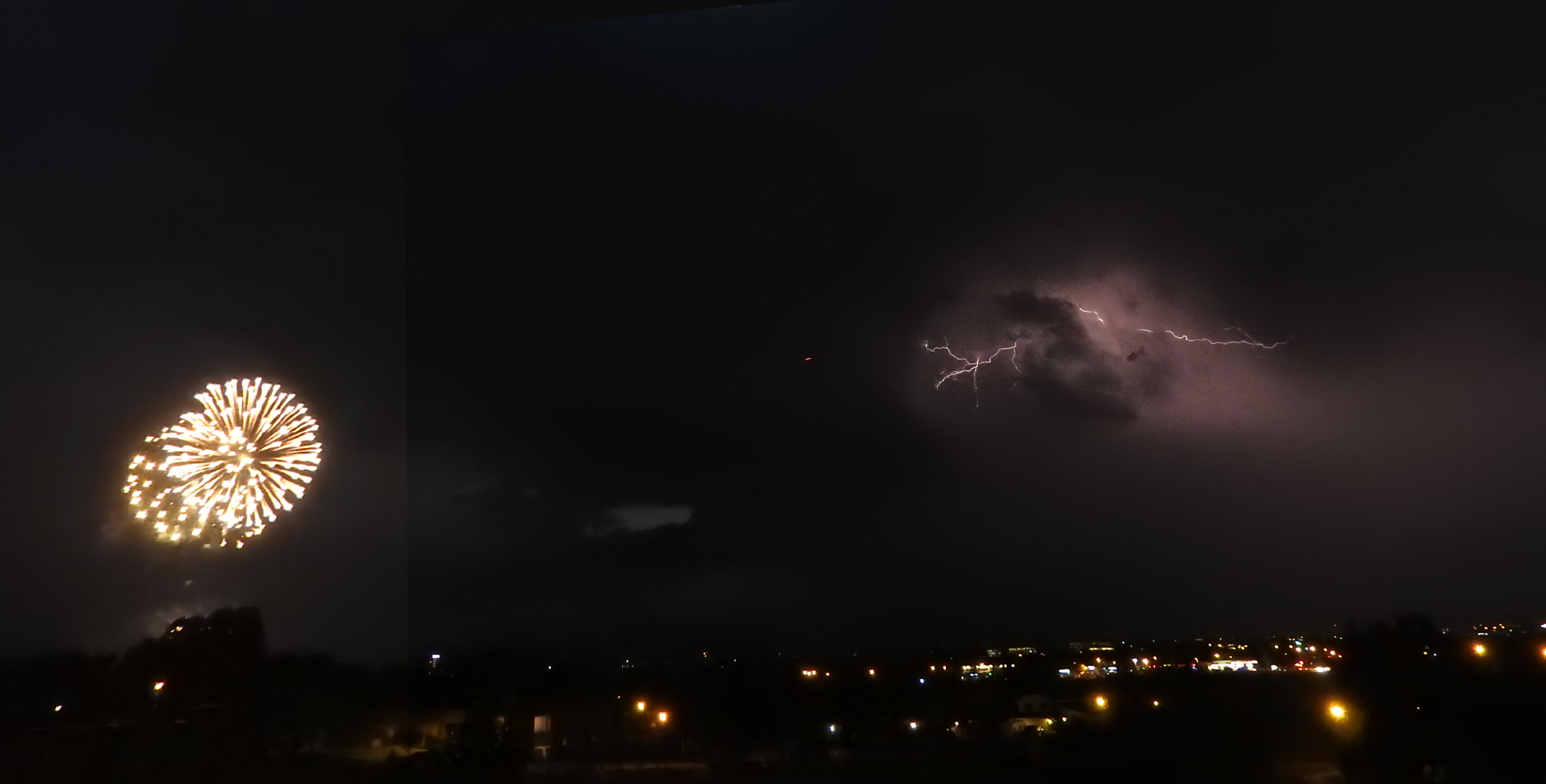
July 4, 2018 – Lightning and fireworks
Forecast Specifics:
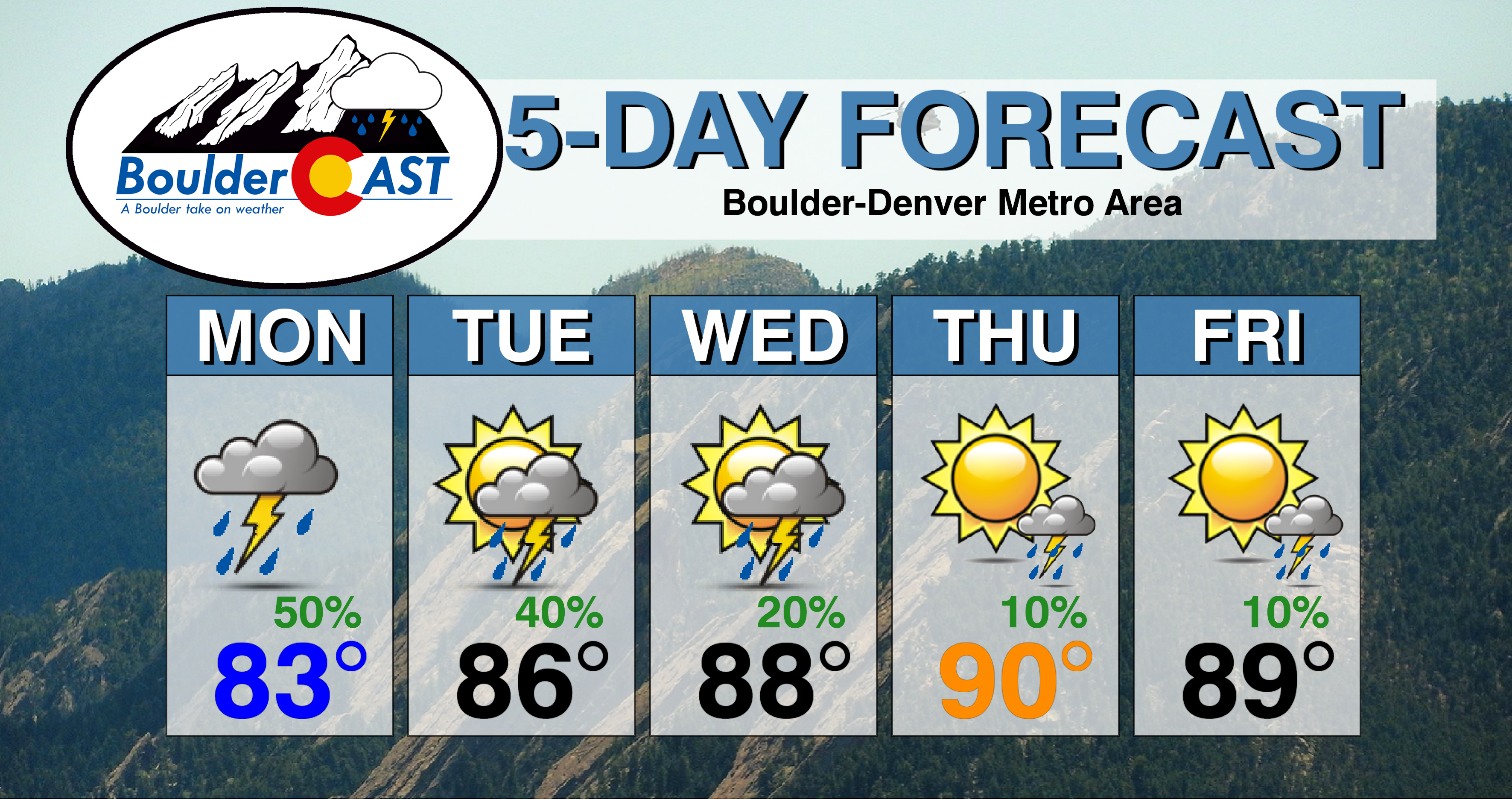
Monday: Morning clouds, then early afternoon sunshine giving way to widespread showers and storms. Storms could produce heavy rainfall, localized flooding and small hail. Highs in the low to middle 80’s on the Plains and low 70’s in the Foothills.
Tuesday: Morning sunshine, then increasing clouds with scattered afternoon/evening thunderstorms with the main threat again being heavy downpours. Highs in the middle 80’s on the Plains and middle 70’s in the Foothills.
Wednesday: Sunshine to start, then isolated to scattered afternoon and early evening thunderstorms. Highs in the middle to upper 80’s on the Plains and middle 70’s in the Foothills.
Thursday July 4th: Partly cloudy with a chance of isolated afternoon and evening storms. Highs in the upper 80’s to near 90 on the Plains and upper 70’s in the Foothills.
Friday: Hot, increasing clouds, and a slight chance of afternoon/evening storms. Highs temperatures near 90 degrees for the Plains and near 80 degrees in the Foothills.
High Country: Much of the pattern this week will feature afternoon/evening storms across the higher terrain. Brace for hiking early each day to not get caught in the rain and lightning. Storm chances lessen a little Thursday and Friday, but still expect a 20 to 30% chance of storms for the 4th and 5th of July.
DISCLAIMER: This weekly outlook forecast was created Monday morning and covers the entire upcoming week. Accuracy will decrease as the week progresses as this post is NOT updated. To receive daily updated forecasts from our team, subscribe to BoulderCAST Premium.

.
Spread the word, share our forecast!


You must be logged in to post a comment.