A strong trough will impact our region to start the first few days of the week bringing the threat of showers and even a few severe storms. A strong cold frontal passage will bring high temperatures below normal by midweek down into the 60s — a true taste of autumn which many of you have been asking for. As the system departs, dry northwest flow will ensue late-week which will promote continued cool temperatures but also lots of sunshine. Read on for more details.
This week’s highlights include:
- A strong shortwave trough will impact the Front Range into midweek
- Scattered showers and storms are expected Monday, with post-frontal showers possible Tuesday into Wednesday
- Monday is our last summer-like day with temperatures reaching the lower 80s before the rain arrives
- Below normal temperatures follow Tuesday with 60s on tap for the rest of the week
- Dry and chilly northwest flow will keep us rain-free for the end of the week, but temperatures on Friday are particularly uncertain
DISCLAIMER: This weekly outlook forecast is created Monday morning and covers the entire upcoming week. Accuracy will decrease as the week progresses as this post is NOT updated. To receive daily updated forecasts from our team, among many other perks, subscribe to BoulderCAST Premium.
Daily Forecast Updates
Get our daily forecast discussion every morning delivered to your inbox.
All Our Model Data
Access to all our Colorado-centric high-resolution weather model graphics. Seriously — every one!
Ski & Hiking Forecasts
6-day forecasts for all the Colorado ski resorts, plus more than 120 hiking trails, including every 14er.
Smoke Forecasts
Wildfire smoke concentration predictions up to 72 hours into the future.
Exclusive Content
Weekend outlooks every Thursday, bonus storm updates, historical data and much more!
No Advertisements
Enjoy ad-free viewing on the entire site.
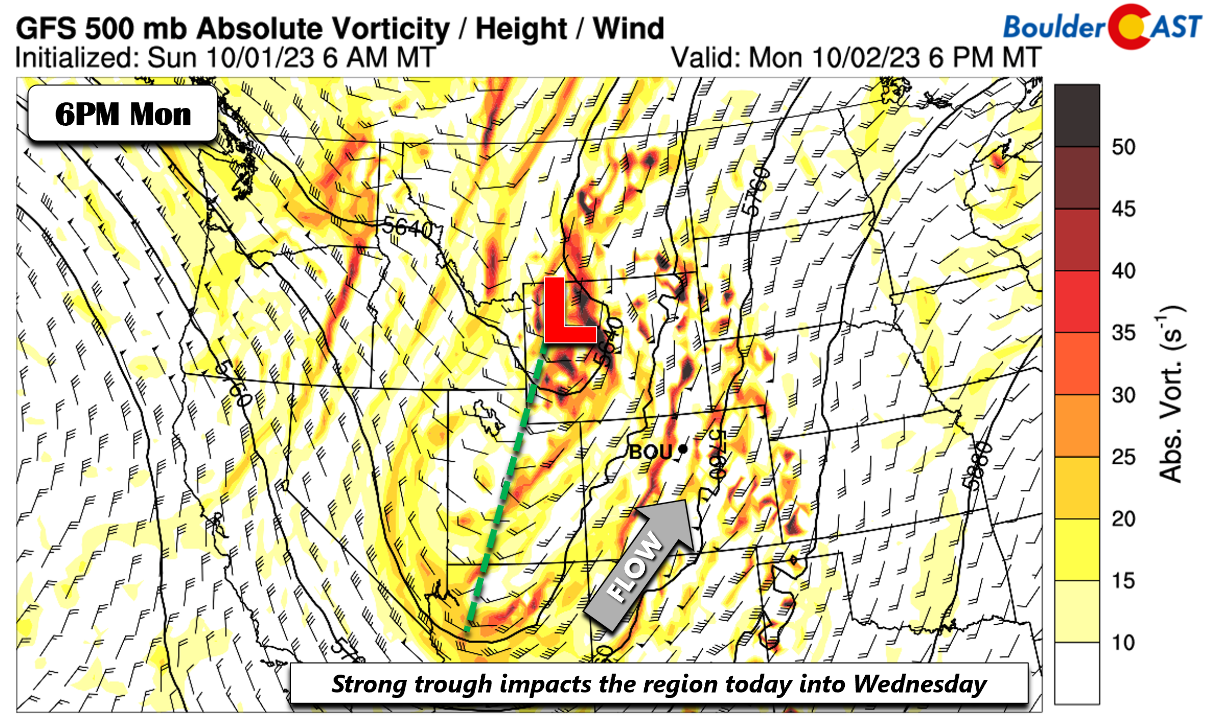
Strong trough impacts us into midweek
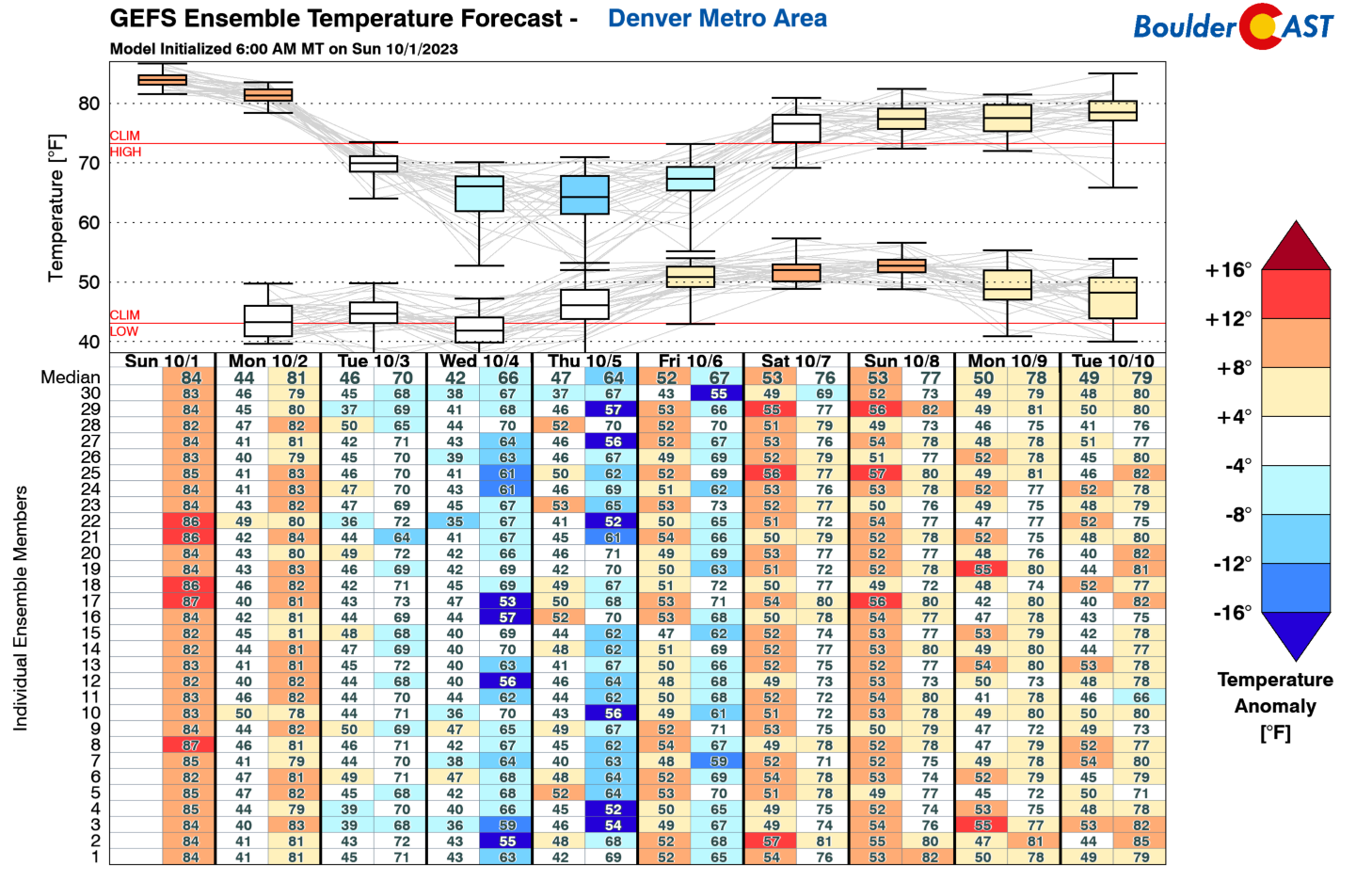
An active week is set to unfold across the Front Range region, especially during the first few days of the week. The GEFS ensemble temperature forecast for Denver shows one aspect of the active week. Monday will be the warmest day with another afternoon of 80s, our eighth in a row. However, the bottom drops out come midweek behind a strong cold front — we see highs only in the low to mid 60s come Wednesday and we never really recover with below normal temperatures through at least Friday.
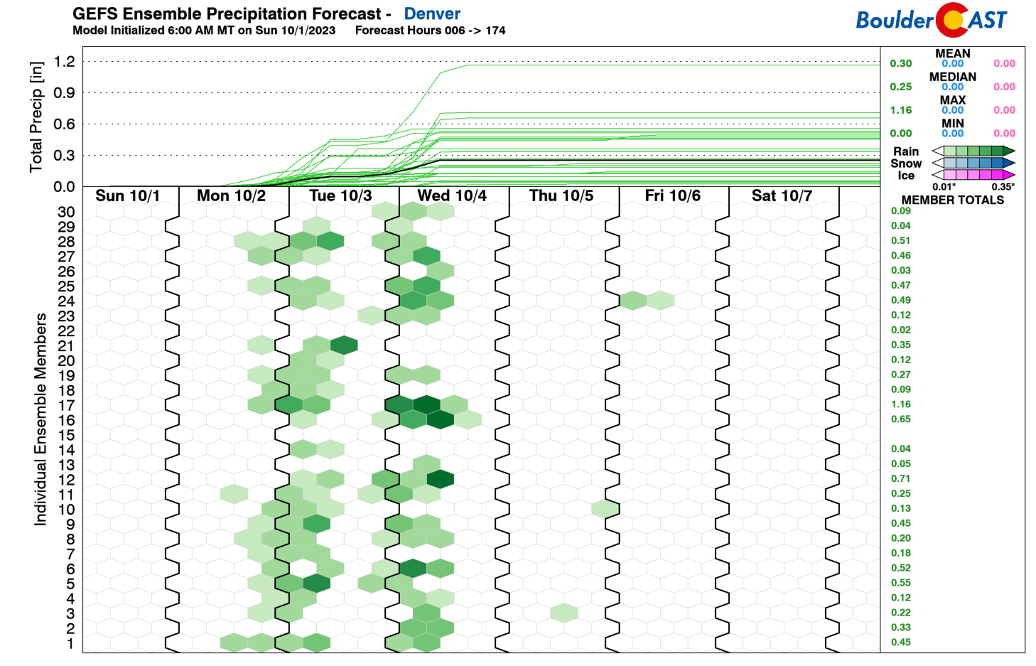
The second aspect of the active weather week ahead is that the chances of precipitation will be front-loaded to the first few days of the week. This is not surprising, given that the drop in temperatures tomorrow and Wednesday is associated with a few autumn cold fronts. We’ll break it down as to our best chances for rain and/or storms in a minute. The for those of your hopeful, there’s no snow in the forecast this week across the lower elevations — temperatures are still too warm.
A deep and rather large trough of low pressure over Wyoming Monday evening will supply moisture, instability, and lift over Colorado during the day into the tonight. Much of this energy will track from southwest to northeast. At the surface, it will be another gusty day with southerly winds gusting to 30 MPH at times, especially in Denver (and not so much Boulder). We should squeak out one more day in the lower 80s.
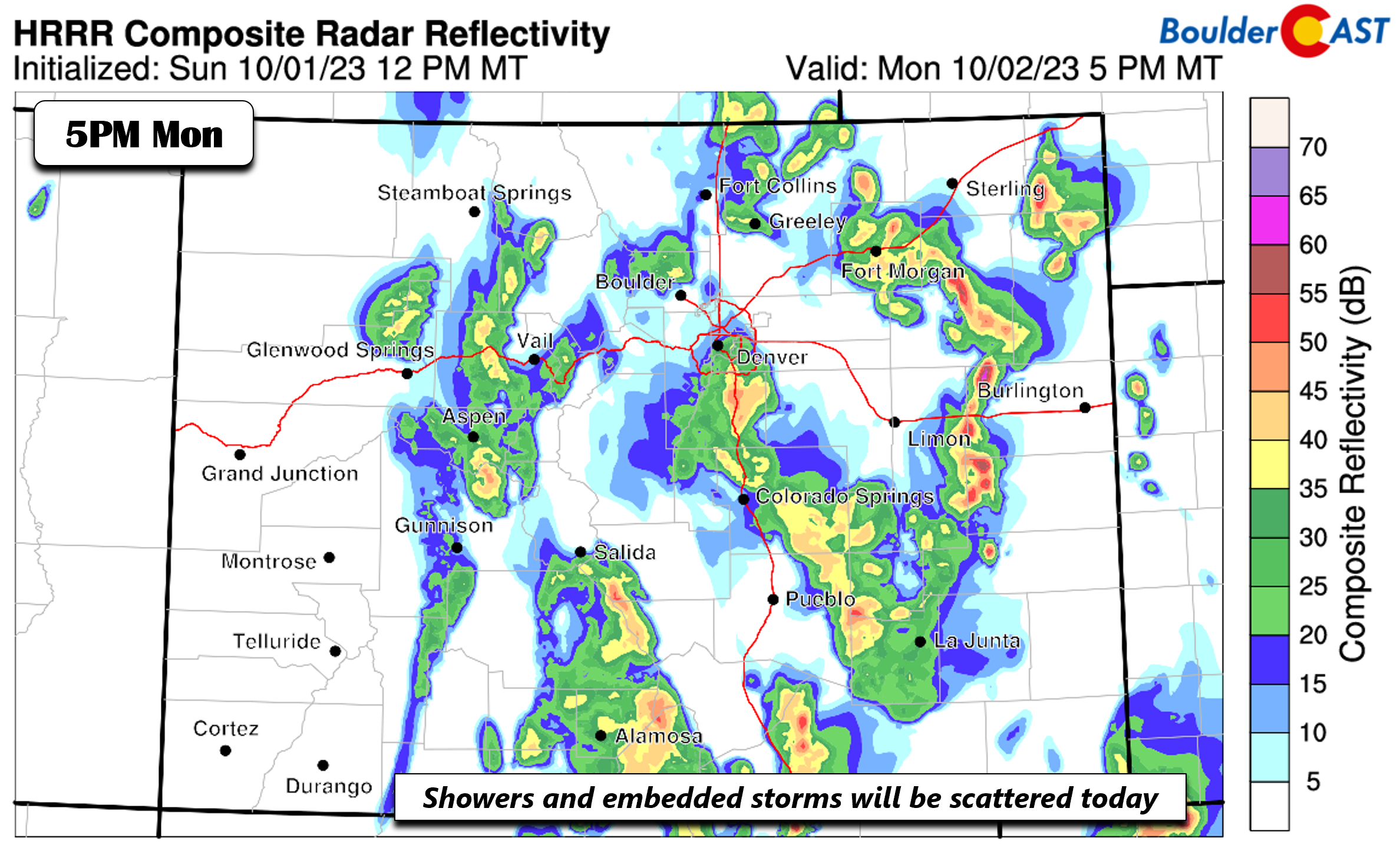
The general downslope flow at the surface and at mid-levels will mean that storms tracking eastward toward the Plains from the High Country will have some difficulty maintaining their strength. However, enough lift should warrant scattered showers and with some embedded storms. Roughly a 30-40% chance is on the table for Monday so not all of us will get wet, with the best chance along and east of I-25.
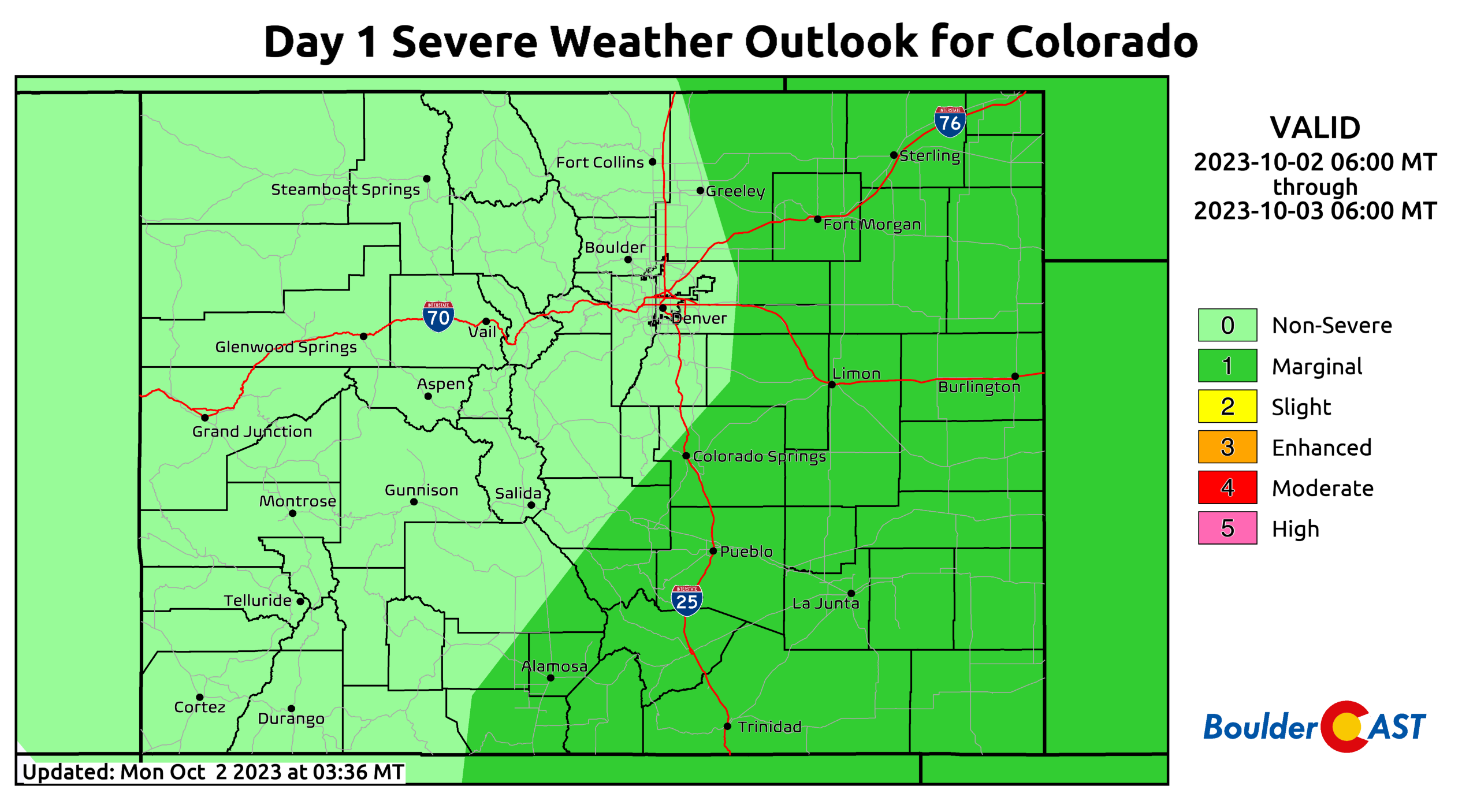
The greatest severe risk (Marginal, which is level 1 out of 5) is shaping up to be east of the Denver Metro area, where the best overlap of instability and lift will be located. It would not be surprising if the Storm Prediction Center expands the Marginal Risk a tad westward closer to I-25, but all-in-all we expect any severe risk to largely reside east of Denver. Storms capable of damaging winds and large hail will be possible towards Ft. Morgan and Limon.
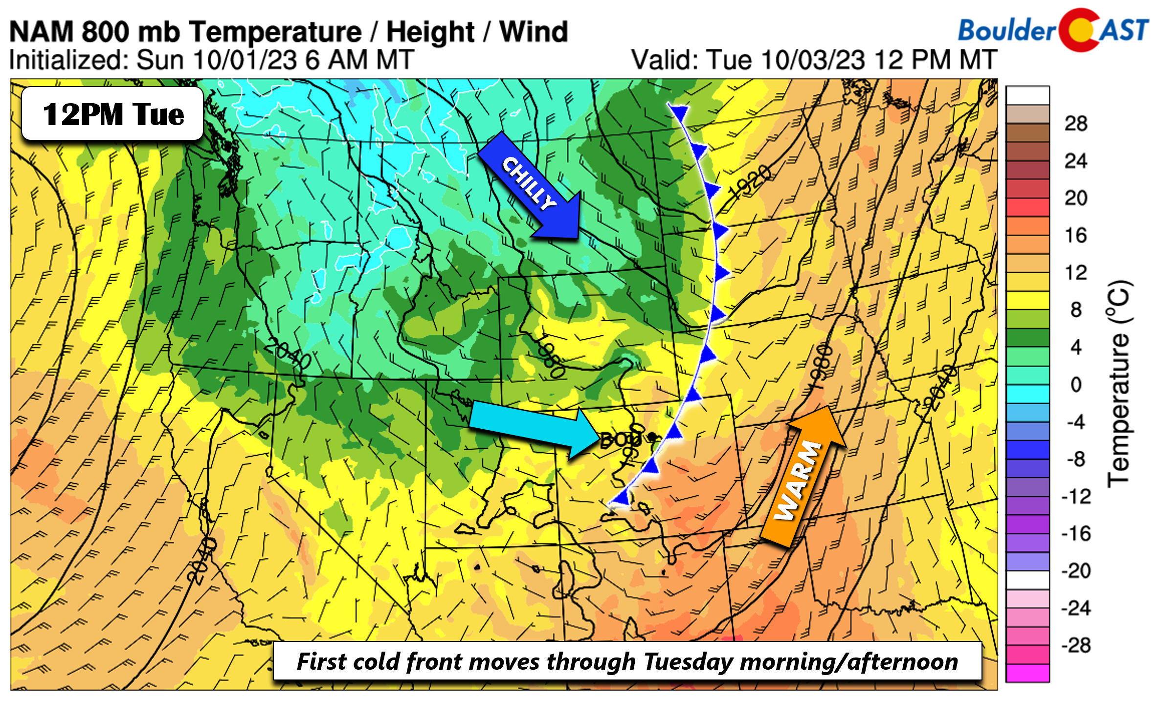
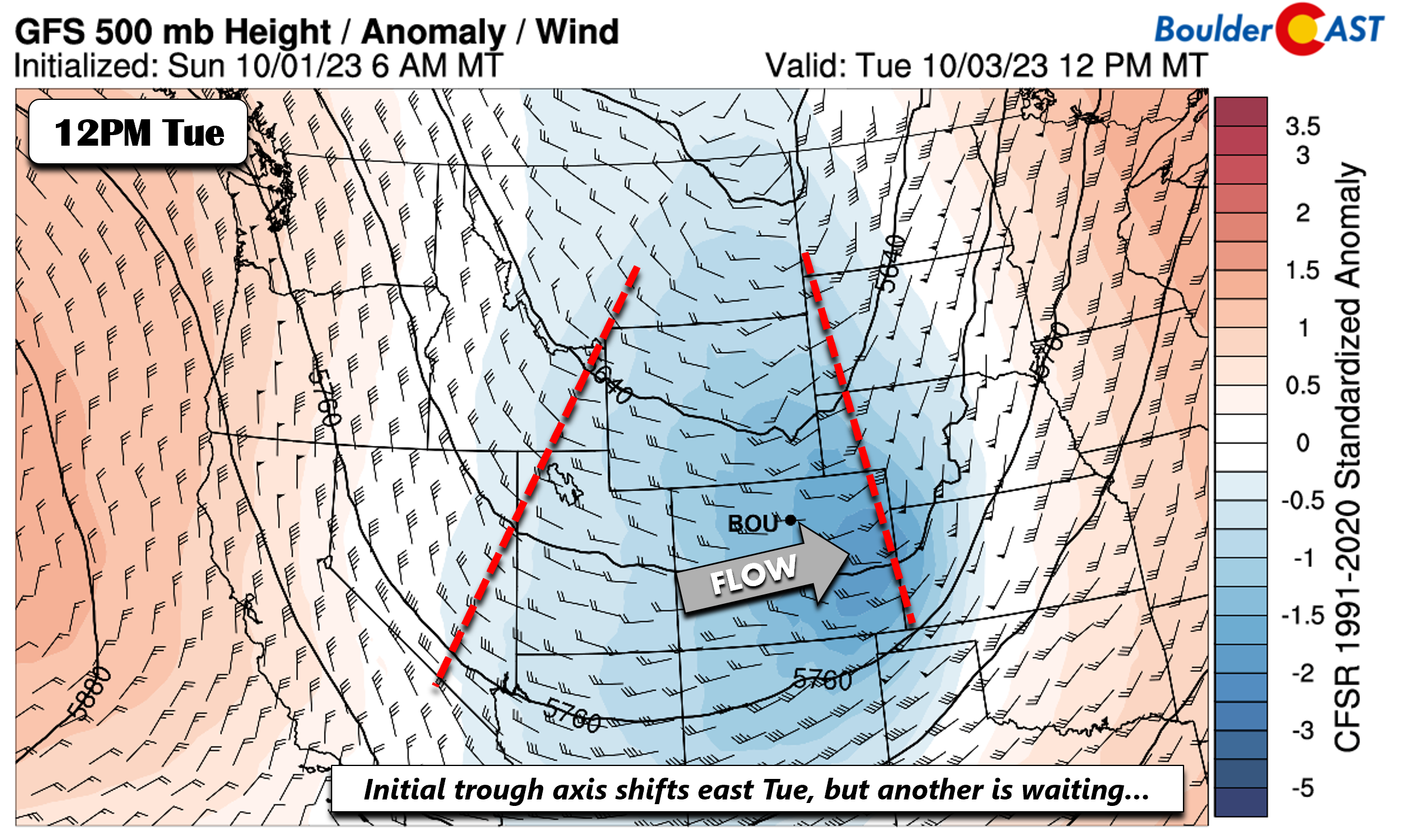
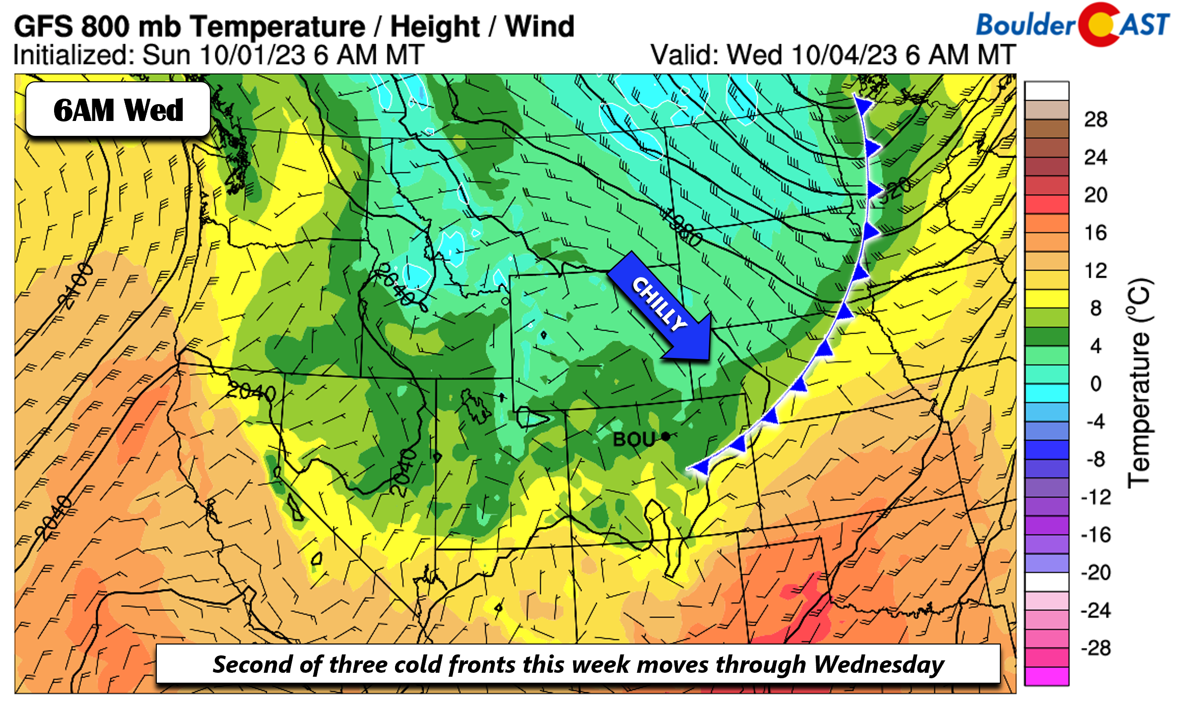
The first in a series of cold fronts tied to the trough will move through Tuesday morning ushering in a much cooler airmass. Highs Tuesday will be about 10 degrees cooler than Monday in the upper 60s to near 70 degrees. However, a chillier airmass is waiting in Montana that will reach us come Wednesday.
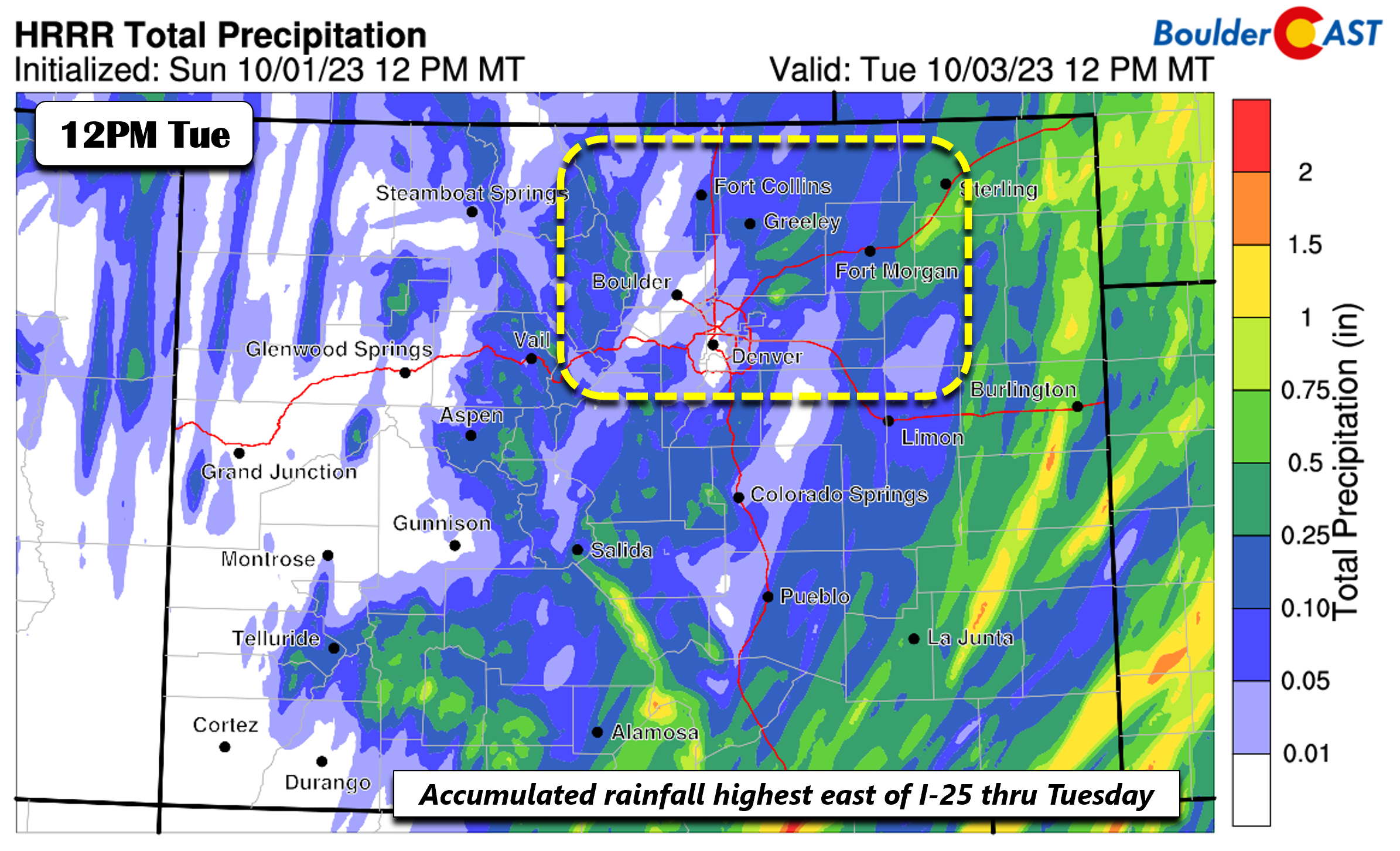
Even though the front will pass through Tuesday, the large trough will see several embedded shortwaves that will provide lift behind the front for both Tuesday and even Wednesday afternoons. The post-frontal lift on Tuesday is not very strong but enough to generate low to mid-level upslope on the Plains. This should bring our area decent shot of some light rain at times in the morning to early afternoon. Rainfall amounts would not be high (a tenth of an inch or less) but it will make for a cooler day nonetheless.
The HRRR total rainfall through midday Tuesday shows amounts of a few hundredths near Boulder to upwards of a tenth to two tenths of an inch in parts of Denver. Bear in mind this includes Monday.
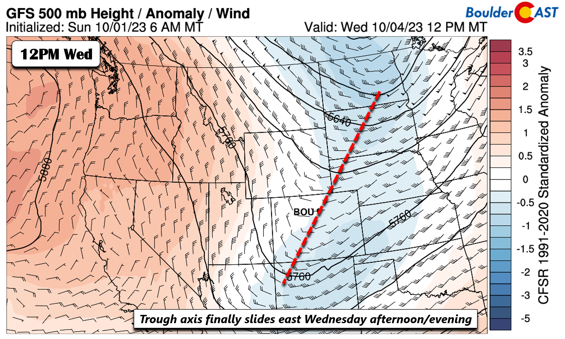
A secondary cold front then plows through Wednesday morning and will have the “true” colder air. Highs by midweek will hover in the low to middle 60s. Clouds will still be over the area with the trough still overhead.
This trough axis will finally slide east Wednesday evening, but not before generating some additional light rain or showers in the morning to early afternoon. Again, amounts look light, but it will make for a true autumn day under the clouds!
Dry and chilly to end the week
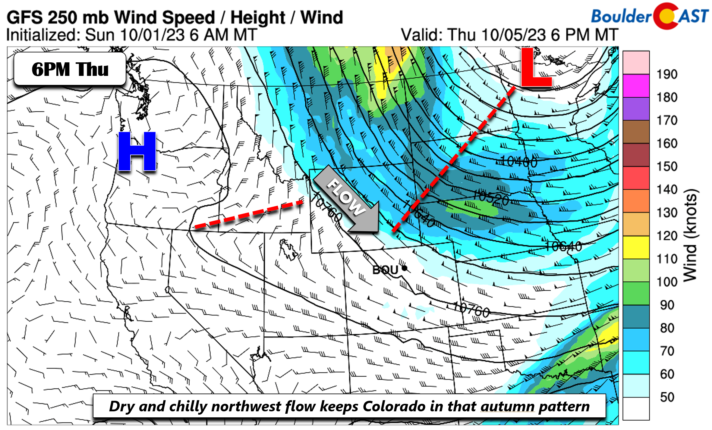
We stay chilly with below normal temperatures the remainder of the week with mid to upper 60s, but largely absent of any rainfall chances. A trough will persist over the northern Great Plains to upper Midwest. Meanwhile, ridging will set up over the Pacific Northwest, favoring a dry northwest flow over the state.
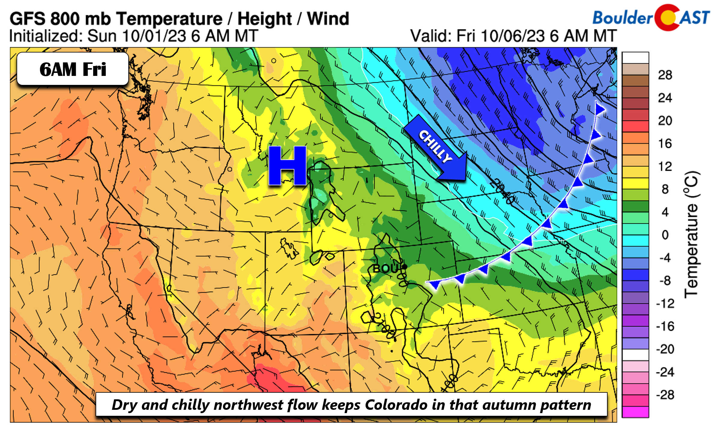
As usually happens under these regimes, additional cold fronts will move through the region from the north and east. Another one may arrive Friday morning or late Thursday night, shown below. It appears the coldest air with this front will stay to our northeast in the Dakotas (according to the GFS) but it may end up clipping more of northeast Colorado (according to the Euro model).
High temperatures as a result on Friday could land anywhere from the upper 60s (GFS) to the lower 50s (Euro). Regardless of which model ultimately verifies, we will definitely stay in a chilly pattern to close out the work week. Most of you have been craving the “autumn feel” for weeks — well, now you’ve got it!
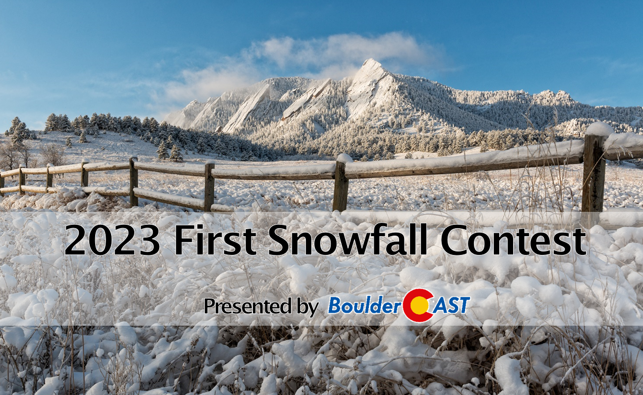
Finally, make sure to get your submission in for our 9th Annual First Snowfall Contest which closes to entries on Monday October 2nd at midnight!
Forecast Specifics:
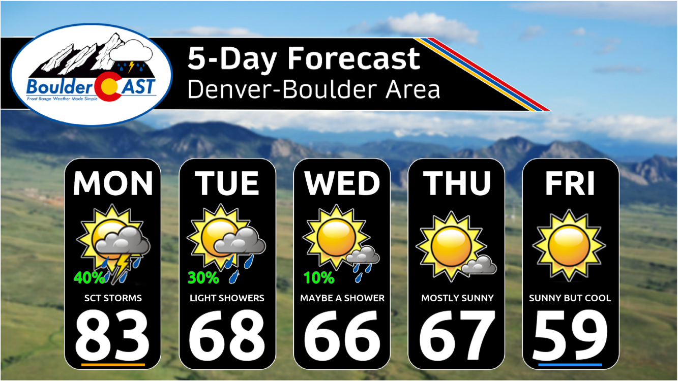
Monday: Partly cloudy becoming mostly cloudy with scattered late-day showers and storms. Warm and breezy with highs in the lower 80s on the Plains and lower 70s in the Foothills.
Tuesday: Partly to mostly cloudy with spotty light rain showers in the morning to early afternoon, then drier by late-day. Highs much cooler to near the upper 60s on the Plains and upper 50s in the Foothills.
Wednesday: Partly to mostly cloudy early with a very slight chance of light rain in the morning to early afternoon, then mostly sunny. Highs in the middle to upper 60s for the Plains and mid 50s in the Foothills.
Thursday: Pleasantly sunny with highs in the upper 60s for the Plains and mid to upper 50s in the Foothills.
Friday: Sunny and quiet but with some uncertainty regarding temperatures as a cold front may clip the area. Highs could range anywhere from the middle 50s to upper 60s, but our current forecast calls for a high around 60 on the Plains and near 50 in the Foothills.
DISCLAIMER: This weekly outlook forecast is created Monday morning and covers the entire upcoming week. Accuracy will decrease as the week progresses as this post is NOT updated. To receive daily updated forecasts from our team, among many other perks, subscribe to BoulderCAST Premium.
Daily Forecast Updates
Get our daily forecast discussion every morning delivered to your inbox.
All Our Model Data
Access to all our Colorado-centric high-resolution weather model graphics. Seriously — every one!
Ski & Hiking Forecasts
6-day forecasts for all the Colorado ski resorts, plus more than 120 hiking trails, including every 14er.
Smoke Forecasts
Wildfire smoke concentration predictions up to 72 hours into the future.
Exclusive Content
Weekend outlooks every Thursday, bonus storm updates, historical data and much more!
No Advertisements
Enjoy ad-free viewing on the entire site.
Get BoulderCAST updates delivered to your inbox:
Enjoy our content? Give it a share!




You must be logged in to post a comment.