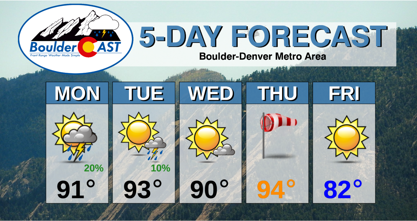
We hope you are ready for the summer heat! The scorching temperatures of late will continue for the next several days. The week kicks off with isolated storms, but rain chances lessen considerably as the week progresses. Our temperatures will largely rise into the 90’s every day, but a late-week cold front will take the edge of the heat. Read on to find out when our hottest day will be and how the upcoming weekend is shaping up.
This week’s highlights include:
- The best chance of storms for the entire week is on Monday
- Hot temperatures in the 90’s are expected through Thursday
- Watching for a slight cool down toward the end of the work week
- The heat rebuilds for the weekend ahead
DISCLAIMER: This weekly outlook forecast is created Monday morning and covers the entire upcoming week. Accuracy will decrease as the week progresses as this post is NOT updated. To receive daily updated forecasts from our team, subscribe to BoulderCAST Premium.
A hot & dry week overall
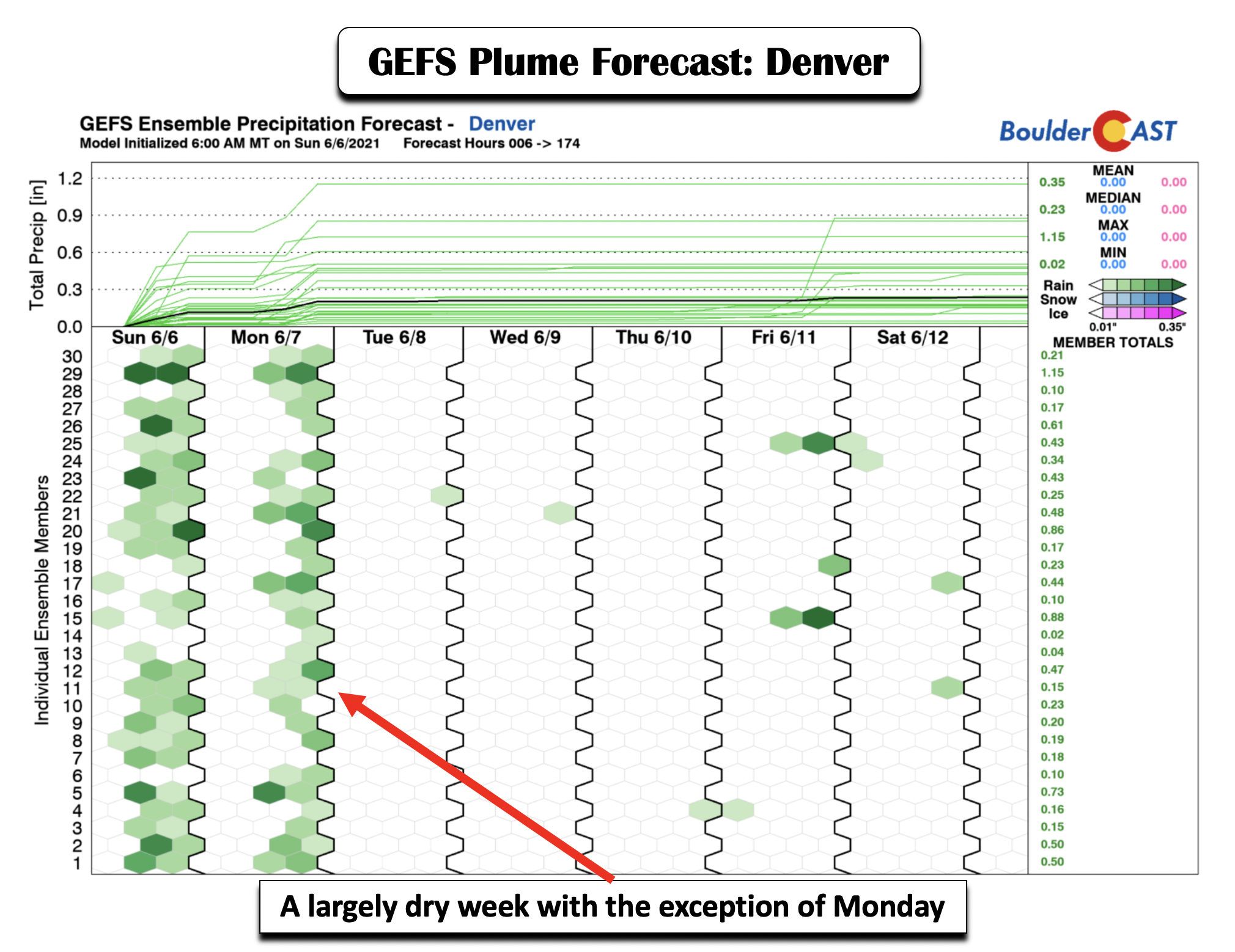
The week’s weather will trend hot and dry, with a few exceptions. Taking a look at the GEFS ensemble plume forecast for precipitation in Denver this week (below), you’ll notice that Monday has the highest probability of seeing isolated to scattered storms. The rest of the week is largely void of any rain, with the exception of a few very meager chances Tuesday through Saturday.
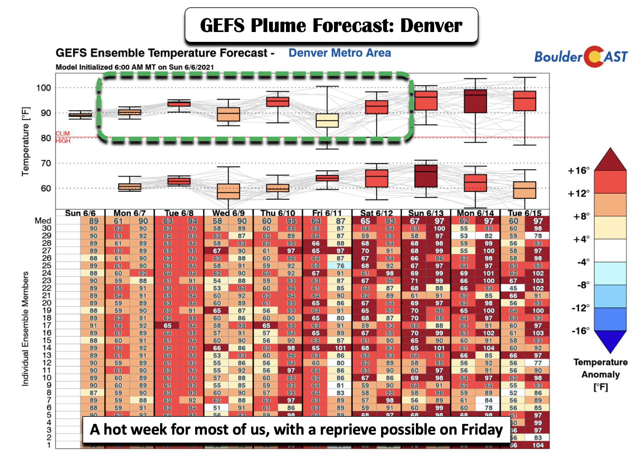
Shown below is the GFS ensemble plume for Denver but this time for temperature. There is a close correlation here between the warm temperatures (well into the 90’s) and the lack of rainfall this week. We’ll discuss this in more detail as we go through our discussion. But suffice to say, it will largely be hot and dry this week. There are some hints, though, that we could end the week cooler on Friday, which would offer a nice reprieve from the 90’s. Speaking of which, those 90’s are expected to return once again for the upcoming weekend and early next week. As you can see below, upper 90’s to low 100’s may be on the table in the extended!
Rain threat is highest on Monday
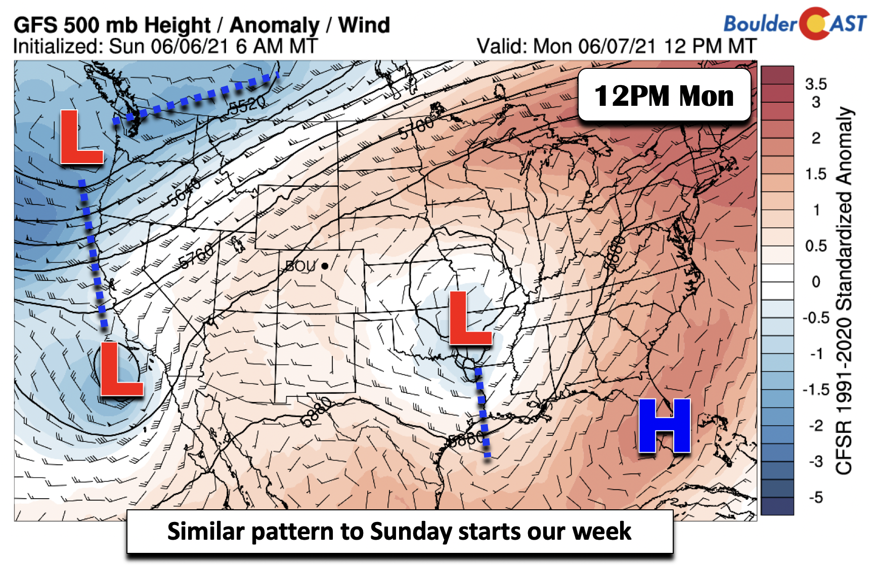
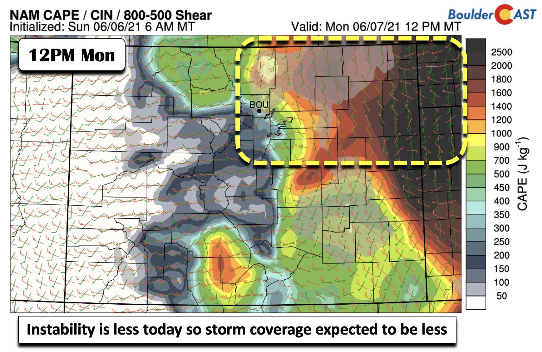
Our best chance of storms is today, albeit the chance is not particularly high. At the mid-levels of the atmosphere, we have a broad trough moving into the Pacific Northwest, along with a weak closed low southwest of California. This California system will be a player for us late Tuesday.
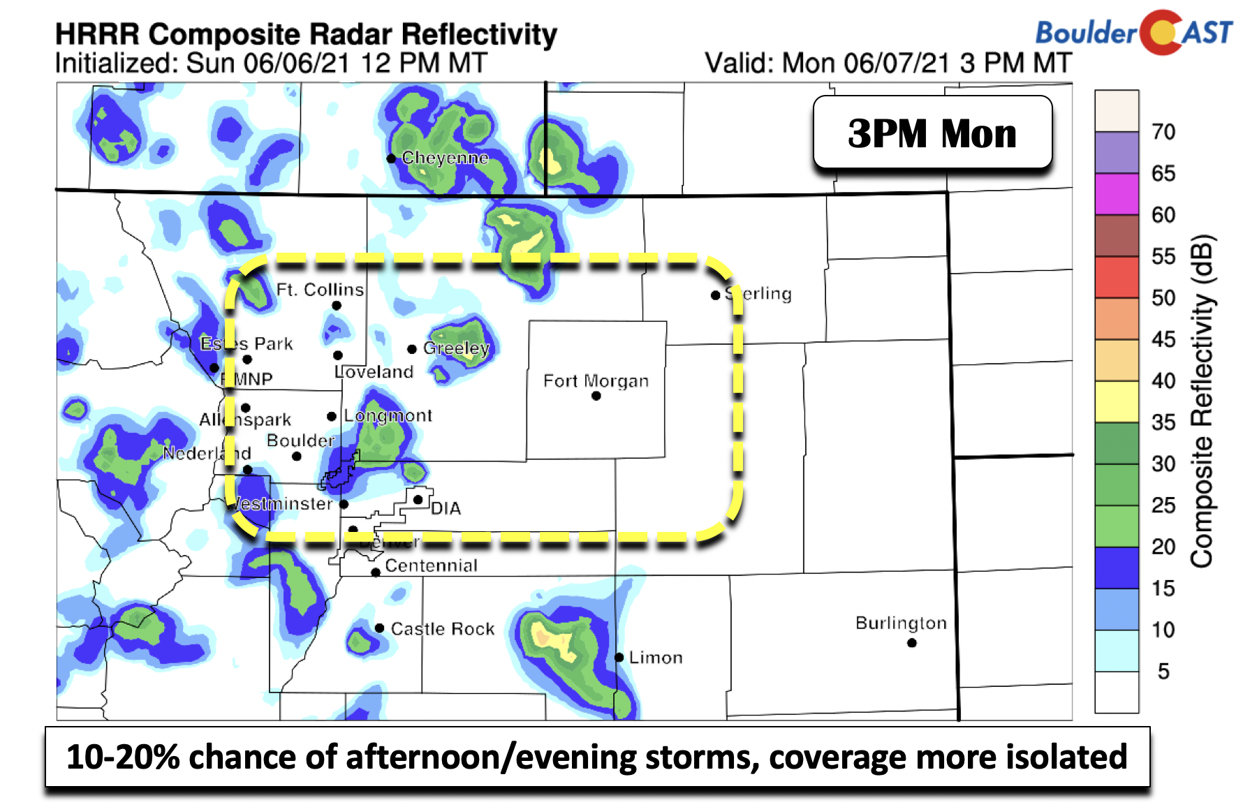
The overall pattern today is fairly similar to Sunday. The few changes include overall weaker instability and partial downslope flow. This will help focus storms and most of the rainfall east of the Denver area on Monday. Temperatures should be similar again nearing the 90-degree mark.
Given the aforementioned conditions, storms today should be more isolated in nature compared to Sunday. A 10 to 20% chance is in our forecast from this afternoon to the early evening hours, with activity waning around sunset.
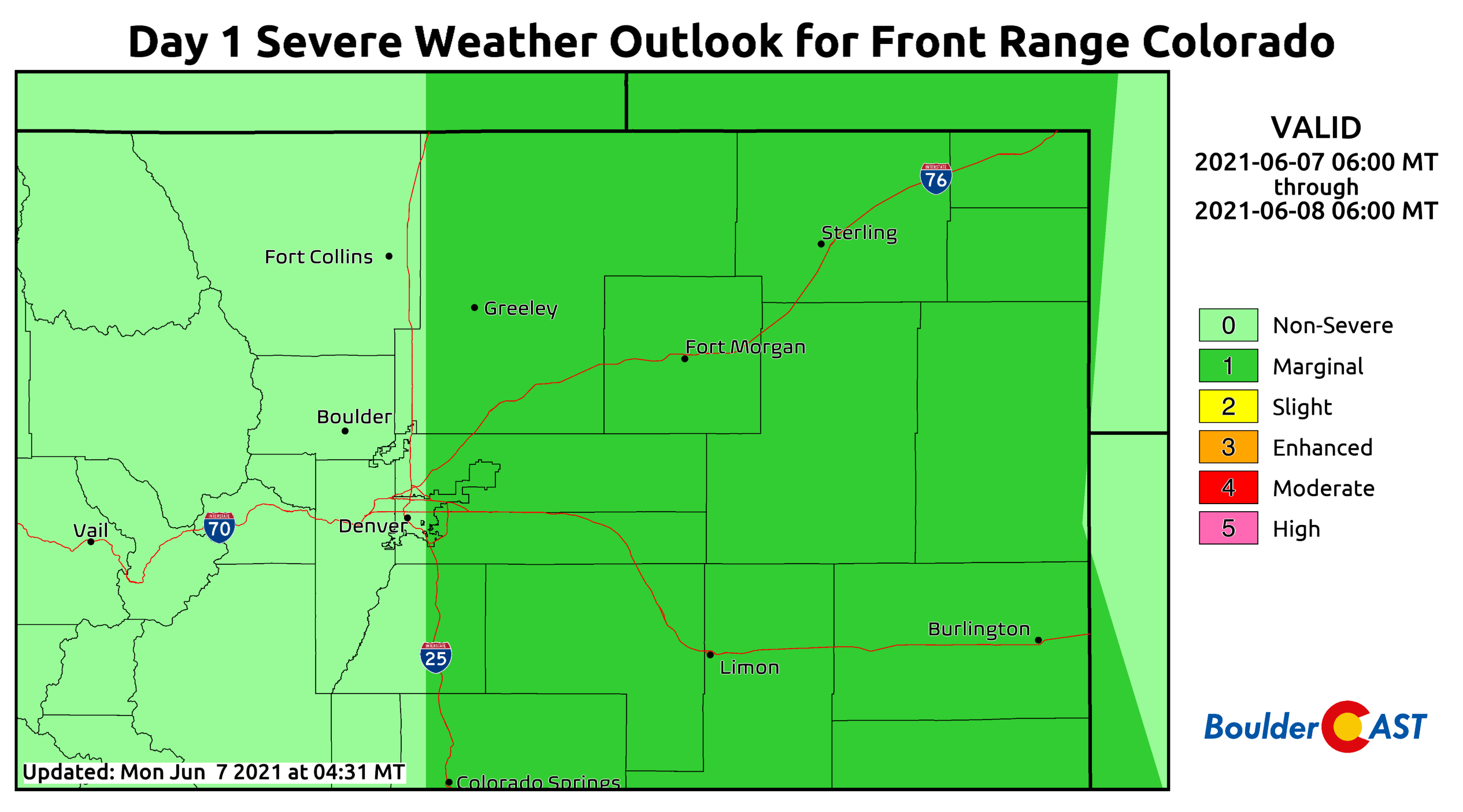
There is a Marginal Risk for severe weather along east of Interstate 25 on Monday. The primary threats will be strong winds and localized heavy rainfall. The hail and tornado concerns are quite low.
Drying out & heating up
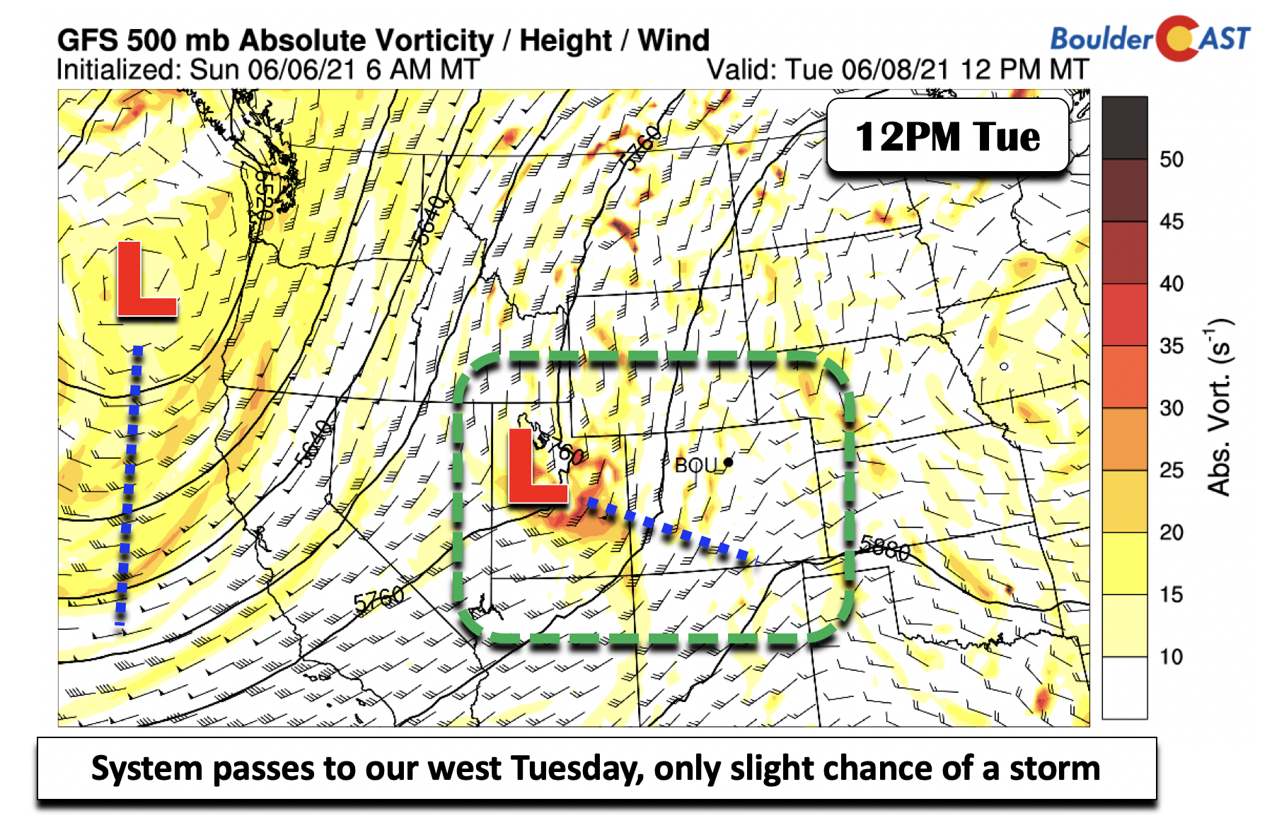
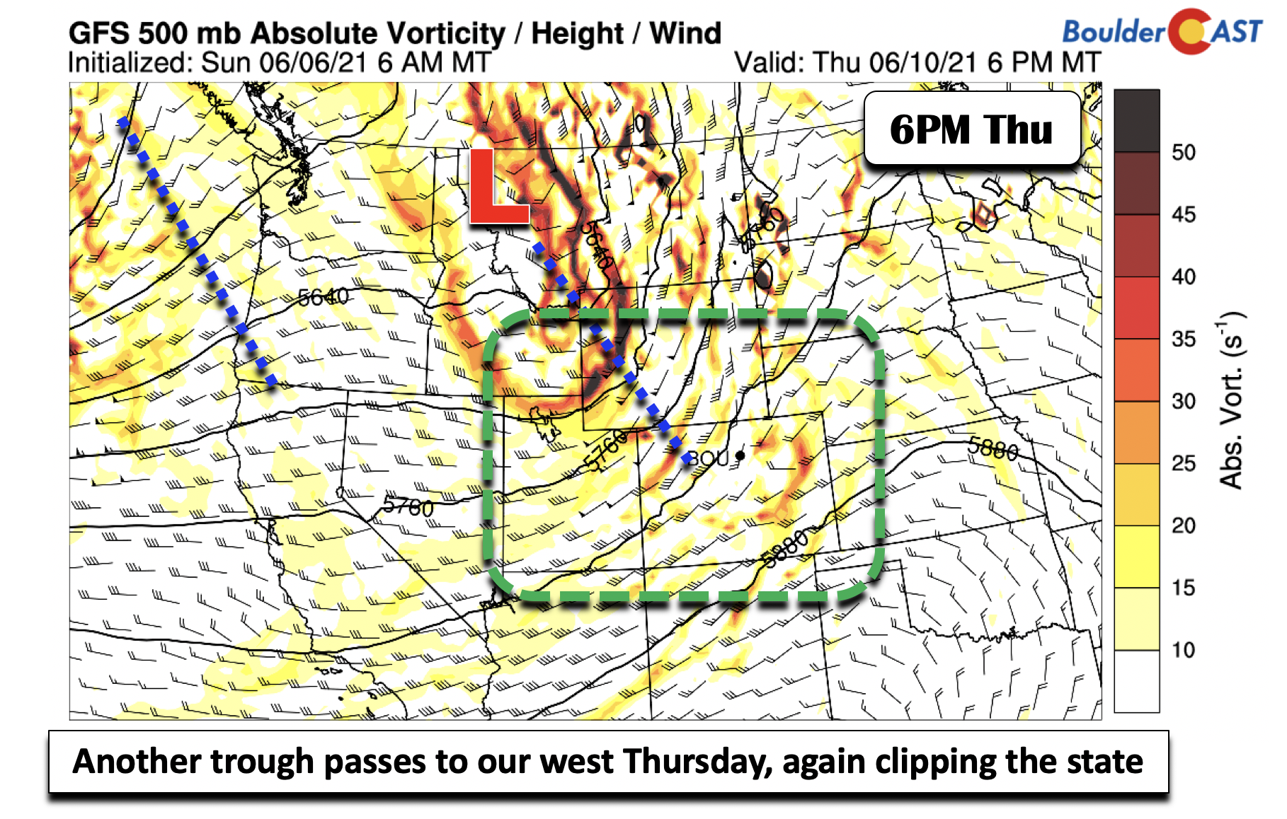
Although the week overall may seem quiet with low rain chances and warming temperatures, the atmosphere will be in constant motion. A series of systems will traverse from southwest to northeast just to our west. The first one arrives Tuesday and Tuesday night (below), skirting to the northwestern part of our state.
Another system passes to our west-northwest on Thursday, tracking up into Montana. While both of these systems will need to be monitored for track changes for potential increased storm chances, in general they will force drier air into the state, further inhibiting chances of rainfall. Storms, however, cannot be entirely ruled given the close proximity of the deep upper-level lift and dynamics, which for right now largely remain in Wyoming both days.
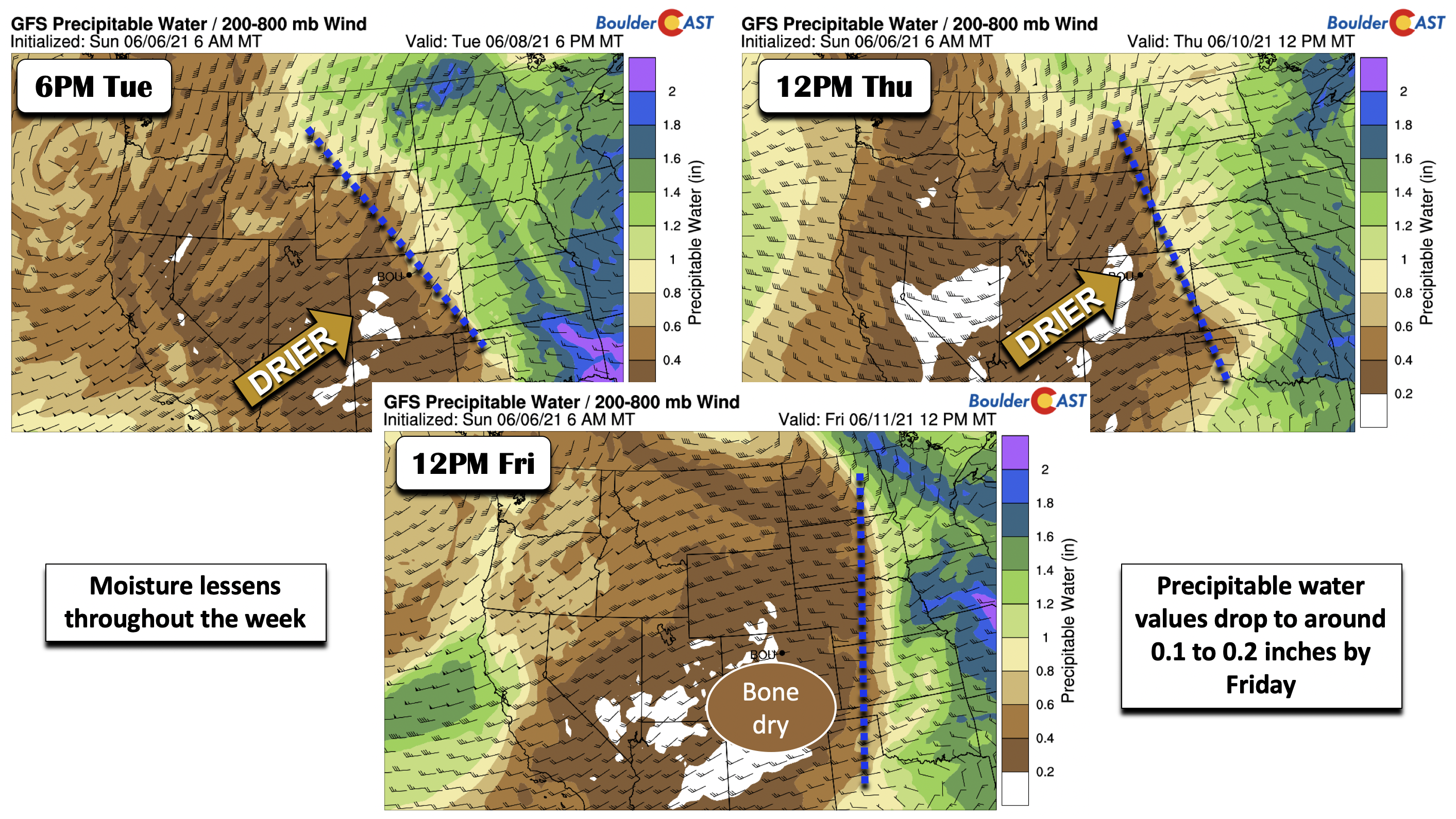
The images below show the successive drying out of the atmosphere over Colorado from Tuesday through Friday as these systems track from south to north. Notice how the brown and white shaded areas fully engulf eastern Colorado by Friday. So while we can’t fully rule out a storm chance as these systems pass through, the storm threat at this point is extremely low.
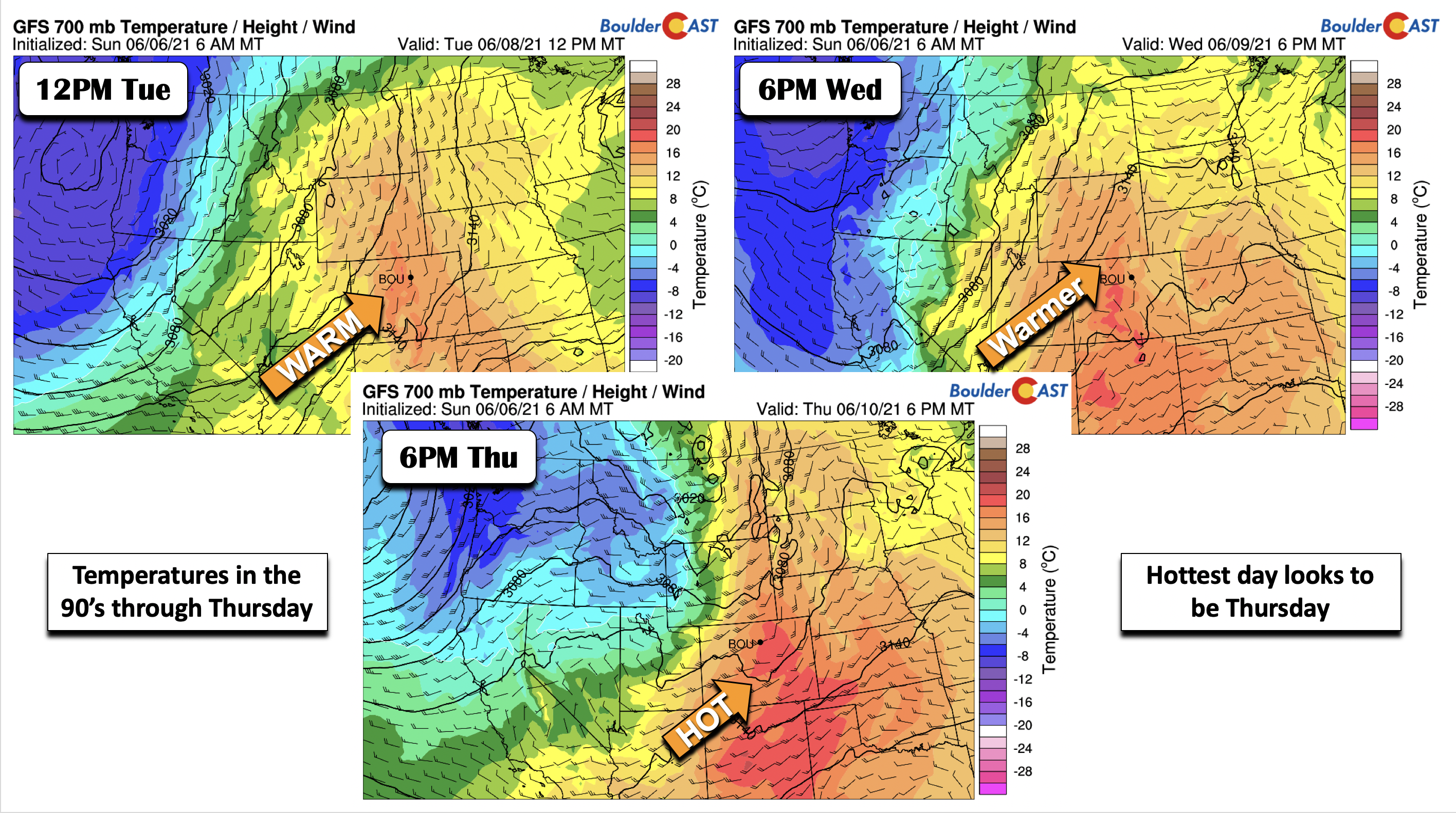
The corresponding airmass temperatures over the state are shown in the figures below for Tuesday through Thursday. Broad southwest flow from the Desert will be in place through this period. Our warmest day of the week looks to be Thursday, with 700 mb temperatures reaching 18°C, supporting middle 90’s for the latter part of the week.
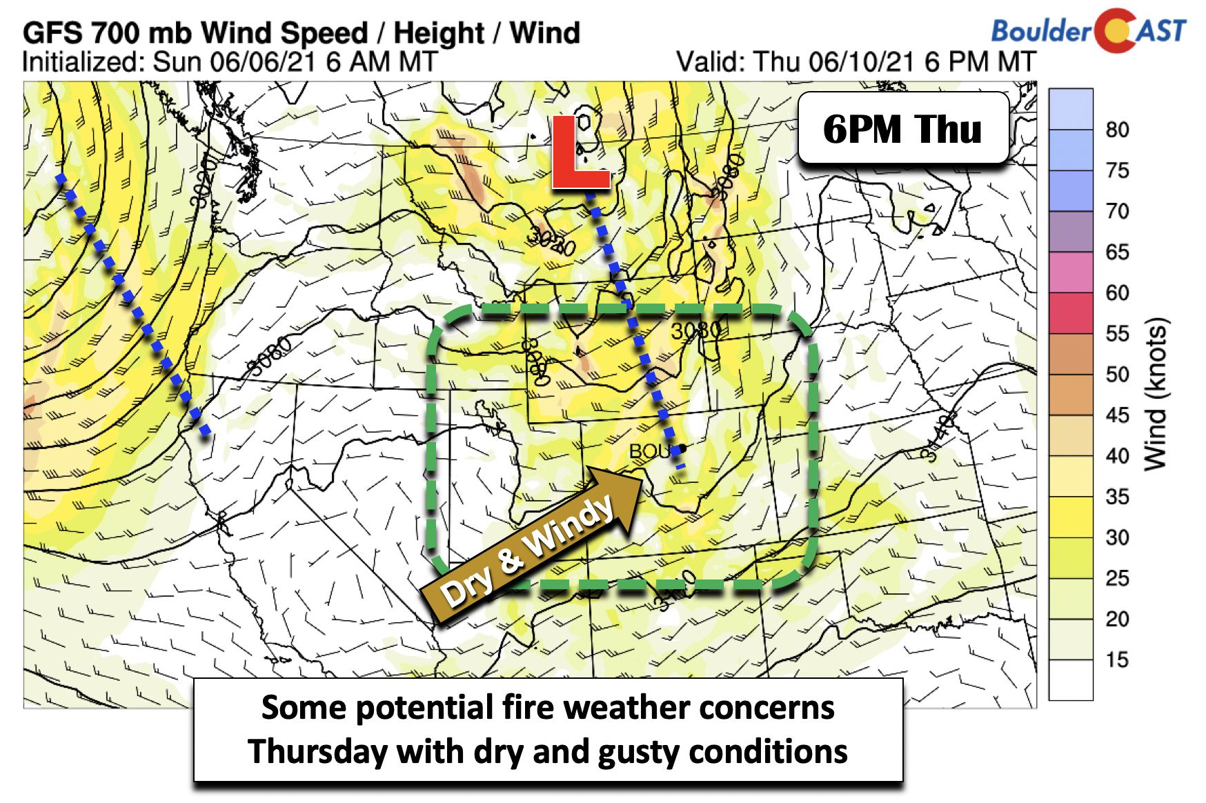
We are watching for potential fire weather conditions on Thursday. The aforementioned system will bring not only dry air, but also gusty winds in the low to mid-levels, especially across the Western Slope where extreme drought remains. It’s certainly too early to say for sure, but Red Flag conditions may exist across the Front Range and much of Colorado with breezy conditions present.
A possible cooler end to the week!
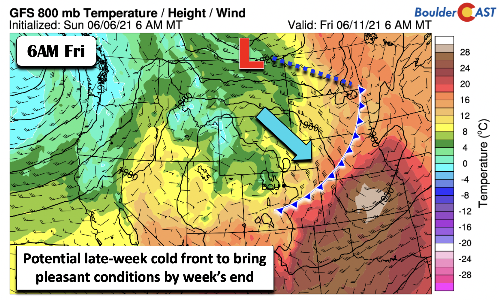
By early Friday, the second low pressure system that tracks up into Montana is forecast to bring a cold front through the Front Range. Hooray! While the exact frontal placement is uncertain at this point, it would make for a welcomed change from the low and middle 90’s prior to Friday. The nearby front could also warrants a slight chance of late-day storms, although the airmass will again be fairly dry, so our expectations are low for any rainfall. We’ll have to wait and see how this front shakes out, but do know that there is a light at the end of the hot tunnel with highs set to drop back into the 80’s to close out the week!
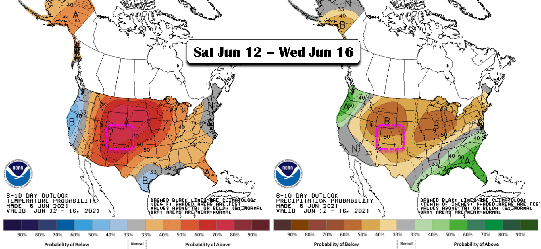
Any potential cool down will be short-lived, however, as a strong ridge of high pressure is expected to rebuild across Colorado this weekend. This ridge will keep storms chances very low to non-existent for the Front Range with highs returning to the 90’s for the weekend ahead. The latest 6 to 10 day forecast from the Climate Prediction Center (shown below) has the Front Range smack in the middle of the bullseye for hot and dry weather to continue well into next week. As mentioned earlier, there is some model consensus that the heat will ramp up further next week for us with possible triple digit temperatures across portions of northeast Colorado. We’re only two weeks from the official start of summer. Mother Nature is certainly making a strong case for that to be sooner.
We trekked above 13,000 feet yesterday & all we can say is that there is a lot of deep snow in western Boulder County!
South Platte River Basin snowpack is melting out about one week behind schedule due to the snowy spring and the chillier month of May #COwx #Snowpack #Boulder pic.twitter.com/ywWccw828L
— BoulderCAST Weather (@BoulderCAST) June 6, 2021
Stay up to date with Colorado weather and get notified of our latest forecasts and storm updates:
We respect your privacy. You can unsubscribe at any time.
.
Forecast Specifics:
Monday: Mostly sunny, then increasing clouds with isolated afternoon and evening storms. Temperatures near 90 on the Plains and near 80 in the Foothills.
Tuesday: Mostly sunny and warmer with highs in the lower to middle 90’s on the Plains and near 80 in the Foothills. Only a slight chance of late-day storm, mainly north and east of Denver.
Wednesday: Partly cloudy with high temperatures in the upper 80’s to around 90 on the Plains and upper 70’s in the Foothills.
Thursday: Hot and sunny with breezy southwest winds. The fire danger will be elevated. Highs in the middle 90’s on the Plains and lower 80’s in the Foothills.
Friday: Much coolers with a few late-day storms possible, especially north and east of Denver. Highs in the low to middle 80’s on the Plains and lower 70’s in the Foothills.
Mountains: Storm chances will exist across the higher terrain Monday afternoon and evening. Drier weather ensues Tuesday through Thursday, though a stray storm or two cannot be entirely ruled out. Gusty winds and potential fire concerns exist on Thursday so do use caution. A slight chance of storms are possible Friday with breezy conditions remaining.
Help support our team of Front Range weather bloggers by joining BoulderCAST Premium. We talk Boulder and Denver weather every single day. Sign up now to get access to our daily forecast discussions each morning, complete six-day skiing and hiking forecasts powered by machine learning, first-class access to all our Colorado-centric high-resolution weather graphics, bonus storm updates and much more! Or not, we just appreciate your readership!
.
Spread the word, share the BoulderCAST forecast!
.





You must be logged in to post a comment.