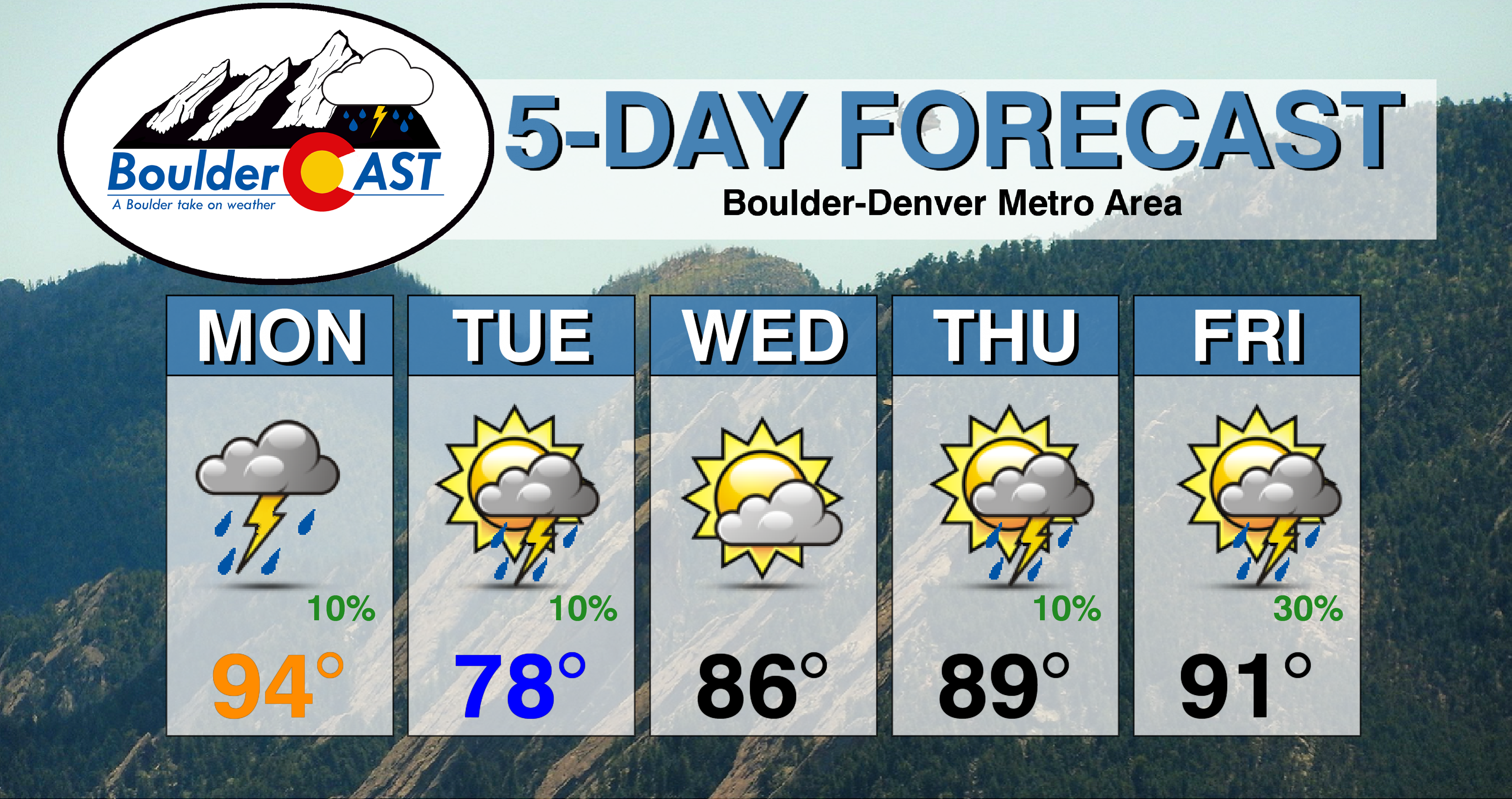
A deep area of low pressure to our northwest brings in a cold front Tuesday, lowering highs into the from the 90’s into the 70’s. Outside of a few meager storm chances, most of the week will be rather dry for the area. However, we are tracking an increase in moisture to reach the area late in the week as temperatures climb back into the 90’s.
This week’s highlights include:
- 90’s to start but it will turning notably cooler Tuesday and Wednesday thanks to a cold front
- Slow creep back into the 90’s by late week
- Watching a few storm chances and increased moisture come Thursday/Friday and for the 4th of July weekend
DISCLAIMER: This weekly outlook forecast is created Monday morning and covers the entire upcoming week. Accuracy will decrease as the week progresses as this post is NOT updated. To receive daily updated forecasts from our team, subscribe to BoulderCAST Premium.
A hot Monday, but a cold front approaches tomorrow
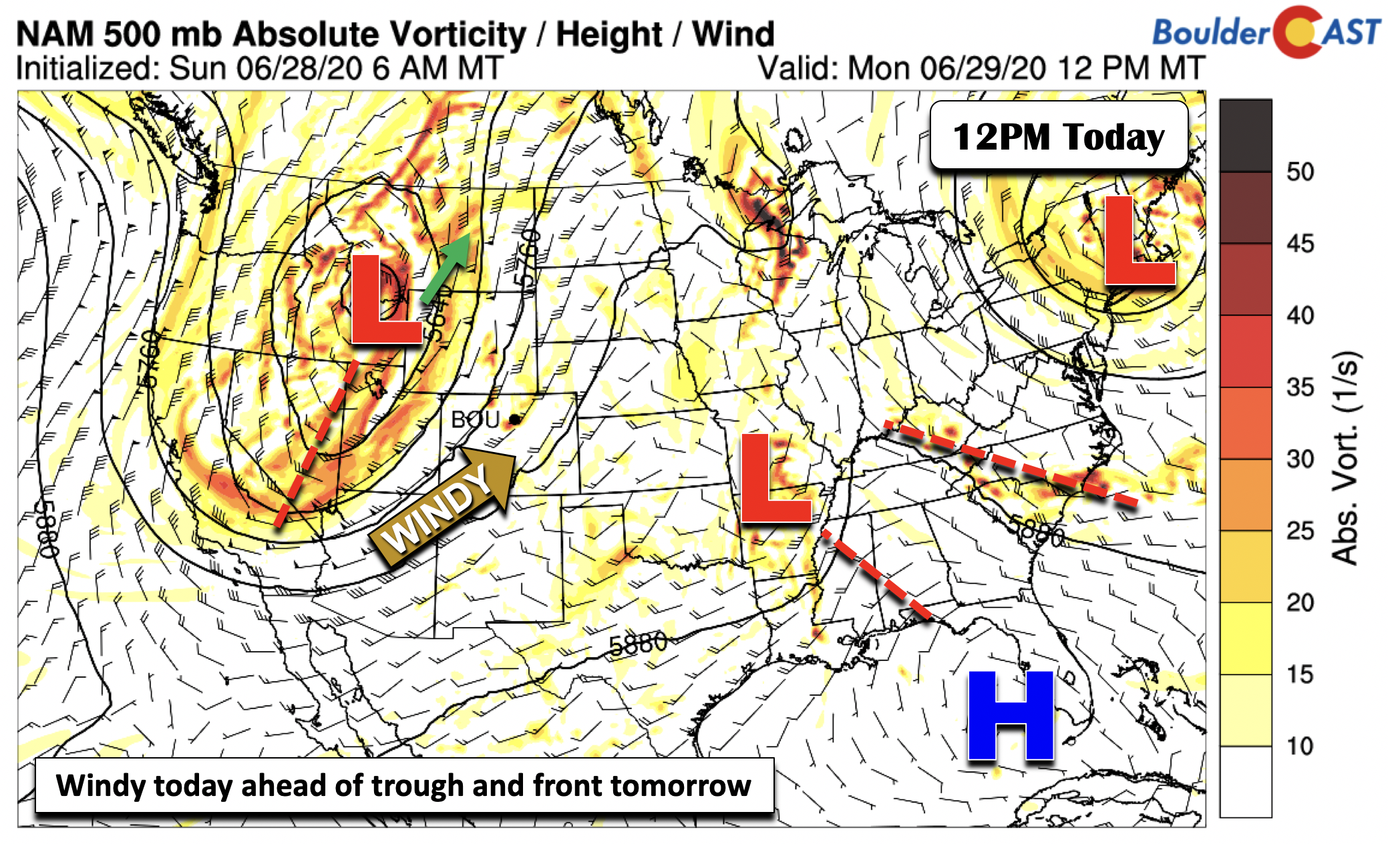
Below shows the pattern setup for the U.S. on this Monday. Several features worth discussing include (1) a cutoff low pressure over New York, (2) a small scale low pressure system tied to thunderstorms over Arkansas, and (3) a deep area of low pressure over eastern Idaho. This third system will be our weather-maker tomorrow.
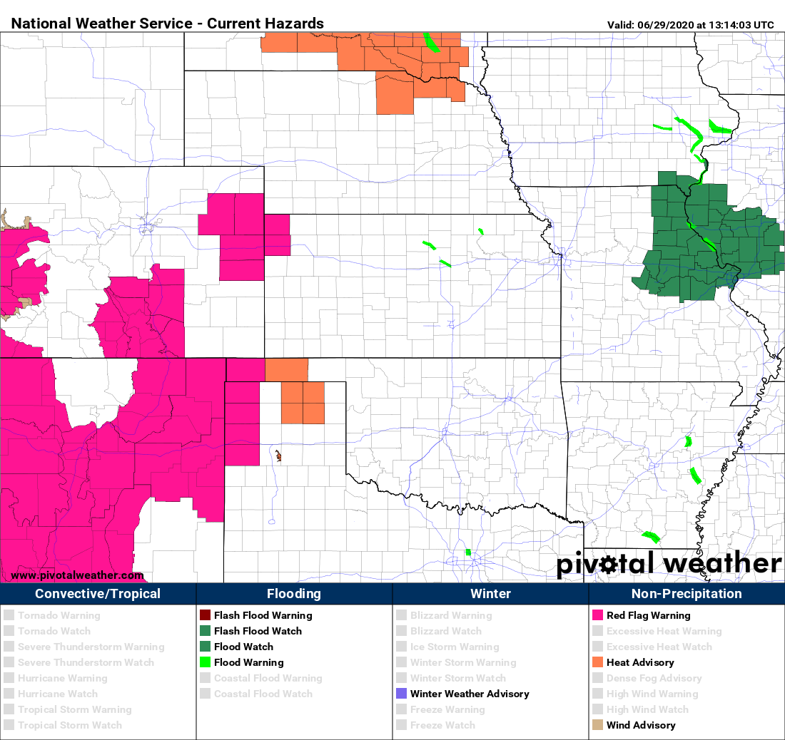
For Monday, we will continue where we left off on Sunday with temperatures in the 90’s. We should expect some mid and high-level clouds throughout the day with the trough approaching. Across the High Country, gusty southwest winds will exist yet again, something that has been all too common in the last few weeks, creating another day of Red Flag Warnings. While we can’t rule out a minor chance of an isolated storm today, most of the Front Range will be bone-dry.
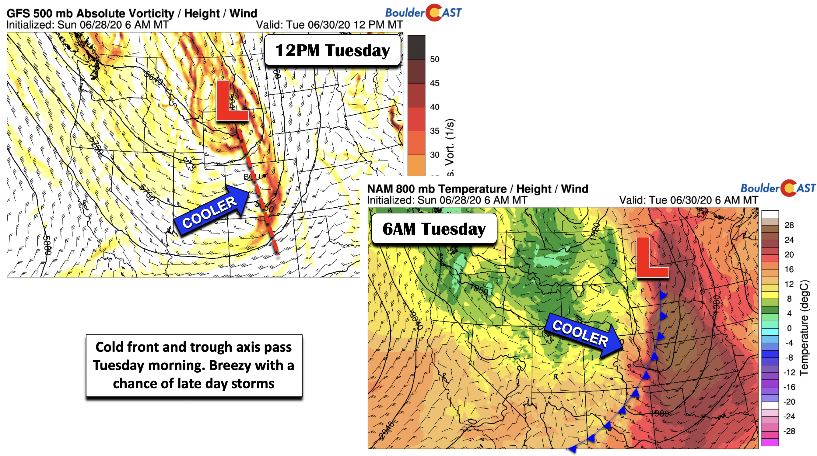
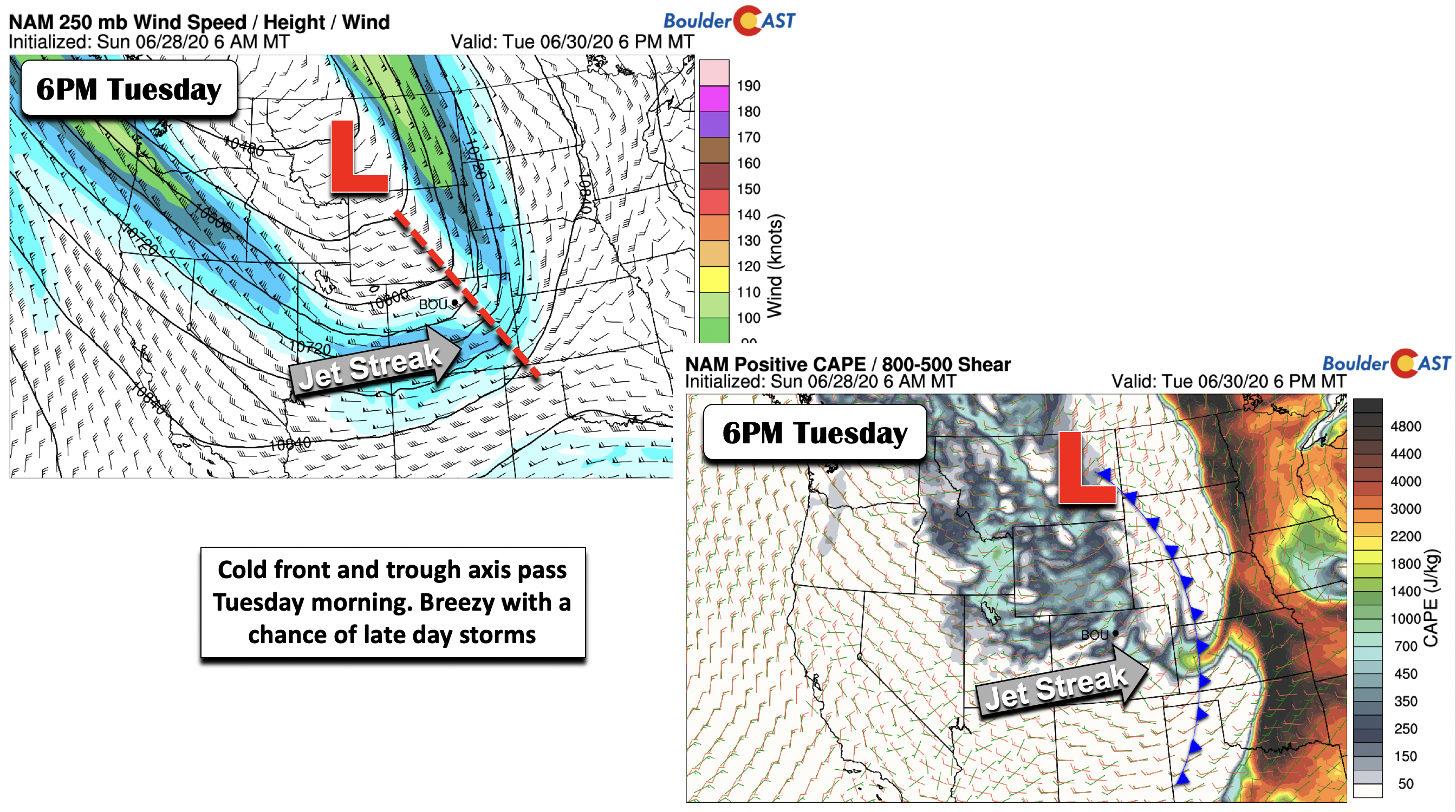
On Tuesday, this same trough of low pressure is poised to track ever-so-slowly into northern Wyoming and southern Montana. As it does so, its trough axis will pass through central and eastern Colorado midday tomorrow (below left), with an associated cold front pushing through during the morning hours. This will lead to early day clouds followed by sunshine. We can also expect some gusty downslope winds up to 25 to 30 mph in the afternoon hours behind the front. Highs will be noticeably cooler in middle 70’s to lower 80’s.
While we are not overly excited or confident in the threat, there are some indications in the guidance that we could see some spotty storms Tuesday afternoon and early evening. This appears to be related to some residual moisture and unstable air (below right), as well as potential jet-forcing aloft (below left). Again, confidence in positioning of this is low at the moment, but we think that it warrants a 10% chance of storms on Tuesday. Given the dry air and wind shear that day, any storms could gusty winds.
Warmth rebuilds and moisture increases late-week
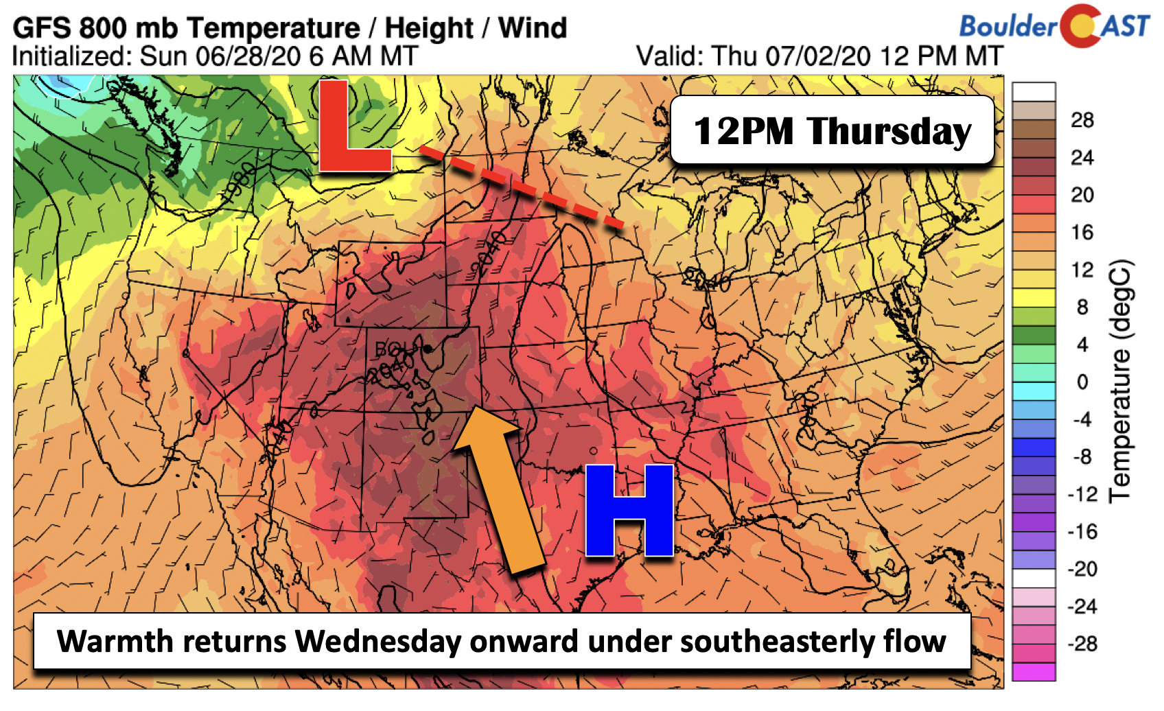
As the trough pushes further north into southern Canada (below) Wednesday and Thursday, the surface front will lift back north as well. In its wake, surface and mid-level high pressure will build from the east and settle across eastern Texas and western Louisiana. Much of the Plains Wednesday onward will be under south-southeasterly flow with ever-increasing temperatures. After highs in the middle 80’s Wednesday, temperatures should climb back into the upper 80’s to lower 90’s by Thursday and Friday.
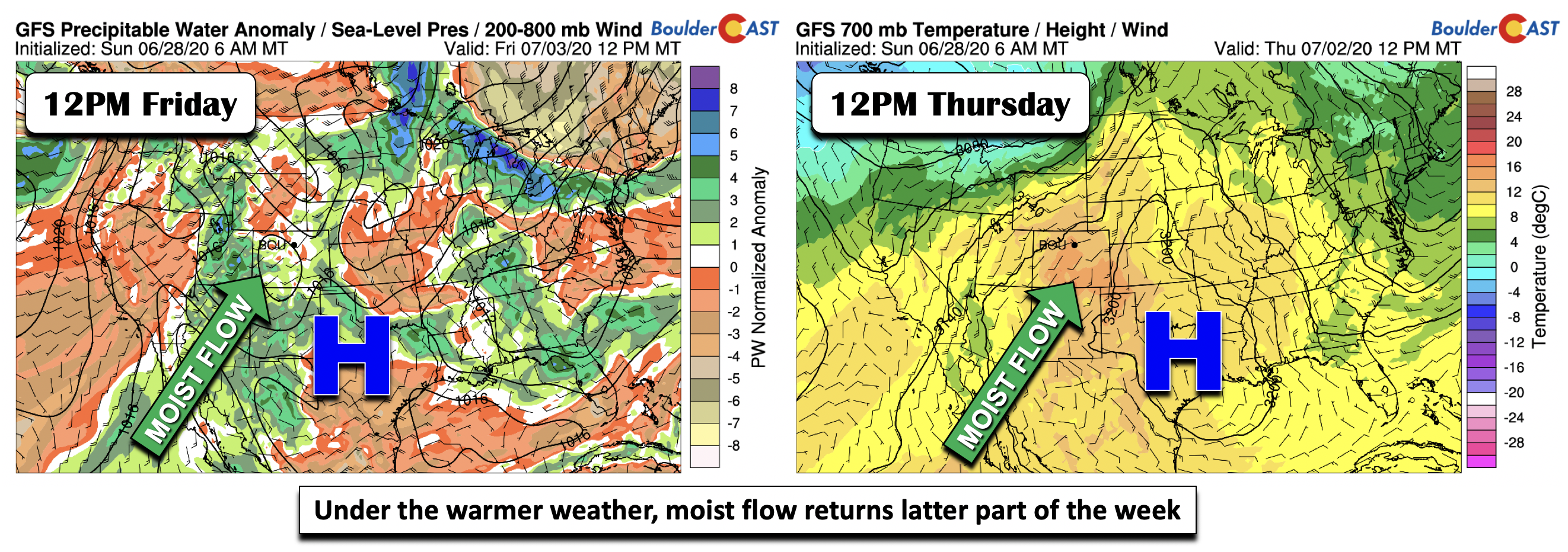
Though the atmosphere will be dry following the front on Wednesday, a return flow of moisture is in the cards it appears, arriving sometime late Thursday into Friday. High pressure will continue to build from the Midwest into western Texas by late week (below). This setup will favor south-southwesterly flow over Colorado, bringing not only the warmer air but also increased monsoonal moisture from the Pacific and Mexico (below left). Given this, our forecast as it stands now is showing increasing thunderstorm chances in the latter part of the week and the upcoming 4th of July holiday weekend.
Forecast Specifics:
Monday: A mixture of high clouds and a little sunshine. A storm or two is possible, mainly in the Foothills. Highs in the low to middle 90’s under southwest winds at 10-15 mph. For the Foothills, highs in the upper 70’s to lower 80’s.
Tuesday: Clouds giving way to brief sunshine and breezy conditions. A slight chance of late-day storms with highs cooler in the upper 70’s on the Plains and upper 60’s in the Foothills.
Wednesday: Mostly sunny and seasonal with highs near the middle to upper 80’s for the Plains and middle 70’s for the Foothills.
Thursday: Morning sunshine but increasing clouds. Then a slight chance of late-day storms. Highs in the upper 80’s on the Plains and middle 70’s in the Foothills.
Friday: Increasing clouds with scattered showers and thunderstorms developing in the afternoon into evening. Highs near the lower 90’s on the Plains and near 80 in the Foothills.
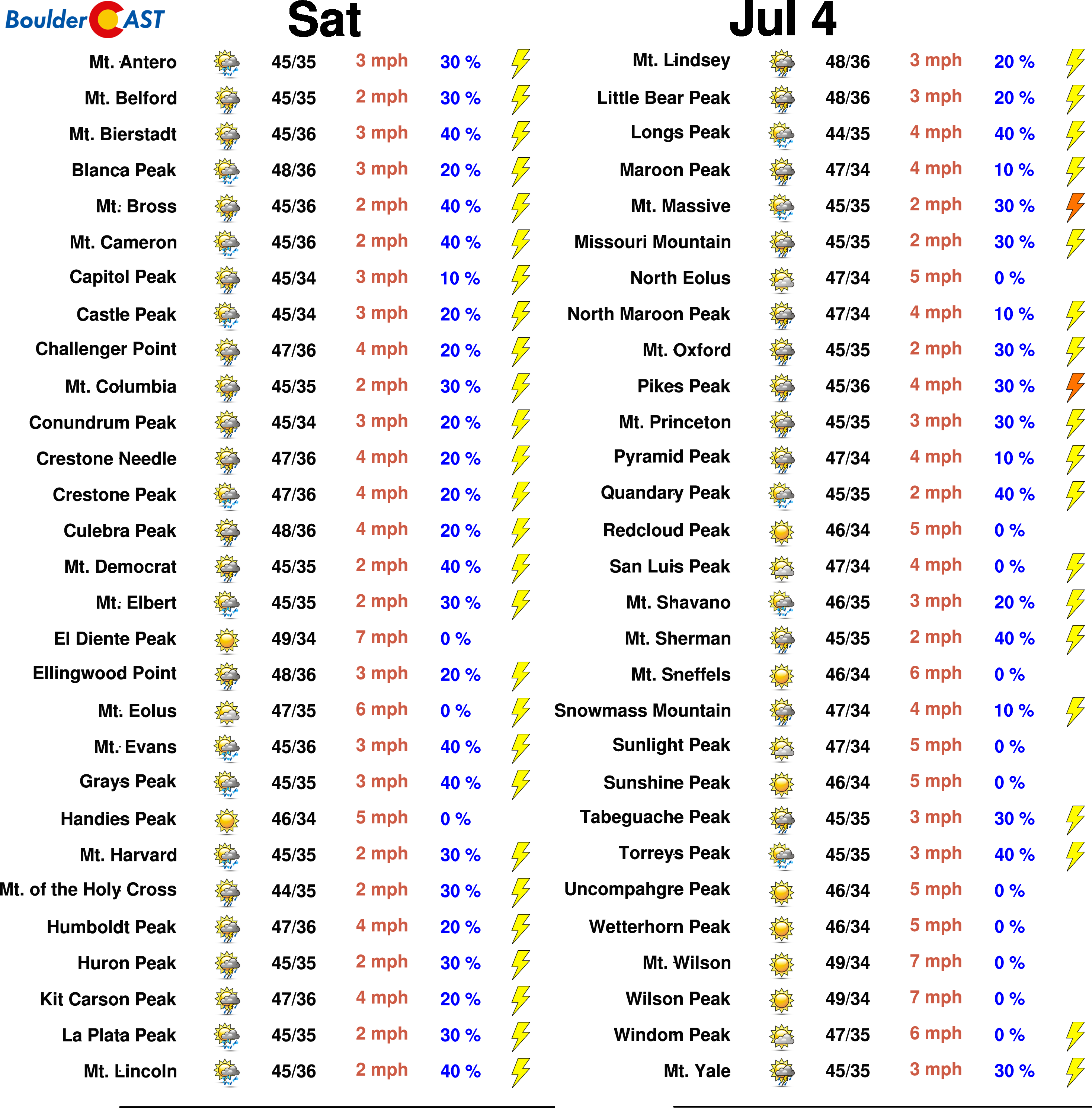
High Country: Breezy conditions will exist over the higher terrain today and tomorrow, as well as some widely scattered afternoon/early evening thunderstorms. Drier weather returns Wednesday. By Thursday and Friday, isolated to scattered storms return to the forecast with monsoonal flow slowly building. Check SummitCAST for daily updated forecasts for more than 120 mountain hiking destinations across Colorado.
We discuss Boulder and Denver weather every single day on BoulderCAST Premium. Sign up today to get access to our daily forecast discussions every morning, complete six-day skiing and hiking forecasts powered by machine learning, access to all our Front Range specific weather models, additional storm updates and much more!
.
Spread the word, share the BoulderCAST forecast!





You must be logged in to post a comment.