Sun, heat, wind, and a few storms. Read on as we provide a quick, to-the-point forecast for the upcoming holiday weekend for the Plains and higher elevations.
Tag: Denver (Page 24 of 38)
Let us be the first to welcome you to fall! That’s right…summer is no more, at least to us weather folks. September 1st marks the beginning of meteorological autumn. Picture-perfect weather has been a mainstay throughout the summer, which is both good and bad. The monsoon plume has largely been confined to our south and west, keeping the Front Range relatively parched, leading to dry and at times, dangerous fire conditions. Will this trend continue into September? Read on as we examine Boulder’s climatology and consider the current state of the atmosphere to give our outlook for next month.
The atmosphere over the last several weeks has been transient across the western United States, with frequent (but weak) systems always keeping us on our toes. We haven’t had an extended period of persistent weather in quite some time. That changes this week as a ridge builds in across the region, bringing a sense of consistency to the forecast once again. Be that as it may, the ridge won’t bring entirely dry and sunny weather. Read on for our full outlook of the week ahead.
After a wet end to the previous week, the weekend started out cool and concluded warm with highs approaching 90 degrees over the Plains on Sunday. This week will begin with above normal temperatures, but a cold front moving in along with subtropical moisture will increase our threat of rain and storms through the middle of the week. Once again our weekly discussion is riddled with mentions of rain, but as always, the extent and intensity for any given location remains to be seen. Read on for the full week-ahead forecast.
Summer is the one time of year when you don’t need us meteorologists. You already know the weather for today (and everyday) will start sunny, warm into the 90’s, then promptly cloud up and produce a brief storm which generates a “just okay” rainbow before another stunning Colorado sunset. If it feels like we’ve been enjoying a much nicer, less rainbow-filled summer than normal, you’re not alone, nor imagining things. It’s been dry. Historically dry.
We discuss the official return of drought to Colorado and provide our thoughts on the outlook heading into September.
As we rapidly sprint towards the end of meteorological summer and the conclusion of Colorado’s wet season, the weather for the week ahead will not sway much from what we have come to expect. Chances of rain will be there, but not substantial. We’re also tracking yet another fall-like cool-down just in time for the weekend. Continue reading for our outlook for the upcoming week.
Following four days of unseasonably cool temperatures, this week begins warm as moderately-moist southwest flow dominates the region. By mid-week, moisture associated with two tropical cyclones spreads into Colorado alongside a cold front from the north. With this, we’ll see storm chances increase and temperatures fall once again. Read on for our complete weekly outlook.
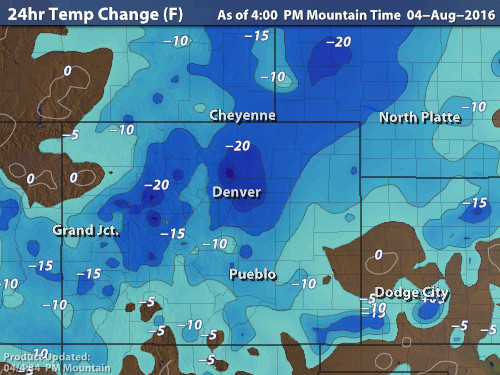
Cooler weather and beneficial rains are spreading across the Front Range as monsoon moisture collides with a cold front on our doorstep. Continue reading for rainfall amounts, timing, and when to expect that brutal August heat to return.
© 2025 Front Range Weather, LLC


