
Page 95 of 569
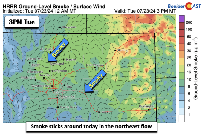
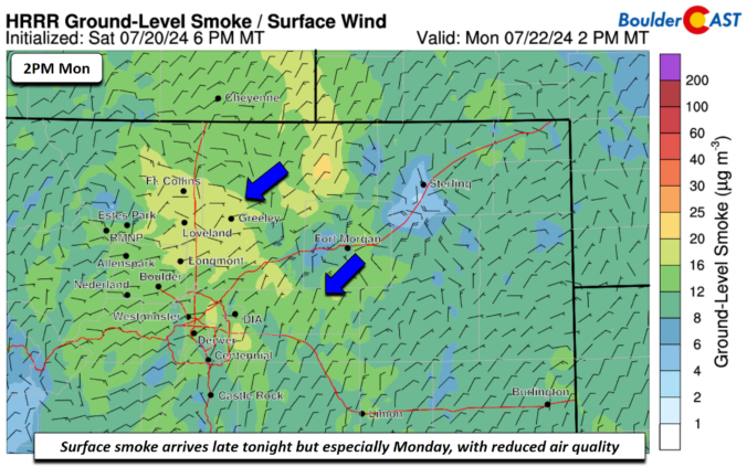
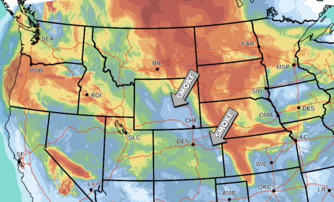
After a cool and unsettled past several days, the week ahead turns much drier, notably hotter, and quite hazy with Canadian wildfire smoke engulfing the Front Range. Rain chances will be limited through the week as the monsoon stays largely suppressed. We will return to the 90s as early as Tuesday, perhaps nearing 100 degrees by week’s end. When is our best chance of rain, how hot will it get and when will our air quality finally improve? Let’s take a look!

Live View of Boulder

Current Conditions

Live Radar

Recent Premium Posts

BoulderCAST Daily – Sun 05/31/26 | Dry and warm today but rain chances increase this week
🌦️ Overall dry and warm Sunday, though cannot rule out a very widely …
BoulderCAST Daily – Sat 05/30/26 | A stray shower today as most activity resides well east of Denver
🌦️ Spotty showers today, mainly well east of the Denver Metro area, where …
BoulderCAST Daily – Fri 05/29/26 | A Marginal Risk of Severe Isolated Storms
🌦️ Spotty showers this afternoon, mainly noon and 4 PM, with highs in …
3-Day Forecast

Trending Content

© 2026 Front Range Weather, LLC