
Page 2 of 556
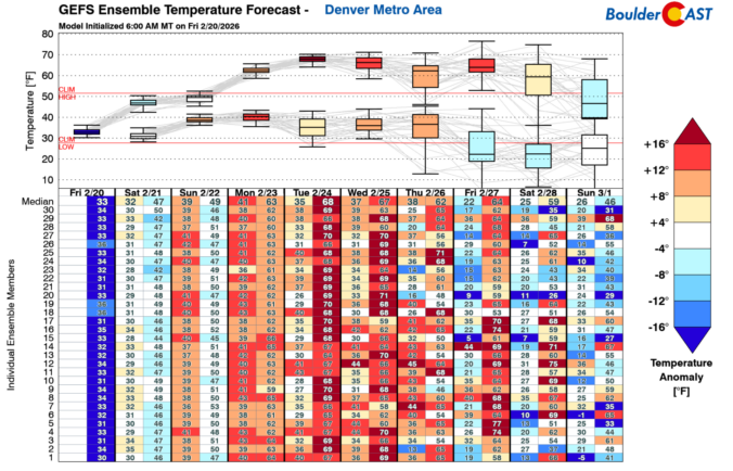
As February limps toward the finish line, Colorado’s “winter” continues to behave like anything but. Last week the Mountains cashed in on a burst of Pacific moisture while the Denver Metro area stayed stubbornly snow‑starved. The week ahead brings more of that same split personality—warmth, wind, fire danger, and another round of Mountain snow. We break down the lopsided snow totals from last week, the updated but still troubling snowpack numbers, and discuss why this week will be so darn warm and windy again in the Front Range.

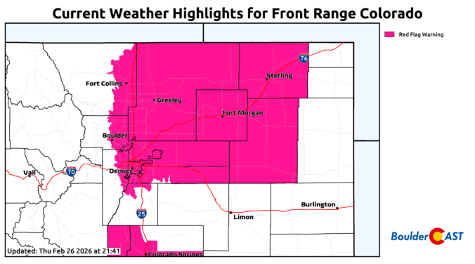
Much-needed snow piled up across all of the Mountains of Colorado this week, but once again Boulder and Denver missed out on almost all of the action.


Live View of Boulder

Current Conditions

Live Radar

Recent Premium Posts

Storm Update – Fri 03/06/25 8:00 AM | Wet snow totals nudged a tad across the board, but impacts remain relatively unchanged
❄️ Sloppy Snowstorm Looking Good: Stronger, slower system is now expected to deliver …
BoulderCAST Daily – Wed 03/04/26 | A pair of gorgeous days preceding a cold & snowy Friday
🌧️ Yesterday’s storm shifted south, dropping 0.4–1.0″ of rain in the Springs/Pueblo while …
BoulderCAST Daily – Tue 03/03/26 | Storm #1 spreads rain in today, while Storm #2 remains on-track to produce snow later this week
🌧️ First shortwave of the week arrives today with rain for the lower …
3-Day Forecast

Trending Content

© 2026 Front Range Weather, LLC