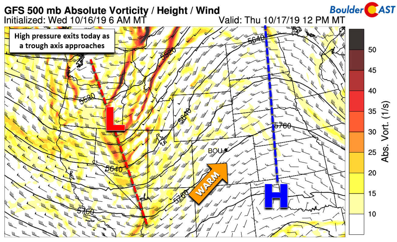
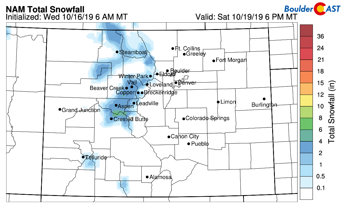
Today will be a day of transition across Colorado with the arrival of a Pacific cold front this evening. We also discuss potential snow amounts in the Mountains.
Remember, these daily forecasts are Premium content. Periodically, we open this forecast up to all of our readers. Today is one of those days!
Sign up today to get the best BoulderCAST experience, including these daily forecasts every morning, complete 6-day skiing and hiking forecasts powered by machine learning, access of all our Front Range specific weather models, additional storm updates and much more!
Warm today ahead of a cold front and Mountain snow tonight
If you’ve been enjoying the warm temperatures of late, you’re going to like today’s forecast! Out ahead of an incoming disorganized trough, southwest flow is really beginning to crank-up across Colorado with strong warm air advection and gusty winds aloft. Just like yesterday, this will lead to another afternoon of dangerous fire conditions across the Mountains and Foothills, with very warm temperatures statewide. Despite a plethora of high-level clouds expected today, both Boulder and Denver should have no trouble hitting the 80-degree mark. It’s a shame the warmth today couldn’t come without the upper-level moisture — we may have set new record highs.
The warmth will be short-lived, however. As the trough nears ever-closer this evening, eventually a Pacific cold front will move through the Metro area after sunset. Do you know what we mean by describing the front as “Pacific”? Pacific cold fronts are easy to distinguish from their Canadian (back-door) counterparts. Just remember these three things:
- Pacific fronts come from the northwest, not the northeast
- They usually are deeper and can be easily recognized on 700 mb temperature maps. Backdoor cold fronts usually don’t extend up beyond the lower Foothills.
- Pacific fronts largely downslope the Front Range and fail to produce much in the way of precipitation. They do bring snow near and west of the Continental Divide, however. Winds behind the front will be northwest, instead of the usual upslope.
Another thing that we will admit to: Pacific fronts are also more difficult to track as they approach the area since they are moving across Colorado’s very mountainous terrain. This makes determining their exact arrival timing a little tricky. Based on guidance from the high-resolution models, particularly when looking at the dew point animation (below) to see the moisture-rich Pacific airmass arriving, the front will move in between 5:00 and 8:00 PM this evening.

HRRR model surface dew point forecast for today and tonight. Watch the Pacific front push in from the west-northwest.
Downslope will prevent any rainfall with the front’s passage for our area, but some rain and eventually snow is possible in the Mountains tonight and especially tomorrow. Snow levels begin high in the the very warm airmass, around 13000 feet this afternoon, but fall closer to 9000 feet by sunrise tomorrow. Accumulating snow will be rather light and confined to areas above 10000 feet mostly with just 1-4″ possible through Friday night.
A secondary, stronger pulse of Pacific energy will move through Saturday night into Sunday offering another chance of light to moderate snow accumulations in the Mountains.
John Oliver on “Weather”
This week, one of my favorite news shows (HBO’s Last Week Tonight) did an excellent piece on why President Trump nominating the “former” CEO of AccuWeather to run NOAA is a MAJOR conflict of interest. Remember that NOAA includes the NWS and the National Centers for Environmental Prediction (NCEP), vital government entities for weather forecasting and public awareness in the United States. While I think their argument could have been stronger considering the severity of the potential implications, it’s a very “watchable” clip. Enjoy!
.


You must be logged in to post a comment.