Slightly warmer than yesterday and just as sunny. Continue reading for today’s full forecast.
 DayCAST’s are Premium content. This is the last day that all BoulderCAST readers will have access to these daily forecasts. Subscribe to BoulderCAST Premium TODAY and get 75% off your first month using the promo code SPRING or 17% off your first year with the promo code WEATHER. Promotion ends today!
——
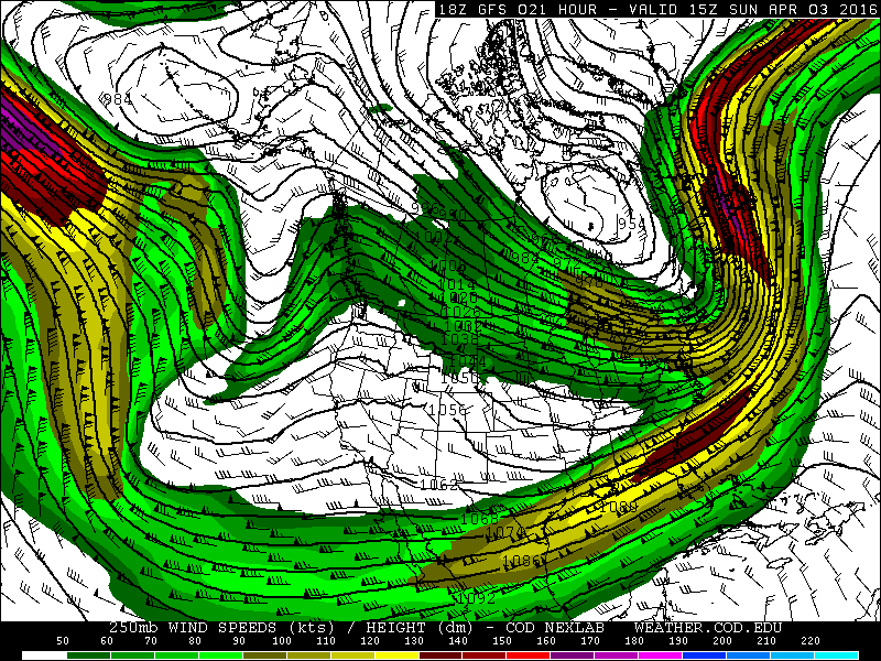
An upper-level ridge continues to build across the region. In fact, it is so strong that the jet stream has split in order to avoid it. We call this a split-flow pattern. We see the two distinct pieces of the jet in the 250 mb wind map below.

Colorado lies right between the two. In this position, conditions are usually calm, seasonal and sunny, which will be the case for the next several days.
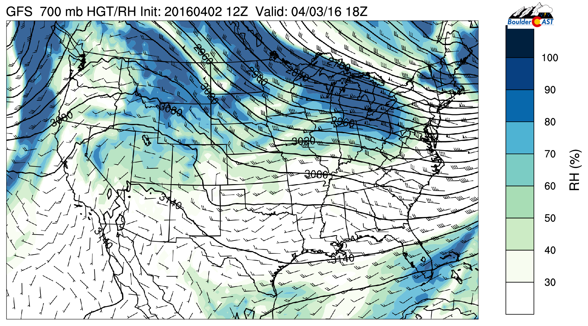
Shown below is the 700 mb relative humidity (RH) forecast for this afternoon. We often use this product to get quick look at where to expect clouds and precipitation.

With RH values below 50% aloft in eastern Colorado and light downslope, we’ll see full sunshine and temperatures in the mid to upper 60’s today.
Our next chance of precipitation comes Tuesday evening when a weak wave moves across the state. Snow levels will be above ~9,000 feet, so were only expecting rain on the Plains and Foothills. More on that later.


You must be logged in to post a comment.