Category: Premium Content (Page 180 of 451)

This content is for Premium Members only.

BoulderCAST Daily – Fri 06/10/22 | The Heat Wave Starts

There was a cold front that slid down from Wyoming and Nebraska late last night and earlier this morning as low pressure tracked into the Mid-Mississippi Valley. That cold front will weaken as it pushes east into Kansas this afternoon. Our winds at the surface as a result will start out from the east-northeast and shift to the south to …

Colorado Weekend Weather Outlook: June 9, 2022

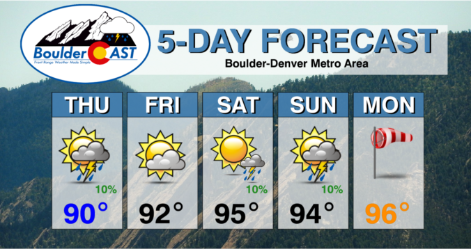
Summer will be in full-swing for the weekend ahead! A hot pattern is developing across the western United States with temperatures progged to soar into the 90s for us the next five days or more. The atmospheric pattern responsible is a stagnant ridge of high pressure that sets up to our south across New Mexico and Arizona --- this will …

BoulderCAST Daily – Tue 06/07/22 | Supercell thunderstorms pop east of Denver

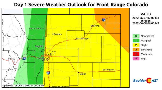
Today will be an active day east of Denver where supercell thunderstorms are likely to develop this afternoon and early evening. The stage is set with a stalled frontal boundary across northeast Colorado, an approaching shortwave moving in from Idaho (shown in the animation below), and an upper-level jet streak coming in as well. This jet will fuel 55+ MPH …

BoulderCAST Daily – Sun 06/05/22 | Another day of 80s with a slight uptick in storms

Aweak cold front will sag south tonight as an area of low pressure tracks from Nebraska into the Mid-Mississippi Valley. The airmass is not overly different from today but it will be enough to bring a slight cool down for our Monday in the lower 80s. For today, though, westerly downslope flow will again be present, with low to middle …

BoulderCAST Daily – Sat 06/04/22 | Warming back into the 80s with only a slim chance of a storm

Different pattern is in shape today relative to our Friday. The shortwave which brought showers and thunderstorms to our region yesterday (mainly east of I-25) has shifted off into eastern Kansas and western MO today. In its wake, a weak ridge will be settling in aloft. This should spell out more stable air, suppressing storm development for the most part. …

BoulderCAST Daily – Fri 06/03/22 | Isolated storms near Foothills grow upscale along/east of I-25 this evening

Aweak mid to upper-level trough, which moved onshore yesterday, will traverse east through the state this afternoon and evening. While the system is fairly muted, it will aid in storm development on the Plains and Foothills later today and tonight. Anomalous moisture will be in place today, especially along the eastern portions of Colorado. This will further enhance the potential …

Colorado Weekend Weather Outlook: June 2, 2022

Precipitation totals from the soaking storm Tuesday into Wednesday are in (see below). Most areas picked between 0.7 and 1.4" of moisture with the highest amounts in the realm between Denver and Boulder where that stationary band of moderate rainfall setup Tuesday evening and night. Boulder officially reported 0.74" of rain, with 0.16" of that funneling into the month of …

« Older posts Newer posts »