Category: Premium Content (Page 177 of 451)

This content is for Premium Members only.
BoulderCAST Daily – Wed 07/06/22 | Morning showers followed by late-day storms capable of producing heavy rainfall

Low clouds and some rain showers are present early this morning across the northern Front Range. We've see a few raindrops here in Boulder already this morning. The current regional radar animation is shown below. The continuation of the showers overnight and early this morning is the result of a healthy monsoonal moisture plume staying directly over the area, plus …

BoulderCAST Daily – Sun 07/03/22 | Amplified monsoonal flow will enhance storm coverage, especially over the higher terrain

Alarge trough situated over the Pacific Northwest will lead to a more amplified pattern over the region today and tonight. Southwest winds at mid to upper levels will bring in moisture from Arizona and New Mexico, this time helping to focus that energy into the western and central part of the state. High temperatures this afternoon should reach the upper …

BoulderCAST Daily – Sat 07/02/22 | Highs in the upper 80s with isolated storms

Another ripple of energy will rotate around the upper ridge in association with monsoonal moisture to warrant afternoon/evening isolated thunderstorms on the Front Range. High temperatures will be in the upper 80s to near 90 degrees. Expect abundant sunshine to start, following by increasing clouds. The latest high-res models are not in agreement in storm coverage and intensity this afternoon …

BoulderCAST Daily – Fri 07/01/22 | Widespread scattered storms later today with lower 80s on the 1st of July

Another ripple of mid-level energy will track from west to east over Colorado this afternoon and evening amid the monsoonal flow. In fact, there is largely little difference between yesterday and today in terms of the synoptic pattern. That wave of energy will move through in the late afternoon, sparking scattered showers/storms across the Front Range. Highs will stay below …

Colorado Weekend Weather Outlook: June 30, 2022

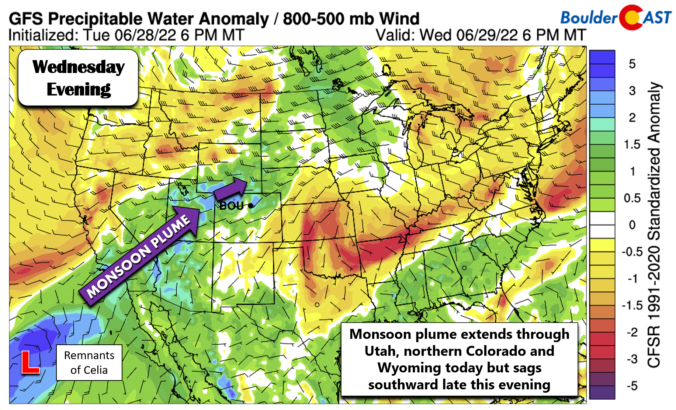
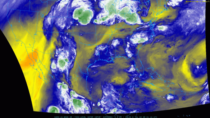
Monsoon season has kicked into high gear with an excellent chance of rain showers and storms developing through the day today! This will be followed up by continued daily chances for storms through the long holiday weekend ahead. The plume of monsoon moisture originating in the subtropics can be seen in the GOES-East water vapor animation below. Note the narrow …

BoulderCAST Daily – Wed 06/29/22 | The hottest day of the week with decent odds for storms late this evening

Today will be the hottest day of the week under peak warming as the ridge axis passes east of the area during the early morning hours. By midday, the ridge axis will be across Kansas and Nebraska (shown below) with hot southwesterly flow streaming into Colorado. That weak low pressure moving along the Canadian Border will eventually force a cold …

BoulderCAST Daily – Tue 06/28/22 | A triumphant return to the 90s

Ashortwave ridge will be drifting across the Rocky Mountains today bringing largely quiet weather to the Front Range. The 500mb height anomaly forecast map from the GFS model below shows that the center of the high pressure is located in northern Arizona with an axis extending northward into western Colorado. Elsewhere, a trough is coming ashore near Seattle --- this …

« Older posts Newer posts »