Category: BoulderCAST Daily (Page 289 of 466)

This page contains an index of our BoulderCAST Daily forecast updates. If you are NOT a Premium member, you will only see a tiny sample of this content below. Subscribe to BoulderCAST Premium to gain access to all of our daily forecasts which get published every morning.
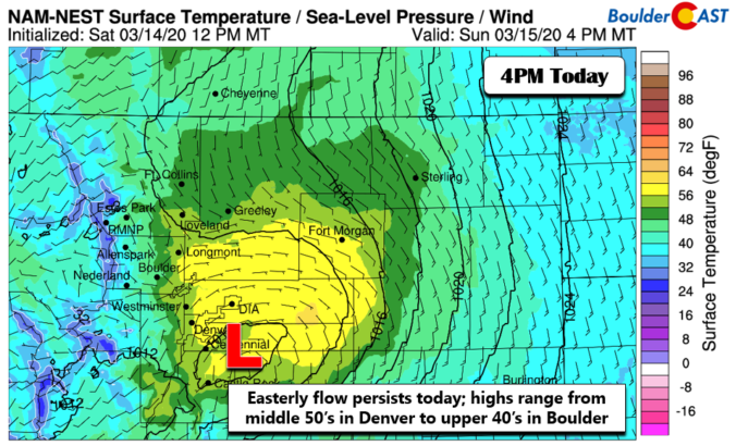
BoulderCAST Daily – Sun 03/15/20 | Turning sunny today (really!)

Detailed Forecast Discussion: We want to start off by apologizing for yesterday's forecast. While it was sunny and pleasant in the Denver Metro, towards Boulder it remained overcast the entire day. We looked into what happened and it was due to a Denver Cyclone, a low-level area of low pressure centered on Denver. The below image shows the observed wind …

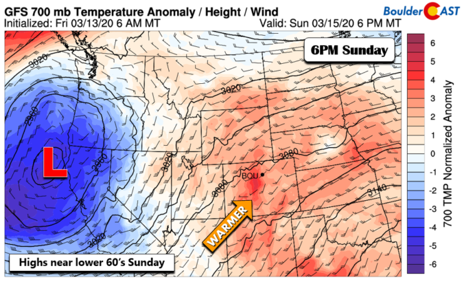
BoulderCAST Daily – Sat 03/14/20 | Warming trend

Detailed Forecast Discussion: After yesterday's light snow showers, the weekend will take on a warmer tone. The atmosphere still remains quite active, however. In the mid-levels (below), the subtropical jet remains steady with another cutoff area of low pressure off the coast of northern California. This system is poised to remain west of us through tomorrow, keeping us dry but …

BoulderCAST Daily – Fri 03/13/20 | Rain/snow showers ending early afternoon

Detailed Forecast Discussion: A fast moving weak area of low pressure in the mid-levels will be tracking through the state this afternoon and evening (below). The main trajectory of this storm will lead to a downslope flow along the Front Range, sparing most of us from seeing anything significant. However, we'll start off the day with clouds and some patchy …

BoulderCAST Daily – Thu 03/12/20 | Cooler behind a morning cold front

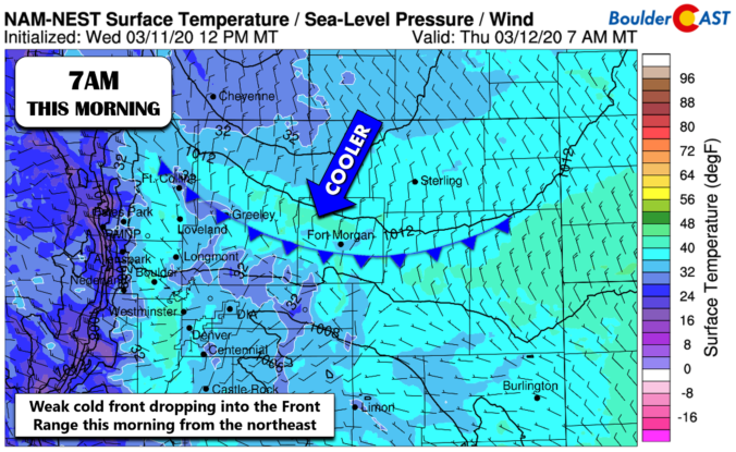
Detailed Forecast Discussion: A weak cold front is about to backdoor into the Front Range later this morning from the north and east. The approximate position of the front at 7:00 AM is shown below in the NAM-NEST surface forecast map. Below is a look at surface temperatures and winds by this afternoon. Winds will initially be from the northeast …

BoulderCAST Daily – Wed 03/11/20 | Another beautiful day

Detailed Forecast Discussion: There are no major changes in our weather today compared to yesterday. In fact, the large-scale atmospheric setup is eerily similar to what we saw on Tuesday. The cut-off low pressure system near California has barely moved, while another weak clipper will be dropping south out of Canada into Montana and Wyoming tonight. The overall stagnant pattern …

BoulderCAST Daily – Tue 03/10/20 | High cloudiness from the subtropical jet

Detailed Forecast Discussion: A quiet and mild day is expected for the region as a rather warm airmass accompanied by anomalously high pressure resides across most of the country. Today's 500mb height anomaly forecast map below pinpoints a cut-off low pressure system near the coast of southern California with an elongated trough extending northeastward into Montana. This trough will weaken …

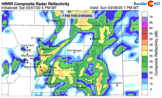
BoulderCAST Daily – Sun 03/08/20 | Scattered showers today

Detailed Forecast Discussion: Highs to be about 8 degrees cooler today thanks to increasing cloud cover and the threat of scattered showers this afternoon and night. At the surface (below), we have a weak cold front pushing down from the north later today and this evening. We'll start off with sunshine, but clouds will work in for the afternoon and …

« Older posts Newer posts »