Category: BoulderCAST Daily (Page 278 of 466)

This page contains an index of our BoulderCAST Daily forecast updates. If you are NOT a Premium member, you will only see a tiny sample of this content below. Subscribe to BoulderCAST Premium to gain access to all of our daily forecasts which get published every morning.
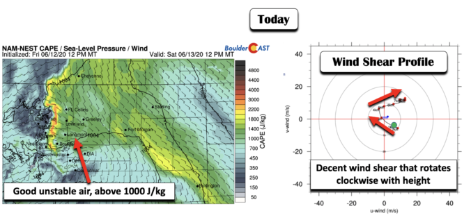
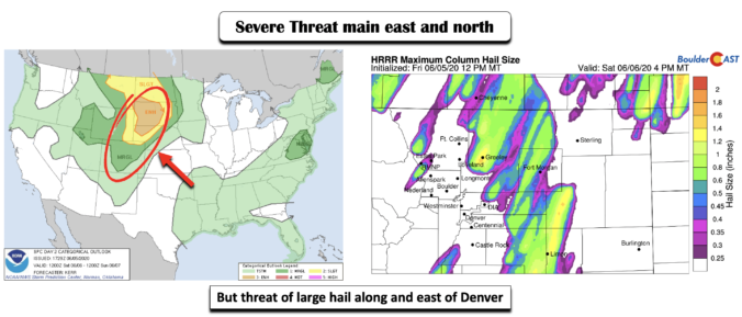
BoulderCAST Daily – Sat 06/13/20 | Sunshine to isolated severe storms

Detailed Forecast Discussion: We have been talking about the increased threat of unsettled weather today for the last couple of forecast posts and our thinking remains unchanged. We continue to watch a fluid and broad trough of low pressure to our west over the Pacific Northwest (below left) that will be sending in mid-level energy into the state and over …

BoulderCAST Daily – Fri 06/12/20 | Hot in the low 90’s

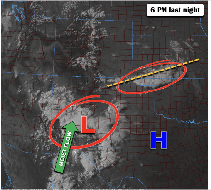
Detailed Forecast Discussion: We decided to show last night's visible satellite image as a precursor to what we'll see for the weekend, albeit in a slightly different shape and trajectory. We highlighted below two areas with thunderstorms. One area was located over the Oklahoma panhandle, tied to a surface trough. A second batch of thunderstorms was tied to a weak …

BoulderCAST Daily – Thu 06/11/20 | Nothing but sun

ADetailed Forecast Discussion: n intensifying high pressure center in West Texas and a ridge axis extending northward will help our weather take a turn towards the warm side today and into the upcoming weekend. The large-scale setup across the country is shown in the 700 mb temperature and wind forecast map for later today below. Notice that west of the …

BoulderCAST Daily – Wed 06/10/20 | Drier air works into the region

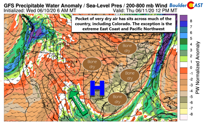
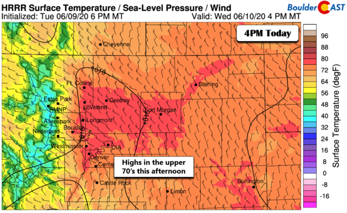
DDetailed Forecast Discussion: rier air aloft began to work into the Front Range late yesterday and this will again be the case today as a large-scale ridge of high pressure begins to build in from the west. It will be rather boring across Colorado today. The "exciting" weather in the country now resides across the Midwest and Great Lakes where …

BoulderCAST Daily – Tue 06/09/20 | Rain tapers off through the morning, staying cool

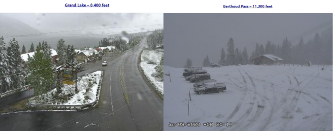
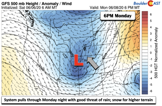
IDetailed Forecast Discussion: t has been a very wet and chilly overnight period with nearly 0.80" of rain having fallen at BoulderCAST Station so far. The current radar animation shows widespread cold rain holding over eastern Colorado. Temperatures are generally in the low to middle 40's across the Plains. Above roughly 8000 feet, it has been cold enough for accumulating …

BoulderCAST Daily – Sun 06/07/20 | Warm and windy…rain tomorrow

Detailed Forecast Discussion: After yesterday's storms, today will be a reprieve with Mostly Sunny skies, highs back to near 90 degrees, along with the continued gusty southwest winds. The large mid-level trough is still out to our west today (below), centered over southwestern Idaho. The bulk of the energy today from this system will be to our north and west, …

BoulderCAST Daily – Sat 06/06/20 | Windy with isolated severe storms

Detailed Forecast Discussion: What a hot one it was yesterday! Portions of the Plains were in the low to middle 90's, with Fort Morgan topping out the hottest near 101 (below)! Gladly, it will be cooler today but mostly due to the clouds and storm threat. A southern track low pressure system is being pumped up into the state later …

« Older posts Newer posts »