Category: BoulderCAST Daily (Page 1 of 378)
This page contains an index of our BoulderCAST Daily forecast updates. If you are NOT a Premium member, you will only see a tiny sample of this content below. Subscribe to BoulderCAST Premium to gain access to all of our daily forecasts which get published every morning.


Live View of Boulder

Current Conditions

Live Radar

Recent Premium Posts

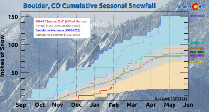
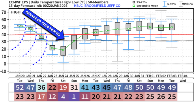
BoulderCAST Daily – Tue 01/27/26 | Early morning clouds will give way to a sunny Tuesday
🌤️ Clouds Clearing Fast — Early morning mid‑level clouds from northwest flow fade …
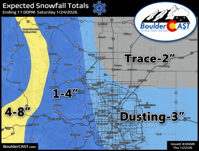
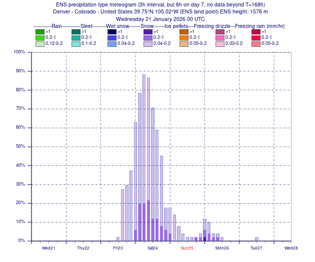
BoulderCAST Daily – Sun 01/25/26 | Light snow develops later today into this evening
❄️ Light snow this afternoon and tonight: A fast-moving clipper type system brings …
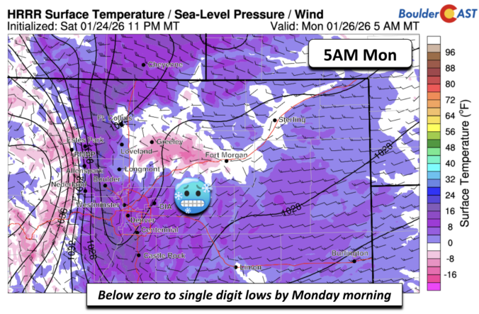
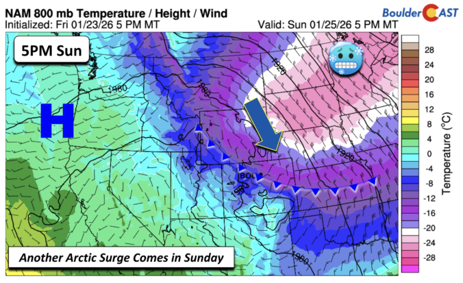
BoulderCAST Daily – Sat 01/24/26 | Bitter Cold This Weekend With Light Snow Again Sunday
🥶 Arctic blast is here: Arctic Air lingers through the weekend with teens …
3-Day Forecast

Trending Content

© 2026 Front Range Weather, LLC