

Author: Ben Castellani (Page 322 of 358)
Ben grew up in southwestern Pennsylvania and holds both a bachelor's and a master's degree in Meteorology, the latter being from CU Boulder. His hometown received nearly three feet of snow from the Storm of the Century back in March of 1993, sparking his initial interest in impactful weather. Ben currently works on remote sensing and data analysis software at NV5 Geospatial Software in Boulder.
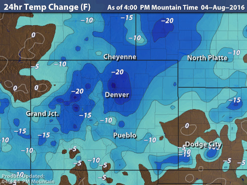
Cooler weather and beneficial rains are spreading across the Front Range as monsoon moisture collides with a cold front on our doorstep. Continue reading for rainfall amounts, timing, and when to expect that brutal August heat to return.
Live Radar

Trending Content


Recent Premium Posts

BoulderCAST Daily – Sun 11/15/26 | Morning Fog Gives Way to a Warmer Stretch of Weather
🌫️ Fog Disperses — Morning low clouds and fog exit, with sunshine in …
BoulderCAST Daily – Sat 11/14/26 | A Pair of Foggy Mornings With Little Rain
🌫️ A Pair of Foggy Mornings — Moisture banked up along the Foothills …
BoulderCAST Daily – Fri 11/13/26 | Quiet Today But Turning Unsettled Tomorrow
☀️ Quiet Today — Sunshine and low to middle 60s across the Front …
© 2026 Front Range Weather, LLC