Author: Ben Castellani (Page 27 of 358)

Ben grew up in southwestern Pennsylvania and holds both a bachelor's and a master's degree in Meteorology, the latter being from CU Boulder. His hometown received nearly three feet of snow from the Storm of the Century back in March of 1993, sparking his initial interest in impactful weather. Ben currently works on remote sensing and data analysis software at NV5 Geospatial Software in Boulder.
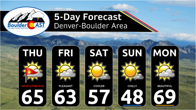
Premium BoulderCAST Daily – Tue 11/18/25 | A quiet few days in the lower 60s before our next storm arrives late on Thursday

As of sunrise, the upper-level system that brought yesterday’s wind and mountain snow has moved east into Iowa. Meanwhile, our next storm—the one expected to bring rain and snow chances later this week—is starting to organize near Los Angeles. High clouds are already streaming north into Colorado ahead of it. Today & Tomorrow Between the departing storm and the one …

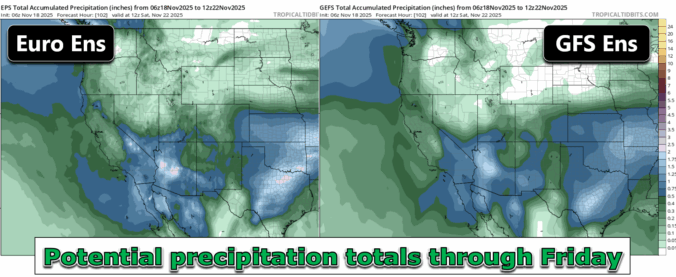
This Week in Colorado Weather: November 17, 2025

After weeks of unseasonable warmth and bone‑dry skies, the Front Range is finally staring down a pattern shift this week. But will it deliver the moisture we’ve been waiting for—or just more wind and disappointment? In this update, we break down some stats from our parched autumn so far, and take a look at several storm systems moving through Colorado this week, one of which will offer an excellent chance of rain (and maybe some snow) in the Boulder-Denver area.

Continue reading

Premium This Weekend in Colorado Weather: Warm & dry conditions continue with a record late first snow now all but certain for Boulder

Boulder matched its November 13th record high yesterday, topping out at 74°F during the afternoon. Hard to complain about a warm, sunny Thursday like that! Looking ahead, the big weather story is a sluggish low-pressure system spinning off the California coast. This feature will dominate our pattern through the weekend and into early next week. Forecast models continue to nudge …

Premium BoulderCAST Daily – Wed 11/12/25 | Staying warm, increased wave cloud activity will limit Northern Lights viewing tonight

Today’s weather won’t bring much change — the ridge of high pressure is still firmly parked over the Rockies, stretching all the way up from the Sonoran Desert. If you check the latest GOES-East water vapor imagery, you’ll notice that this ridge is carrying quite a bit of moisture. That’s why we’re seeing more cloud cover today, especially as that …

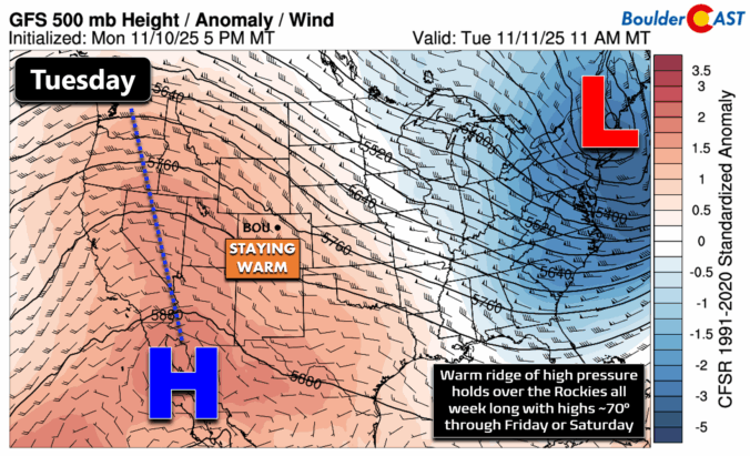
Premium BoulderCAST Daily – Tue 11/11/25 | Exceptional November warmth holds strong through Friday

As we mentioned in yesterday’s outlook, the rest of this week isn’t shaping up to be particularly eventful for weather along the Front Range. A strong ridge of high pressure is firmly in place over the Rockies, and it’s not going anywhere through Friday or early Saturday. That means dry skies and unseasonably warm afternoons—warm enough that we could flirt …

Premium This Weekend in Colorado Weather: Red Flag Conditions Thursday, a cooler weekend ahead, and chances increase for a record late first snowfall

While the weather stays relatively calm across eastern Colorado over the next several days, there’s still plenty happening just above our heads to keep things interesting. A series of fast-moving storm systems will continue to zip by to our north—one today, another Friday night, and a stronger one Saturday night. None of these will bring precipitation to the Denver Metro …

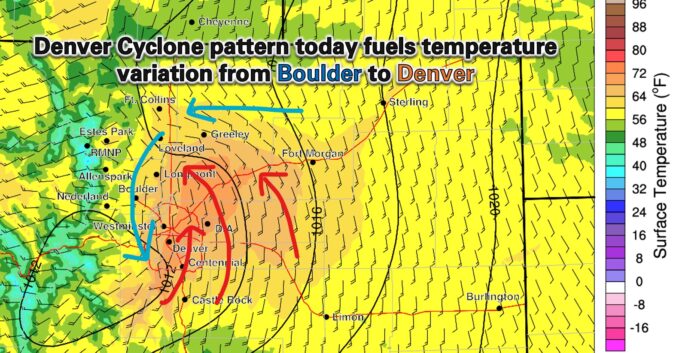
Premium BoulderCAST Daily – Wed 11/05/25 | Relatively cooler today, but far from cool by November standards

The advertised cold front did indeed slip south across eastern Colorado overnight, nudging us into a cooler setup today — though let’s be honest, “cool” is a stretch by November standards. We’re still running warmer than average across the board. Behind the front, upslope flow is kicking in, and that’s helping spin up a surface Denver Cyclone. This localized wind …

« Older posts Newer posts »