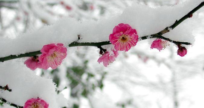
The sun is out Saturday morning and already working quickly to melt our most recent round of late-season snow in the Front Range. We briefly review the snowfall totals which greatly favored the western side of the Metro area including Boulder. We also tackle the question of whether this will be our final snowfall of the season or not.
Author: Ben Castellani (Page 18 of 294)
Ben grew up in southwestern Pennsylvania and holds both a bachelor's and a master's degree in Meteorology, the latter being from CU Boulder. His hometown received nearly three feet of snow from the Storm of the Century back in March of 1993, sparking his initial interest in impactful weather. Ben currently works on remote sensing and data analysis software at NV5 Geospatial Software in Boulder.
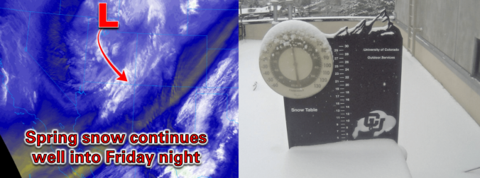
Springtime snow is underway across the area with wet accumulations overnight up to 6 inches in the higher terrain (Estes Park) and up to 3.5 inches across the lower elevations (Boulder). We discuss the latest forecast details, including when we expect an uptick in snow coverage and intensity, how much more snow will accumulate, and when the flakes will come to an end.
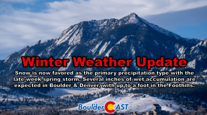
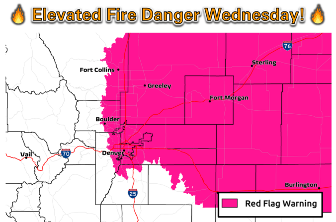
Following a rather benign stretch of weather this week so far, a strong storm system will bring winter weather back to the entire Front Range in the days ahead. After a warm day with fire danger on Thursday, a cold front will blow through in the early evening hours paving the way for a prolonged period of upslope-enhanced precipitation lasting into early Saturday. While the predominant precipitation type will indeed be snow with this storm, even across the lower elevations, there will be a lot of melting happening limiting the overall impacts and potential snow accumulation. We discuss the latest storm details, how much moisture will fall, and how much wet snow this will translate into for the area.
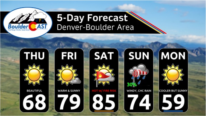
Following a chilly and unsettled first week of April, this week will be much quieter across Colorado with generally warm and dry conditions favored throughout the entire week under the protection of high pressure. Temperatures will fluctuate a tad due to a pair of dry backdoor cold fronts, but otherwise this week will offer-up gorgeous spring weather. That theme will continue right into the upcoming weekend with the first 80-degree temperatures of the year likely. Read on for all the details.

Live View of Boulder

Current Conditions

Live Radar

Recent Premium Posts

BoulderCAST Daily – Sun 01/11/26 | A mild Sunday with readings reaching the 50s
🌤️ Mild & Melty Sunday: Light winds and patchy clouds, with lingering snowpack …
BoulderCAST Daily – Sat 01/10/26| Widespread sunshine and moderating temperatures this weekend as our recent snow melts off
🌤️ Calm Saturday: Winter storm systems have departed the state, leaving behind a …
BoulderCAST Daily – Fri 01/09/26| Snow ends quickly this morning with a quieter weekend in store
❄️ Overnight snow bands: A second push of upslope after midnight sparked narrow …
3-Day Forecast

Trending Content

© 2026 Front Range Weather, LLC