Author: Andy (Page 99 of 217)
Born and raised in St. Louis, Andrew obtained a Ph.D. in Atmospheric Science from the University of Colorado in 2015. From 2015 to 2020, he worked remotely in Boulder as an atmospheric scientist with NOAA's Atlantic Oceanographic and Meteorological Laboratory in Miami. Andy is now a full-time meteorologist.
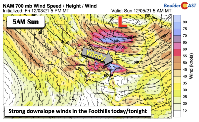
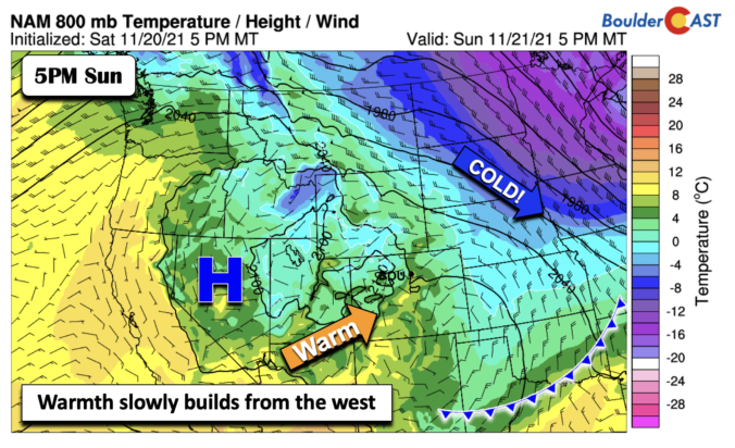
The entire upcoming week will feature well above average temperatures across the Front Range with several days of record highs up for grabs. There will be a couple of “cool-downs” behind dry cold fronts but temperatures will still remain above seasonal normals on those days as well. While the upcoming week is expected to be totally dry, there are some hints of a return to a more active and unsettled pattern next week. We’ll discuss this and more in our weekly outlook so read on!
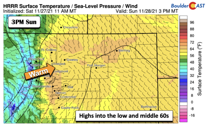


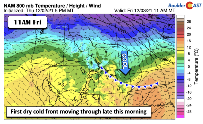
Warm weather and sunshine will start out our holiday week as temperatures reach comfortably into the 60’s. A strong cold front will usher in much colder temperatures around midweek, along with a slight chance of snow. Early indications are that Thanksgiving will be seasonal and dry. A gradual warming trend is in-store for the latter half of the week and into the weekend with no major storm systems anywhere to be found in the pipeline.

Live View of Boulder

Current Conditions

Live Radar

Recent Premium Posts

BoulderCAST Daily – Tue 06/02/26 | Storms Reload This Afternoon, But With Noticeably Less Bite
❄️ Monday delivered lots of hail to northeast Colorado, with one supercell tracking …
BoulderCAST Daily – Sun 05/31/26 | Dry and warm today but rain chances increase this week
🌦️ Overall dry and warm Sunday, though cannot rule out a very widely …
BoulderCAST Daily – Sat 05/30/26 | A stray shower today as most activity resides well east of Denver
🌦️ Spotty showers today, mainly well east of the Denver Metro area, where …
3-Day Forecast

Trending Content

© 2026 Front Range Weather, LLC