Author: Andy (Page 72 of 217)
Born and raised in St. Louis, Andrew obtained a Ph.D. in Atmospheric Science from the University of Colorado in 2015. From 2015 to 2020, he worked remotely in Boulder as an atmospheric scientist with NOAA's Atlantic Oceanographic and Meteorological Laboratory in Miami. Andy is now a full-time meteorologist.

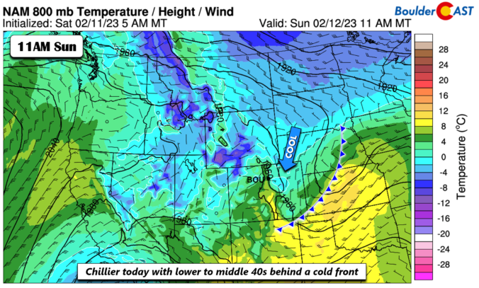
The sun is out but temperatures are way below zero this Thursday morning! Here’s a few highlights from the ongoing Arctic blast as snow wraps up and a slow warming trend begins across the Front Range.
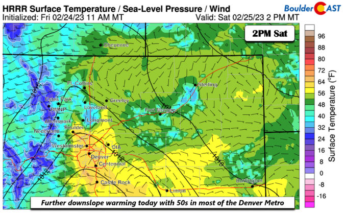
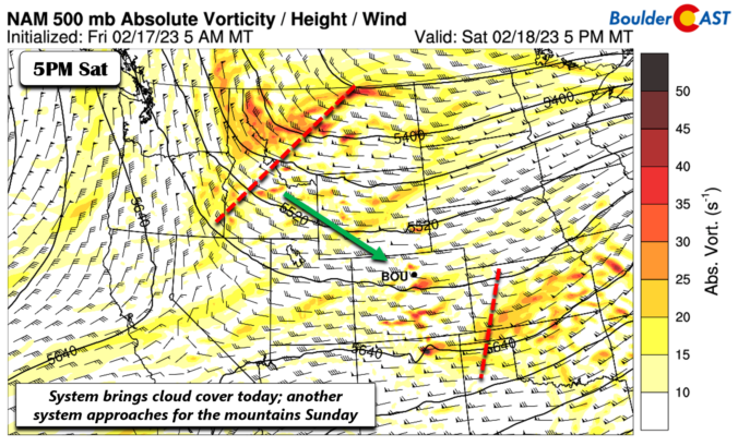
The week starts out mild and at times breezy under a split-flow regime aloft combined with downslope flow at the surface. A deep and highly anomalous trough digs across the western US, Colorado, and Great Plains Wednesday and Thursday, bringing snowfall and record cold for late February. Confidence is increasing for several inches of snow to accompany the cold over portions of the Plains Wednesday, primarily from Boulder northward. The Arctic air slowly retreats by week’s end as a ridge in the southeast US builds westward.


Live View of Boulder

Current Conditions

Live Radar

Recent Premium Posts

BoulderCAST Daily – Sun 05/31/26 | Dry and warm today but rain chances increase this week
🌦️ Overall dry and warm Sunday, though cannot rule out a very widely …
BoulderCAST Daily – Sat 05/30/26 | A stray shower today as most activity resides well east of Denver
🌦️ Spotty showers today, mainly well east of the Denver Metro area, where …
BoulderCAST Daily – Fri 05/29/26 | A Marginal Risk of Severe Isolated Storms
🌦️ Spotty showers this afternoon, mainly noon and 4 PM, with highs in …
3-Day Forecast

Trending Content

© 2026 Front Range Weather, LLC