Author: Andy (Page 6 of 205)
Born and raised in St. Louis, Andrew obtained a Ph.D. in Atmospheric Science from the University of Colorado in 2015. From 2015 to 2020, he worked remotely in Boulder as an atmospheric scientist with NOAA's Atlantic Oceanographic and Meteorological Laboratory in Miami. Andy is now a full-time meteorologist.
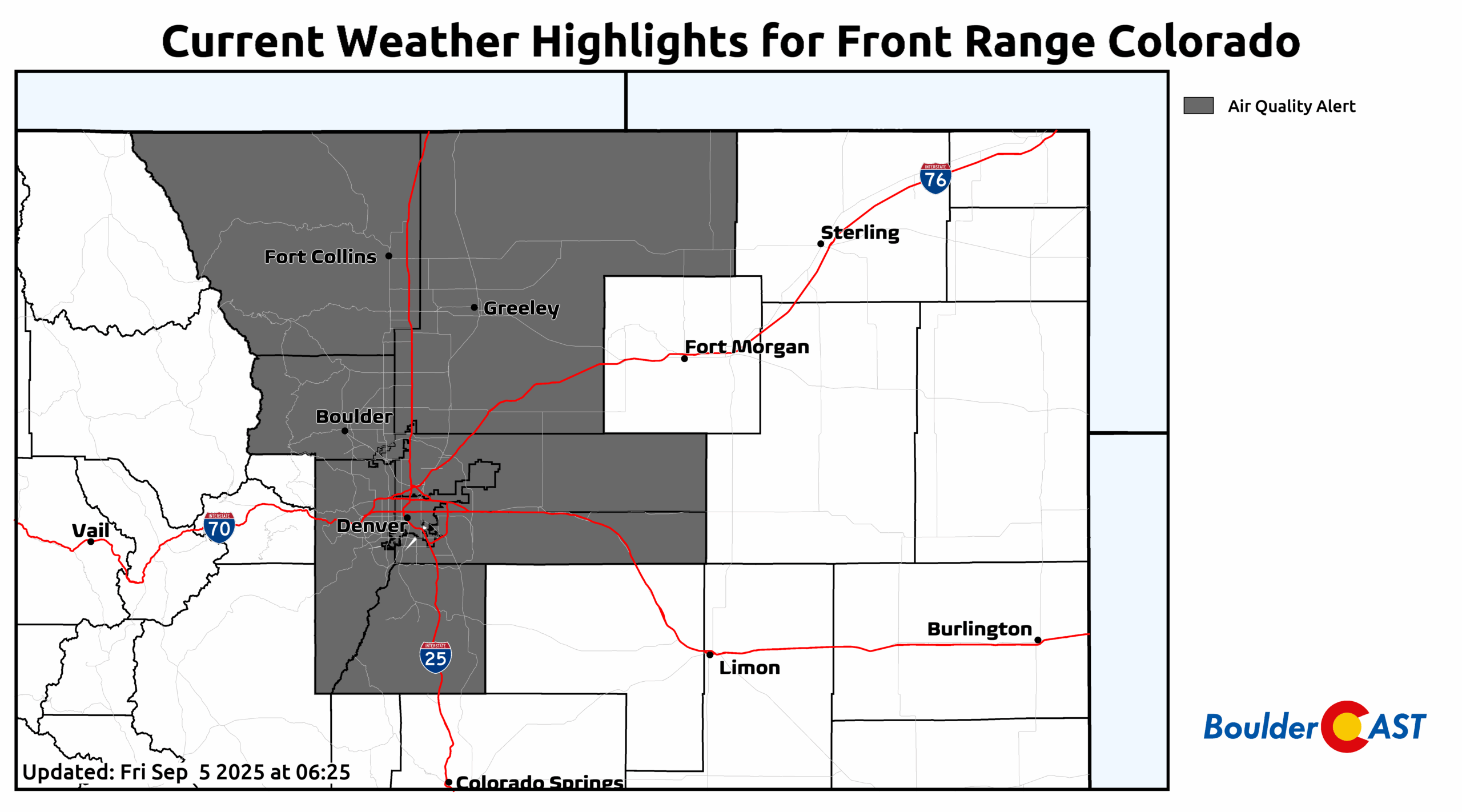
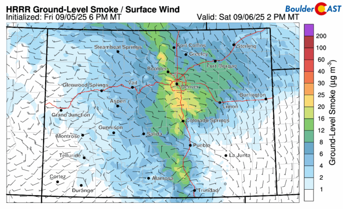
September kicks off with a mellow vibe across the Front Range — warm days and mostly dry skies are expected. But don’t let the quiet start fool you. Between drifting wildfire smoke, sneaky cold fronts, and a potential tropical system by the weekend, there’s more nuance in our forecast this week than meets the eye. Read on as we break down what to expect day by day, plus what might shake things up by the weekend.
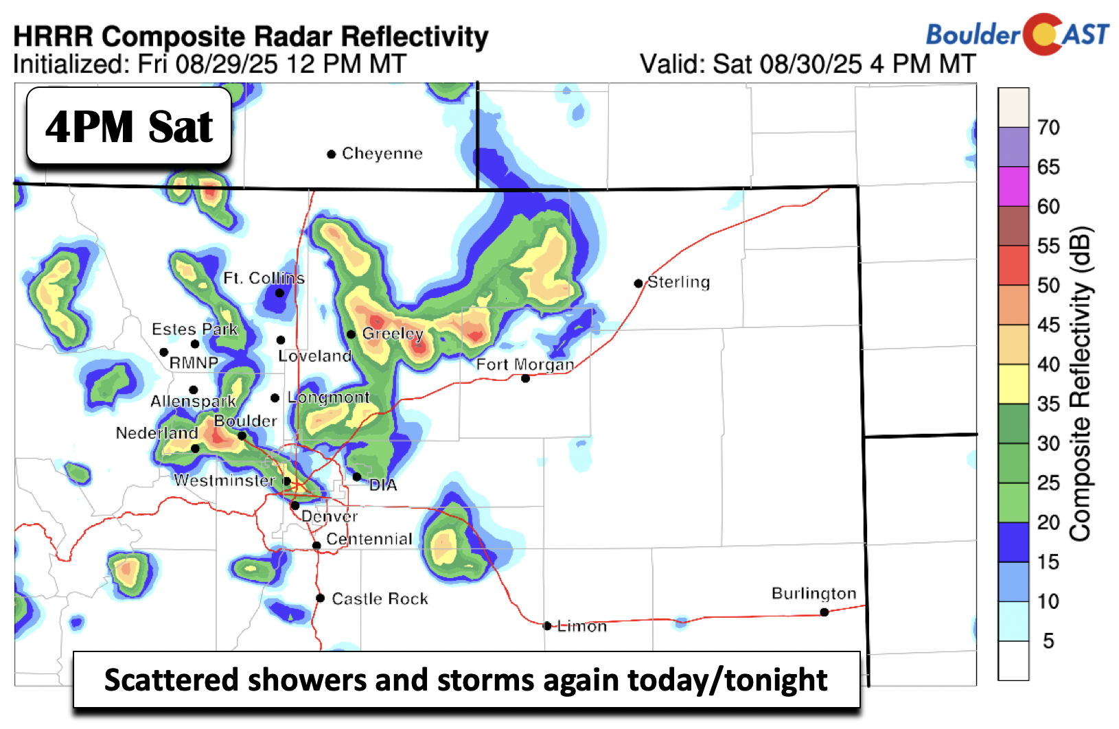
The unsettled weather pattern isn’t done with us just yet—and that’s good news for the rain-starved Front Range. While recent days have underdelivered in most areas, this week still holds promise for more moisture and continued cool weather. We break down when and where the best rain chances will line up this week, why optimism is cautious, and what to watch for as the pattern turns warmer and drier heading into Labor Day Weekend.

Live View of Boulder

Current Conditions

Live Radar

Recent Premium Posts

Flash Sale: Winter is back! Save 30% Through Monday December 1st Only!

Winter Weather Update: Historic snow drought likely comes to an end during what will be a bitter cold holiday weekend in the Front Range
After weeks of unseasonable warmth, the Front Range is staring down its first …
BoulderCAST Daily – Tue 11/25/25 | Quiet weather through Friday afternoon, but much colder temperatures and snow are on-track to arrive this weekend
🌡️ A dry cold front dropped temps ~15°F in an hour before sunrise …
3-Day Forecast

Trending Content


© 2025 Front Range Weather, LLC