Author: Andy (Page 2 of 208)
Born and raised in St. Louis, Andrew obtained a Ph.D. in Atmospheric Science from the University of Colorado in 2015. From 2015 to 2020, he worked remotely in Boulder as an atmospheric scientist with NOAA's Atlantic Oceanographic and Meteorological Laboratory in Miami. Andy is now a full-time meteorologist.
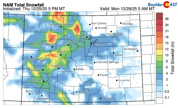
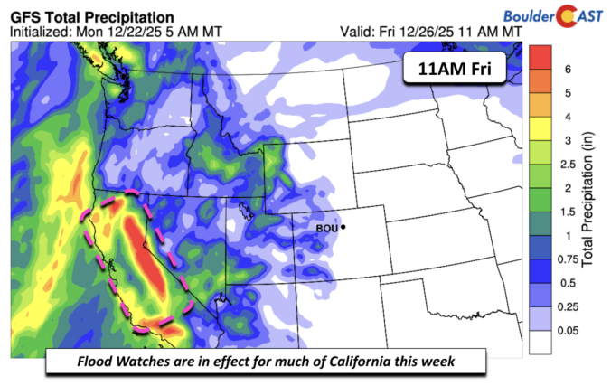
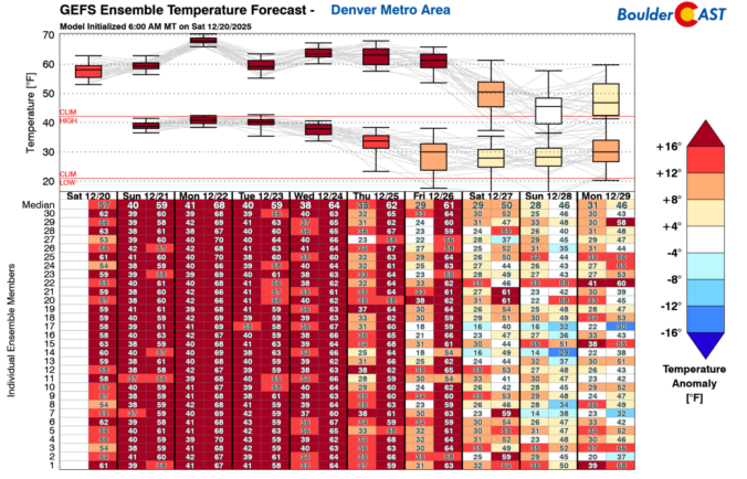
As we head into what’s normally the coldest stretch of the year along the Front Range, the atmosphere has other plans. Instead of Arctic air and snow globe conditions, we’re staring down a week of springlike warmth, fire weather concerns, and multiple shots at breaking long‑standing temperature records—including on Christmas Day. We’ll walk you through why this pattern is so unusual, what it means for Boulder and the Foothills, and where you can still find real winter this week if you’re craving it.

Live View of Boulder

Current Conditions

Live Radar

Recent Premium Posts

BoulderCAST Daily – Wed 01/07/26 | Quiet today but snowflakes are on the horizon tomorrow
⛅ Quiet Weather Today: Highs will be mild in the upper 50s in …
BoulderCAST Daily – Tue 01/06/26 | Critical Fire Conditions Today
🔥Critical Fire Conditions: Fire Weather conditions could be critical today with gusty winds …
BoulderCAST Daily – Sun 01/04/26 | Red Flag Warning in effect for some
🌤️ Mild but Red Flag Warning in effect for some of us: Highs …
3-Day Forecast

Trending Content

© 2026 Front Range Weather, LLC