Author: Andy (Page 1 of 211)
Born and raised in St. Louis, Andrew obtained a Ph.D. in Atmospheric Science from the University of Colorado in 2015. From 2015 to 2020, he worked remotely in Boulder as an atmospheric scientist with NOAA's Atlantic Oceanographic and Meteorological Laboratory in Miami. Andy is now a full-time meteorologist.

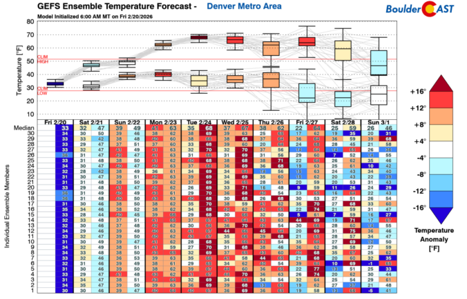

As we roll into the new week, Colorado is staring down a remarkably busy stretch of weather — the kind that keeps both meteorologists and emergency managers on their toes. From dangerous fire conditions on the Plains to a multi‑day snow dump in the Mountains, the state is set to experience just about every flavor of February weather. A powerful longwave trough will anchor itself over the West through the week, sending repeated waves of wind, moisture, and cold our way. The result will be critical fire danger, high winds, heavy snow, and a late‑week cooldown. Let’s take a closer look at what’s coming and why this week could be one of the more impactful ones Colorado has seen so far this “winter” season.


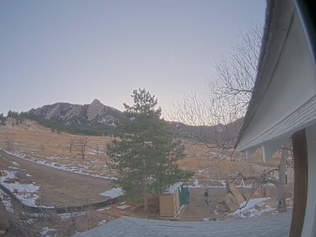
Live View of Boulder
Current Conditions

Live Radar

Recent Premium Posts

BoulderCAST Daily – Tue 02/24/26 | High winds, critical fire danger, and Mountain snow develop as a Pacific jet drops south
🌬️ Jet‑Driven Wind Surge: A 150+ MPH polar‑jet segment sliding south will produce …
BoulderCAST Daily – Sun 02/22/26 | Warm with gusty winds by midweek as snow returns to the High Country
☀️ Warm into midweek with mid/upper 60s Tuesday and Wednesday 💨Gusty winds return …
BoulderCAST Daily – Sat 02/21/26 | Trending warmer this weekend through early next week
☀️ Warming up this weekend through early next week to eventual 60s by …
3-Day Forecast

Trending Content

© 2026 Front Range Weather, LLC