Both Denver and Boulder will be challenging record highs today, nearly 30 degrees above normal for this time of year! Expect mostly cloudy skies with highs in the low to middle 70’s. Very strong winds will be blowing during the morning in and near the Foothills as a mountain wave has set-up overnight. Sustained winds of 45 mph will be complimented by gusts approaching 90 mph! This includes the city of Boulder. Be careful! Breezy conditions will remain during the afternoon and evening, but gusts shouldn’t exceed 40 mph.
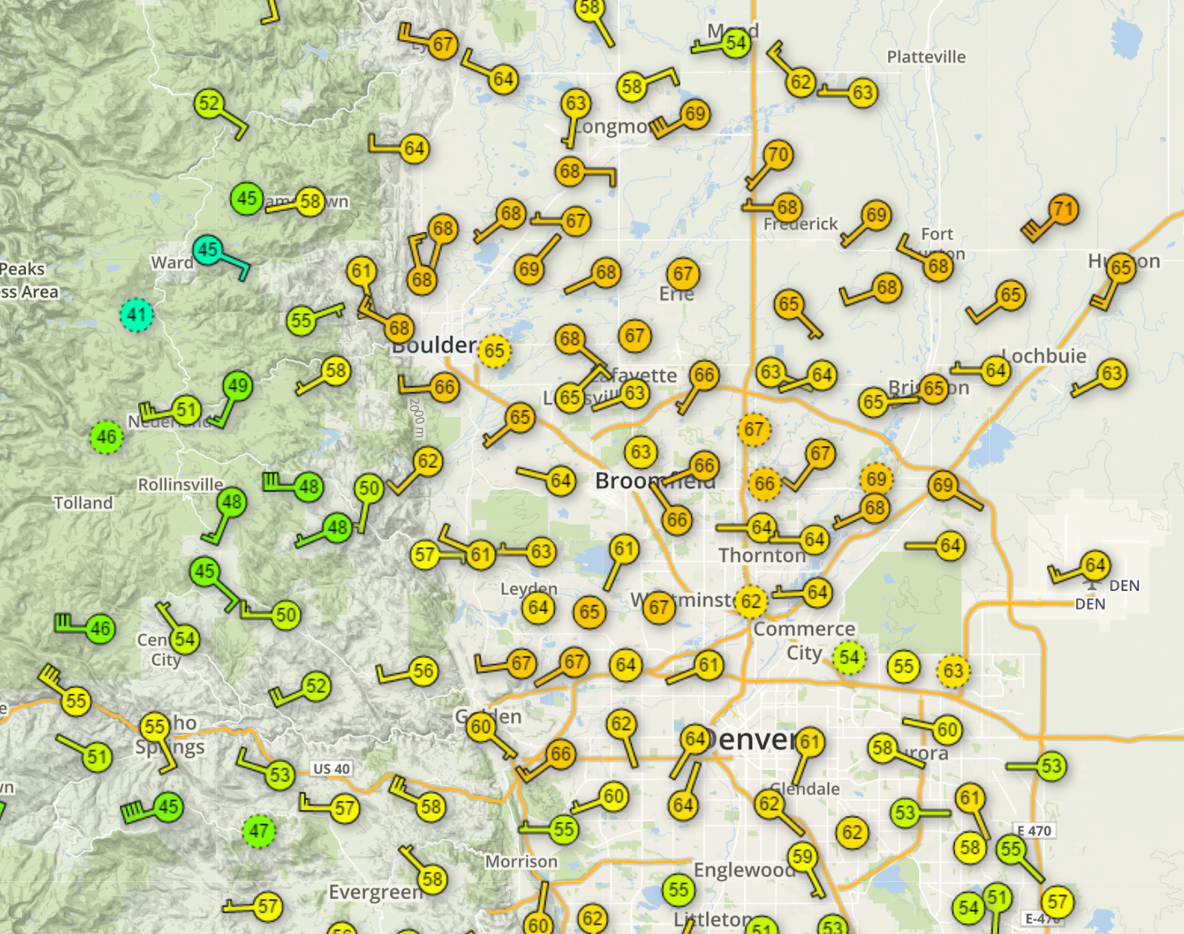
Below shows current temperatures as of 6AM. Very warm already out there, between 65 and 70 degrees. It’s going to be a very warm day!

Current temperatures as of 6AM Friday
Our next weather system is knocking on the door already. Snow will increase in the Mountains this evening and persist through Saturday. Accumulations of 6-14″ can be expected across much of the state above 10,000 feet by Sunday morning. A cold front will swing south across the Plains overnight tonight and bring cooler weather and a chance of light rain/snow for the weekend. Accumulating snow on the Plains around 1″ seems plausible Saturday evening and night, with more possible south of Denver.
—
Remember, DayCAST’s are Premium content. Periodically, we open these forecasts up to all of our readers. Today is one of those days!
Sign up to become a Premium member today to get the best BoulderCAST experience, including daily forecasts, an enhanced LiveCAST and PowderCAST, custom forecasts, early access to select content and much more! Start your subscription today for just $1 using the promo code TRIAL.


You must be logged in to post a comment.