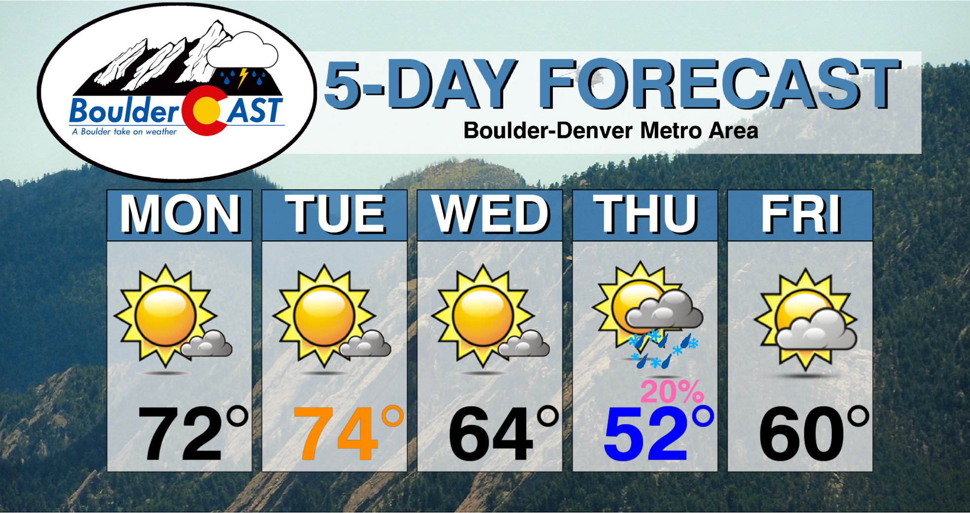
Temperatures 10 to 15 degrees above average will be the norm to start the first full week of April. Beyond this, we’re watching for a cool-down come Wednesday, along with a chance of unsettled weather for Thursday. A gradual chillier pattern looks to develop for the upcoming weekend.
This week’s highlights include:
- 70+ degree temperatures and sunshine to begin week
- Weak cool front Wednesday
- Watching chance of light rain/snow mix Thursday
- Trending chilly over weekend
DISCLAIMER: This weekly outlook forecast is created Monday morning and covers the entire upcoming week. Accuracy will decrease as the week progresses as this post is NOT updated. To receive daily updated forecasts from our team, subscribe to BoulderCAST Premium.
70’s and sunshine dominate through Tuesday
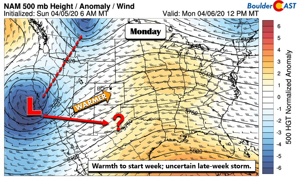
The figure below shows the country’s weather as of midday today. A rather deep and “cut-off” area of low pressure exists offshore of California. This system may potentially effect our region Thursday. However, as you will see later, there is some uncertainty as to its exact track late in the week. Outside of this storm system, much of the nation is quiet with high pressure ridging across the mid-section of the country. Southwest flow over Colorado today and tomorrow will spell out wonderful weather for early April!
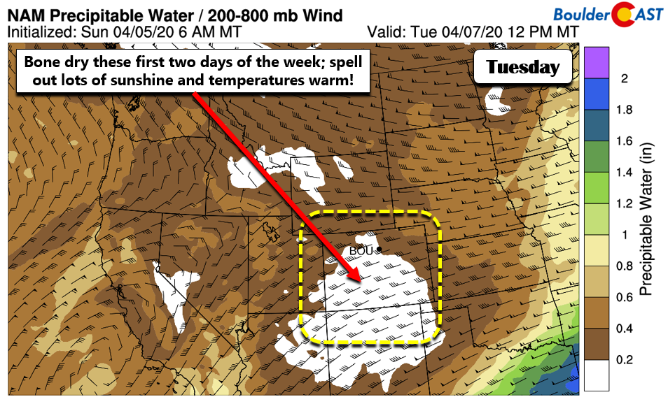
The atmosphere is basically “bone-dry” across Colorado today and tomorrow (below), with precipitable water values less than 0.2 inches. For perspective, a typical spring-time storm can bring these moisture values above three-quarters of an inch at times. Those dry conditions early in the week are thanks to warm southwesterly winds coming from the deserts of New Mexico and Arizona.
We can expect very little clouds these next few days with lots of sunshine!
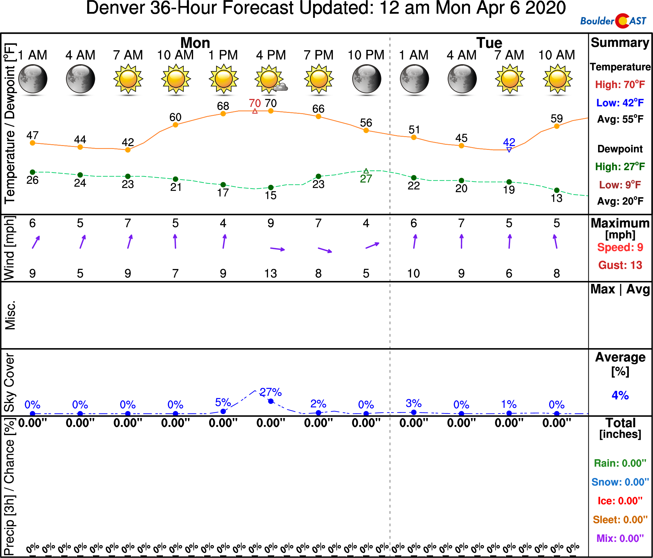
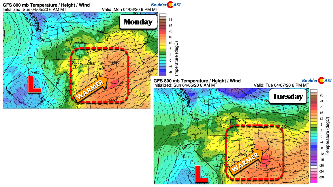
The airmass over the state this afternoon (below left) and Tuesday (below right) will support highs into the lower 70’s both days. Dare we say mid 70’s tomorrow? That’s certainly possible, too!
Weak cold front Wednesday
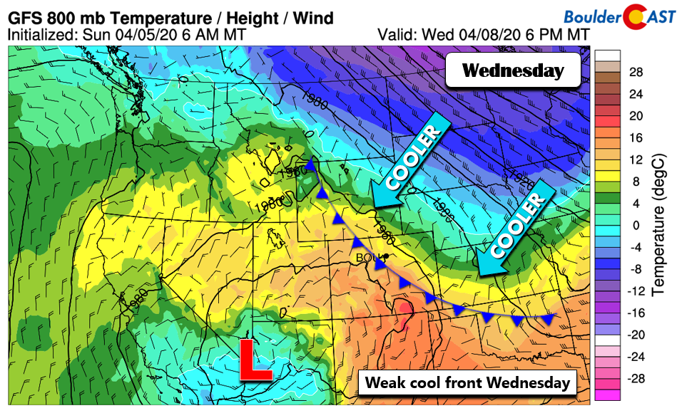
We are watching a weak cold front that will slide through midday Wednesday (below). The airmass will be still fairly warm behind it, so temperatures should have no issue still getting into the 60’s. Nevertheless, highs will be noticeably cooler than Tuesday. Chillier weather arrives most prominently on Thursday.
Unsettled Thursday or no dice?
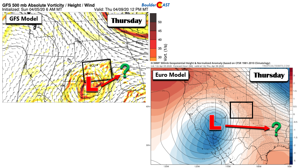
After a rather quiet week through Wednesday, there is some potential of an unsettled Thursday. However, the current model guidance is not in the best of agreement. The GFS model (below left) shows that system which was near California on Monday will move into northern New Mexico by Thursday. The Euro model (below right), though, has the system still to our south and west over southern Nevada. The GFS is faster and further north than the Euro model. This places Thursday in a conundrum. If the Euro solution verifies, the system could stay to our south, sparring us from any precipitation. If the GFS verifies, we could see a mix of rain/snow, depending on its exact northward position. A blend of the two would call for increasing clouds and colder weather.
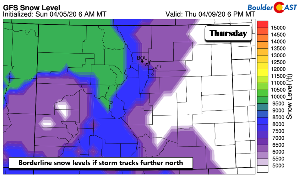
Even if the GFS solution were to verify, snow levels are somewhat borderline on Thursday (below), dropping to their lowest around 6,000 feet. That would mean most precipitation, if any, would be in the form of rain.
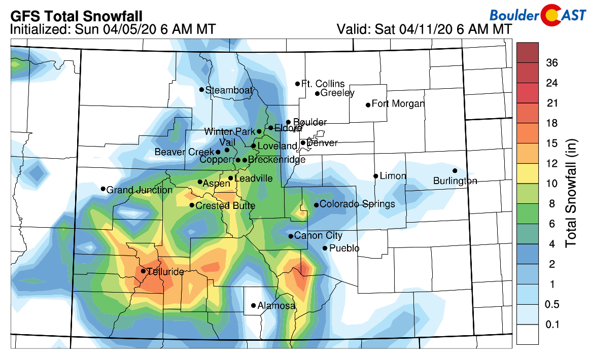
The mountains of southern and southwest Colorado would be most likely to see snowfall (below) from this system.
Colder weekend?
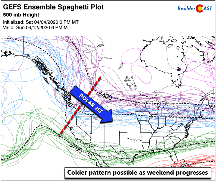
For the upcoming weekend, a gradual trend to colder temperatures is more likely than not. The GEFS ensemble and Euro models are showing a dip in the polar jet stream from Montana. This would bring down cooler than average weather along with increased chances of cold rain or snow. We are a week away from this, but it is something for us all to keep an eye on over the next several days (in addition to Thursday’s slight chance rain/snow.
Subscribe to receive email notifications for BoulderCAST updates:
We respect your privacy. You can unsubscribe at any time.
.
Forecast Specifics:
Monday: Sunny and warm with highs in the lower 70’s for the Plains and upper 50’s for the Foothills.
Tuesday: Highs in the low to middle 70’s for the Plains with abundant sunshine and low 60’s for the Foothills.
Wednesday: Cooler but near normal with temperatures in the lower 60’s on the Plains and lower 50’s in the Foothills under partly cloudy skies.
Thursday: Increasing cloud cover with a slight chance of showers or snow showers late in the day. Highs in the low 50’s on the Plains and middle 40’s in the Foothills.
Friday: Partly sunny skies with highs returning to near 60 for the Plains and low 50’s in the Foothills.

High Country: Dry weather will be the norm across the higher terrain through Wednesday. Snowfall is possible Thursday and Friday mainly across southern and southwest Colorado. Check our PowderCAST page for always-updated weather forecasts for all of the Colorado ski resorts.
Help support our team of Front Range forecasters by joining BoulderCAST Premium. We talk Boulder and Denver weather every single day. Sign up now to get access to our daily forecast discussions each morning, complete six-day skiing and hiking forecasts powered by machine learning, first-class access to all our Colorado-centric high-resolution weather graphics, bonus storm updates and much more! Or not, we just appreciate your readership!
.
Spread the word, share our forecast!




You must be logged in to post a comment.