Today’s forecast covers the cooler weather and potentially the first measurable precipitation of 2020 later today. An abbreviated weekly outlook will be posted tomorrow.
Remember, these daily forecasts are Premium content. Periodically, we open this forecast up to all of our readers. Today is one of those days!
Sign up today to get the best BoulderCAST experience, including these daily forecasts every morning, complete 6-day skiing and hiking forecasts, access of all our Front Range specific weather models, additional storm updates and much more!
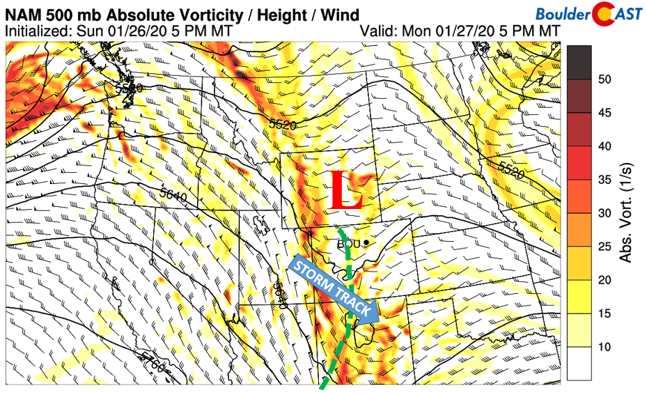
A weak and fast moving trough of low pressure will track through the state this afternoon and tonight. There is definitely a lack of a core circulation, but one exists to our south in New Mexico and another up north in Wyoming, with a trough axis connecting the two (below). The system takes more-or-less an unfavorable movement for precipitation chances on the Plains of eastern Colorado. It will track into New Mexico and the panhandle of Texas as we head into tonight.
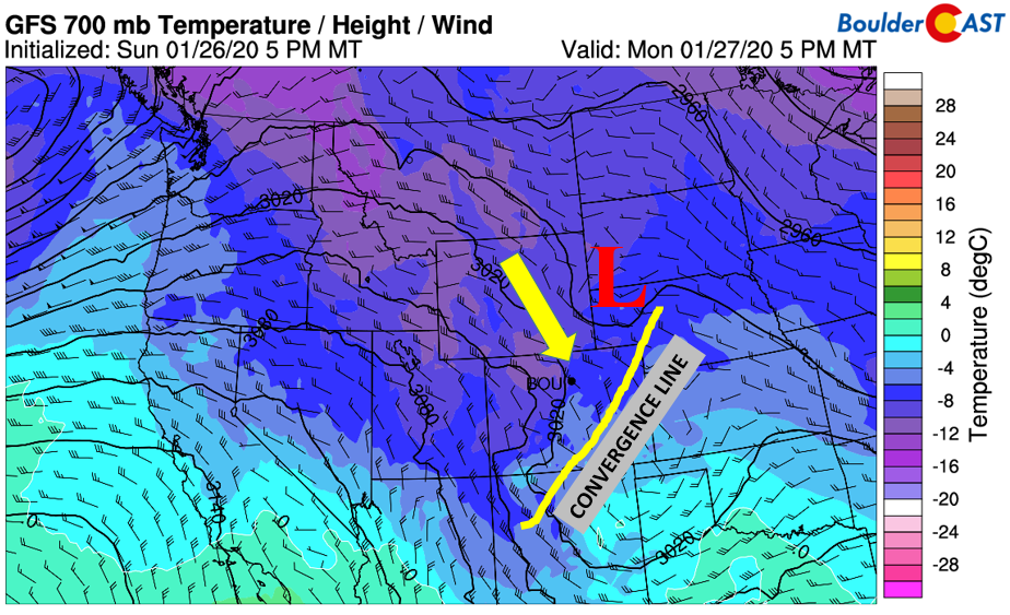
Flow across the Plains as a result will mainly be downslope, with north-northwest winds the primary direction (below). This will mean a relatively dry day for the Denver Metro area. However, as the trough axis pulls through this afternoon, a weak convergence line will help focus lift for scattered rain/snow showers before the evening commute.
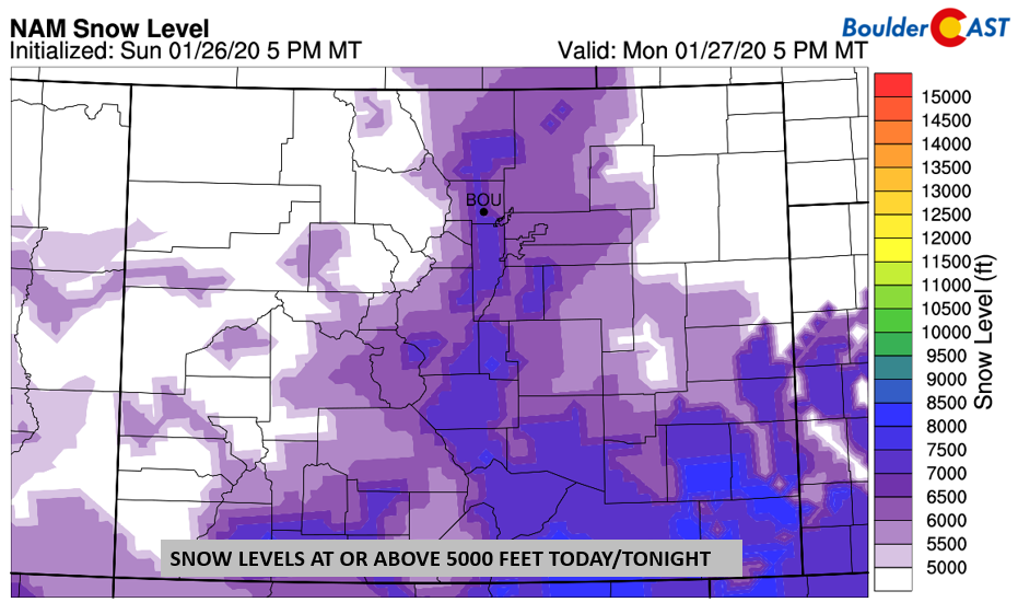
Overall, mostly cloudy skies will be the norm today outside of any isolated rain/snow showers. BoulderCAST’s model-derived snow levels come this evening stay more or less above 6000 feet, meaning any precipitation that falls will likely be mostly light rain. Though a mix of snow cannot be ruled out given the colder airmass headed in tonight. We think the best chance of precipitation will be this afternoon to early evening, but primarily east of Interstate 25 and south of Denver. Certainly no accumulation is expected, thus continuing our snowless January. By tonight, downslope shifts in and dries us out. Expect highs in the middle 40’s.
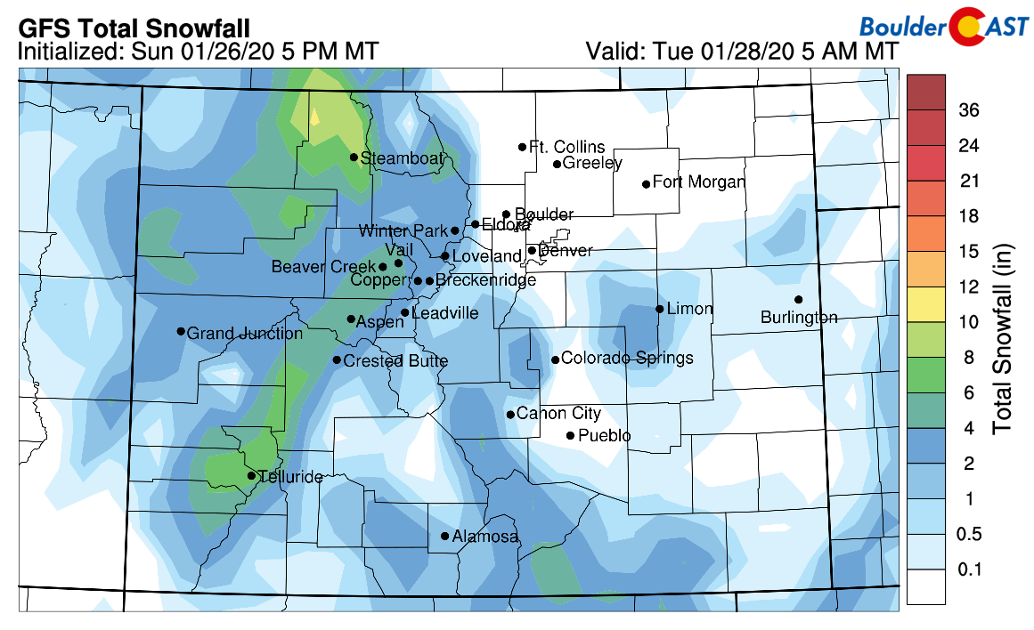
This system today will primarily be a snow maker for the mountains to our west (below). Persistent light to moderate snow will be located across west and northwest Colorado, making for favorable ski conditions later today and tomorrow.


You must be logged in to post a comment.