A persistent and slow-moving cutoff low pressure system will lead to scattered daytime thunderstorms through Wednesday, with gradual drier and summer temperatures taking hold by the end of the week. Read on for more details.
Stormy Monday through Wednesday
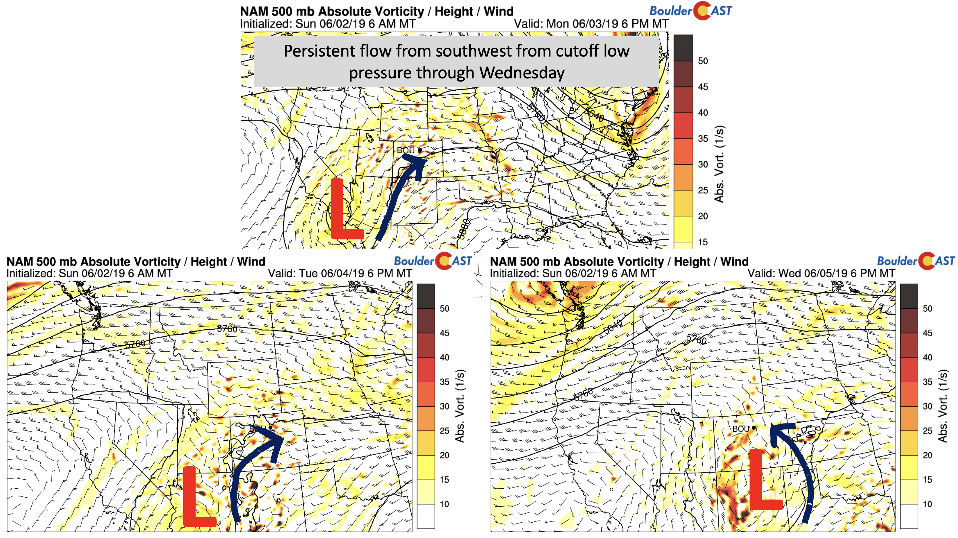
If you were out and about this weekend, you probably noticed afternoon and early evening scattered storms with temperatures in the 70’s. Much of this same setup will exist through midweek as not much has changed. The mid-level vorticity and height pattern for Monday through Wednesday is shown below. Today, that pesky cutoff low is in Baja California. As the week progresses, this system moves ever-so-slowly to the east. Ripples of energy will build across the High Country and drift onto the Plains in the southerly flow, similar to what we saw over the weekend. This will continue to allow scattered storms in the forecast.
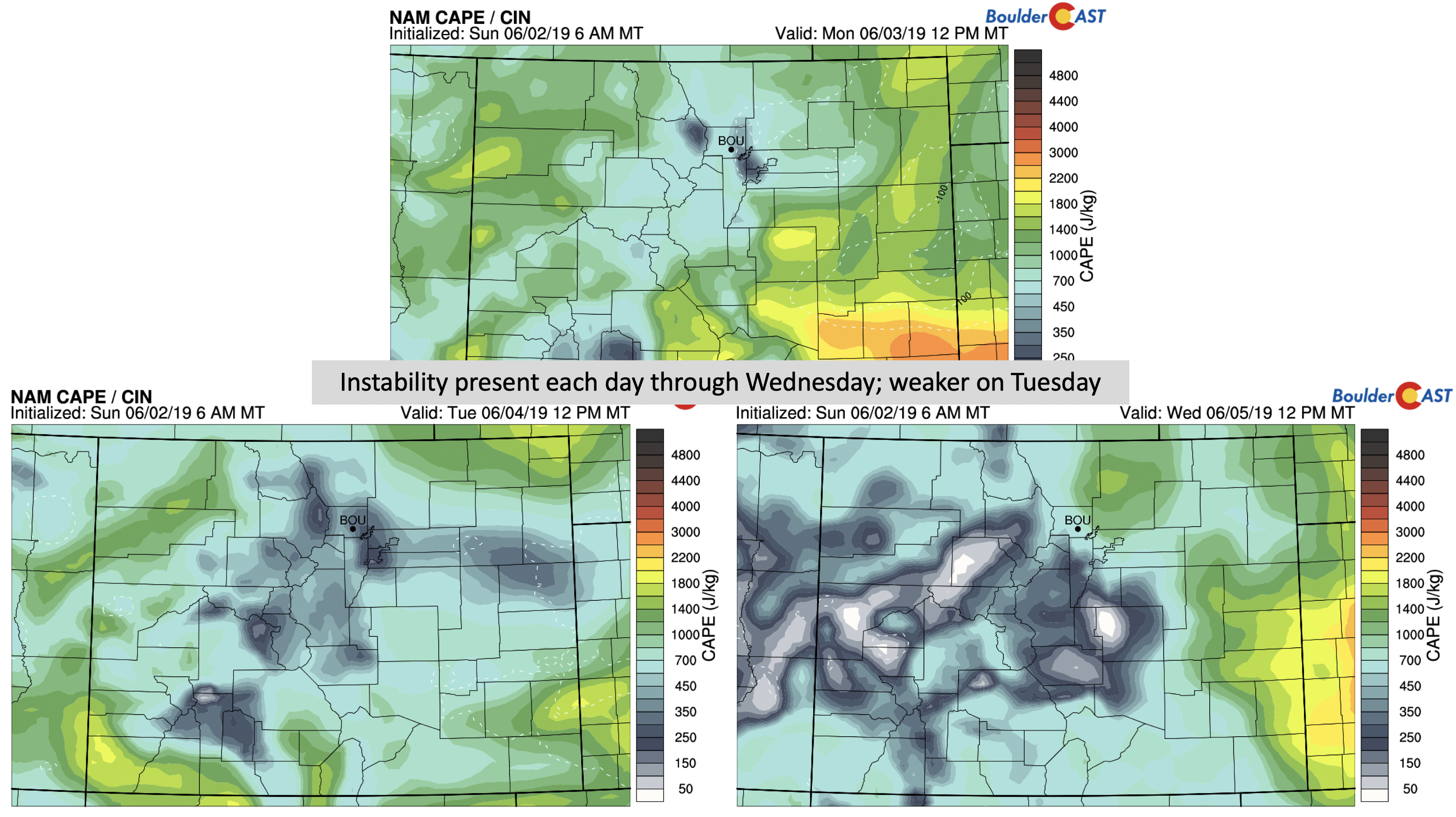
By Wednesday (above right), the system will move into New Mexico, with flow turning southeasterly across Colorado which could lead to more widespread precipitation before exiting Thursday. Instability during these next few days as well will be present, adding “fuel to the fire” for afternoon and early evening storm activity. Tuesday the unstable air is weaker (bottom left), mainly from slightly drier air working in and also a more westerly flow over the state (above left).
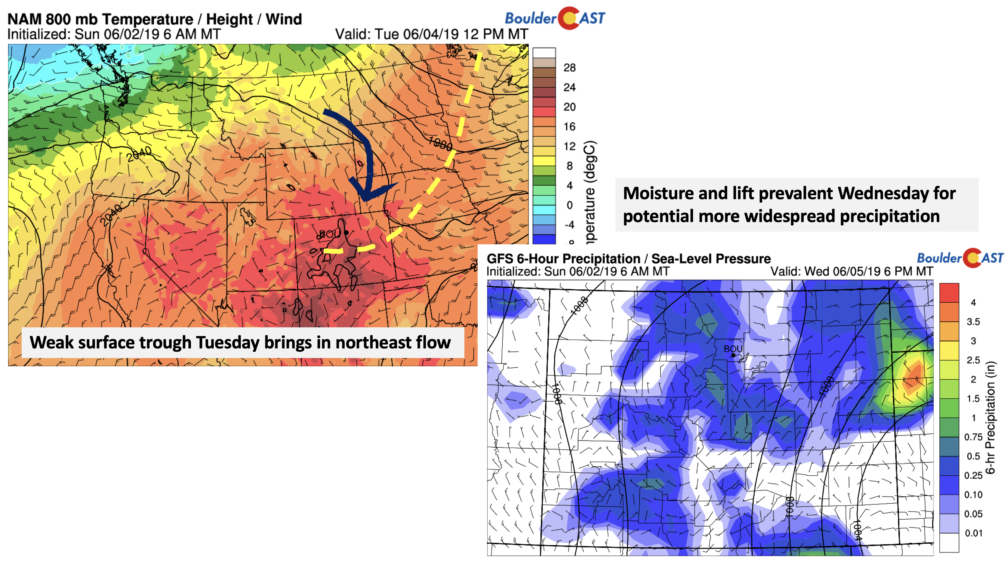
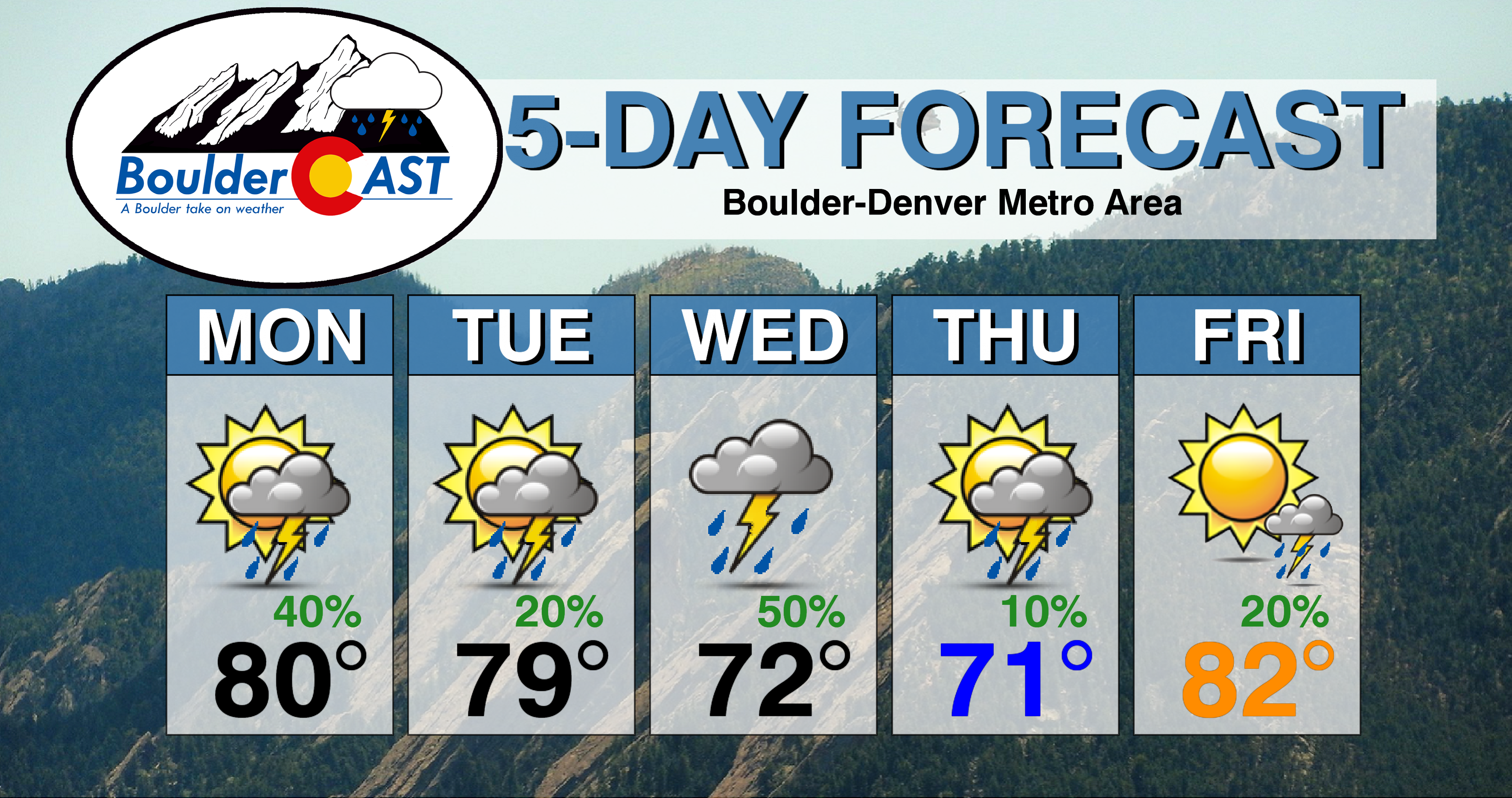
In general, precipitation chances will be in the 30 to 40% range each day through midweek, except for Wednesday, where more widespread lift will likely increase chances to 50%. High temperatures look to be in the upper 70’s to lower 80’s, but slightly cooler Wednesday due to increased cloud cover and cooler air. Expect low to middle 70’s by the middle of the week. A weak surface trough (below left) moves in early Tuesday, bringing in a more broad easterly upslope flow. We won’t see any lowering of highs but it will prep the atmosphere for Wednesday. Wednesday the mid-level system will drift to our south, with southeasterly flow over the eastern part of Colorado. The GFS shows widespread precipitation (below right) stemming from this pattern change.
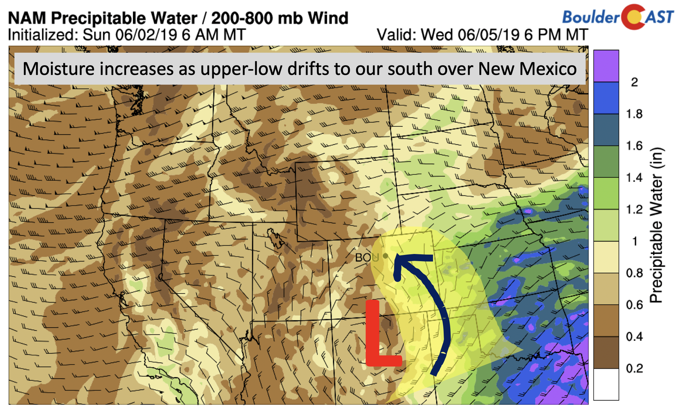
The reason for increased rain chances on Wednesday come from the broad easterly flow and increased deep-level moisture (below). Precipitable water values briefly approach one inch around Denver, making the air quite juicy! You’ll also notice below the weak easterly upslope winds from the surface to 200 mb (35,000 feet up). Wednesday could be the wettest day for us with cooler temperatures, though the southern track of the storm could keep the best energy just south of the Front Range.
All in all, here is a breakdown for the weather through Wednesday:
- Monday – scattered afternoon early evening storms between 12 and 8 PM. Decent wind shear and instability will lead to a 30 to 40% chance of storms, some producing hail and strong winds east of Denver.
- Tuesday – 20 to 30% chance of isolated to scattered storms in the afternoon/early evening. No real threat of severe storms due to weak wind shear. More dry time due to drier air working in.
- Wednesday – Potential for more widespread rainfall and isolated storms during the day and evening hours, chance of rain at 50%.
Drying out late week
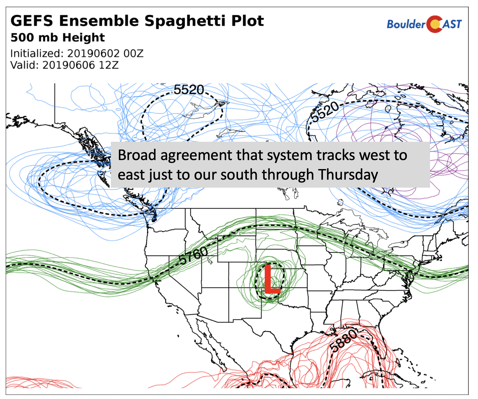
There is good agreement in the ensemble forecast models (below) that this cutoff system will move into Kansas by Thursday. Some lingering isolated storms are possible Thursday and Friday, but should be more limited in coverage thanks to downslope flow slowly taking hold.
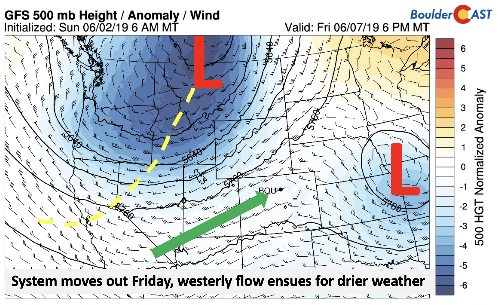
By Friday, the system exits into Missouri (below). Behind it, southwest winds at mid-levels take over thanks to a deep trough over Montana. These southwest winds should help us get into the middle 80’s to end the week, with also lots of sunshine, but still a slight chance of storms. This same trough may be a player for Colorado over the weekend, ushering in some cooler weather Saturday and Sunday.
Forecast Specifics:
Monday: Mostly sunny giving way to increasing clouds with scattered thunderstorms in the mid afternoon to early evening hours. Some storms may contain small hail and gusty winds. Highs in the lower 80’s on the Plains and low 70’s in the Foothills.
Tuesday: Mostly sunny to start, then increasing clouds with isolated to scattered afternoon/early evening storms. Storms should be more isolated in nature. Storms could produce brief heavy rain. Highs in the lower 80’s on the Plains and lower 70’s in the Foothills.
Wednesday: Partly to mostly cloudy with the potential for widespread rain showers and some embedded storms in the day and evening hours. Highs cooler in the lower 70’s on the Plains and lower 60’s in the Foothills.
Thursday: Partly cloudy with a chance of isolated storms and highs in the low 70’s in the Denver Metro and upper 50’s in the Foothills.
Friday: Mostly sunny and warm with isolated afternoon and evening storms. Highs in the lower 80’s on the Plains and lower 70’s in the Foothills.
High Country: Scattered afternoon to early evening thunderstorms will exist over the High Country through Friday, though the best chances will be Monday through Wednesday. Check SummitCAST for daily updated forecasts for more than 120 hiking destinations across Colorado.
DISCLAIMER: This weekly outlook forecast was created Monday morning and covers the entire upcoming week. Accuracy will decrease as the week progresses as this post is NOT updated. To receive daily updated forecasts from our team, subscribe to BoulderCAST Premium.
.
Spread the word, share our forecast!




You must be logged in to post a comment.