Author: Andy (Page 11 of 205)
Born and raised in St. Louis, Andrew obtained a Ph.D. in Atmospheric Science from the University of Colorado in 2015. From 2015 to 2020, he worked remotely in Boulder as an atmospheric scientist with NOAA's Atlantic Oceanographic and Meteorological Laboratory in Miami. Andy is now a full-time meteorologist.
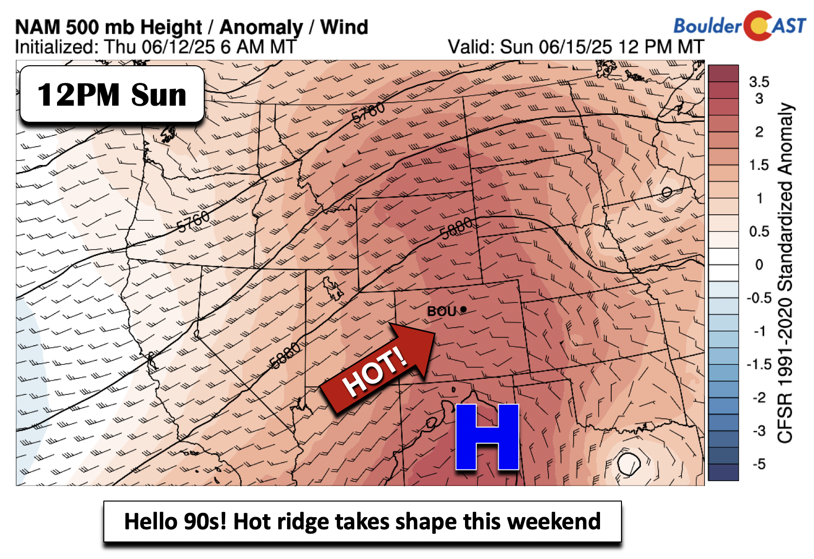
As we step into the first full week of June, get ready for more cool and wet weather in the Front Range! A promising rain event kicks off the week Monday afternoon through midday Tuesday, with a cold front bringing much cooler temperatures and widespread showers and storms. Rain chances will linger through much of the week ahead, though uncertainty remains on exactly how things will unfold from midweek onwards. Expect highs to drop from the 80s Monday into the 50s Tuesday, and continue to run below average the rest of the week. If you were hoping for a dry stretch for early June, you might need to adjust your plans—keep those umbrellas handy!
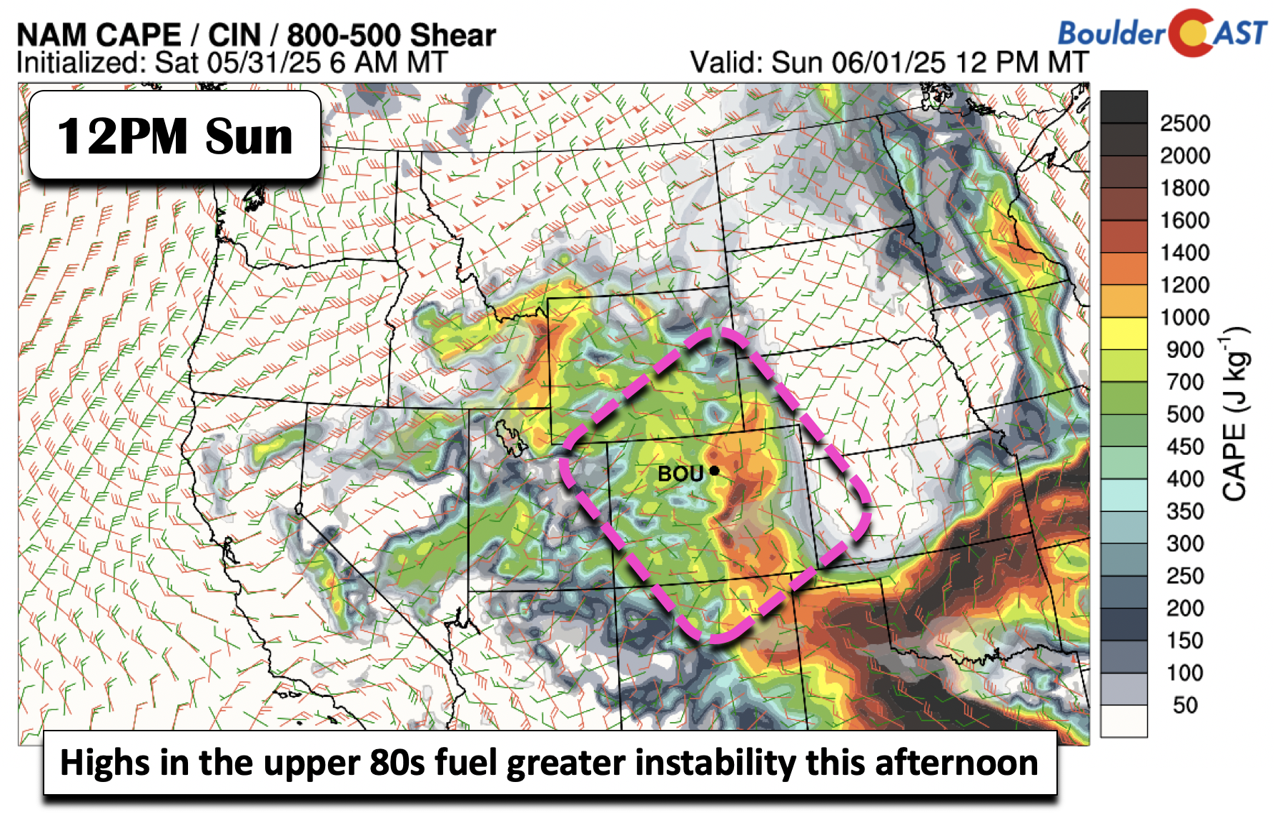

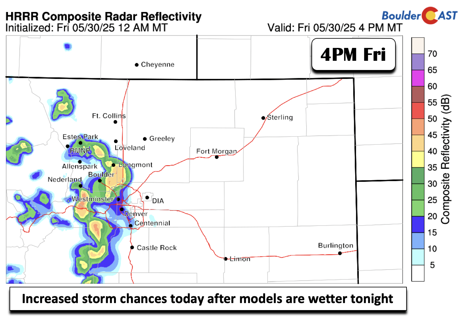
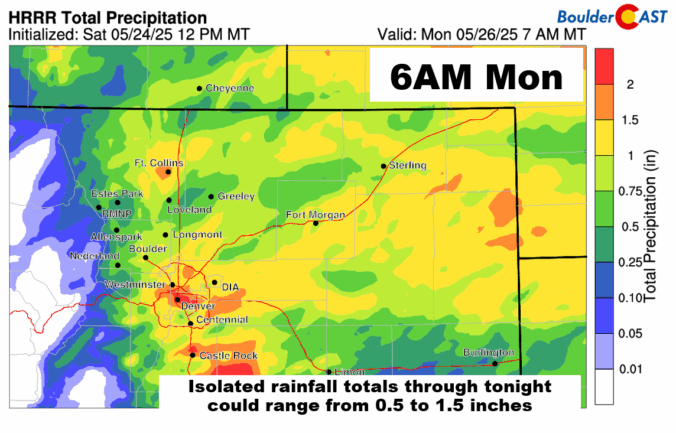
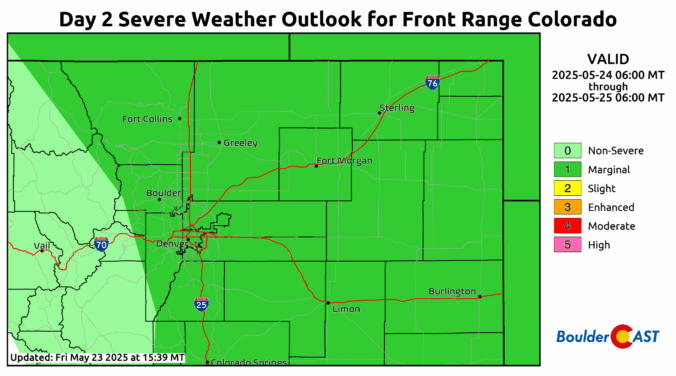
So far this Memorial Day Weekend has brought a mix of welcomed rainfall and intense thunderstorms across the Front Range, with some areas seeing over two inches of rainfall and even hail. While the first half of Monday should be dry for holiday festivities, scattered showers and storms will develop in the afternoon with brief downpours, gusty winds, and lightning. The unsettled pattern continues throughout the week ahead, with Wednesday and Thursday offering the highest storm chances, fueled by lingering atmospheric energy. However, as we approach the weekend, a shift toward warmer and drier conditions is expected, with highs climbing into the lower 80s and fewer storms impacting the region.

Live View of Boulder

Current Conditions

Live Radar

Recent Premium Posts

BoulderCAST Daily – Thu 11/27/25 | A sunny Thanksgiving, plus an update on the cold/snow brewing for the weekend
🌞 Thanksgiving Day: Calm, sunny weather statewide under high pressure; highs 49–54°F across …
Flash Sale: Winter is back! Save 30% Through Monday December 1st Only!

Winter Weather Update: Historic snow drought likely comes to an end during what will be a bitter cold holiday weekend in the Front Range
After weeks of unseasonable warmth, the Front Range is staring down its first …
3-Day Forecast

Trending Content


© 2025 Front Range Weather, LLC